Alder Copse

Wood, Forest in Sussex Chichester

England

Alder Copse

The Heath I had a meeting at East Hampshire District Council offices, and as I was early I took the opportunity of revisiting The Heath, my playground when I was a child.  No time for a walk but it looked inviting on a sunny spring day.  I see the cricket pitch is still there in the background.
The Heath Credit: Graham Horn

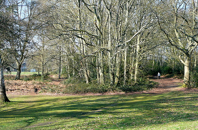
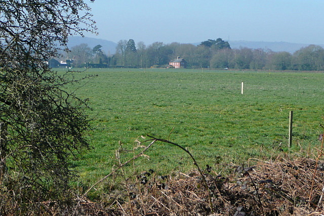
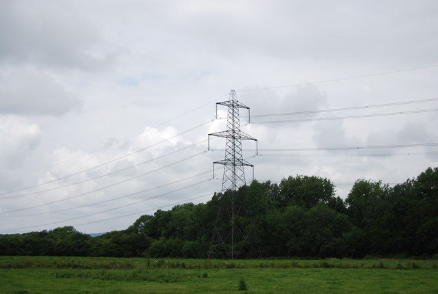
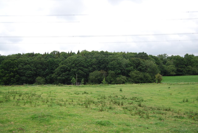
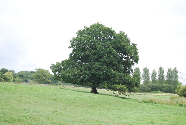
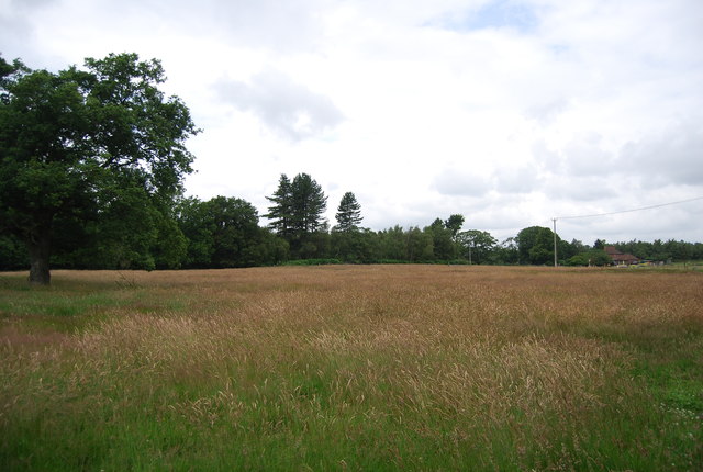
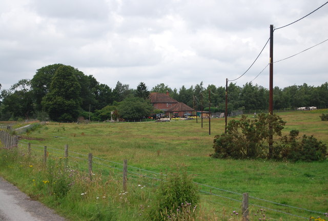
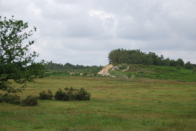
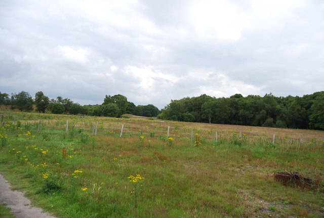
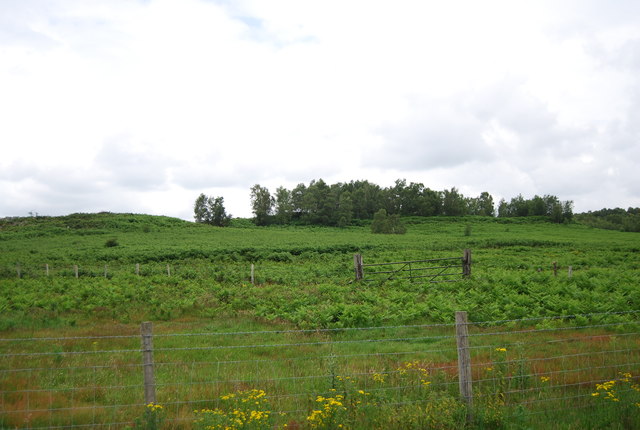
Alder Copse is a picturesque woodland located in Sussex, England. Spanning over several acres, it is known for its dense growth of alder trees, which lend their name to the copse. The copse is situated in a rural area, surrounded by rolling hills and meadows, providing a tranquil and serene atmosphere.

The alder trees in Alder Copse are typically tall and slender, with their leaves displaying vibrant shades of green during the spring and summer months. In autumn, the copse transforms into a breathtaking display of colors, as the foliage turns into various hues of red, orange, and yellow. The copse is a haven for wildlife, attracting a wide array of birds, such as woodpeckers and song thrushes, as well as small mammals like squirrels and hedgehogs.

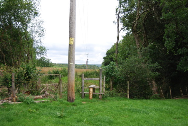
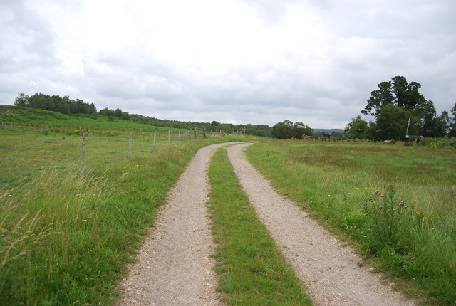
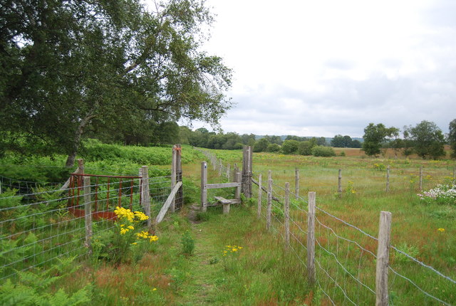
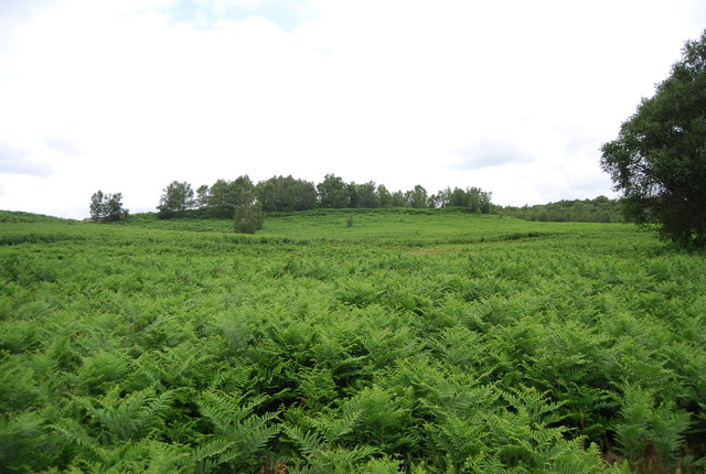
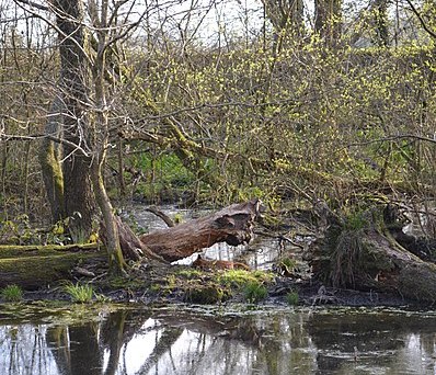
The woodland floor is covered in a thick carpet of mosses, ferns, and wildflowers, adding to the copse's natural beauty. A network of narrow footpaths winds through the copse, allowing visitors to explore and immerse themselves in the tranquil surroundings. These paths also provide access to a small stream that runs through the copse, providing a refreshing spot for visitors to cool off in the summer months.

Alder Copse is a popular destination for nature enthusiasts, photographers, and those seeking a peaceful retreat. Its beauty changes with the seasons, making it a captivating sight all year round. Whether it's a leisurely stroll, birdwatching, or simply admiring the natural landscape, Alder Copse offers a serene and captivating experience for all who visit.

If you have any feedback on the listing, please let us know in the comments section below.
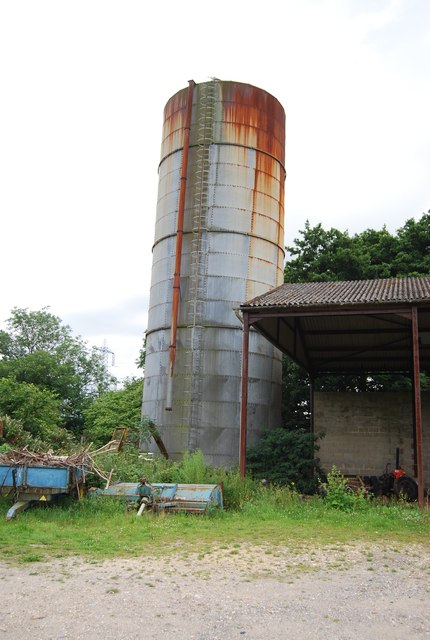
Alder Copse Images

Images are sourced within 2km of 51.008441/-0.89537121 or Grid Reference SU7723. Thanks to Geograph Open Source API. All images are credited.

The Heath I had a meeting at East Hampshire District Council offices, and as I was early I took the opportunity of revisiting The Heath, my playground when I was a child.  No time for a walk but it looked inviting on a sunny spring day.  I see the cricket pitch is still there in the background.
The Heath
I had a meeting at East Hampshire District Council offices, and as I was early I took the opportunity of revisiting The Heath, my playground when I was a child. No time for a walk but it looked inviting on a sunny spring day. I see the cricket pitch is still there in the background.
View from Rival Moor Road The road to the East Hampshire District Council Offices at Penns Place goes along the edge of the housing.  To the south the view is across open farmland towards a solitary house at the southern end of Heath Road East.  I lived within 400 metres of here as a child so this visit, for a meeting, took me back.
View from Rival Moor Road
The road to the East Hampshire District Council Offices at Penns Place goes along the edge of the housing. To the south the view is across open farmland towards a solitary house at the southern end of Heath Road East. I lived within 400 metres of here as a child so this visit, for a meeting, took me back.
Junction of Inmans Lane and London Road
The corner of Parsonage Close and Inmans Lane
Pylon, Brickkiln Copse
Brickkiln Copse
Brickkiln Copse
Tree by the Sussex Border Path
Stile, Sussex Border Path The Sussex Border Path is a footpath route nearly 150 miles long around the inland boundary of the county of Sussex. The county owes its origins to the kingdom of the South Saxons and can claim to have one of the longest inland county boundaries from Emsworth to Rye. The route was devised in 1983 and is well signed along most of the route. Website <span class="nowrap"><a title="http://www.sussexborderpath.co.uk/" rel="nofollow ugc noopener" href="http://www.sussexborderpath.co.uk/">Link</a><img style="margin-left:2px;" alt="External link" title="External link - shift click to open in new window" src="https://s1.geograph.org.uk/img/external.png" width="10" height="10"/></span> 
Map: <a title="https://www.geograph.org.uk/search.php?i=40140109&page=1&displayclass=map#i=40140109&page=1&displayclass=map&zoom=2&lat=51.03263&lon=-0.05427&layers=FTTB00000000000T" href="https://www.geograph.org.uk/search.php?i=40140109&page=1&displayclass=map#i=40140109&page=1&displayclass=map&zoom=2&lat=51.03263&lon=-0.05427&layers=FTTB00000000000T">Link</a>
Stile, Sussex Border Path
The Sussex Border Path is a footpath route nearly 150 miles long around the inland boundary of the county of Sussex. The county owes its origins to the kingdom of the South Saxons and can claim to have one of the longest inland county boundaries from Emsworth to Rye. The route was devised in 1983 and is well signed along most of the route. Website LinkExternal link Map: Link
Field, Down Park Farm
Down Park Farm House
Sand pit, West Heath Common A small heathland with some woodland near West Harting. The underlying geology is Greensand. The western part of the heath is quarried for sand (West Heath Quarry). There are several prehistoric burial mounds on the heath.
Sand pit, West Heath Common
A small heathland with some woodland near West Harting. The underlying geology is Greensand. The western part of the heath is quarried for sand (West Heath Quarry). There are several prehistoric burial mounds on the heath.
Down Park Farm
Down Park Farm
Silo, Down Park Farm
Serpent Trail, Down Park Farm The Serpent Trail is a 64 mile long footpath. It runs from Haslemere to Petersfield by a winding route and is designed to join up  many heathland areas on the greensand in the western Weald The path takes its name both from its serpentine shape and from passing through the habitat of all three British species of snake. The logo is a serpent see <a href="https://www.geograph.org.uk/photo/2512508">SU8931 : Logo for the Serpent Trail</a>
Website: <span class="nowrap"><a title="http://www.ldwa.org.uk/ldp/members/show_path.php?path_name=Serpent+Trail" rel="nofollow ugc noopener" href="http://www.ldwa.org.uk/ldp/members/show_path.php?path_name=Serpent+Trail">Link</a><img style="margin-left:2px;" alt="External link" title="External link - shift click to open in new window" src="https://s1.geograph.org.uk/img/external.png" width="10" height="10"/></span>
Serpent Trail, Down Park Farm
The Serpent Trail is a 64 mile long footpath. It runs from Haslemere to Petersfield by a winding route and is designed to join up many heathland areas on the greensand in the western Weald The path takes its name both from its serpentine shape and from passing through the habitat of all three British species of snake. The logo is a serpent see SU8931 : Logo for the Serpent Trail Website: LinkExternal link
West Heath Common A small heathland with some woodland near West Harting. The underlying geology is Greensand. The western part of the heath is quarried for sand (West Heath Quarry). There are several prehistoric burial mounds on the heath.
West Heath Common
A small heathland with some woodland near West Harting. The underlying geology is Greensand. The western part of the heath is quarried for sand (West Heath Quarry). There are several prehistoric burial mounds on the heath.
Stile, Sussex Border Path & Serpent Trail The Sussex Border Path is a footpath route nearly 150 miles long around the inland boundary of the county of Sussex. The county owes its origins to the kingdom of the South Saxons and can claim to have one of the longest inland county boundaries from Emsworth to Rye. The route was devised in 1983 and is well signed along most of the route. Website <span class="nowrap"><a title="http://www.sussexborderpath.co.uk/" rel="nofollow ugc noopener" href="http://www.sussexborderpath.co.uk/">Link</a><img style="margin-left:2px;" alt="External link" title="External link - shift click to open in new window" src="https://s1.geograph.org.uk/img/external.png" width="10" height="10"/></span> 
Map: <a title="https://www.geograph.org.uk/search.php?i=40140109&page=1&displayclass=map#i=40140109&page=1&displayclass=map&zoom=2&lat=51.03263&lon=-0.05427&layers=FTTB00000000000T" href="https://www.geograph.org.uk/search.php?i=40140109&page=1&displayclass=map#i=40140109&page=1&displayclass=map&zoom=2&lat=51.03263&lon=-0.05427&layers=FTTB00000000000T">Link</a>
Stile, Sussex Border Path & Serpent Trail
The Sussex Border Path is a footpath route nearly 150 miles long around the inland boundary of the county of Sussex. The county owes its origins to the kingdom of the South Saxons and can claim to have one of the longest inland county boundaries from Emsworth to Rye. The route was devised in 1983 and is well signed along most of the route. Website LinkExternal link Map: Link
Bracken, West Heath Common A small heathland with some woodland near West Harting. The underlying geology is Greensand. The western part of the heath is quarried for sand (West Heath Quarry). There are several prehistoric burial mounds on the heath.
Bracken, West Heath Common
A small heathland with some woodland near West Harting. The underlying geology is Greensand. The western part of the heath is quarried for sand (West Heath Quarry). There are several prehistoric burial mounds on the heath.
Show me another place!

Alder Copse is located at Grid Ref: SU7723 (Lat: 51.008441, Lng: -0.89537121)

Administrative County: West Sussex

District: Chichester

Police Authority: Sussex

What 3 Words

///bland.pegs.flexibly. Near Petersfield, Hampshire

Nearby Locations

Alder Copse

Related Wikis

Dureford Abbey

Dureford Abbey, in Sussex, England, was a Premonstratensian monastery. It was founded by Henry Hussey who in 1161 granted land to the abbot of Welbeck...

East Hampshire

East Hampshire is a local government district in Hampshire, England. Its council is based in the town of Petersfield, although the largest town is Alton...

Rotherlands

Rotherlands is a 7.6-hectare (19-acre) Local Nature Reserve in Petersfield in Hampshire. It is owned by Petersfield Town Council and managed by Rotherlands...

Adhurst

Adhurst (also known as Adhurst St Mary) is a hamlet in Hampshire, United Kingdom. The settlement is within the civil parish of Steep, and is located approximately...

Bowyer's Common

Bowyer's Common is a village in East Hampshire, England. It is located in the East Hampshire district and part of the civil parish of Binsted.

Sheet, Hampshire

Sheet is a village and civil parish in the East Hampshire district of Hampshire, England. It is 1.1 miles (1.8 km) northeast of Petersfield, just off the...

Petersfield Town F.C.

Petersfield Town Football Club are an English football club based in Petersfield, Hampshire, England. The club is affiliated to the Hampshire Football...

Churcher's College

Churcher's College is an independent, fee-charging day school for girls and boys, founded in 1722. The Senior School (ages 11–18) is in the market town...

Nearby Amenities

Located within 500m of 51.008441,-0.89537121
Parking
Access: yes
Fee: no
Parking: layby
Lat/Long: 51.009981/-0.8942916
Durford Abbey Farm
Place: locality
Lat/Long: 51.0044179/-0.8922129
The data included in this document is from www.openstreetmap.org. The data is made available under ODbL.

Have you been to Alder Copse?

Leave your review of Alder Copse below (or comments, questions and feedback).