Alder Moors

Wood, Forest in Berkshire

England

Alder Moors

St. John the Evangelist, Woodley: early February 2022
St. John the Evangelist, Woodley: early February 2022 Credit: Basher Eyre

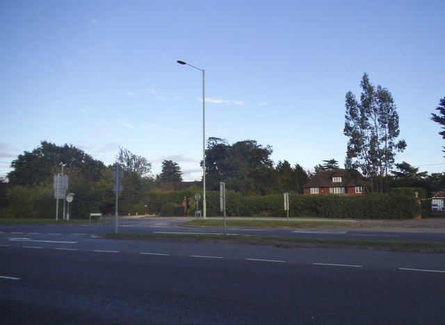
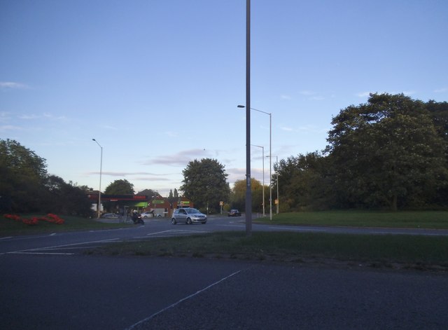
Alder Moors is a picturesque woodland located in the county of Berkshire, England. Stretching over an area of several square miles, this enchanting forest is known for its dense growth of alder trees, which give the moors their name. The forest is part of the larger Alder Moors Nature Reserve, which has been recognized for its ecological significance and is protected by local conservation efforts.

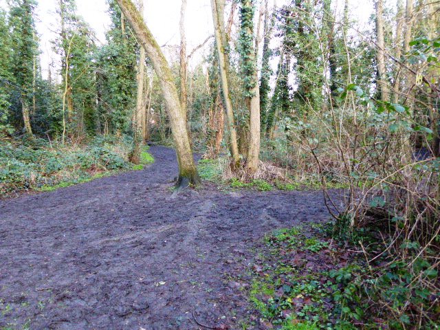
The landscape of Alder Moors is characterized by a mix of ancient woodland and more recent plantation areas. The older sections of the forest are filled with towering alder trees, some of which are several centuries old. The forest floor is blanketed with a diverse array of flora and fauna, including bluebells, foxgloves, and various species of ferns.

The moors are crisscrossed by a network of walking trails, offering visitors the opportunity to explore the forest's natural beauty. These trails wind through the woodland, taking hikers past babbling brooks, moss-covered rocks, and hidden ponds. Nature enthusiasts can also spot a variety of wildlife in Alder Moors, such as deer, squirrels, and a wide variety of bird species.

Alder Moors is not only a haven for nature lovers but also serves as an important ecological corridor. Its dense vegetation provides vital habitats for a diverse range of species, contributing to the overall biodiversity of the area. The forest is also a valuable carbon sink, helping to mitigate the impact of climate change.

With its stunning natural beauty and ecological significance, Alder Moors is a must-visit destination for those seeking a peaceful retreat in the heart of Berkshire's countryside.

If you have any feedback on the listing, please let us know in the comments section below.
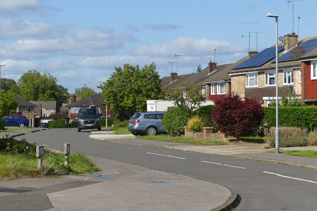
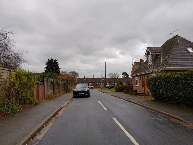
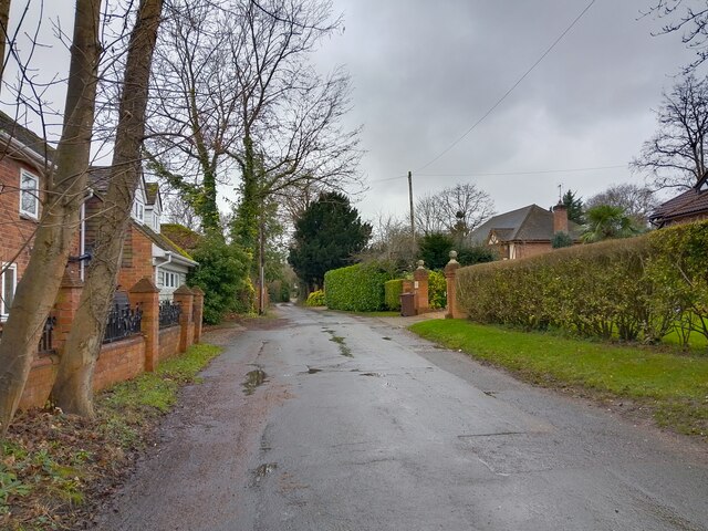
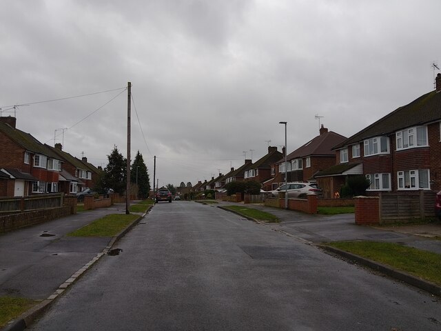
Alder Moors Images

Images are sourced within 2km of 51.459751/-0.88566441 or Grid Reference SU7774. Thanks to Geograph Open Source API. All images are credited.

St. John the Evangelist, Woodley: early February 2022
St. John the Evangelist, Woodley: churchyard
Looking north-northeast in Church Road
The finish at Woodley parkrun in Woodford Park Parkrun is a free timed 5k run which takes place in numerous locations at 9.00am every Saturday.
The finish at Woodley parkrun in Woodford Park
Parkrun is a free timed 5k run which takes place in numerous locations at 9.00am every Saturday.
War memorial at Woodley Green
Information panels adjacent to Woodley Green war memorial
Greengrocery stall at Woodley Green Saturday market
Forecourt on a Texaco fuel station on the A4 at Sonning
Duncan Road, Woodley From the junction with Foster's Lane.
Duncan Road, Woodley
From the junction with Foster's Lane.
Little Glebe, Sonning
Mustard Lane, Sonning
Selsdon Avenue, Woodley
Welford Road, Woodley
The A4 in Charvil Looking towards the Wee Waif Hotel
The A4 in Charvil
Looking towards the Wee Waif Hotel
The A4 in Charvil
The A4 in Charvil
The A4, Sonning
The A4, Sonning
The A4, Sonning
The A4, Sonning
Roundabout on the A4, Charvil
Show me another place!

Alder Moors is located at Grid Ref: SU7774 (Lat: 51.459751, Lng: -0.88566441)

Unitary Authority: Wokingham

Police Authority: Thames Valley

What 3 Words

///retaliate.slogged.homework. Near Woodley, Berkshire

Nearby Locations

Norris's Copse Alder Moors

Related Wikis

Alder Moors

Alder Moors is a 8.5-hectare (21-acre) Local Nature Reserve in Woodley, a suburb of Reading in Berkshire. It is owned and managed by Wokingham District...

Waingels College

Waingels College is an 11–18 mixed, secondary school and sixth form with academy status in Woodley, Berkshire, England. == Notable alumni == James Henry...

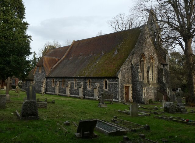
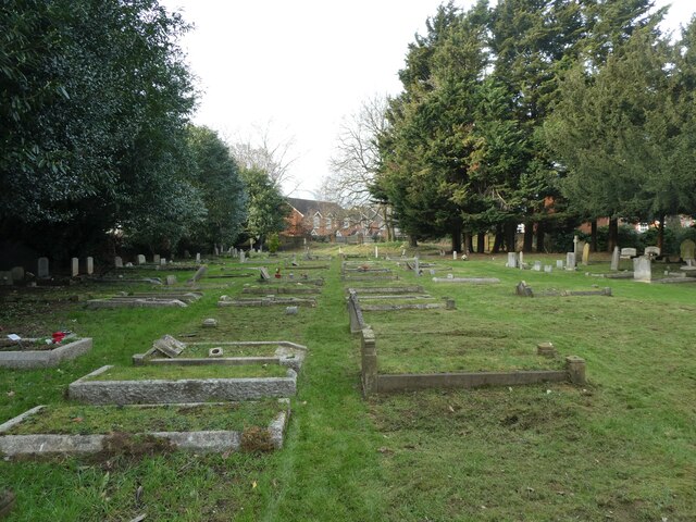
St John the Evangelist Church, Woodley

St John the Evangelist, Woodley, is a parish church in Woodley, close to Reading in the English county of Berkshire. It is a Church of England church in...

Emm Brook

The Emm Brook, sometimes known as the Embrook or Emmbrook, is a small river in the English county of Berkshire. It is a tributary of the River Loddon which...

Lodge Wood and Sandford Mill

Lodge Wood and Sandford Mill is a 2.3-hectare (5.7-acre) biological Site of Special Scientific Interest east of Woodley in Berkshire.This site consists...

Museum of Berkshire Aviation

The Museum of Berkshire Aviation is a small aviation museum in Woodley, a suburb of Reading in Berkshire, England. The museum is on the edge of the site...

Lavells Lake

Lavells Lake is a 12.5-hectare (31-acre) Local Nature Reserve on the outskirts of Woodley, a suburb of Reading in Berkshire. It is owned by Wokingham...

Woodley, Berkshire

Woodley is a town and civil parish in the Borough of Wokingham, Berkshire, England, four miles (6.4 km) east of Reading and joined to the neighbouring...

Nearby Amenities

Located within 500m of 51.459751,-0.88566441
Barrier: bollard
Bicycle: yes
Foot: yes
Lat/Long: 51.4571868/-0.8901723
Barrier: bollard
Bicycle: yes
Foot: yes
Lat/Long: 51.4573018/-0.8896098
Barrier: bollard
Bicycle: yes
Foot: yes
Lat/Long: 51.4574239/-0.8892009
Barrier: bollard
Bicycle: yes
Foot: yes
Lat/Long: 51.4575865/-0.8888543
Barrier: bollard
Bicycle: yes
Foot: yes
Lat/Long: 51.4607038/-0.8917786
Barrier: bollard
Bicycle: yes
Foot: yes
Lat/Long: 51.4614953/-0.8797729
Bus Stop
Lat/Long: 51.4566663/-0.8875982
Bus Stop
Lat/Long: 51.4560459/-0.8883792
Bus Stop
Oakdale Walk
Naptan AtcoCode: 035085520001
Naptan NaptanCode: wokdjap
Lat/Long: 51.4576269/-0.8888528
Bus Stop
Oakdale Walk
Lat/Long: 51.4572867/-0.8880788
Bus Stop
Lat/Long: 51.4597841/-0.8900712
Bus Stop
Lat/Long: 51.4597093/-0.8896667
Bus Stop
Lysander Close
Naptan AtcoCode: 035085460002
Naptan NaptanCode: wokdgwt
Public Transport: platform
Lat/Long: 51.4553934/-0.8848001
Bus Stop
Harward Close
Bench: no
Bin: yes
Check Date Shelter: 2023-01-22
Lit: yes
Naptan AtcoCode: 035085440001
Naptan NaptanCode: wokdgwj
Shelter: no
Tactile Paving: no
Lat/Long: 51.4570665/-0.8834455
Bus Stop
Harward Close
Bench: no
Naptan AtcoCode: 035085440002
Naptan NaptanCode: wokdgwm
Route Ref: 13
Shelter: no
Lat/Long: 51.4574358/-0.8832834
Tourism: viewpoint
Lat/Long: 51.4636195/-0.8835497
Bench
Lat/Long: 51.4636902/-0.8835073
Waste Basket
Lat/Long: 51.4636456/-0.883468
Barrier: kissing_gate
Foot: yes
Lat/Long: 51.4592076/-0.8889553
Bench
Lat/Long: 51.4609104/-0.8897415
Bench
Lat/Long: 51.4609284/-0.8898406
Leisure: picnic_table
Lat/Long: 51.4610027/-0.8893187
Barrier: cycle_barrier
Lat/Long: 51.4569575/-0.8813015
Waste Basket
Lat/Long: 51.4619235/-0.8846306
Waste Basket
Lat/Long: 51.4613135/-0.8868977
Waste Basket
Lat/Long: 51.4622817/-0.8830799
Bench
Lat/Long: 51.4609273/-0.8881823
Waste Basket
Lat/Long: 51.460972/-0.8887482
Barrier: bollard
Bicycle: yes
Foot: yes
Lat/Long: 51.4604262/-0.8915298
Bench
Backrest: yes
Colour: black
Material: metal
Lat/Long: 51.4614563/-0.8869396
Bench
Backrest: yes
Colour: black
Material: metal
Lat/Long: 51.4619727/-0.8841932
Bench
Backrest: yes
Colour: black
Material: metal
Lat/Long: 51.4619777/-0.8842347
Barrier: cycle_barrier
Lat/Long: 51.4570724/-0.8811149
Post Box
Collection Times: Mo-Fr 09:00; Sa 07:00
Operator: Royal Mail
Ref: RG5 33D
Royal Cypher: EIIR
Royal Cypher Wikidata: Q33102113
Lat/Long: 51.4570926/-0.8834677
Barrier: cycle_barrier
Bicycle: yes
Foot: yes
Lat/Long: 51.456316/-0.8825822
Traffic Calming: choker
Lat/Long: 51.4559601/-0.8827447
Barrier: cycle_barrier
Bicycle: yes
Foot: yes
Lat/Long: 51.4566626/-0.8873428
Barrier: cycle_barrier
Bicycle: yes
Foot: yes
Lat/Long: 51.4578531/-0.8846099
Bus Stop
Lund's Farm Road
Lat/Long: 51.4601634/-0.892102
Waste Basket
Lat/Long: 51.4575724/-0.8888026
Traffic Signals
Crossing: traffic_signals
Lat/Long: 51.4598694/-0.8901705
Waste Basket
Lat/Long: 51.4604286/-0.8905674
Bus Stop
Lund's Farm Road
Naptan AtcoCode: 035085540002
Naptan NaptanCode: wokdjda
Lat/Long: 51.4603256/-0.8915313
Post Box
Operator: Royal Mail
Lat/Long: 51.461721/-0.8905502
Direction: 215
Generator Method: photovoltaic
Generator Output Electricity: yes
Generator Solar Modules: 10
Generator Source: solar
Generator Type: solar_photovoltaic_panel
Location: roof
Power: generator
Lat/Long: 51.459122/-0.8909341
Direction: 140
Generator Method: photovoltaic
Generator Output Electricity: yes
Generator Solar Modules: 38
Generator Source: solar
Generator Type: solar_photovoltaic_panel
Location: roof
Power: generator
Lat/Long: 51.4555137/-0.8833413
Direction: 165
Generator Method: photovoltaic
Generator Output Electricity: yes
Generator Solar Modules: 42
Generator Source: solar
Generator Type: solar_photovoltaic_panel
Location: roof
Power: generator
Lat/Long: 51.4559057/-0.884449
Direction: SE
Generator Method: photovoltaic
Generator Output Electricity: yes
Generator Solar Modules: 10
Generator Source: solar
Generator Type: solar_photovoltaic_panel
Location: roof
Power: generator
Lat/Long: 51.4567706/-0.8841218
Direction: 235
Generator Method: photovoltaic
Generator Output Electricity: yes
Generator Solar Modules: 14
Generator Source: solar
Generator Type: solar_photovoltaic_panel
Location: roof
Power: generator
Lat/Long: 51.4570714/-0.8850311
Direction: 125
Generator Method: photovoltaic
Generator Output Electricity: yes
Generator Solar Modules: 14
Generator Source: solar
Generator Type: solar_photovoltaic_panel
Location: roof
Power: generator
Lat/Long: 51.4590785/-0.8908065
Direction: 150
Generator Method: photovoltaic
Generator Output Electricity: yes
Generator Solar Modules: 19
Generator Source: solar
Generator Type: solar_photovoltaic_panel
Location: roof
Power: generator
Lat/Long: 51.4614551/-0.8917034
Direction: 205
Generator Method: photovoltaic
Generator Output Electricity: yes
Generator Solar Modules: 14
Generator Source: solar
Generator Type: solar_photovoltaic_panel
Location: roof
Power: generator
Lat/Long: 51.4580319/-0.8912239
Direction: SSE
Generator Method: photovoltaic
Generator Output Electricity: yes
Generator Solar Modules: 12
Generator Source: solar
Generator Type: solar_photovoltaic_panel
Location: roof
Power: generator
Lat/Long: 51.4579638/-0.885712
Direction: 165
Generator Method: photovoltaic
Generator Output Electricity: yes
Generator Solar Modules: 12
Generator Source: solar
Generator Type: solar_photovoltaic_panel
Location: roof
Power: generator
Lat/Long: 51.4588801/-0.8815094
Direction: 170
Generator Method: photovoltaic
Generator Output Electricity: yes
Generator Solar Modules: 18
Generator Source: solar
Generator Type: solar_photovoltaic_panel
Location: roof
Power: generator
Lat/Long: 51.4579231/-0.8892156
Direction: SW
Generator Method: photovoltaic
Generator Output Electricity: yes
Generator Solar Modules: 16
Generator Source: solar
Generator Type: solar_photovoltaic_panel
Location: roof
Power: generator
Lat/Long: 51.4590628/-0.8816383
Direction: 165
Generator Method: photovoltaic
Generator Output Electricity: yes
Generator Solar Modules: 12
Generator Source: solar
Generator Type: solar_photovoltaic_panel
Location: roof
Power: generator
Lat/Long: 51.4560893/-0.8815691
Direction: 235
Generator Method: photovoltaic
Generator Output Electricity: yes
Generator Solar Modules: 12
Generator Source: solar
Generator Type: solar_photovoltaic_panel
Location: roof
Power: generator
Lat/Long: 51.4575127/-0.8902931
Direction: 190
Generator Method: photovoltaic
Generator Output Electricity: yes
Generator Solar Modules: 12
Generator Source: solar
Generator Type: solar_photovoltaic_panel
Location: roof
Power: generator
Lat/Long: 51.4585732/-0.8803495
Direction: 190
Generator Method: photovoltaic
Generator Output Electricity: yes
Generator Solar Modules: 4
Generator Source: solar
Generator Type: solar_photovoltaic_panel
Location: roof
Power: generator
Lat/Long: 51.4585908/-0.880425
Woodley Airfield Battle HQ
Building: bunker
Bunker Type: bomb_shelter
Military: bunker
Lat/Long: 51.456243/-0.8826743
The data included in this document is from www.openstreetmap.org. The data is made available under ODbL.

Have you been to Alder Moors?

Leave your review of Alder Moors below (or comments, questions and feedback).