Dundry, East

Settlement in Somerset

England

Dundry, East

Dundry church High on a hill overlooking Bristol.
Dundry church Credit: mym

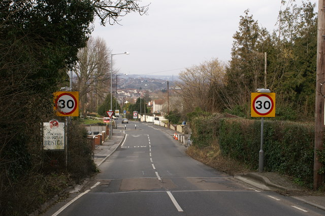
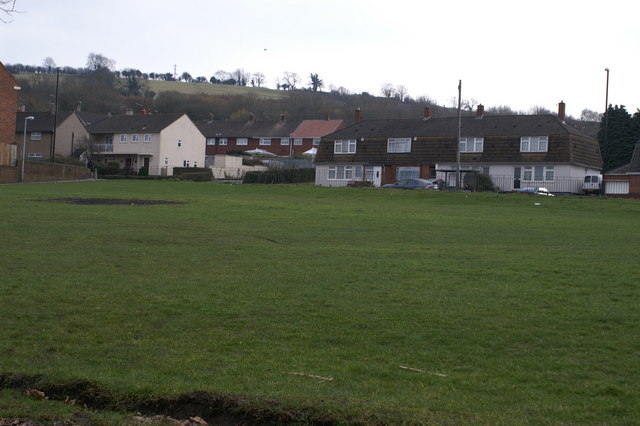
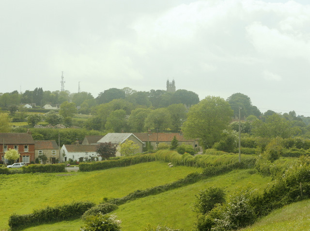
Dundry, East Somerset is a small village located in the county of Somerset, England. It lies approximately 5 miles south of Bristol city centre and is situated on the southern slopes of the Dundry Hill, offering picturesque views of the surrounding countryside.

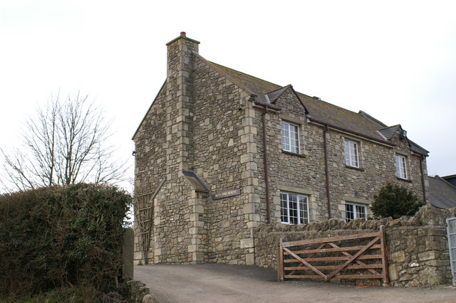
The village has a population of around 1,500 people and is known for its quaint charm and rural character. It is predominantly a residential area, with a mix of traditional cottages, larger modern houses, and a few small businesses. The village is well-connected to nearby towns and cities, with regular bus services and easy access to major roads.

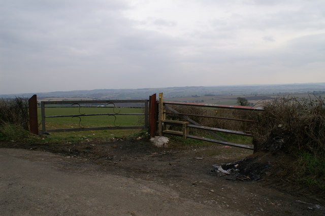
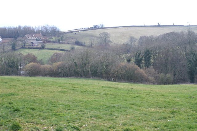
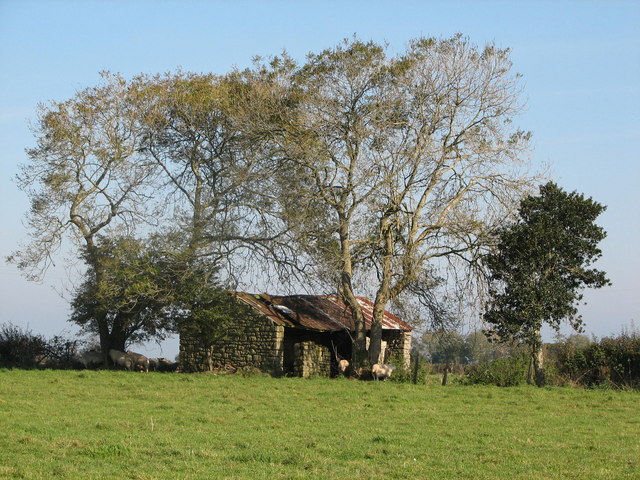
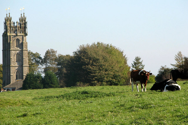
Dundry is surrounded by beautiful countryside, making it a popular destination for outdoor enthusiasts. The Dundry Hill, which stands at 220 meters above sea level, offers numerous walking and cycling trails, providing visitors with stunning panoramic views of Bristol, the Mendip Hills, and even the Brecon Beacons on a clear day.

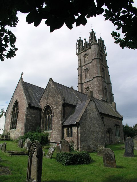
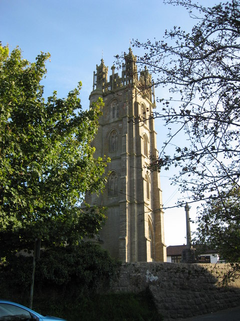
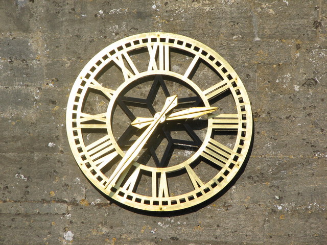
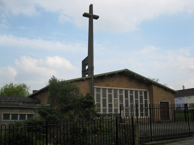
The village has a strong sense of community, with various organizations and clubs catering to different interests. These include sports clubs, such as cricket and football, as well as social groups and events that bring the residents together. The local church, St. Michael and All Angels, is a prominent landmark in the village and holds regular services.

In summary, Dundry, East Somerset is a charming village nestled in the beautiful countryside of Somerset. With its scenic views, strong community spirit, and convenient location, it offers a peaceful and idyllic place to live or visit.

If you have any feedback on the listing, please let us know in the comments section below.
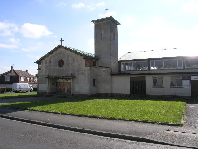
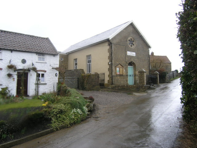
Dundry, East Images

Images are sourced within 2km of 51.393315/-2.611539 or Grid Reference ST5766. Thanks to Geograph Open Source API. All images are credited.

Dundry church High on a hill overlooking Bristol.
Dundry church
High on a hill overlooking Bristol.
Hartcliffe, Bristol, Methodist Church Stands in Mowcroft Road.
Hartcliffe, Bristol, Methodist Church
Stands in Mowcroft Road.
Dundry, Baptist Chapel at Maiden Head crossroads
Bristol City Limits by Withywood
Playing Green Withywoods Estate, Bristol
Playing Green
Withywoods Estate, Bristol
Rutland House, East Dundry
Car Burning Spot.  Dundry Hill
Car Burning Spot. Dundry Hill
B.A.B bicycle shop at Elton Farm weblink: <span class="nowrap"><a title="www.bristolfreeride.com" rel="nofollow ugc noopener" href="http://www.bristolfreeride.com">Link</a><img style="margin-left:2px;" alt="External link" title="External link - shift click to open in new window" src="https://s1.geograph.org.uk/img/external.png" width="10" height="10"/></span>
B.A.B bicycle shop at Elton Farm
weblink: LinkExternal link
Field on Dundry Hill
Dundry Church Built on a prominent ridge, south of Bristol, this church has an unusually ornate tower, making it a prominent landmark.
Dundry Church
Built on a prominent ridge, south of Bristol, this church has an unusually ornate tower, making it a prominent landmark.
Disused Barn On top of Dundry hill stands this derelict farm building.  Currently being used by the local sheep population for shade and other sheep business.
Disused Barn
On top of Dundry hill stands this derelict farm building. Currently being used by the local sheep population for shade and other sheep business.
Holy cow This photo shows part of Dundry church as seen from Dundry Down.  After walking across this field we found a sign that had fallen off the stile - 'Bull in field with cows - NO ACCESS'.
Holy cow
This photo shows part of Dundry church as seen from Dundry Down. After walking across this field we found a sign that had fallen off the stile - 'Bull in field with cows - NO ACCESS'.
Dundry Church Clock Most of the photos found in this grid feature Dundry Church (interesting information about the Church itself can be found on the link below).   This photo provides a close-up of the clock on the south wall of the Tower, installed in 1999 to celebrate the millennium.

<span class="nowrap"><a title="http://www.jobdone.org.uk/dundryweb/then_now/about_dundry.htm" rel="nofollow ugc noopener" href="http://www.jobdone.org.uk/dundryweb/then_now/about_dundry.htm">Link</a><img style="margin-left:2px;" alt="External link" title="External link - shift click to open in new window" src="https://s1.geograph.org.uk/img/external.png" width="10" height="10"/></span>
Dundry Church Clock
Most of the photos found in this grid feature Dundry Church (interesting information about the Church itself can be found on the link below). This photo provides a close-up of the clock on the south wall of the Tower, installed in 1999 to celebrate the millennium. LinkExternal link
St Andrew, Hartcliffe Parish Church in Hartcliffe.
St Andrew, Hartcliffe
Parish Church in Hartcliffe.
2009 : View from East Dundry Lane Unfortunately there are few places available for stopping along the top of Dundry Hill. Travelling on foot or by mountain bike would be the answer.
2009 : View from East Dundry Lane
Unfortunately there are few places available for stopping along the top of Dundry Hill. Travelling on foot or by mountain bike would be the answer.
2009 : Looking west near the end of Dundry Lane A hamlet near Maiden Head is in the foreground, also the minor road out of Bishopsworth to Chew Magna.
The tower of Dundry Church sits on the skyline with two transmitter pylons.
2009 : Looking west near the end of Dundry Lane
A hamlet near Maiden Head is in the foreground, also the minor road out of Bishopsworth to Chew Magna. The tower of Dundry Church sits on the skyline with two transmitter pylons.
Show me another place!

Dundry, East is located at Grid Ref: ST5766 (Lat: 51.393315, Lng: -2.611539)

Unitary Authority: North Somerset

Police Authority: Avon and Somerset

What 3 Words

///holds.gravy.erase. Near Dundry, Somerset

Related Wikis

East Dundry

East Dundry is a south-facing hamlet some 160 metres above sea level in a sheltered valley of Dundry Hill just south of Bristol, England. The hamlet is...

Dundry Main Road South Quarry

Dundry Main Road South Quarry (grid reference ST566654) is a 0.7 hectare geological Site of Special Scientific Interest near the village of East Dundry...

Barns Batch Spinney

Barns Batch Spinney (grid reference ST557659) is a 0.06-hectare geological Site of Special Scientific Interest near the village of Dundry, North Somerset...

Dundry

Dundry is a village and civil parish, situated on Dundry Hill in the northern part of the Mendip Hills, between Bristol and the Chew Valley Lake, in the...

Nearby Amenities

Located within 500m of 51.393315,-2.611539
East Dundry
Is In: North Somerset, England, UK
Place: hamlet
Source Ref: npe
Wikidata: Q5328260
Lat/Long: 51.392431/-2.6097249
New Down
Ele: 196
Natural: peak
Lat/Long: 51.3960204/-2.6116105
North Hill Farm
Building: yes
Lat/Long: 51.3953567/-2.614804
Barrier: chain across path
Note: chain across path
Lat/Long: 51.3954463/-2.6149376
Communication Mobile Phone: yes
Man Made: mast
Tower Type: communication
Lat/Long: 51.3960037/-2.6139977
Barrier: stile
Lat/Long: 51.3917622/-2.6166738
Power: pole
Lat/Long: 51.3958195/-2.6145118
Power: pole
Lat/Long: 51.3957124/-2.6149917
Power: pole
Lat/Long: 51.3952758/-2.615224
Power: pole
Lat/Long: 51.3954867/-2.61672
Power: pole
Lat/Long: 51.3955252/-2.617315
Power: pole
Lat/Long: 51.3954503/-2.6161467
Power: pole
Lat/Long: 51.392178/-2.6154527
Power: pole
Lat/Long: 51.3920064/-2.614265
Power: pole
Lat/Long: 51.3917231/-2.6124644
Power: pole
Lat/Long: 51.3921136/-2.6109898
Power: pole
Lat/Long: 51.3928496/-2.6102892
Power: pole
Lat/Long: 51.3920251/-2.6162632
Power: pole
Lat/Long: 51.3918122/-2.6172856
Direction: 170
Generator Method: photovoltaic
Generator Output Electricity: yes
Generator Solar Modules: 10
Generator Source: solar
Generator Type: solar_photovoltaic_panel
Location: roof
Power: generator
Lat/Long: 51.3955432/-2.6175168
Direction: 260
Generator Method: photovoltaic
Generator Output Electricity: yes
Generator Solar Modules: 7
Generator Source: solar
Generator Type: solar_photovoltaic_panel
Location: roof
Power: generator
Lat/Long: 51.3954786/-2.6175901
The data included in this document is from www.openstreetmap.org. The data is made available under ODbL.

Have you been to Dundry, East?

Leave your review of Dundry, East below (or comments, questions and feedback).