Moorlane Copse

Wood, Forest in Hampshire Hart

England

Moorlane Copse

Red Hill, Hazeley
Red Hill, Hazeley Credit: David Howard

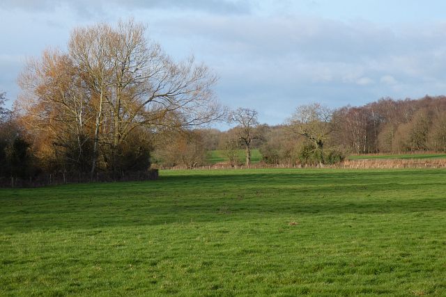
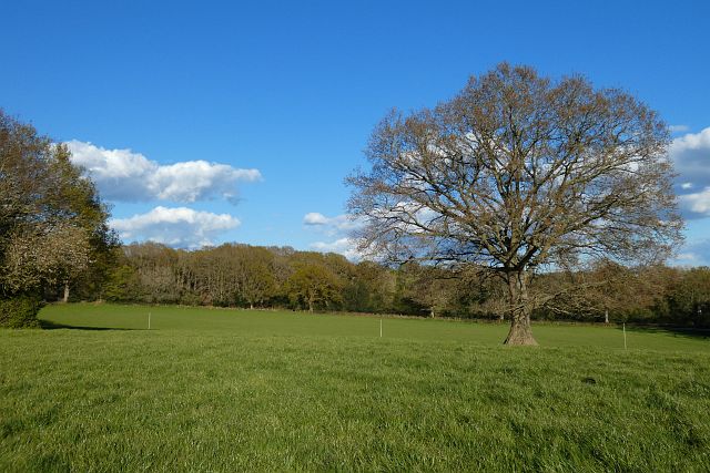
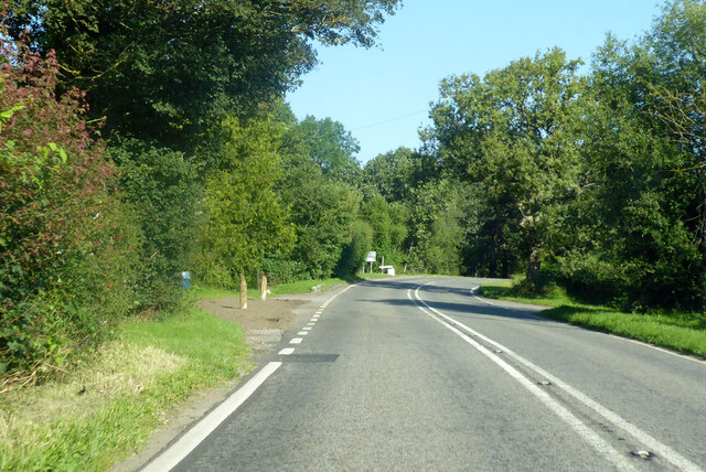
Moorlane Copse is a picturesque woodland located in the county of Hampshire, England. Spanning an area of approximately 20 acres, this enchanting forest is renowned for its natural beauty and diverse range of flora and fauna.

The copse is predominantly composed of native broadleaf trees such as oak, beech, and birch, which create a dense canopy overhead, providing shade and shelter for the woodland floor. The forest floor is adorned with a variety of wildflowers, including bluebells, primroses, and wood anemones, which carpet the ground in vibrant hues during the springtime.

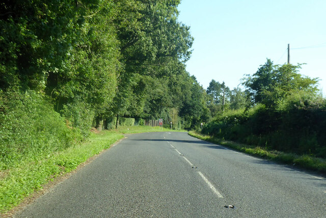
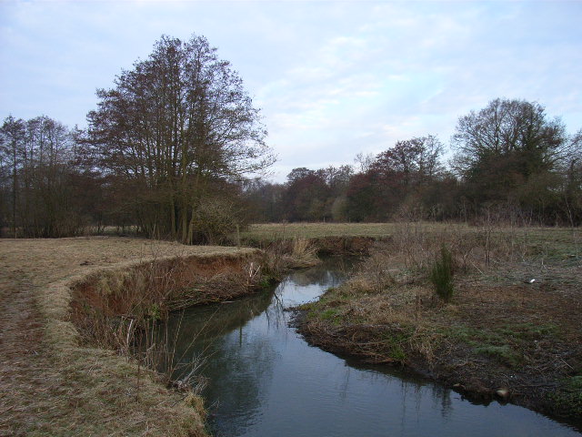
Moorlane Copse is intersected by several meandering footpaths, allowing visitors to explore the woodland at their leisure. These paths lead to various points of interest, such as a small pond teeming with aquatic life, and a clearing that offers panoramic views of the surrounding countryside.

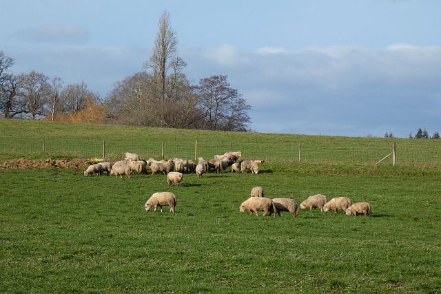
The copse is a haven for wildlife, with a wide range of species calling it home. Birdwatchers will delight in spotting resident and migratory birds, including woodpeckers, nuthatches, and jays. Squirrels scamper through the treetops, while deer occasionally make an appearance, adding to the charm and tranquility of this natural sanctuary.

Moorlane Copse is a popular destination for nature enthusiasts, walkers, and families seeking a peaceful retreat from the hustle and bustle of everyday life. The copse offers a sense of serenity and an opportunity to reconnect with nature, making it a must-visit location for anyone exploring the beauty of Hampshire.

If you have any feedback on the listing, please let us know in the comments section below.

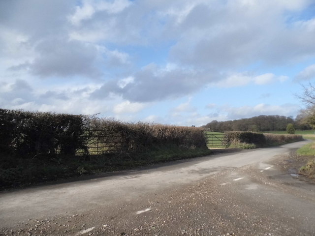
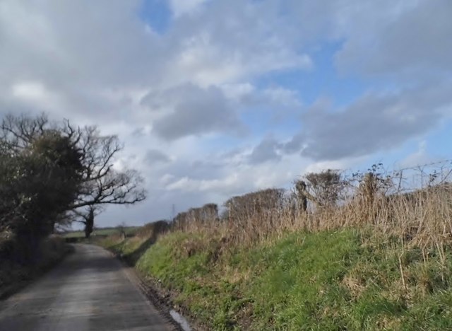
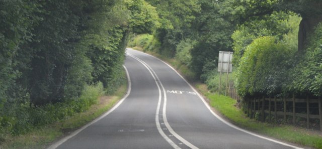
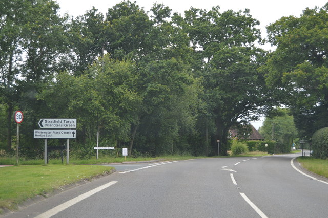
Moorlane Copse Images

Images are sourced within 2km of 51.332011/-0.93997837 or Grid Reference SU7359. Thanks to Geograph Open Source API. All images are credited.

Red Hill, Hazeley
Red Hill, Hazeley
Unnamed road through Hazeley
B3349 The B3349 runs 27 miles from Alton <a href="https://www.geograph.org.uk/photo/5212600">SU7038 : Junction of A339 & B3349</a> to Wokingham.
<span class="nowrap"><a title="http://www.sabre-roads.org.uk/wiki/index.php?title=B3349" rel="nofollow ugc noopener" href="http://www.sabre-roads.org.uk/wiki/index.php?title=B3349">Link</a><img style="margin-left:2px;" alt="External link" title="External link - shift click to open in new window" src="https://s1.geograph.org.uk/img/external.png" width="10" height="10"/></span>
B3349
The B3349 runs 27 miles from Alton SU7038 : Junction of A339 & B3349 to Wokingham. LinkExternal link
B3349, northbound The B3349 runs 27 miles from Alton <a href="https://www.geograph.org.uk/photo/5212600">SU7038 : Junction of A339 & B3349</a> to Wokingham.
<span class="nowrap"><a title="http://www.sabre-roads.org.uk/wiki/index.php?title=B3349" rel="nofollow ugc noopener" href="http://www.sabre-roads.org.uk/wiki/index.php?title=B3349">Link</a><img style="margin-left:2px;" alt="External link" title="External link - shift click to open in new window" src="https://s1.geograph.org.uk/img/external.png" width="10" height="10"/></span>
B3349, northbound
The B3349 runs 27 miles from Alton SU7038 : Junction of A339 & B3349 to Wokingham. LinkExternal link
Old Milestone by the B3349, Reading Road, Mattingley Green Carved stone post by the B3349, in parish of MATTINGLEY (HART District), Mattingley Green, North of Mattingley village, at junction to Hazley, on wide grass verge, on West side of road. Hook pillar, erected by the Basingstoke, Hartfordbridge & Blackwater (and Odiham) turnpike trust in the 19th century. 

Inscription reads:-
: READiNG / 10 / MILES : : ODIHAM / (5) / (MILES) :

Grade II listed.  
List Entry Number: 1243658 <span class="nowrap"><a title="https://historicengland.org.uk/listing/the-list/list-entry/1243658" rel="nofollow ugc noopener" href="https://historicengland.org.uk/listing/the-list/list-entry/1243658">Link</a><img style="margin-left:2px;" alt="External link" title="External link - shift click to open in new window" src="https://s1.geograph.org.uk/img/external.png" width="10" height="10"/></span>

Milestone Society National ID: HA_REOD10.
Old Milestone by the B3349, Reading Road, Mattingley Green
Carved stone post by the B3349, in parish of MATTINGLEY (HART District), Mattingley Green, North of Mattingley village, at junction to Hazley, on wide grass verge, on West side of road. Hook pillar, erected by the Basingstoke, Hartfordbridge & Blackwater (and Odiham) turnpike trust in the 19th century. Inscription reads:- : READiNG / 10 / MILES : : ODIHAM / (5) / (MILES) : Grade II listed. List Entry Number: 1243658 LinkExternal link Milestone Society National ID: HA_REOD10.
Farmland, Mattingley A footpath through a crop of rye to the south-west of Hound Green. The crop is quite high and the path quite narrow so it was fortunate that it had been dry.
Farmland, Mattingley
A footpath through a crop of rye to the south-west of Hound Green. The crop is quite high and the path quite narrow so it was fortunate that it had been dry.
Wood and farmland, Mattingley A footpath follows the edge of this arable field to the east of Alder Moor Farm.
Wood and farmland, Mattingley
A footpath follows the edge of this arable field to the east of Alder Moor Farm.
Pasture, Mattingley Fields at Steven's Farm in Hazeley. A public footpath passes through the smaller gate.
Pasture, Mattingley
Fields at Steven's Farm in Hazeley. A public footpath passes through the smaller gate.
Pasture, Mattingley A field on the eastern bank of the River Whitewater.  Bannister's Copse is on the right.
Pasture, Mattingley
A field on the eastern bank of the River Whitewater. Bannister's Copse is on the right.
Pasture, Mattingley Fields on a hillside and crossed by a footpath to the west of Hazeley Heath.
Pasture, Mattingley
Fields on a hillside and crossed by a footpath to the west of Hazeley Heath.
Mattingley War memorial bus shelter A practical memorial 'in memory of Mattingley parishioners who gave their lives in the 1914–18 and 1939–45 wars'. Or it would be, if there remained any buses serving the village.  A milestone on the former Heckfield to Odiham turnpike is alongside.
Mattingley War memorial bus shelter
A practical memorial 'in memory of Mattingley parishioners who gave their lives in the 1914–18 and 1939–45 wars'. Or it would be, if there remained any buses serving the village. A milestone on the former Heckfield to Odiham turnpike is alongside.
B3349 Reading Road Towards Reading, between Mattingley and Hound Green.
B3349 Reading Road
Towards Reading, between Mattingley and Hound Green.
B3349 Reading Road, Hound Green Towards Reading.
B3349 Reading Road, Hound Green
Towards Reading.
B3349 Reading Road Towards Reading.
B3349 Reading Road
Towards Reading.
B3349 passing The New Inn The B3349 runs 27 miles from Alton <a href="https://www.geograph.org.uk/photo/5212600">SU7038 : Junction of A339 & B3349</a> to Wokingham.
<span class="nowrap"><a title="http://www.sabre-roads.org.uk/wiki/index.php?title=B3349" rel="nofollow ugc noopener" href="http://www.sabre-roads.org.uk/wiki/index.php?title=B3349">Link</a><img style="margin-left:2px;" alt="External link" title="External link - shift click to open in new window" src="https://s1.geograph.org.uk/img/external.png" width="10" height="10"/></span>
B3349 passing The New Inn
The B3349 runs 27 miles from Alton SU7038 : Junction of A339 & B3349 to Wokingham. LinkExternal link
B3349 The B3349 runs 27 miles from Alton <a href="https://www.geograph.org.uk/photo/5212600">SU7038 : Junction of A339 & B3349</a> to Wokingham.
<span class="nowrap"><a title="http://www.sabre-roads.org.uk/wiki/index.php?title=B3349" rel="nofollow ugc noopener" href="http://www.sabre-roads.org.uk/wiki/index.php?title=B3349">Link</a><img style="margin-left:2px;" alt="External link" title="External link - shift click to open in new window" src="https://s1.geograph.org.uk/img/external.png" width="10" height="10"/></span>
B3349
The B3349 runs 27 miles from Alton SU7038 : Junction of A339 & B3349 to Wokingham. LinkExternal link
Old Milestone by the B3349, Heckfield Carved stone post by the B3349, in parish of HECKFIELD (HART District), Heckfield, by junction with road to Heckfield Memorial Hall, on wide grass verge, on West side of road. Hook pillar, erected by the Basingstoke, Hartfordbridge & Blackwater (and Odiham) turnpike trust in the 19th century. Mileage defaced.

Inscription reads:-
: READING / (8) / Miles : : ODIHAM / (7) / Miles :  

Milestone Society National ID: HA_REOD08.
Old Milestone by the B3349, Heckfield
Carved stone post by the B3349, in parish of HECKFIELD (HART District), Heckfield, by junction with road to Heckfield Memorial Hall, on wide grass verge, on West side of road. Hook pillar, erected by the Basingstoke, Hartfordbridge & Blackwater (and Odiham) turnpike trust in the 19th century. Mileage defaced. Inscription reads:- : READING / (8) / Miles : : ODIHAM / (7) / Miles : Milestone Society National ID: HA_REOD08.
Farmland, Heckfield The sheep had just been relocated to this field from a neighbouring riverside field.
Farmland, Heckfield
The sheep had just been relocated to this field from a neighbouring riverside field.
Show me another place!

Moorlane Copse is located at Grid Ref: SU7359 (Lat: 51.332011, Lng: -0.93997837)

Administrative County: Hampshire

District: Hart

Police Authority: Hampshire

What 3 Words

///spiking.soft.spreading. Near Hartley Wintney, Hampshire

Related Wikis

Hazeley

Hazeley is a village in the Hart District in Hampshire, England. It is 2.5 miles (3 km) away from Hartley Wintney and comes under the parish of Mattingley...

Hound Green

Hound Green is a village in the Hart District of Hampshire, England. It is in the civil parish of Mattingley. Its nearest town is Hook approximately 3...

River Hart

The River Hart is a tributary of the River Whitewater in north Hampshire, England. It rises at Ashley Head spring in Crondall and flows north to meet the...

Heckfield Place

A country estate of 438 acres, the heart of Heckfield Place is a Georgian Grade II listed manor house, located in Hampshire, United Kingdom. It was built...

Highfield House, Heckfield

Highfield House, also known as Highfield Park, is an early 18th-century Queen Anne style country house in Heckfield, Hampshire, England. A Grade II* listed...

Bramshill

Bramshill is a civil parish in the English county of Hampshire. Its name has become synonymous with the Police Staff College, Bramshill located in Bramshill...

Bramshill House

Bramshill House, in Bramshill, northeast Hampshire, England, is one of the largest and most important Jacobean prodigy house mansions in England. It was...

Police Staff College, Bramshill

The Police Staff College, Bramshill, Bramshill House, Bramshill, (near Hook) Hampshire, England, was until 2015 the principal police staff training establishment...

Nearby Amenities

Located within 500m of 51.332011,-0.93997837
Bus Stop
Holdshott Farm
Bench: no
Naptan AtcoCode: 1900HA060047
Naptan Bearing: N
Naptan CommonName: Holdshott Farm
Naptan NaptanCode: hamgpgwp
Naptan Street: B3011
Naptan Verified: no
Shelter: no
Source: naptan_import
Tactile Paving: no
Lat/Long: 51.3364712/-0.9408775
Bus Stop
Holdshott Farm
Bench: no
Naptan AtcoCode: 1900HA060048
Naptan Bearing: S
Naptan CommonName: Holdshott Farm
Naptan NaptanCode: hamgpgwt
Naptan Street: B3011
Naptan Verified: no
Shelter: no
Source: naptan_import
Tactile Paving: no
Lat/Long: 51.3363687/-0.9407549
Power: tower
Source: bing
Lat/Long: 51.3291149/-0.936
Power: tower
Source: bing
Lat/Long: 51.331943/-0.9349553
The data included in this document is from www.openstreetmap.org. The data is made available under ODbL.

Have you been to Moorlane Copse?

Leave your review of Moorlane Copse below (or comments, questions and feedback).