Borough Court Copse

Wood, Forest in Hampshire Hart

England

Borough Court Copse

Looking through the moon gate at West Green House Garden West Green House Garden is a National Trust garden.
Looking through the moon gate at West Green House Garden Credit: Steve Daniels

Borough Court Copse is a charming woodland area located in Hampshire, England. Covering an area of approximately 100 acres, this copse is a natural treasure that provides a tranquil escape from the hustle and bustle of everyday life. It is situated near the village of Borough Court, hence the name.

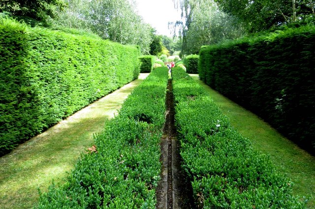
The copse is primarily made up of deciduous trees, including oak, beech, and ash, which create a dense canopy that filters sunlight and creates a cool and shaded environment. The forest floor is covered in a thick layer of leaf litter, providing a haven for various species of flora and fauna.

Walking trails wind their way through the copse, allowing visitors to explore the natural beauty at their own pace. These trails are well-maintained and offer a gentle terrain, making it accessible for people of all ages and abilities.

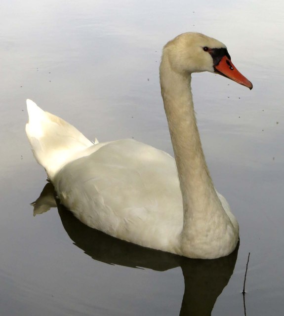
Borough Court Copse is known for its diverse wildlife. It is home to a range of bird species, such as woodpeckers, nightingales, and tawny owls. Squirrels can be seen scurrying through the trees, while deer occasionally make an appearance, adding to the copse's enchanting atmosphere.

During the spring, the forest floor comes alive with a vibrant display of bluebells, providing a picturesque scene that attracts photographers and nature enthusiasts alike. In the autumn, the copse is transformed into a kaleidoscope of colors as the leaves change, creating a breathtaking spectacle.

Overall, Borough Court Copse is a hidden gem in Hampshire, offering visitors a chance to connect with nature and enjoy the serenity of a beautiful woodland setting.

If you have any feedback on the listing, please let us know in the comments section below.

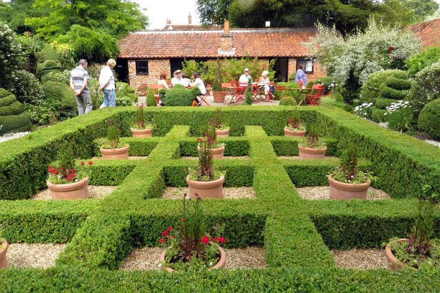
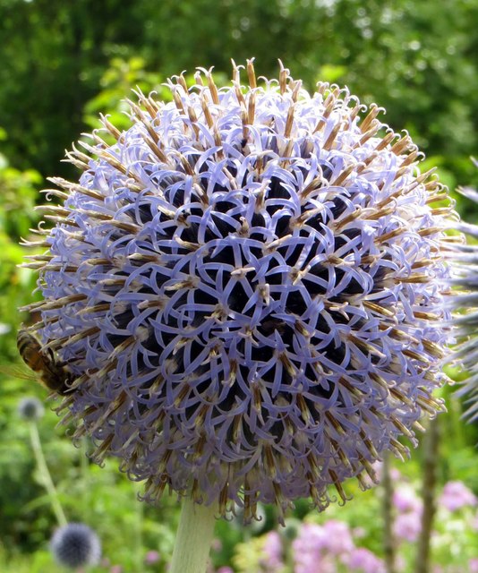
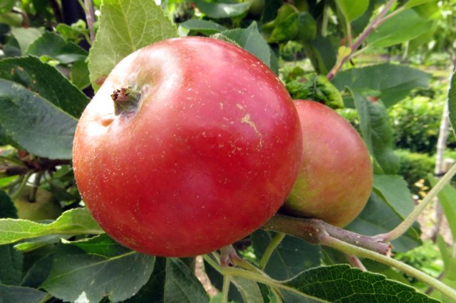
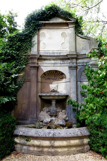
Borough Court Copse Images

Images are sourced within 2km of 51.300624/-0.94249437 or Grid Reference SU7356. Thanks to Geograph Open Source API. All images are credited.

Looking through the moon gate at West Green House Garden West Green House Garden is a National Trust garden.
Looking through the moon gate at West Green House Garden
West Green House Garden is a National Trust garden.
A path in West Green House Garden West Green House Garden is a National Trust garden.
A path in West Green House Garden
West Green House Garden is a National Trust garden.
West Green House The 18th century house was damaged by an IRA bomb attack in 1990.
West Green House
The 18th century house was damaged by an IRA bomb attack in 1990.
The Courtyard Garden in West Green House Garden West Green House Garden is a National Trust garden.
The Courtyard Garden in West Green House Garden
West Green House Garden is a National Trust garden.
The well in the walled garden West Green House Garden is a National Trust garden.
The well in the walled garden
West Green House Garden is a National Trust garden.
An allium in West Green House Garden West Green House Garden is a National Trust garden.
An allium in West Green House Garden
West Green House Garden is a National Trust garden.
Apples in West Green House Garden West Green House Garden is a National Trust garden.
Apples in West Green House Garden
West Green House Garden is a National Trust garden.
The Nymphaeum in West Green House Garden West Green House Garden is a National Trust garden. The Nymphaeum Fountain was designed by architect Quinlan Terry.
The Nymphaeum in West Green House Garden
West Green House Garden is a National Trust garden. The Nymphaeum Fountain was designed by architect Quinlan Terry.
The Water Garden in West Green House Garden West Green House Garden is a National Trust garden.
The Water Garden in West Green House Garden
West Green House Garden is a National Trust garden.
The Garden of the Five Bridges in West Green House Garden West Green House Garden is a National Trust garden.
The Garden of the Five Bridges in West Green House Garden
West Green House Garden is a National Trust garden.
A swan on the lake West Green House Garden is a National Trust garden.
A swan on the lake
West Green House Garden is a National Trust garden.
Footbridge over the lake to the island in West Green House Garden West Green House Garden is a National Trust garden.
Footbridge over the lake to the island in West Green House Garden
West Green House Garden is a National Trust garden.
Wooden temple in West Green House Garden West Green House Garden is a National Trust garden.
Wooden temple in West Green House Garden
West Green House Garden is a National Trust garden.
The greenhouse at West Green House Garden West Green House Garden is a National Trust garden.
The greenhouse at West Green House Garden
West Green House Garden is a National Trust garden.
B3349, northbound The B3349 runs 27 miles from Alton <a href="https://www.geograph.org.uk/photo/5212600">SU7038 : Junction of A339 & B3349</a> to Wokingham.
<span class="nowrap"><a title="http://www.sabre-roads.org.uk/wiki/index.php?title=B3349" rel="nofollow ugc noopener" href="http://www.sabre-roads.org.uk/wiki/index.php?title=B3349">Link</a><img style="margin-left:2px;" alt="External link" title="External link - shift click to open in new window" src="https://s1.geograph.org.uk/img/external.png" width="10" height="10"/></span>
B3349, northbound
The B3349 runs 27 miles from Alton SU7038 : Junction of A339 & B3349 to Wokingham. LinkExternal link
B3349, Reading Rd The B3349 runs 27 miles from Alton <a href="https://www.geograph.org.uk/photo/5212600">SU7038 : Junction of A339 & B3349</a> to Wokingham.
<span class="nowrap"><a title="http://www.sabre-roads.org.uk/wiki/index.php?title=B3349" rel="nofollow ugc noopener" href="http://www.sabre-roads.org.uk/wiki/index.php?title=B3349">Link</a><img style="margin-left:2px;" alt="External link" title="External link - shift click to open in new window" src="https://s1.geograph.org.uk/img/external.png" width="10" height="10"/></span>
B3349, Reading Rd
The B3349 runs 27 miles from Alton SU7038 : Junction of A339 & B3349 to Wokingham. LinkExternal link
Entering Mattingley, B3349 The B3349 runs 27 miles from Alton <a href="https://www.geograph.org.uk/photo/5212600">SU7038 : Junction of A339 & B3349</a> to Wokingham.
<span class="nowrap"><a title="http://www.sabre-roads.org.uk/wiki/index.php?title=B3349" rel="nofollow ugc noopener" href="http://www.sabre-roads.org.uk/wiki/index.php?title=B3349">Link</a><img style="margin-left:2px;" alt="External link" title="External link - shift click to open in new window" src="https://s1.geograph.org.uk/img/external.png" width="10" height="10"/></span>
Entering Mattingley, B3349
The B3349 runs 27 miles from Alton SU7038 : Junction of A339 & B3349 to Wokingham. LinkExternal link
West Green Fruits - PYO fruit farm Last of the season's strawberries.
West Green Fruits - PYO fruit farm
Last of the season's strawberries.
Show me another place!

Borough Court Copse is located at Grid Ref: SU7356 (Lat: 51.300624, Lng: -0.94249437)

Administrative County: Hampshire

District: Hart

Police Authority: Hampshire

What 3 Words

///tarred.arranger.noisy. Near Hook, Hampshire

Related Wikis

West Green, Hampshire

West Green is a village in the Hartley Wintney parish of Hampshire, England. The villages lies 2 miles (3 km) from Hook, its nearest town.
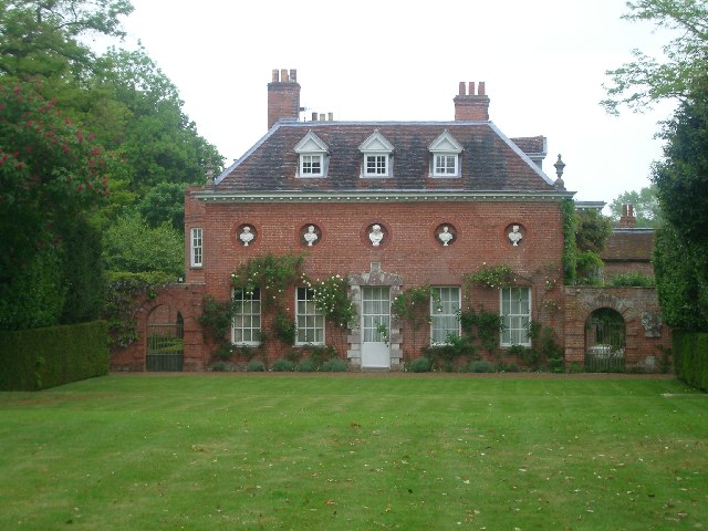
West Green House

West Green House is an 18th-century country house and garden at West Green in Hartley Wintney in the English county of Hampshire. The house is listed Grade...
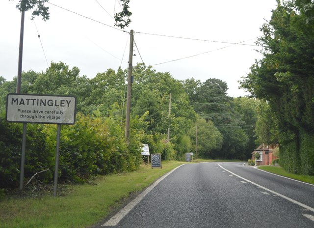
Mattingley

Mattingley is a village and large civil parish in Hampshire, England. The village lies on the Reading road between the town of Hook and Reading. The village...

Chandlers Green

Chandlers Green is a hamlet in the civil parish of Mattingley in the Hart District of Hampshire, England. Its nearest town is Hook approximately 2.5 miles...

Phoenix Green

Phoenix Green is a village in the Hart District of Hampshire, England about 1 mile (1.6 km) southwest of Hartley Wintney. It has a petrol station and one...

Rotherwick

Rotherwick is a village and civil parish in the Hart district of Hampshire, England. == Extent and layout == It is briefly limited to the east and the...

Hartley Wintney F.C.

Hartley Wintney Football Club is a semi-professional football club based in the village of Hartley Wintney, Hampshire, England. They are currently members...
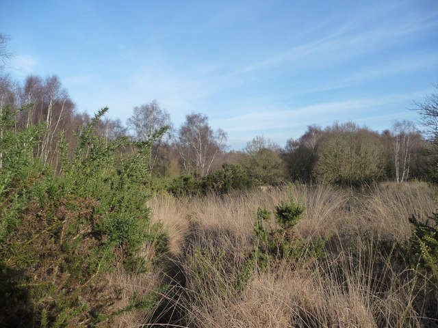
Hazeley Heath

Hazeley Heath is a 180.8-hectare (447-acre) biological Site of Special Scientific Interest west of Farnborough in Hampshire. It is part of Thames Basin...

Nearby Amenities

Located within 500m of 51.300624,-0.94249437
Power: tower
Source: bing
Lat/Long: 51.2974814/-0.9471078
Power: tower
Source: bing
Lat/Long: 51.3005159/-0.9491011
Power: tower
Source: bing
Lat/Long: 51.3025536/-0.9475963
Damale's Farm
Landuse: farm
Note Retag: CS #48756035
Source: OS_OpenData_StreetView
Lat/Long: 51.3021518/-0.9381954
Building: bunker
Bunker Type: pillbox
Military: bunker
Lat/Long: 51.3043597/-0.941675
Direction: 235
Generator Method: photovoltaic
Generator Output Electricity: yes
Generator Solar Modules: 8
Generator Source: solar
Generator Type: solar_photovoltaic_panel
Location: roof
Power: generator
Lat/Long: 51.298003/-0.9369309
Direction: 235
Generator Method: photovoltaic
Generator Output Electricity: yes
Generator Solar Modules: 9
Generator Source: solar
Generator Type: solar_photovoltaic_panel
Location: roof
Power: generator
Lat/Long: 51.2979283/-0.9368517
The data included in this document is from www.openstreetmap.org. The data is made available under ODbL.

Have you been to Borough Court Copse?

Leave your review of Borough Court Copse below (or comments, questions and feedback).