Shrub Croft Copse
Wood, Forest in Hampshire East Hampshire
England
Shrub Croft Copse

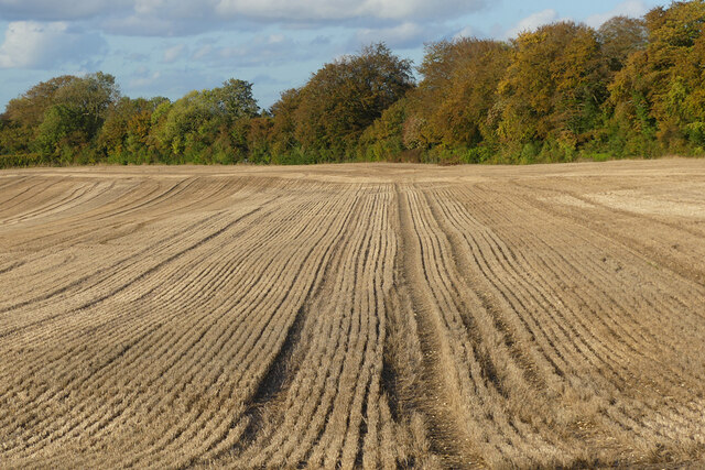
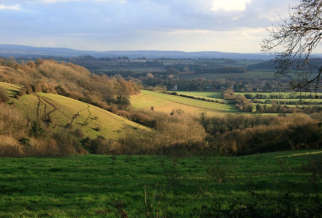
Shrub Croft Copse, located in Hampshire, England, is a charming woodland area that spans approximately 10 hectares. Situated in the southeast of the county, this copse is nestled within the picturesque countryside and offers a peaceful natural retreat for visitors.
The copse is primarily composed of mixed deciduous trees, including oak, beech, ash, and birch, creating a diverse and vibrant woodland ecosystem. The dense canopy created by these trees provides shelter and sustenance for a wide variety of wildlife, making it an important habitat for many species.
Walking through Shrub Croft Copse, visitors will find themselves surrounded by a tranquil and enchanting atmosphere. The forest floor is carpeted with a rich tapestry of wildflowers, ferns, and mosses, adding to the beauty of the surroundings. The gentle sounds of birdsong and rustling leaves create a soothing symphony, further enhancing the sensory experience.
The copse is crisscrossed by a network of well-maintained footpaths, allowing visitors to explore the area at their leisure. These paths wind their way through the trees, occasionally opening up to reveal stunning vistas of the surrounding countryside. Informative signposts along the way provide interesting facts about the flora and fauna found within the copse, enriching the visitor's experience and understanding of the natural environment.
Shrub Croft Copse is a popular destination for nature enthusiasts, walkers, and photographers alike. Its natural beauty and peaceful ambiance offer a welcome respite from the busyness of everyday life. Whether one is seeking solitude, a connection with nature, or simply a refreshing walk, this woodland oasis in Hampshire provides a perfect setting for relaxation and exploration.
If you have any feedback on the listing, please let us know in the comments section below.
Shrub Croft Copse Images
Images are sourced within 2km of 51.184944/-0.94701762 or Grid Reference SU7343. Thanks to Geograph Open Source API. All images are credited.


Shrub Croft Copse is located at Grid Ref: SU7343 (Lat: 51.184944, Lng: -0.94701762)
Administrative County: Hampshire
District: East Hampshire
Police Authority: Hampshire
What 3 Words
///paint.tributes.fizzled. Near Long Sutton, Hampshire
Nearby Locations
Related Wikis

Holybourne Hill
Holybourne Hill or Holybourne Down is one of the highest points in the county of Hampshire, England, and in the Hampshire Downs, rising to 225 metres...

Holybourne Freight railway station
Holybourne Freight railway station is where freight trains serving Holybourne Oil Terminal terminate. These freight trains ran daily from Bentley and Alton...
Froyle
Froyle is a village and civil parish in the East Hampshire district of Hampshire, England. It is 3.6 miles (5.8 km) northeast of Alton. The nearest railway...
Holybourne
Holybourne is a village in the East Hampshire district of Hampshire, England. It is 1.3 miles (2.2 km) northeast of the centre of Alton, is contiguous...
Treloar School
Treloar School and College is a non-maintained residential and day special school and college for disabled children and young people aged from 2 to 25...
Alton line
The Alton line is a railway line in Hampshire and Surrey, England, operated by South Western Railway as a relatively long branch of the South West Main...

Neatham
Neatham is a Roman hamlet, an ancient hundred and a former civil parish, now in the parish of Alton, in the East Hampshire district of Hampshire, England...
Golden Pot
Golden Pot is a hamlet in the East Hampshire district of Hampshire, England. It lies 2.4 miles (3.9 km) north of Alton, on the B3349 road. The nearest...
Nearby Amenities
Located within 500m of 51.184944,-0.94701762Have you been to Shrub Croft Copse?
Leave your review of Shrub Croft Copse below (or comments, questions and feedback).