King's Copse

Wood, Forest in Northamptonshire

England

King's Copse

The A5 Watling Street from the air Waterslade Copse is in the foreground, with Potterspury Lodge School at the end of a tree-lined lane on the other side of the road. The residential school supports and educates students with Aspergers Syndrome and other associated challenges within the autistic spectrum.

School web site: <span class="nowrap"><a title="https://www.cambiangroup.com/specialist-education/our-schools/asperger-schools/potterspury-lodge-school/" rel="nofollow ugc noopener" href="https://www.cambiangroup.com/specialist-education/our-schools/asperger-schools/potterspury-lodge-school/">Link</a><img style="margin-left:2px;" alt="External link" title="External link - shift click to open in new window" src="https://s1.geograph.org.uk/img/external.png" width="10" height="10"/></span> .
The A5 Watling Street from the air Credit: Thomas Nugent

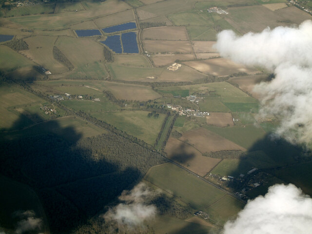
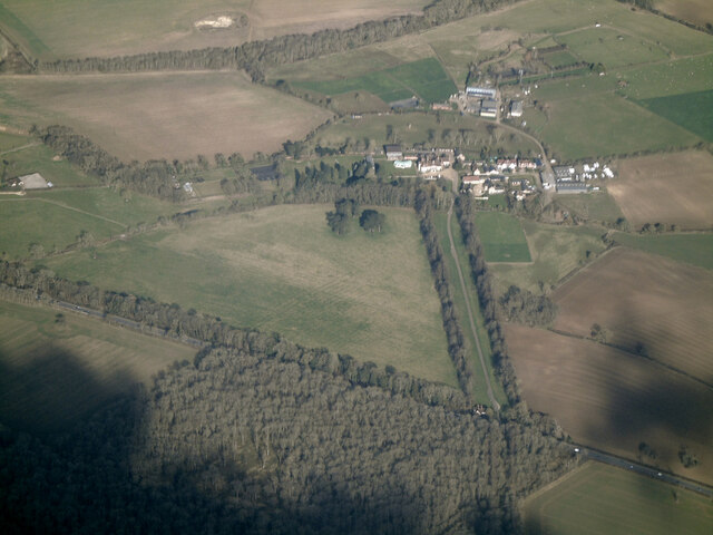
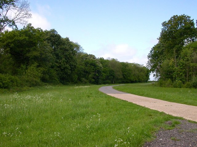
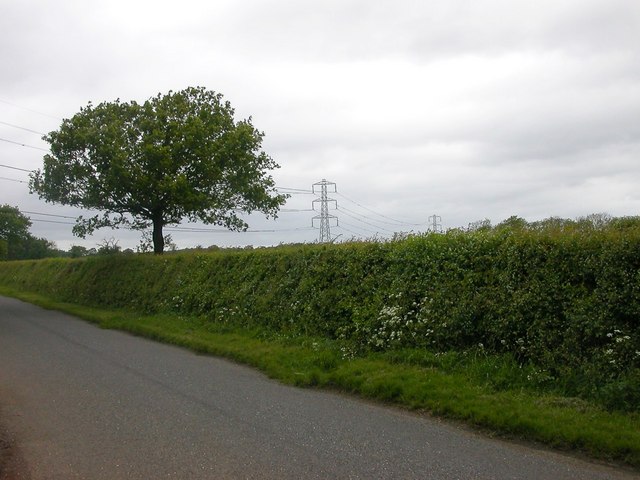
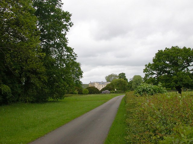
King's Copse is a picturesque woodland located in the county of Northamptonshire, England. Covering an area of approximately 50 hectares, it is a popular destination for nature enthusiasts and outdoor enthusiasts alike. The copse is situated in a rural setting, surrounded by rolling hills and scenic countryside, offering visitors a tranquil and serene escape from the hustle and bustle of city life.

The woodland is predominantly made up of mature deciduous trees, including oak, ash, and beech, which provide a rich and diverse habitat for a wide range of flora and fauna. The forest floor is carpeted with an array of wildflowers, creating a vibrant and colorful display during the spring and summer months.

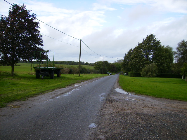
King's Copse is crisscrossed by a network of well-maintained walking trails, allowing visitors to explore the woodland at their own pace. These trails offer breathtaking views of the surrounding landscape and provide opportunities for wildlife spotting, birdwatching, and photography. The copse is also home to a variety of wildlife, including deer, foxes, badgers, and a plethora of bird species.

In addition to its natural beauty, King's Copse has historical significance, with evidence of human activity dating back centuries. The woodland is believed to have been used as a hunting ground by ancient kings, hence its name. Today, it serves as a peaceful retreat for locals and tourists alike, providing a haven for relaxation, recreation, and appreciation of the natural world.

If you have any feedback on the listing, please let us know in the comments section below.

King's Copse Images

Images are sourced within 2km of 52.090401/-0.93326973 or Grid Reference SP7344. Thanks to Geograph Open Source API. All images are credited.

The A5 Watling Street from the air Waterslade Copse is in the foreground, with Potterspury Lodge School at the end of a tree-lined lane on the other side of the road. The residential school supports and educates students with Aspergers Syndrome and other associated challenges within the autistic spectrum.

School web site: <span class="nowrap"><a title="https://www.cambiangroup.com/specialist-education/our-schools/asperger-schools/potterspury-lodge-school/" rel="nofollow ugc noopener" href="https://www.cambiangroup.com/specialist-education/our-schools/asperger-schools/potterspury-lodge-school/">Link</a><img style="margin-left:2px;" alt="External link" title="External link - shift click to open in new window" src="https://s1.geograph.org.uk/img/external.png" width="10" height="10"/></span> .
The A5 Watling Street from the air
Waterslade Copse is in the foreground, with Potterspury Lodge School at the end of a tree-lined lane on the other side of the road. The residential school supports and educates students with Aspergers Syndrome and other associated challenges within the autistic spectrum. School web site: LinkExternal link .
Pottersbury Lodge School from the air The residential school supports and educates students with Aspergers Syndrome and other associated challenges within the autistic spectrum.

School web site: <span class="nowrap"><a title="https://www.cambiangroup.com/specialist-education/our-schools/asperger-schools/potterspury-lodge-school/" rel="nofollow ugc noopener" href="https://www.cambiangroup.com/specialist-education/our-schools/asperger-schools/potterspury-lodge-school/">Link</a><img style="margin-left:2px;" alt="External link" title="External link - shift click to open in new window" src="https://s1.geograph.org.uk/img/external.png" width="10" height="10"/></span> .
Pottersbury Lodge School from the air
The residential school supports and educates students with Aspergers Syndrome and other associated challenges within the autistic spectrum. School web site: LinkExternal link .
The A5, Paulerspury Spot the difference <a title="https://www.geograph.org.uk/photo/6384610" href="https://www.geograph.org.uk/photo/6384610">Link</a>
The A5, Paulerspury
Spot the difference Link
Layby on The A5, Paulerspury
Road junction at the A5 north west of Potterspury
Entrance driveway to The Rudolf Steiner School
Queen's Oak The blacked stump - all that remains of the famous Queen's Oak.
Where Edward IV is reputed to have fallen in love with Elizabeth Woodville in 1461 - whilst out hunting in Whittlewood Forest.
Queen's Oak
The blacked stump - all that remains of the famous Queen's Oak. Where Edward IV is reputed to have fallen in love with Elizabeth Woodville in 1461 - whilst out hunting in Whittlewood Forest.
Paulerspury Paulerspury Chapel which is the local United Reformed Church.
Paulerspury
Paulerspury Chapel which is the local United Reformed Church.
Paulerspury The Barley Mow Public House, the only pub in the Village.
Paulerspury
The Barley Mow Public House, the only pub in the Village.
Plumpton End Road leading up to Farm Buildings from Watling Street.
Plumpton End
Road leading up to Farm Buildings from Watling Street.
Paulerspury Old Farm buildings on the Grafton Way.
Paulerspury
Old Farm buildings on the Grafton Way.
Plumpton End Looking along Grafton Way towards King's Copse.
Plumpton End
Looking along Grafton Way towards King's Copse.
Whittlewood Forest Kennels Drive heading back to the main road.
Whittlewood Forest
Kennels Drive heading back to the main road.
Whittlebury A Clearing in old Tun Copse.
Whittlebury
A Clearing in old Tun Copse.
Whittlewood Forest The point at which the power lines cross the road from Whittlebury to Deanshanger.
Whittlewood Forest
The point at which the power lines cross the road from Whittlebury to Deanshanger.
Whittlewood Forest Approaching Wakefield Lodge.
Whittlewood Forest
Approaching Wakefield Lodge.
Watling Street Entrance to the Homestead a small industrial area opposite the Gullet.
Watling Street
Entrance to the Homestead a small industrial area opposite the Gullet.
Looking south from Salcey Pine
Show me another place!

King's Copse is located at Grid Ref: SP7344 (Lat: 52.090401, Lng: -0.93326973)

Unitary Authority: West Northamptonshire

Police Authority: Northamptonshire

What 3 Words

///guards.innocence.greeting. Near Potterspury, Northamptonshire

Nearby Locations

King's Copse Bradlem Pond

Related Wikis

Whittlewood Forest

Whittlewood Forest is a former medieval hunting forest east of Silverstone in Northamptonshire in England. It is managed by the Forestry England. There...

Potterspury Lodge School

Potterspury Lodge School is a Cambian Group school in Northamptonshire, England. It is an Independent School that caters to children with ASD [autism spectrum...

Paulerspury

Paulerspury is a civil parish and small village in South Northamptonshire, England. It is approximately 3 miles (5 km) south of Towcester and 8 miles...

Moor End Castle

The site of Moor End Castle (historically known as Moreende) is situated opposite Moor End Farm, along Moor End Road in the civil parish of Yardley Gobion...

Potterspury

Potterspury is a populous village and civil parish in West Northamptonshire, England. The nearest main town is Milton Keynes, the centre of which is about...

Pury End

Pury End is a hamlet of approximately 100 houses in the civil parish of Paulerspury, near Towcester in West Northamptonshire, England. The Grafton Way...

Alderton, Northamptonshire

Alderton is a small English village and civil parish about 9 miles (14 km) south of Northampton, and 10 miles (16 km) north of Milton Keynes, along a road...

Puxley

Puxley is a hamlet in the West Northamptonshire civil parish of Deanshanger. England. It is 6 miles (10 km) west of Milton Keynes

Nearby Amenities

Located within 500m of 52.090401,-0.93326973
The data included in this document is from www.openstreetmap.org. The data is made available under ODbL.

Have you been to King's Copse?

Leave your review of King's Copse below (or comments, questions and feedback).