Bouchiers Copse

Wood, Forest in Hampshire Hart

England

Bouchiers Copse

Red Hill, Hazeley
Red Hill, Hazeley Credit: David Howard

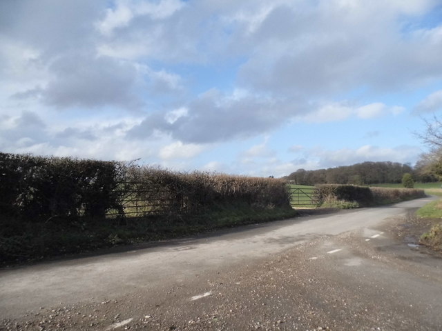
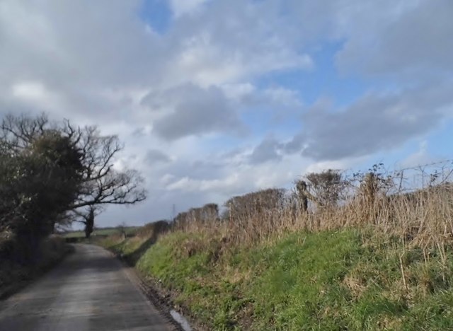
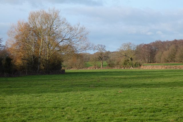
Bouchiers Copse is a picturesque woodland located in Hampshire, England. Covering an area of approximately 20 hectares, this ancient forest is renowned for its natural beauty and diverse ecosystem. The copse is situated near the village of Brockenhurst, within the New Forest National Park.

Bouchiers Copse is predominantly composed of broadleaf trees, including oak, beech, and birch. These towering giants provide a dense canopy, creating a sense of tranquility and seclusion within the forest. The forest floor is adorned with a rich carpet of wildflowers and ferns, adding vibrant colors to the landscape during the spring and summer months.

The copse is home to a variety of wildlife, making it a haven for nature enthusiasts and birdwatchers. Visitors may spot deer, rabbits, and squirrels roaming freely among the trees, while the melodious songs of various bird species fill the air. Additionally, Bouchiers Copse is known for its population of rare butterflies, which thrive in the tranquil environment.

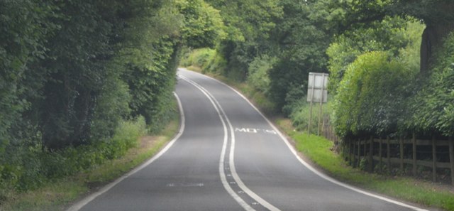
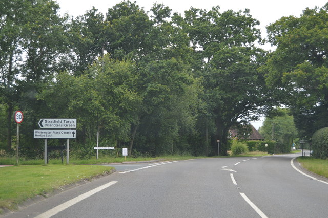
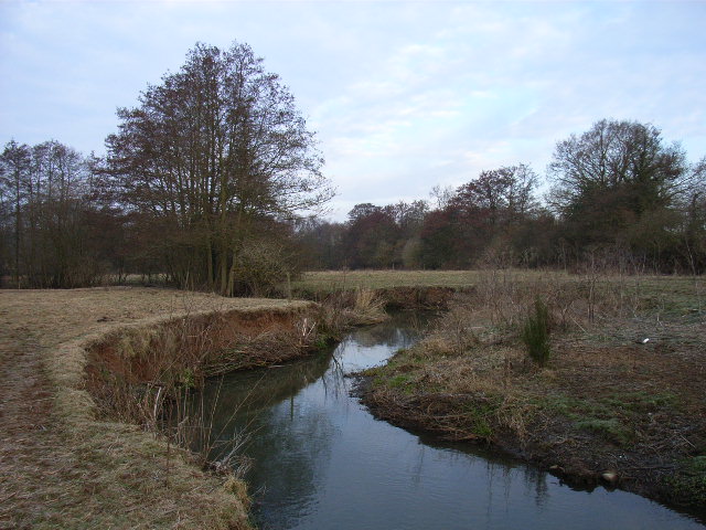
The forest offers several walking trails, allowing visitors to explore its natural wonders at their own pace. The paths wind through the ancient woodland, providing glimpses of hidden glades and babbling brooks along the way. The copse is also intersected by a small stream, adding to its enchanting charm.

Bouchiers Copse attracts visitors throughout the year, with each season offering a unique experience. Whether one is seeking a peaceful retreat, a chance to connect with nature, or an opportunity to capture stunning photographs, this Hampshire woodland is sure to leave a lasting impression.

If you have any feedback on the listing, please let us know in the comments section below.

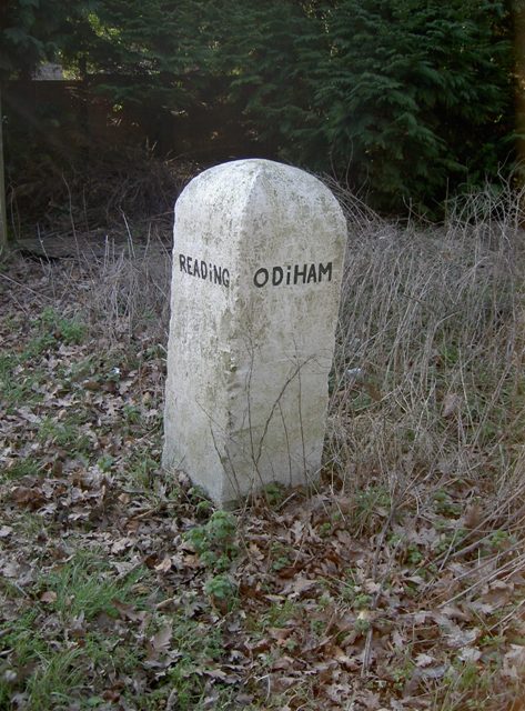
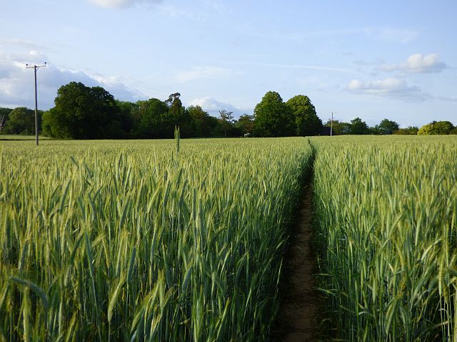
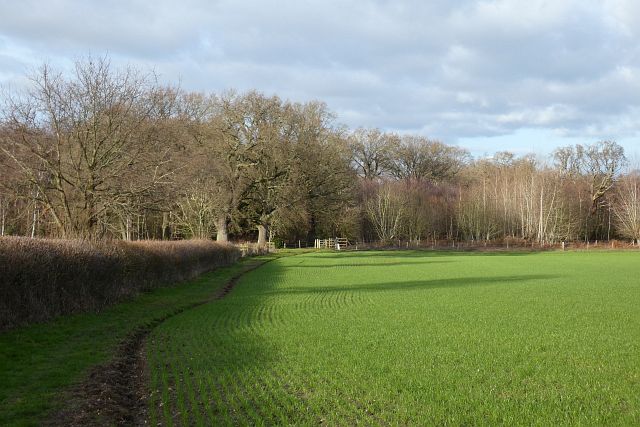
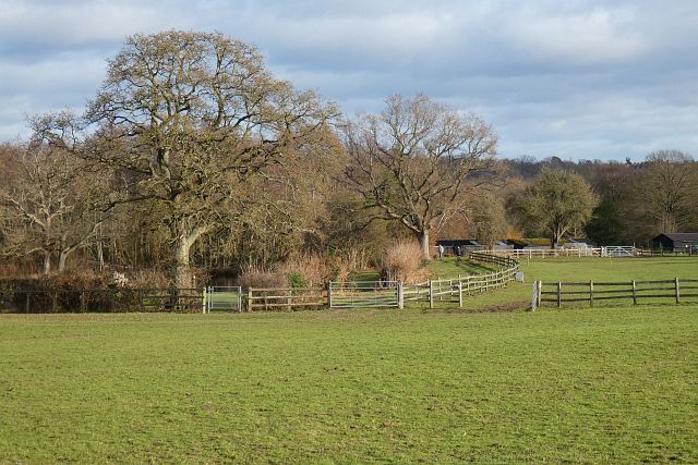
Bouchiers Copse Images

Images are sourced within 2km of 51.332018/-0.95377238 or Grid Reference SU7259. Thanks to Geograph Open Source API. All images are credited.

Red Hill, Hazeley
Red Hill, Hazeley
Unnamed road through Hazeley
Tractor delivery at Willowbank Farm There was another load following him. They had to stop for someone to come and open the gate.
Tractor delivery at Willowbank Farm
There was another load following him. They had to stop for someone to come and open the gate.
B3349 The B3349 runs 27 miles from Alton <a href="https://www.geograph.org.uk/photo/5212600">SU7038 : Junction of A339 & B3349</a> to Wokingham.
<span class="nowrap"><a title="http://www.sabre-roads.org.uk/wiki/index.php?title=B3349" rel="nofollow ugc noopener" href="http://www.sabre-roads.org.uk/wiki/index.php?title=B3349">Link</a><img style="margin-left:2px;" alt="External link" title="External link - shift click to open in new window" src="https://s1.geograph.org.uk/img/external.png" width="10" height="10"/></span>
B3349
The B3349 runs 27 miles from Alton SU7038 : Junction of A339 & B3349 to Wokingham. LinkExternal link
B3349, northbound The B3349 runs 27 miles from Alton <a href="https://www.geograph.org.uk/photo/5212600">SU7038 : Junction of A339 & B3349</a> to Wokingham.
<span class="nowrap"><a title="http://www.sabre-roads.org.uk/wiki/index.php?title=B3349" rel="nofollow ugc noopener" href="http://www.sabre-roads.org.uk/wiki/index.php?title=B3349">Link</a><img style="margin-left:2px;" alt="External link" title="External link - shift click to open in new window" src="https://s1.geograph.org.uk/img/external.png" width="10" height="10"/></span>
B3349, northbound
The B3349 runs 27 miles from Alton SU7038 : Junction of A339 & B3349 to Wokingham. LinkExternal link
Old Milestone by the B3349, Reading Road, Mattingley Green Carved stone post by the B3349, in parish of MATTINGLEY (HART District), Mattingley Green, North of Mattingley village, at junction to Hazley, on wide grass verge, on West side of road. Hook pillar, erected by the Basingstoke, Hartfordbridge & Blackwater (and Odiham) turnpike trust in the 19th century. 

Inscription reads:-
: READiNG / 10 / MILES : : ODIHAM / (5) / (MILES) :

Grade II listed.  
List Entry Number: 1243658 <span class="nowrap"><a title="https://historicengland.org.uk/listing/the-list/list-entry/1243658" rel="nofollow ugc noopener" href="https://historicengland.org.uk/listing/the-list/list-entry/1243658">Link</a><img style="margin-left:2px;" alt="External link" title="External link - shift click to open in new window" src="https://s1.geograph.org.uk/img/external.png" width="10" height="10"/></span>

Milestone Society National ID: HA_REOD10.
Old Milestone by the B3349, Reading Road, Mattingley Green
Carved stone post by the B3349, in parish of MATTINGLEY (HART District), Mattingley Green, North of Mattingley village, at junction to Hazley, on wide grass verge, on West side of road. Hook pillar, erected by the Basingstoke, Hartfordbridge & Blackwater (and Odiham) turnpike trust in the 19th century. Inscription reads:- : READiNG / 10 / MILES : : ODIHAM / (5) / (MILES) : Grade II listed. List Entry Number: 1243658 LinkExternal link Milestone Society National ID: HA_REOD10.
Farmland, Mattingley A footpath to the east of Goodchilds Farm crosses the field to Thorne's Copse. Stubble is unusual at this time of year and it is possible that the whole crop has been harvested as silage.
Farmland, Mattingley
A footpath to the east of Goodchilds Farm crosses the field to Thorne's Copse. Stubble is unusual at this time of year and it is possible that the whole crop has been harvested as silage.
Farmland, Mattingley A footpath through a crop of rye to the south-west of Hound Green. The crop is quite high and the path quite narrow so it was fortunate that it had been dry.
Farmland, Mattingley
A footpath through a crop of rye to the south-west of Hound Green. The crop is quite high and the path quite narrow so it was fortunate that it had been dry.
Wood and farmland, Mattingley A footpath follows the edge of this arable field to the east of Alder Moor Farm.
Wood and farmland, Mattingley
A footpath follows the edge of this arable field to the east of Alder Moor Farm.
Pasture, Mattingley Fields at Steven's Farm in Hazeley. A public footpath passes through the smaller gate.
Pasture, Mattingley
Fields at Steven's Farm in Hazeley. A public footpath passes through the smaller gate.
Pasture, Mattingley A field on the eastern bank of the River Whitewater.  Bannister's Copse is on the right.
Pasture, Mattingley
A field on the eastern bank of the River Whitewater. Bannister's Copse is on the right.
Mattingley War memorial bus shelter A practical memorial 'in memory of Mattingley parishioners who gave their lives in the 1914–18 and 1939–45 wars'. Or it would be, if there remained any buses serving the village.  A milestone on the former Heckfield to Odiham turnpike is alongside.
Mattingley War memorial bus shelter
A practical memorial 'in memory of Mattingley parishioners who gave their lives in the 1914–18 and 1939–45 wars'. Or it would be, if there remained any buses serving the village. A milestone on the former Heckfield to Odiham turnpike is alongside.
B3349 Reading Road Towards Reading, between Mattingley and Hound Green.
B3349 Reading Road
Towards Reading, between Mattingley and Hound Green.
B3349 Reading Road, Hound Green Towards Reading.
B3349 Reading Road, Hound Green
Towards Reading.
B3349 Reading Road Towards Reading.
B3349 Reading Road
Towards Reading.
A33, southbound The A33 is a 52 mile long road from Reading to Southampton.
It is split into two distinct sections - the first is the main cross country route from Reading to Basingstoke, and the second the ancient Roman road from Popham, through Winchester, to Southampton. 
<span class="nowrap"><a title="http://www.sabre-roads.org.uk/wiki/index.php?title=A33" rel="nofollow ugc noopener" href="http://www.sabre-roads.org.uk/wiki/index.php?title=A33">Link</a><img style="margin-left:2px;" alt="External link" title="External link - shift click to open in new window" src="https://s1.geograph.org.uk/img/external.png" width="10" height="10"/></span>
A33, southbound
The A33 is a 52 mile long road from Reading to Southampton. It is split into two distinct sections - the first is the main cross country route from Reading to Basingstoke, and the second the ancient Roman road from Popham, through Winchester, to Southampton. LinkExternal link
B3349 passing The New Inn The B3349 runs 27 miles from Alton <a href="https://www.geograph.org.uk/photo/5212600">SU7038 : Junction of A339 & B3349</a> to Wokingham.
<span class="nowrap"><a title="http://www.sabre-roads.org.uk/wiki/index.php?title=B3349" rel="nofollow ugc noopener" href="http://www.sabre-roads.org.uk/wiki/index.php?title=B3349">Link</a><img style="margin-left:2px;" alt="External link" title="External link - shift click to open in new window" src="https://s1.geograph.org.uk/img/external.png" width="10" height="10"/></span>
B3349 passing The New Inn
The B3349 runs 27 miles from Alton SU7038 : Junction of A339 & B3349 to Wokingham. LinkExternal link
B3349 The B3349 runs 27 miles from Alton <a href="https://www.geograph.org.uk/photo/5212600">SU7038 : Junction of A339 & B3349</a> to Wokingham.
<span class="nowrap"><a title="http://www.sabre-roads.org.uk/wiki/index.php?title=B3349" rel="nofollow ugc noopener" href="http://www.sabre-roads.org.uk/wiki/index.php?title=B3349">Link</a><img style="margin-left:2px;" alt="External link" title="External link - shift click to open in new window" src="https://s1.geograph.org.uk/img/external.png" width="10" height="10"/></span>
B3349
The B3349 runs 27 miles from Alton SU7038 : Junction of A339 & B3349 to Wokingham. LinkExternal link
Show me another place!

Bouchiers Copse is located at Grid Ref: SU7259 (Lat: 51.332018, Lng: -0.95377238)

Administrative County: Hampshire

District: Hart

Police Authority: Hampshire

What 3 Words

///mended.hobbit.spurted. Near Hartley Wintney, Hampshire

Related Wikis

Hound Green

Hound Green is a village in the Hart District of Hampshire, England. It is in the civil parish of Mattingley. Its nearest town is Hook approximately 3...

Highfield House, Heckfield

Highfield House, also known as Highfield Park, is an early 18th-century Queen Anne style country house in Heckfield, Hampshire, England. A Grade II* listed...
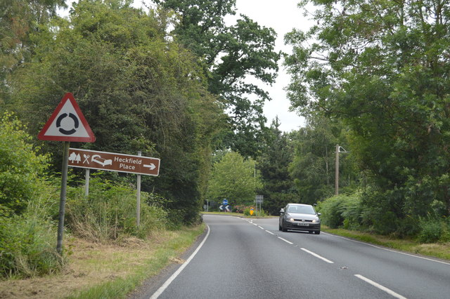
Heckfield Place

A country estate of 438 acres, the heart of Heckfield Place is a Georgian Grade II listed manor house, located in Hampshire, United Kingdom. It was built...

Hazeley

Hazeley is a village in the Hart District in Hampshire, England. It is 2.5 miles (3 km) away from Hartley Wintney and comes under the parish of Mattingley...

Heckfield Heath

Heckfield Heath is a hamlet in the civil parish of Heckfield in the Hart district of Hampshire, England. Its nearest town is Hook, which lies approximately...

River Hart

The River Hart is a tributary of the River Whitewater in north Hampshire, England. It rises at Ashley Head spring in Crondall and flows north to meet the...

Heckfield

Heckfield is a village in Hampshire, England. It lies between Reading and Hook. It is the location of Highfield House, where Neville Chamberlain died in...

Chandlers Green

Chandlers Green is a hamlet in the civil parish of Mattingley in the Hart District of Hampshire, England. Its nearest town is Hook approximately 2.5 miles...

Nearby Amenities

Located within 500m of 51.332018,-0.95377238
Power: tower
Source: bing
Lat/Long: 51.33283/-0.9568355
Power: tower
Lat/Long: 51.3340611/-0.9518868
Give Way
Source: Bing
Lat/Long: 51.3327983/-0.9604576
Give Way
Source: Bing
Lat/Long: 51.3338484/-0.9601234
The data included in this document is from www.openstreetmap.org. The data is made available under ODbL.

Have you been to Bouchiers Copse?

Leave your review of Bouchiers Copse below (or comments, questions and feedback).