Ridge Hanger
Wood, Forest in Hampshire East Hampshire
England
Ridge Hanger

Ridge Hanger is a picturesque woodland area located in Hampshire, England. Situated on the southern edge of the county, this idyllic spot is a popular destination for nature lovers and outdoor enthusiasts alike.
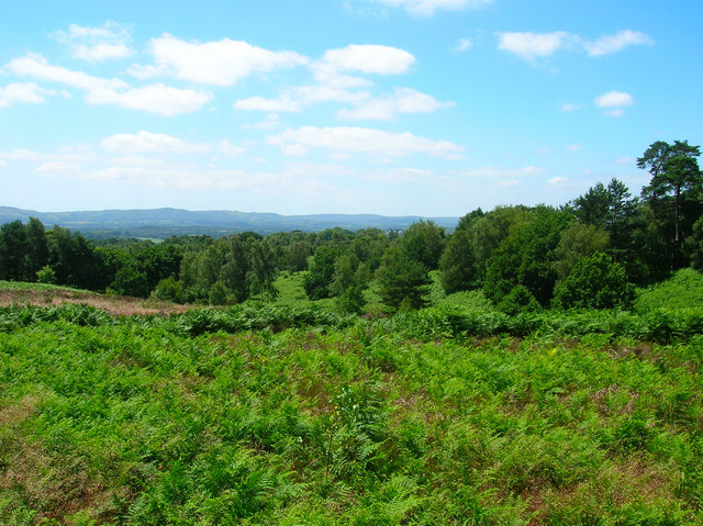
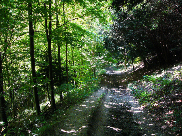
Covering an expansive area of dense forest, Ridge Hanger offers a tranquil escape from the hustle and bustle of everyday life. The woodland is characterized by a variety of tree species, including oak, beech, and birch, which create a stunning canopy of greenery throughout the year. The forest floor is adorned with a carpet of vibrant wildflowers, adding to the area's natural beauty.
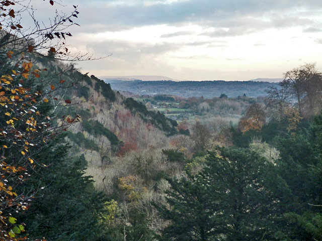
The hilly terrain of Ridge Hanger provides visitors with breathtaking views of the surrounding countryside. From the ridge, one can marvel at the rolling hills and valleys that stretch as far as the eye can see. The area is particularly renowned for its stunning sunsets, which bathe the landscape in a golden hue.
The wood is home to a diverse range of wildlife, making it a haven for nature enthusiasts. Birdwatchers can spot a variety of species, including woodpeckers, owls, and various songbirds. Deer can also be spotted roaming freely in the woodland, adding to its enchanting atmosphere.
Ridge Hanger offers numerous walking trails and footpaths, allowing visitors to explore the woodland at their own pace. There are also picnic areas dotted throughout the forest, providing the perfect spot to relax and enjoy a packed lunch amidst nature.
Overall, Ridge Hanger is a captivating woodland area in Hampshire, offering a serene and magical experience for those seeking solace in nature.
If you have any feedback on the listing, please let us know in the comments section below.
Ridge Hanger Images
Images are sourced within 2km of 51.025867/-0.96086326 or Grid Reference SU7225. Thanks to Geograph Open Source API. All images are credited.


Ridge Hanger is located at Grid Ref: SU7225 (Lat: 51.025867, Lng: -0.96086326)
Administrative County: Hampshire
District: East Hampshire
Police Authority: Hampshire
What 3 Words
///alike.cashiers.shins. Near Petersfield, Hampshire
Nearby Locations
Related Wikis
Woolbeding and Pound Commons
Woolbeding and Pound Commons is a 171.9-hectare (425-acre) biological Site of Special Scientific Interest north of Midhurst in West Sussex.The commons...

Steep, Hampshire
Steep is a village and civil parish in the East Hampshire district of Hampshire, England. Its nearest town is Petersfield, which lies 1.4 miles (2.3 km...

Bedales School
Bedales School is a public school (co-educational private school, boarding and day) in the village of Steep, near the market town of Petersfield in Hampshire...
Steep Marsh
Steep Marsh is a small village in the civil parish of Steep situated in the South Downs Area of Outstanding Natural Beauty in the East Hampshire district...
High Cross, Hampshire
High Cross is a village in the East Hampshire district of Hampshire, England. It is 2.9 miles (4.6 km) northwest of Petersfield, north of the A272 road...

Wheatham Hill
At 249 metres (817 ft), Wheatham Hill is one of the highest hills in the county of Hampshire, England. It is part of the North Hampshire Downs. Much of...

Stroud, Hampshire
Stroud () is a village and civil parish in the East Hampshire district of Hampshire, England. It is 1.4 miles (2.3 km) west of Petersfield, on the A272...
Wealden Edge Hangers
Wealden Edge Hangers is a 222.4-hectare (550-acre) biological Site of Special Scientific Interest north of Petersfield in Hampshire. An area of 48 hectares...
Nearby Amenities
Located within 500m of 51.025867,-0.96086326Have you been to Ridge Hanger?
Leave your review of Ridge Hanger below (or comments, questions and feedback).