Cliff Spinney

Wood, Forest in Leicestershire Melton

England

Cliff Spinney

Coal stacks, Holwell Works
Coal stacks, Holwell Works Credit: Jonathan Thacker

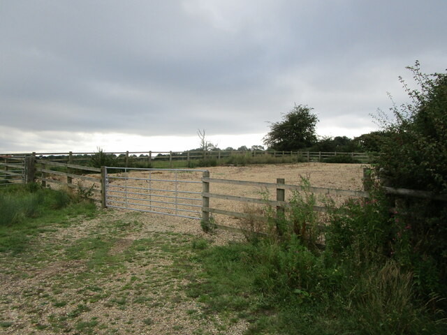
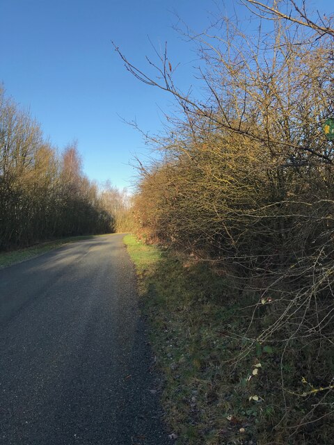
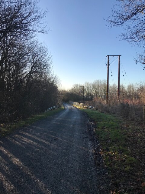
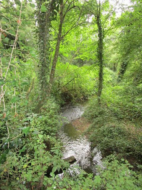
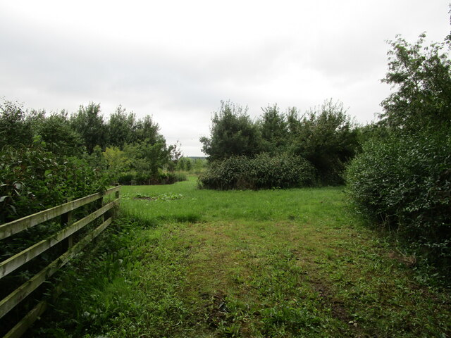
Cliff Spinney is a serene and picturesque woodland area located in the county of Leicestershire, England. Nestled in the heart of the Charnwood Forest, this charming woodland exudes tranquility and natural beauty. Spanning approximately 200 acres, it offers a haven for nature enthusiasts and outdoor explorers.

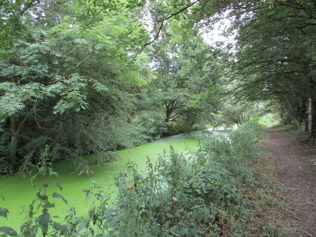
The enchanting woodland of Cliff Spinney showcases a diverse range of tree species, including native oaks, birches, and beeches. The canopy of lush green foliage provides a refreshing escape from the hustle and bustle of daily life, making it a popular destination for locals and visitors alike seeking solace in nature.

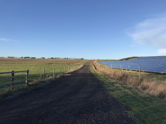
Walking trails meander through the woodland, allowing visitors to immerse themselves in its captivating ambiance. These well-maintained paths offer an opportunity to observe the local flora and fauna, with sightings of deer, squirrels, and a variety of bird species being a common occurrence.

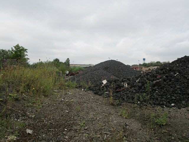
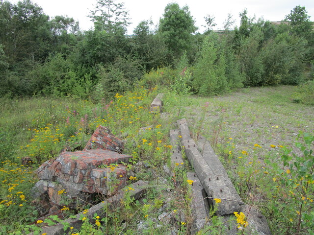
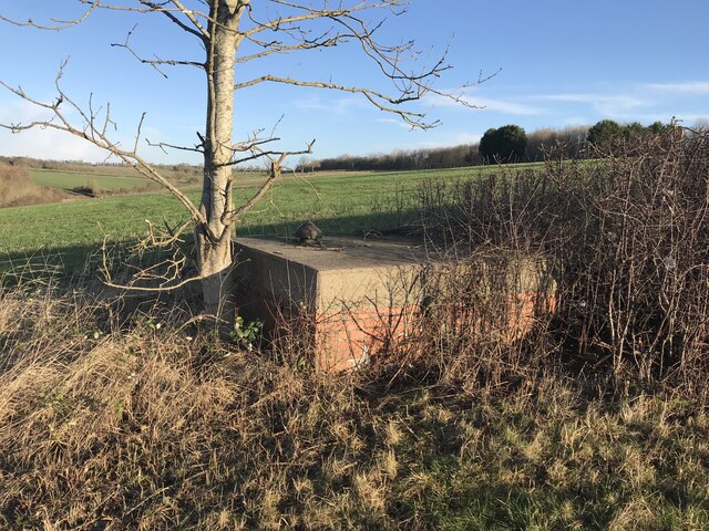
Cliff Spinney also boasts a rich historical heritage. The area was once home to ironstone mining and quarrying activities, and remnants of these industries can still be seen, adding an intriguing layer to the woodland's character.

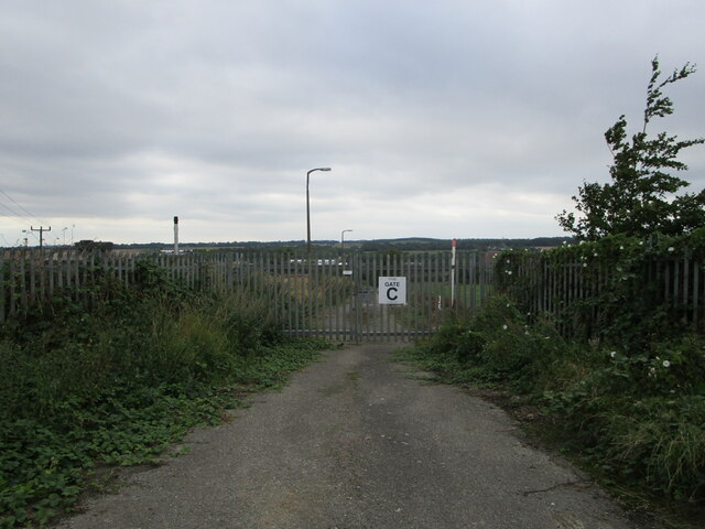
The woodland is managed by the local authorities, who ensure its conservation and accessibility. They have implemented measures to preserve the ecological balance, protect the diverse wildlife, and maintain the natural beauty of the area.

For those seeking respite from the urban environment or a chance to reconnect with nature, Cliff Spinney in Leicestershire is an idyllic destination that promises a rejuvenating experience amidst the enchanting woodlands of Charnwood Forest.

If you have any feedback on the listing, please let us know in the comments section below.

Cliff Spinney Images

Images are sourced within 2km of 52.764585/-0.92632778 or Grid Reference SK7219. Thanks to Geograph Open Source API. All images are credited.

Coal stacks, Holwell Works
Disused entrance, Holwell Works
Remains at former industrial site
Melton Rail Innovation and Development Centre
St. Bartholomew's church, Welby Despite its relatively remote position this is very much an active church. Listed grade II* <span class="nowrap"><a title="https://historicengland.org.uk/listing/the-list/list-entry/1075115" rel="nofollow ugc noopener" href="https://historicengland.org.uk/listing/the-list/list-entry/1075115">Link</a><img style="margin-left:2px;" alt="External link" title="External link - shift click to open in new window" src="https://s1.geograph.org.uk/img/external.png" width="10" height="10"/></span>
St. Bartholomew's church, Welby
Despite its relatively remote position this is very much an active church. Listed grade II* LinkExternal link
Church car park, Welby
Road towards Welby
Road towards Welby
Road towards bridge
Road towards bridge
Subterranean structure
Bridleway - solar farm on right
Melton Mowbray Navigation Just above the site of Asfordby Lock. The canal was opened in 1797 and closed in 1877. There are plans to re-open the navigation but that will take many years to complete. <span class="nowrap"><a title="https://en.wikipedia.org/wiki/Melton_Mowbray_Navigation" rel="nofollow ugc noopener" href="https://en.wikipedia.org/wiki/Melton_Mowbray_Navigation">Link</a><img style="margin-left:2px;" alt="External link" title="External link - shift click to open in new window" src="https://s1.geograph.org.uk/img/external.png" width="10" height="10"/></span>
Melton Mowbray Navigation
Just above the site of Asfordby Lock. The canal was opened in 1797 and closed in 1877. There are plans to re-open the navigation but that will take many years to complete. LinkExternal link
Church of St. Peter, Kirby Bellars Grade I listed <span class="nowrap"><a title="https://historicengland.org.uk/listing/the-list/list-entry/1261717" rel="nofollow ugc noopener" href="https://historicengland.org.uk/listing/the-list/list-entry/1261717">Link</a><img style="margin-left:2px;" alt="External link" title="External link - shift click to open in new window" src="https://s1.geograph.org.uk/img/external.png" width="10" height="10"/></span>
Church of St. Peter, Kirby Bellars
Grade I listed LinkExternal link
Kirby Hall
Kirby Hall
Drain in Stanton Plantation
Nursery, Kirby Bellars On the site of an Augustinian Priory.
Nursery, Kirby Bellars
On the site of an Augustinian Priory.
Lost sheep, Kirby Bellars It was not obvious where this sheep had come from. There were no other sheep in the churchyard.
Lost sheep, Kirby Bellars
It was not obvious where this sheep had come from. There were no other sheep in the churchyard.
Cottages, Main Road, Kirby Bellars
Greater Anglia Class 720/5 being propelled into the Melton Rail Innovation and Development Centre Another Great Anglia Class 720 on the left.
Greater Anglia Class 720/5 being propelled into the Melton Rail Innovation and Development Centre
Another Great Anglia Class 720 on the left.
Show me another place!

Cliff Spinney is located at Grid Ref: SK7219 (Lat: 52.764585, Lng: -0.92632778)

Administrative County: Leicestershire

District: Melton

Police Authority: Leicestershire

What 3 Words

///terribly.unlocking.iteration. Near Asfordby, Leicestershire

Related Wikis

Asfordby Hill

Asfordby Hill is a hamlet on the A6006 road, in the parish of Asfordby, in the Melton district, in the English county of Leicestershire. == Amenities... ==

Holwell Sports F.C.

Holwell Sports Football Club is a football club based in Asfordby Hill, near Melton Mowbray, Leicestershire, England. They are currently members of the...

Kirby Bellars Priory

Kirby Bellars Priory was a small priory of Canons Regular of Saint Augustine in Leicestershire, England. It is now the Church of England Parish Church...

Asfordby Colliery

Asfordby Colliery (also known as Asfordby super-pit and Asfordby Mine) was a coal mine located in the village of Asfordby, near to Melton Mowbray in Leicestershire...

River Eye, Leicestershire

The River Eye is a slender, slow-flowing river in north-eastern Leicestershire, England. The river is known to flood periodically; especially within the...

Asfordby railway station

Asfordby railway station was a station serving the villages of Asfordby and Kirby Bellars in Leicestershire. The station was situated at a level crossing...

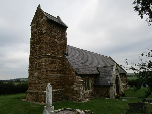
All Saints' Church, Asfordby

All Saints' Church is a church in Asfordby, Leicestershire, England. It is a Grade I listed building. == History == The church is made up of a nave, tower...

Kirby Bellars

Kirby Bellars is a village and civil parish near Melton Mowbray in Leicestershire, England. The population of the civil parish at the 2011 census was 369...

Nearby Amenities

Located within 500m of 52.764585,-0.92632778
Railway: switch
Lat/Long: 52.7665091/-0.9284406
Asfordby Hill
Place: village
Wikidata: Q4804244
Wikipedia: en:Asfordby Hill
Lat/Long: 52.7666022/-0.9277299
Bus Stop
Primary School
Alt Name: Asfordby Hill
Bus: yes
Naptan AltCommonName: Asfordby Hill
Naptan AtcoCode: 260000009
Naptan Bearing: E
Naptan CommonName: Primary School
Naptan Indicator: adjacent
Naptan Landmark: Asfordby Hill Primary School
Naptan NaptanCode: leidmtaj
Naptan Notes: Hourly - County
Naptan Street: Melton Road
Naptan Verified: no
Public Transport: platform
Shelter: yes
Source: naptan_import
Lat/Long: 52.7655182/-0.9252694
Bus Stop
Primary School
Alt Name: Asfordby Hill
Bus: yes
Naptan AltCommonName: Asfordby Hill
Naptan AtcoCode: 260000010
Naptan Bearing: W
Naptan CommonName: Primary School
Naptan Indicator: opposite
Naptan Landmark: Primary School
Naptan NaptanCode: leidmtam
Naptan Notes: Hourly - County
Naptan Street: Melton Road
Naptan Verified: no
Public Transport: platform
Source: naptan_import
Lat/Long: 52.7655567/-0.9265975
Crossing
Crossing: marked
Lat/Long: 52.7655186/-0.9259646
Crossing
Crossing: unmarked
Lat/Long: 52.7657227/-0.9271395
Power: pole
Lat/Long: 52.7638332/-0.9285112
Barrier: bollard
Lat/Long: 52.7655954/-0.9257139
Post Box
Lat/Long: 52.7657658/-0.9255959
Barrier: block
Lat/Long: 52.7644889/-0.9200247
Restaurant
Alpine Bar & Restaurant
Addr City: Melton Mowbray
Addr Country: GB
Addr Housename: The Grange Garden Centre
Addr Postcode: LE14 3QU
Addr Street: Melton Road
Addr Village: Asfordby Hill
Fhrs Authority: Melton
Fhrs Id: 20462
Fhrs Local Authority Id: 06010/4001/2/000
Lat/Long: 52.762886/-0.9246455
Railway: switch
Lat/Long: 52.7666004/-0.9289216
Power: pole
Lat/Long: 52.7646397/-0.9229374
Power: pole
Lat/Long: 52.7638753/-0.9222722
Power: pole
Lat/Long: 52.7630605/-0.9216017
Power: pole
Lat/Long: 52.7622782/-0.9209579
Power: pole
Lat/Long: 52.7601601/-0.9263089
Power: pole
Lat/Long: 52.7605058/-0.9279531
Power: pole
Lat/Long: 52.7608531/-0.9295946
Generator Method: photovoltaic
Generator Output Electricity: yes
Generator Source: solar
Generator Type: solar_photovoltaic_panel
Location: roof
Power: generator
Lat/Long: 52.7655864/-0.9279007
Generator Method: photovoltaic
Generator Output Electricity: yes
Generator Source: solar
Generator Type: solar_photovoltaic_panel
Location: roof
Power: generator
Lat/Long: 52.7655831/-0.927788
Generator Method: photovoltaic
Generator Output Electricity: yes
Generator Source: solar
Generator Type: solar_photovoltaic_panel
Location: roof
Power: generator
Lat/Long: 52.7640591/-0.9283405
Generator Method: photovoltaic
Generator Output Electricity: yes
Generator Source: solar
Generator Type: solar_photovoltaic_panel
Location: roof
Power: generator
Lat/Long: 52.7640624/-0.9282762
Generator Method: photovoltaic
Generator Output Electricity: yes
Generator Source: solar
Generator Type: solar_photovoltaic_panel
Location: roof
Power: generator
Lat/Long: 52.7647043/-0.929687
Generator Method: photovoltaic
Generator Output Electricity: yes
Generator Source: solar
Generator Type: solar_photovoltaic_panel
Location: roof
Power: generator
Lat/Long: 52.7643521/-0.926691
Generator Method: photovoltaic
Generator Output Electricity: yes
Generator Source: solar
Generator Type: solar_photovoltaic_panel
Location: roof
Power: generator
Lat/Long: 52.7669111/-0.9253767
Generator Method: photovoltaic
Generator Output Electricity: yes
Generator Source: solar
Generator Type: solar_photovoltaic_panel
Location: roof
Power: generator
Lat/Long: 52.7669241/-0.9254438
Brockleby's Homemade Pies
Shop: butcher
Lat/Long: 52.7628313/-0.9244736
Barrier: stile
Stile: fence
Lat/Long: 52.7659049/-0.9276738
Asfordby Junction
Railway: junction
Lat/Long: 52.7667974/-0.9296724
The data included in this document is from www.openstreetmap.org. The data is made available under ODbL.

Have you been to Cliff Spinney?

Leave your review of Cliff Spinney below (or comments, questions and feedback).