Flowercroft Wood

Wood, Forest in Oxfordshire South Oxfordshire

England

Flowercroft Wood

Crowsley Park Wood
Crowsley Park Wood Credit: Matthew Chadwick

Flowercroft Wood is a picturesque woodland located in Oxfordshire, a county in south-central England. Nestled within the stunning countryside, this tranquil forest covers an area of approximately 50 acres, providing a haven for nature enthusiasts and outdoor lovers alike.

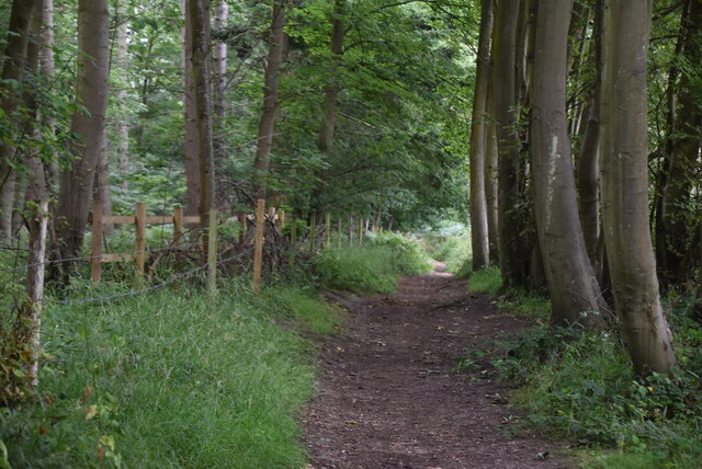
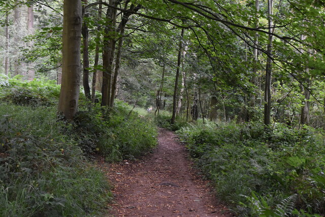
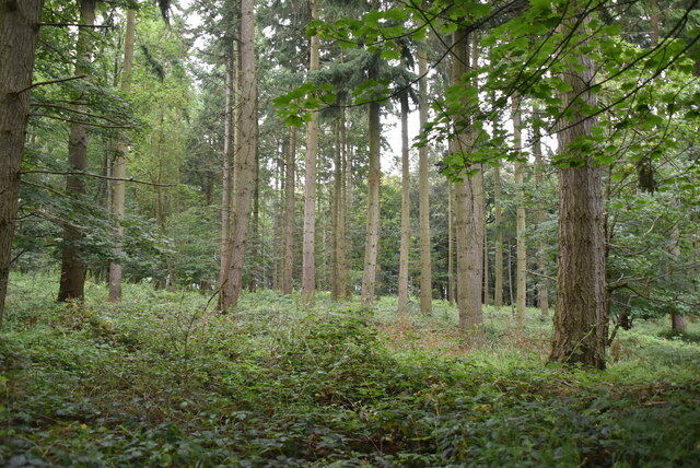
The wood is predominantly composed of a diverse range of deciduous trees, including oak, beech, and ash. These majestic trees create a lush canopy that blankets the forest floor, filtering the sunlight and creating a soothing ambiance. In the springtime, Flowercroft Wood transforms into a breathtaking spectacle as it bursts into a riot of vibrant colors with the blooming of bluebells, primroses, and wild orchids.

The woodland is crisscrossed by a network of well-maintained footpaths, allowing visitors to explore its beauty at their own pace. As visitors wander through the wood, they may encounter various wildlife species, such as deer, foxes, and a multitude of bird species. The peaceful atmosphere and natural surroundings make it an ideal spot for birdwatching and photography.

Flowercroft Wood is also home to a variety of ecological habitats, including a small pond and wetland areas. These provide a haven for amphibians, insects, and other aquatic creatures. The wood is managed by a local conservation group, who work tirelessly to preserve its natural beauty and protect its delicate ecosystem.

With its serene atmosphere and stunning natural scenery, Flowercroft Wood offers a perfect escape from the hustle and bustle of everyday life. Whether it's a leisurely walk, a picnic, or simply immersing oneself in the wonders of nature, this enchanting woodland is a must-visit destination for anyone seeking solace and tranquility in the heart of Oxfordshire.

If you have any feedback on the listing, please let us know in the comments section below.

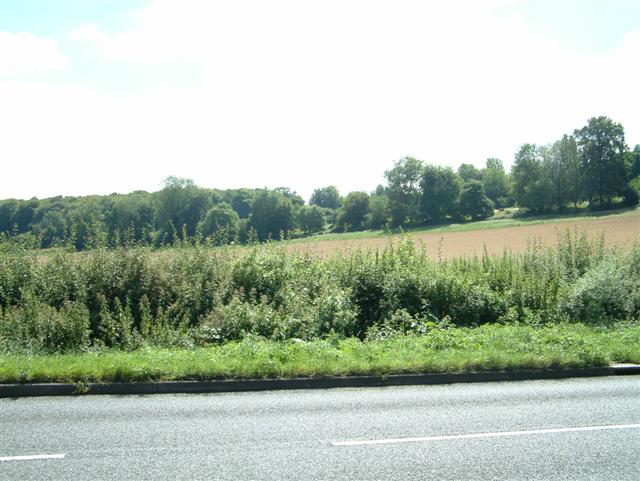
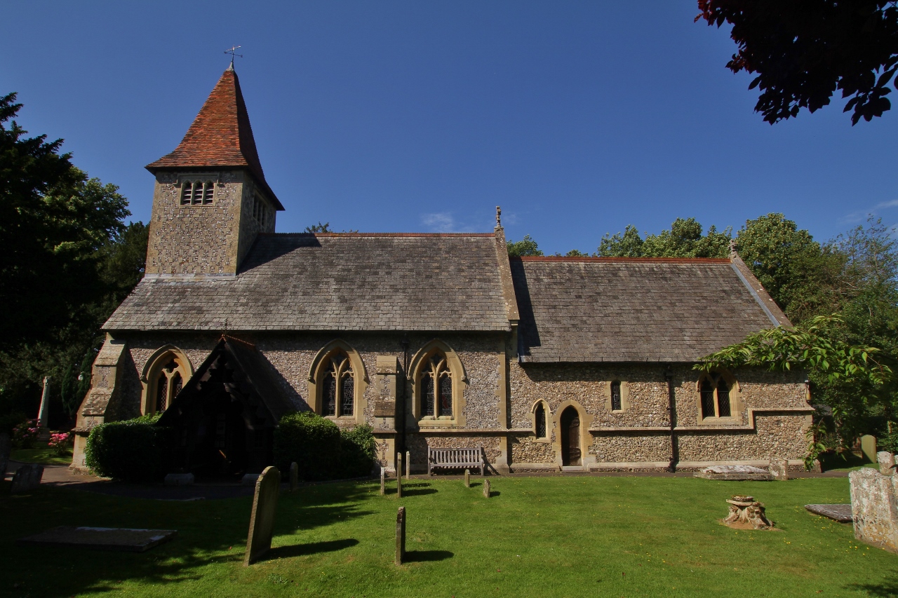
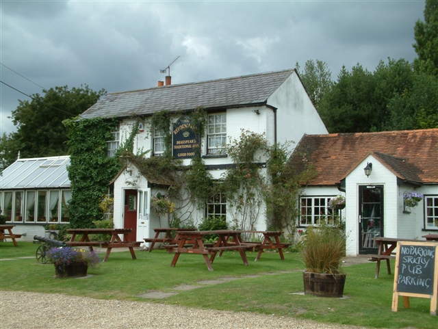
Flowercroft Wood Images

Images are sourced within 2km of 51.524175/-0.95681326 or Grid Reference SU7281. Thanks to Geograph Open Source API. All images are credited.

Crowsley Park Wood
Crowsley Park Wood
Farmland, Binfield Heath The footpath between Bishopsland and Crowsley follows the edge of this field of barley.
Farmland, Binfield Heath
The footpath between Bishopsland and Crowsley follows the edge of this field of barley.
Farmland, Sonning Common
Chiltern Way Created by the Chiltern Society as its Millennium Project, the Way originally took in all of the Chilterns from north to south across the Chilterns Area of Outstanding Natural Beauty, in a 125-miles circuit extending from Ewelme in the south west, Chorleywood in the south east and Sharpenhoe Clappers and Great Offley in the north east. It was based on an earlier unofficial route, the Chiltern Hundred.
The Way passes through some of the most attractive parts of the Chilterns, including the Bovingdon Plateau, the Chess valley, the Misbourne valley, Penn Country, the Hambleden valley, Stonor Park, Ewelme, Swyncombe Down, Bledlow Ridge, Hampden Country, Bulbourne valley and Dunstable Down.
The original 200km (125 miles) Way took in Hemel via Chalfont St Giles, the edge of Marlow, Hambleden, Bix Bottom, Ewelme, the Ridgeway, Stokenchurch, Great Hampden, Aldbury, the Dunstable Downs, Sharpenhoe Clappers and Harpenden.
Two extensions have been added in 2003: the southern adds a loop of 50km (35 miles) from Bix Bottom via Mapledurham on the Thames and the northern extension 44km (27 miles) from Sharpenhoe Clappers via the Icknield Way and the outskirts of Hitchin. A short cut from Bix Bottom creates a 16km (10 miles) loop via Ewelme.
Although officially starting at Hemel Hempstead Station, the walk can be started at many other places on the route. The Way also has links with other routes including Chiltern Heritage Trail, Ridgeway National Trail, Icknield Way Path, Oxfordshire, Swan's and South Bucks Ways and Grand Union Canal, Lea Valley and Chess Valley Walks.
Chiltern Way
Created by the Chiltern Society as its Millennium Project, the Way originally took in all of the Chilterns from north to south across the Chilterns Area of Outstanding Natural Beauty, in a 125-miles circuit extending from Ewelme in the south west, Chorleywood in the south east and Sharpenhoe Clappers and Great Offley in the north east. It was based on an earlier unofficial route, the Chiltern Hundred. The Way passes through some of the most attractive parts of the Chilterns, including the Bovingdon Plateau, the Chess valley, the Misbourne valley, Penn Country, the Hambleden valley, Stonor Park, Ewelme, Swyncombe Down, Bledlow Ridge, Hampden Country, Bulbourne valley and Dunstable Down. The original 200km (125 miles) Way took in Hemel via Chalfont St Giles, the edge of Marlow, Hambleden, Bix Bottom, Ewelme, the Ridgeway, Stokenchurch, Great Hampden, Aldbury, the Dunstable Downs, Sharpenhoe Clappers and Harpenden. Two extensions have been added in 2003: the southern adds a loop of 50km (35 miles) from Bix Bottom via Mapledurham on the Thames and the northern extension 44km (27 miles) from Sharpenhoe Clappers via the Icknield Way and the outskirts of Hitchin. A short cut from Bix Bottom creates a 16km (10 miles) loop via Ewelme. Although officially starting at Hemel Hempstead Station, the walk can be started at many other places on the route. The Way also has links with other routes including Chiltern Heritage Trail, Ridgeway National Trail, Icknield Way Path, Oxfordshire, Swan's and South Bucks Ways and Grand Union Canal, Lea Valley and Chess Valley Walks.
Crowsley Park Woods
Crowsley Park Woods
Chiltern Way Created by the Chiltern Society as its Millennium Project, the Way originally took in all of the Chilterns from north to south across the Chilterns Area of Outstanding Natural Beauty, in a 125-miles circuit extending from Ewelme in the south west, Chorleywood in the south east and Sharpenhoe Clappers and Great Offley in the north east. It was based on an earlier unofficial route, the Chiltern Hundred.
The Way passes through some of the most attractive parts of the Chilterns, including the Bovingdon Plateau, the Chess valley, the Misbourne valley, Penn Country, the Hambleden valley, Stonor Park, Ewelme, Swyncombe Down, Bledlow Ridge, Hampden Country, Bulbourne valley and Dunstable Down.
The original 200km (125 miles) Way took in Hemel via Chalfont St Giles, the edge of Marlow, Hambleden, Bix Bottom, Ewelme, the Ridgeway, Stokenchurch, Great Hampden, Aldbury, the Dunstable Downs, Sharpenhoe Clappers and Harpenden.
Two extensions have been added in 2003: the southern adds a loop of 50km (35 miles) from Bix Bottom via Mapledurham on the Thames and the northern extension 44km (27 miles) from Sharpenhoe Clappers via the Icknield Way and the outskirts of Hitchin. A short cut from Bix Bottom creates a 16km (10 miles) loop via Ewelme.
Although officially starting at Hemel Hempstead Station, the walk can be started at many other places on the route. The Way also has links with other routes including Chiltern Heritage Trail, Ridgeway National Trail, Icknield Way Path, Oxfordshire, Swan's and South Bucks Ways and Grand Union Canal, Lea Valley and Chess Valley Walks.
Chiltern Way
Created by the Chiltern Society as its Millennium Project, the Way originally took in all of the Chilterns from north to south across the Chilterns Area of Outstanding Natural Beauty, in a 125-miles circuit extending from Ewelme in the south west, Chorleywood in the south east and Sharpenhoe Clappers and Great Offley in the north east. It was based on an earlier unofficial route, the Chiltern Hundred. The Way passes through some of the most attractive parts of the Chilterns, including the Bovingdon Plateau, the Chess valley, the Misbourne valley, Penn Country, the Hambleden valley, Stonor Park, Ewelme, Swyncombe Down, Bledlow Ridge, Hampden Country, Bulbourne valley and Dunstable Down. The original 200km (125 miles) Way took in Hemel via Chalfont St Giles, the edge of Marlow, Hambleden, Bix Bottom, Ewelme, the Ridgeway, Stokenchurch, Great Hampden, Aldbury, the Dunstable Downs, Sharpenhoe Clappers and Harpenden. Two extensions have been added in 2003: the southern adds a loop of 50km (35 miles) from Bix Bottom via Mapledurham on the Thames and the northern extension 44km (27 miles) from Sharpenhoe Clappers via the Icknield Way and the outskirts of Hitchin. A short cut from Bix Bottom creates a 16km (10 miles) loop via Ewelme. Although officially starting at Hemel Hempstead Station, the walk can be started at many other places on the route. The Way also has links with other routes including Chiltern Heritage Trail, Ridgeway National Trail, Icknield Way Path, Oxfordshire, Swan's and South Bucks Ways and Grand Union Canal, Lea Valley and Chess Valley Walks.
Chiltern Way
Chiltern Way
Bones Wood
Bones Wood
Chiltern Way Created by the Chiltern Society as its Millennium Project, the Way originally took in all of the Chilterns from north to south across the Chilterns Area of Outstanding Natural Beauty, in a 125-miles circuit extending from Ewelme in the south west, Chorleywood in the south east and Sharpenhoe Clappers and Great Offley in the north east. It was based on an earlier unofficial route, the Chiltern Hundred.
The Way passes through some of the most attractive parts of the Chilterns, including the Bovingdon Plateau, the Chess valley, the Misbourne valley, Penn Country, the Hambleden valley, Stonor Park, Ewelme, Swyncombe Down, Bledlow Ridge, Hampden Country, Bulbourne valley and Dunstable Down.
The original 200km (125 miles) Way took in Hemel via Chalfont St Giles, the edge of Marlow, Hambleden, Bix Bottom, Ewelme, the Ridgeway, Stokenchurch, Great Hampden, Aldbury, the Dunstable Downs, Sharpenhoe Clappers and Harpenden.
Two extensions have been added in 2003: the southern adds a loop of 50km (35 miles) from Bix Bottom via Mapledurham on the Thames and the northern extension 44km (27 miles) from Sharpenhoe Clappers via the Icknield Way and the outskirts of Hitchin. A short cut from Bix Bottom creates a 16km (10 miles) loop via Ewelme.
Although officially starting at Hemel Hempstead Station, the walk can be started at many other places on the route. The Way also has links with other routes including Chiltern Heritage Trail, Ridgeway National Trail, Icknield Way Path, Oxfordshire, Swan's and South Bucks Ways and Grand Union Canal, Lea Valley and Chess Valley Walks.
Chiltern Way
Created by the Chiltern Society as its Millennium Project, the Way originally took in all of the Chilterns from north to south across the Chilterns Area of Outstanding Natural Beauty, in a 125-miles circuit extending from Ewelme in the south west, Chorleywood in the south east and Sharpenhoe Clappers and Great Offley in the north east. It was based on an earlier unofficial route, the Chiltern Hundred. The Way passes through some of the most attractive parts of the Chilterns, including the Bovingdon Plateau, the Chess valley, the Misbourne valley, Penn Country, the Hambleden valley, Stonor Park, Ewelme, Swyncombe Down, Bledlow Ridge, Hampden Country, Bulbourne valley and Dunstable Down. The original 200km (125 miles) Way took in Hemel via Chalfont St Giles, the edge of Marlow, Hambleden, Bix Bottom, Ewelme, the Ridgeway, Stokenchurch, Great Hampden, Aldbury, the Dunstable Downs, Sharpenhoe Clappers and Harpenden. Two extensions have been added in 2003: the southern adds a loop of 50km (35 miles) from Bix Bottom via Mapledurham on the Thames and the northern extension 44km (27 miles) from Sharpenhoe Clappers via the Icknield Way and the outskirts of Hitchin. A short cut from Bix Bottom creates a 16km (10 miles) loop via Ewelme. Although officially starting at Hemel Hempstead Station, the walk can be started at many other places on the route. The Way also has links with other routes including Chiltern Heritage Trail, Ridgeway National Trail, Icknield Way Path, Oxfordshire, Swan's and South Bucks Ways and Grand Union Canal, Lea Valley and Chess Valley Walks.
Bones Wood
Bones Wood
Ploughing the headland, Sonning Common Looking north-east from Peppard Road towards the corner of Young Wood.
Ploughing the headland, Sonning Common
Looking north-east from Peppard Road towards the corner of Young Wood.
Ploughing the headland, Sonning Common Looking north-east from Peppard Road towards the corner of Young Wood.
Ploughing the headland, Sonning Common
Looking north-east from Peppard Road towards the corner of Young Wood.
All Saints' Church, Rotherfield Peppard This pretty church sits on the edge of agricultural land that fills much of this square
All Saints' Church, Rotherfield Peppard
This pretty church sits on the edge of agricultural land that fills much of this square
Footpath near Rotherfield Greys Beechwoods with good paths fill much of this square.
Footpath near Rotherfield Greys
Beechwoods with good paths fill much of this square.
St Nicholas' Church, Rotherfield Greys The tiny village of Rotherfield Greys is surrounded by fields.
St Nicholas' Church, Rotherfield Greys
The tiny village of Rotherfield Greys is surrounded by fields.
Harvest over. Blounts farm to the east of Sonning Common.
Harvest over.
Blounts farm to the east of Sonning Common.
Field NE of Sonning Common Looking NW from a footpath by Crosscroft Wood which is behind the camera
Field NE of Sonning Common
Looking NW from a footpath by Crosscroft Wood which is behind the camera
The north end of Stony Bottom The north end of Stony Bottom taken from SU707816 looking South towards Green Trees Farm.
The north end of Stony Bottom
The north end of Stony Bottom taken from SU707816 looking South towards Green Trees Farm.
Show me another place!

Flowercroft Wood is located at Grid Ref: SU7281 (Lat: 51.524175, Lng: -0.95681326)

Administrative County: Oxfordshire

District: South Oxfordshire

Police Authority: Thames Valley

What 3 Words

///lines.husband.thud. Near Sonning Common, Oxfordshire

Related Wikis

Rotherfield Peppard

Rotherfield Peppard (often referred to simply as Peppard by locals) is a village and civil parish in the Chiltern Hills in South Oxfordshire. It is centred...

Crowsley Park

Crowsley Park is a 160-acre (65 ha) country estate in South Oxfordshire, central-southern England, owned by the British Broadcasting Corporation (BBC)...

Rotherfield Greys

Rotherfield Greys is a village and civil parish in the Chiltern Hills in South Oxfordshire. It is 2 miles (3 km) west of Henley-on-Thames and just over...

Sonning Common

Sonning Common is a village and civil parish in a relatively flat, former common land part of the Chiltern Hills in South Oxfordshire, centred 3.5 miles...

Greys Court

Greys Court is a Tudor country house and gardens in the southern Chiltern Hills at Rotherfield Greys, near Henley-on-Thames in the county of Oxfordshire...

Rotherfield Greys Castle

Rotherfield Greys Castle, initially known as Retherfield Castle, is a 14th-century fortified manor house built in Rotherfield Greys, Oxfordshire. Only...

Gillotts School

Gillotts School is a coeducational secondary school with academy status in Henley-on-Thames, Oxfordshire, England. The school is sited on a 33 acre verdant...

Gallowstree Common

Gallowstree Common is a hamlet in South Oxfordshire, England, about 4.5 miles (7.2 km) north of Reading, Berkshire. The village had a public house, the...

Nearby Amenities

Located within 500m of 51.524175,-0.95681326
Barrier: kissing_gate
Foot: yes
Lat/Long: 51.5243593/-0.9607862
Barrier: kissing_gate
Foot: yes
Lat/Long: 51.5244281/-0.9608334
The data included in this document is from www.openstreetmap.org. The data is made available under ODbL.

Have you been to Flowercroft Wood?

Leave your review of Flowercroft Wood below (or comments, questions and feedback).