Doyley Wood

Wood, Forest in Oxfordshire South Oxfordshire

England

Doyley Wood

Path along Pishill Bottom The road along the valley is not particularly pedestrian friendly. This path through the wood beside the road provides a safer if muddier option.
Path along Pishill Bottom Credit: Des Blenkinsopp

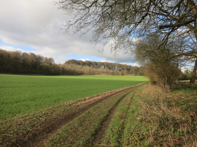
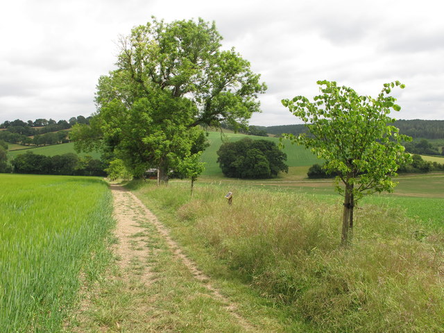
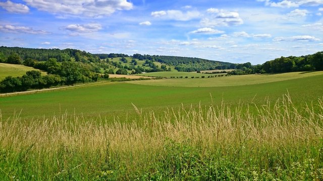
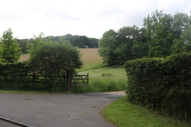
Doyley Wood is a picturesque forest located in Oxfordshire, England. Situated near the village of Woodcote, this woodland area spans approximately 100 acres and is known for its natural beauty and diverse wildlife.

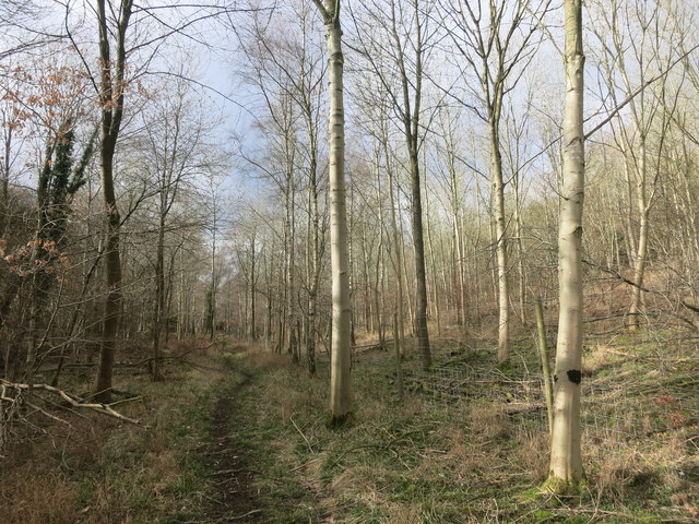
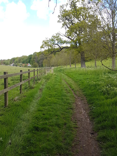
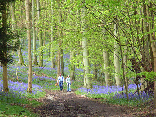
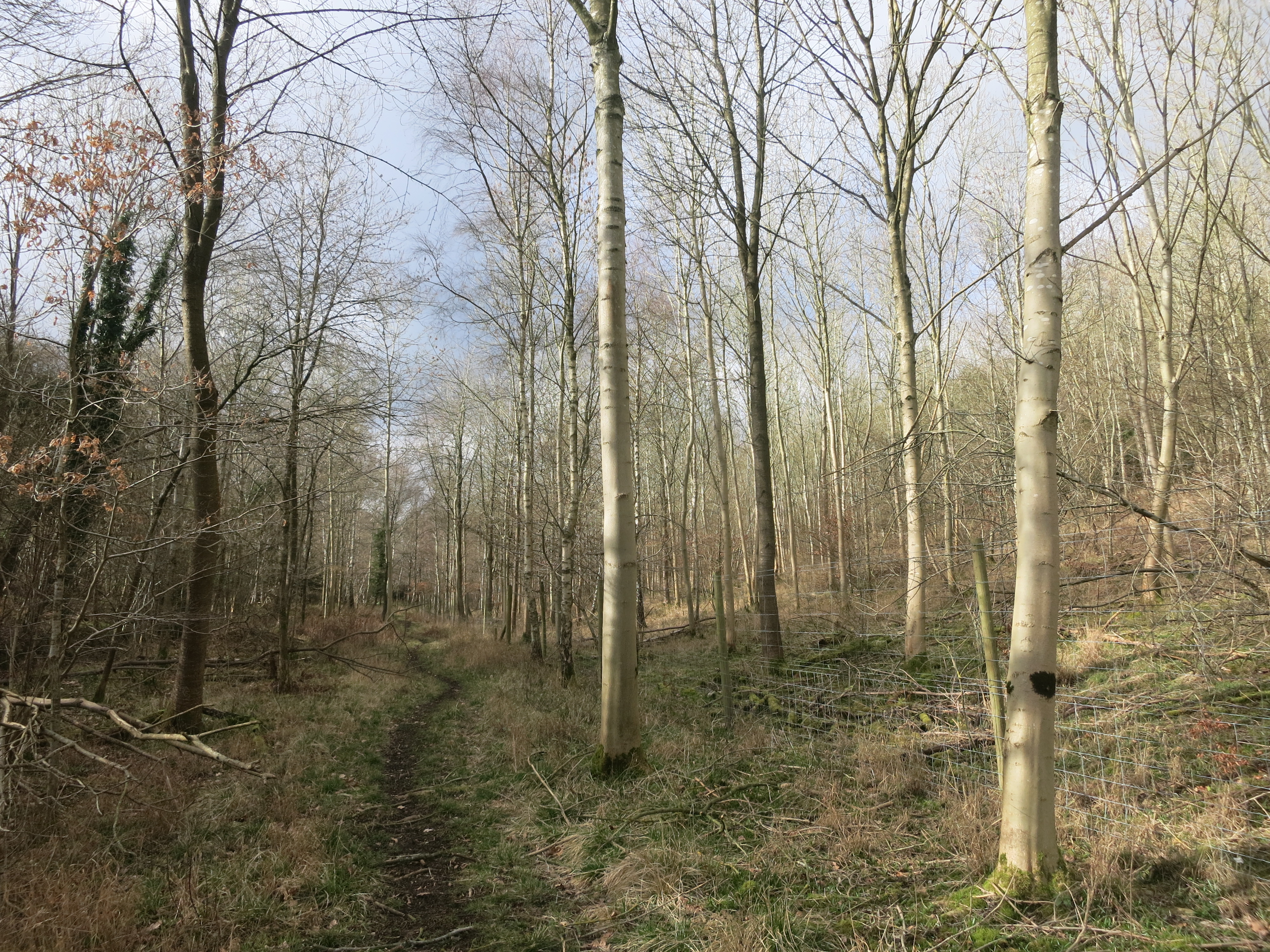
The forest is predominantly composed of native broadleaf trees, including oak, beech, and birch, which create a dense and vibrant canopy overhead. Walking through the wood, one can experience the tranquility and serenity that nature has to offer, with sunlight filtering through the foliage and creating a dappled effect on the forest floor.

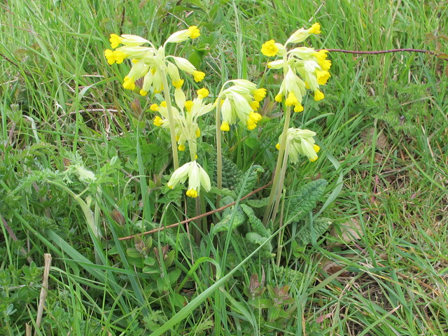
Doyley Wood is home to a variety of wildlife species, including deer, foxes, badgers, and a wide range of bird species. Birdwatchers can catch a glimpse of woodpeckers, owls, and various songbirds that inhabit the area. The forest also boasts a rich variety of flora, with bluebells and wildflowers carpeting the forest floor during the spring months.

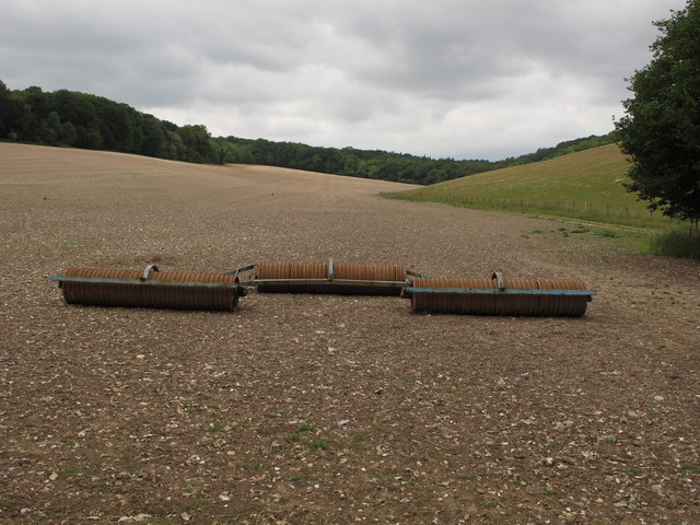
For outdoor enthusiasts, Doyley Wood offers numerous walking trails and paths that meander through the forest, providing visitors with ample opportunities for hiking, jogging, or simply enjoying a leisurely stroll amidst nature. The forest is well-maintained and has picnic spots and benches scattered throughout, allowing visitors to relax and soak in the peaceful atmosphere.

Overall, Doyley Wood in Oxfordshire is a haven for nature lovers, offering a harmonious blend of scenic beauty, diverse wildlife, and recreational activities. Whether one seeks solitude, adventure, or a chance to reconnect with nature, this woodland area provides an enchanting escape from the bustle of everyday life.

If you have any feedback on the listing, please let us know in the comments section below.
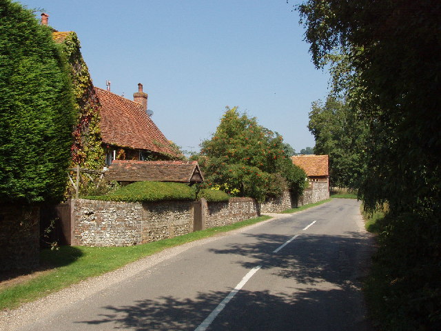
Doyley Wood Images

Images are sourced within 2km of 51.597922/-0.95755034 or Grid Reference SU7289. Thanks to Geograph Open Source API. All images are credited.

Path along Pishill Bottom The road along the valley is not particularly pedestrian friendly. This path through the wood beside the road provides a safer if muddier option.
Path along Pishill Bottom
The road along the valley is not particularly pedestrian friendly. This path through the wood beside the road provides a safer if muddier option.
Bucks and Oxon Oxfordshire on the left of the track here and Buckinghamshire on the right.
Bucks and Oxon
Oxfordshire on the left of the track here and Buckinghamshire on the right.
Trailer in the mud This square is all farmland apart from the small area of woodland on the horizon.
Trailer in the mud
This square is all farmland apart from the small area of woodland on the horizon.
Ploughed fields from the crossroads
Sign for the church at Pishill Also the way to go if following the Oxfordshire Way.
Sign for the church at Pishill
Also the way to go if following the Oxfordshire Way.
Woodland, Watlington The Chiltern Way passing through beeches in Greenfield Wood.
Woodland, Watlington
The Chiltern Way passing through beeches in Greenfield Wood.
B480 Patemore Lane, Pishill Bottom Towards Watlington.
B480 Patemore Lane, Pishill Bottom
Towards Watlington.
B480 north of Pishill Extensive vineyards on the right and also out of sight to the left. They seem rather new. I hope the result is passable, otherwise the reviews could be full of puns.
B480 north of Pishill
Extensive vineyards on the right and also out of sight to the left. They seem rather new. I hope the result is passable, otherwise the reviews could be full of puns.
Bridleway behind Turville Park
Wall postbox, by Pishill farmhouse, on B480 road See <a href="https://www.geograph.org.uk/photo/6502680">SU7290 : EIIR wall postbox by Pishill farmhouse</a> for detail of wall popstbox.
Wall postbox, by Pishill farmhouse, on B480 road
See SU7290 : EIIR wall postbox by Pishill farmhouse for detail of wall popstbox.
EIIR wall postbox by Pishill farmhouse It is letterbox RG917, the cipher has the crown over the II between the E and the R. See <a href="https://www.geograph.org.uk/photo/6502669">SU7290 : Wall postbox, by Pishill farmhouse, on B480 road</a> for view of it across B480 road.
EIIR wall postbox by Pishill farmhouse
It is letterbox RG917, the cipher has the crown over the II between the E and the R. See SU7290 : Wall postbox, by Pishill farmhouse, on B480 road for view of it across B480 road.
Elder trees, stubble cultivator and Dutch barn The elder trees in the hedge have their bunches of white flowers. The Dutch barn is on White Pond Farm. The bridleway down to the farmhouse is beyond the hedge.
Elder trees, stubble cultivator and Dutch barn
The elder trees in the hedge have their bunches of white flowers. The Dutch barn is on White Pond Farm. The bridleway down to the farmhouse is beyond the hedge.
Jubilee Lime Walk of White Pond Farm The tree on the right and smaller trees beyond were planted in 2012 to celebrate the golden jubilee of the Stacey family at White Pond Farm; the plaque giving these details is on a post between the first two trees. The trees are beside a public footpath.
Jubilee Lime Walk of White Pond Farm
The tree on the right and smaller trees beyond were planted in 2012 to celebrate the golden jubilee of the Stacey family at White Pond Farm; the plaque giving these details is on a post between the first two trees. The trees are beside a public footpath.
Rollers on freshly cultivated stubble field The large flinty field had stubble fragments well rolled down. A public footpath is on the right of the field.
Rollers on freshly cultivated stubble field
The large flinty field had stubble fragments well rolled down. A public footpath is on the right of the field.
Valley view Looking towards Stonor Park.
Valley view
Looking towards Stonor Park.
Border country Just inside the Buckinghamshire border and looking uphill on footpath 37.
Border country
Just inside the Buckinghamshire border and looking uphill on footpath 37.
Cowslips on Jubilee lime walk Beside the public footpath shown in <a href="https://www.geograph.org.uk/photo/6503633">SU7390 : Jubilee Lime Walk of White Pond Farm</a>.
Cowslips on Jubilee lime walk
Beside the public footpath shown in SU7390 : Jubilee Lime Walk of White Pond Farm.
The entrance to Whitelands Farm, Pishill
Show me another place!

Doyley Wood is located at Grid Ref: SU7289 (Lat: 51.597922, Lng: -0.95755034)

Administrative County: Oxfordshire

District: South Oxfordshire

Police Authority: Thames Valley

What 3 Words

///trinkets.staring.turkeys. Near Watlington, Oxfordshire

Related Wikis

Pishill

Pishill is a village and former civil parish, now in the parish of Pishill with Stonor, in the South Oxfordshire district, in the county of Oxfordshire...

Pishill with Stonor

Pishill with Stonor is a civil parish in the high Chilterns, South Oxfordshire. It includes the villages of Pishill (Ordnance Survey grid reference SU727899...

Pishill Woods

Pishill Woods is a 42.8-hectare (106-acre) biological Site of Special Scientific Interest north of Nettlebed in Oxfordshire.These semi-natural woods have...

Stonor

Stonor is a mostly cultivated and wooded village and former civil parish, now in the parish of Pishill with Stonor, in the South Oxfordshire, district...

Russell's Water

Russell's Water is a hamlet about 6 miles (9.7 km) north of Henley-on-Thames in South Oxfordshire. It is in the Chiltern Hills about 620 feet (190 m)...

Bix Bottom

Bix Bottom is a 102.3-hectare (253-acre) biological Site of Special Scientific Interest north-west of Henley-on-Thames in Oxfordshire. It is owned and...
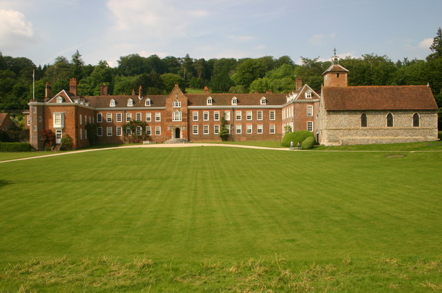
Stonor Park

Stonor Park is a historic country house and private deer park situated in a valley in the Chiltern Hills at Stonor, about four miles (6.4 km) north of...

Maidensgrove

Maidensgrove is a hamlet above the Stonor valley in the Chiltern Hills, adjacent to Russell's Water common. It is about 5 miles (8.0 km) northwest of...

Nearby Amenities

Located within 500m of 51.597922,-0.95755034
Barrier: stile
Bicycle: no
Foot: yes
Material: wood
Stile: stepover
Lat/Long: 51.5949035/-0.9600486
Barrier: stile
Bicycle: no
Foot: yes
Material: wood
Stile: stepover
Lat/Long: 51.594957/-0.960046
Barrier: kissing_gate
Bicycle: no
Foot: yes
Lat/Long: 51.5993759/-0.9627535
The data included in this document is from www.openstreetmap.org. The data is made available under ODbL.

Have you been to Doyley Wood?

Leave your review of Doyley Wood below (or comments, questions and feedback).