Ashford Common

Settlement in Middlesex Spelthorne

England

Ashford Common

On Anderson Drive
On Anderson Drive Credit: Dave Thompson

Ashford Common is a residential area located in the borough of Spelthorne, in the county of Middlesex, England. Situated just a few miles west of Heathrow Airport, it is a part of the Greater London Urban Area.

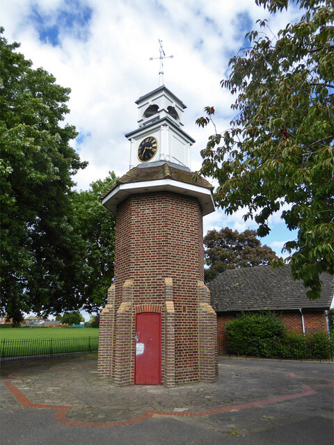
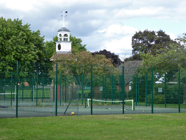
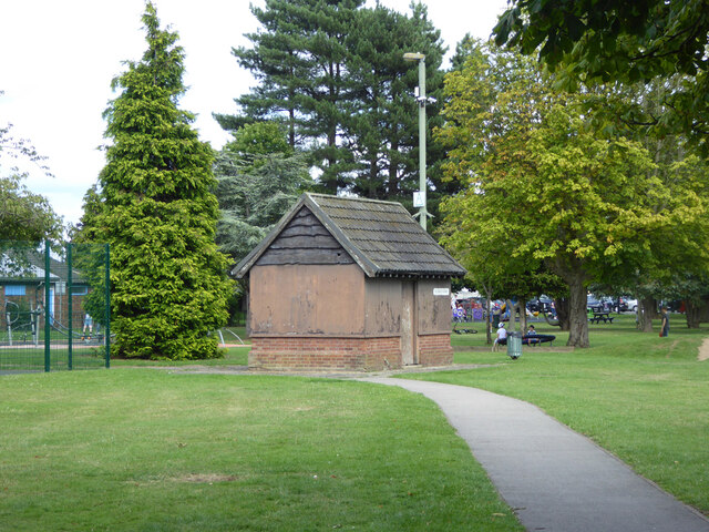
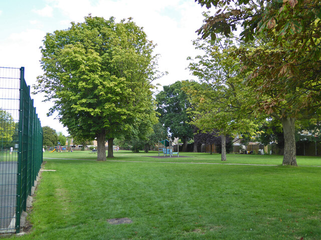
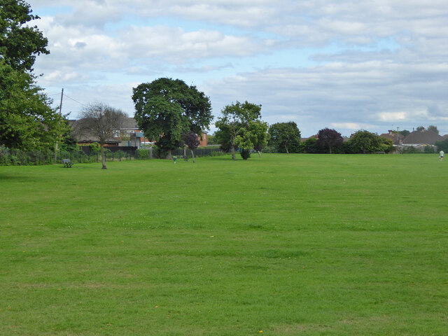
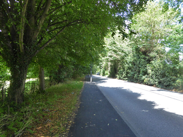
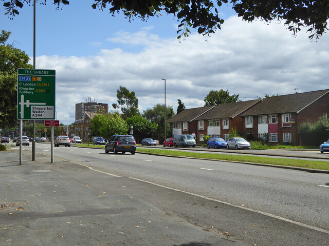
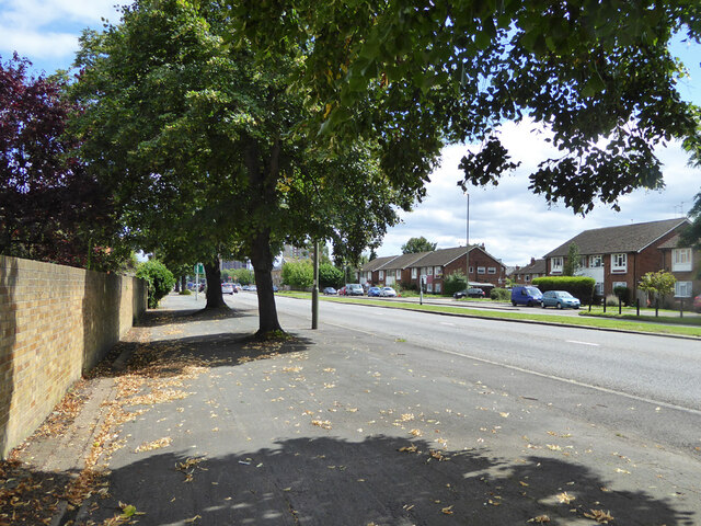
The area is known for its tranquil atmosphere and picturesque surroundings. Ashford Common is bordered by the River Ash to the north, which provides a scenic backdrop to the community. The common itself is a large open space with grassy areas and trees, offering residents and visitors a peaceful place to relax and enjoy nature.

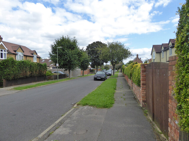
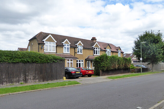
The residential properties in Ashford Common consist mainly of detached and semi-detached houses, along with a few apartment buildings. The neighborhood has a mix of architectural styles, reflecting its development over the years.

Ashford Common benefits from its proximity to major transport links, including the M25 motorway and Ashford railway station, which provides regular services to London Waterloo. This makes it an attractive location for commuters working in the city.

The area is well-served in terms of amenities, with several shops, restaurants, and pubs located nearby. There are also several schools in the vicinity, catering to families with children.

Overall, Ashford Common offers a peaceful and convenient place to live, with its natural beauty, good transport links, and range of amenities.

If you have any feedback on the listing, please let us know in the comments section below.

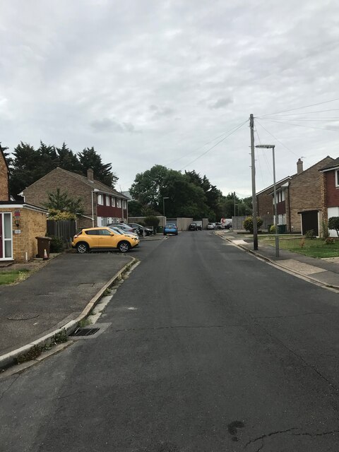
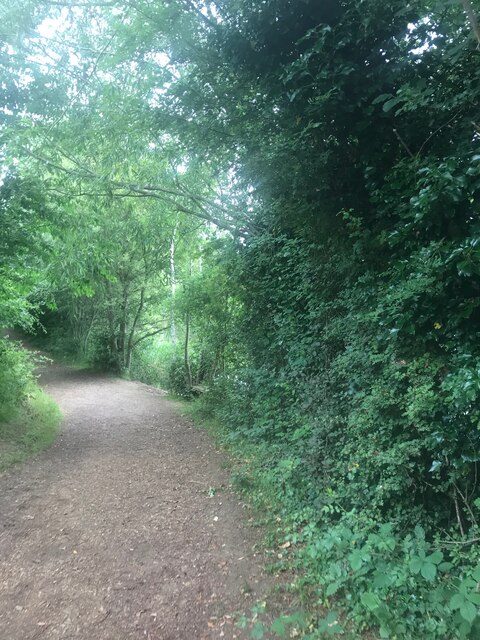
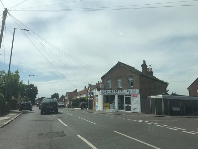
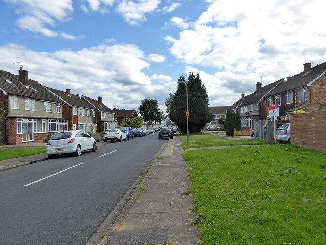
Ashford Common Images

Images are sourced within 2km of 51.423595/-0.432242 or Grid Reference TQ0970. Thanks to Geograph Open Source API. All images are credited.

On Anderson Drive
On Anderson Drive
Path in Bedford Lakes Country Park
Smart Dry Cleaners - near Ashford
Ashford Road
Ashford Road
Ashford Road
Ashford Road
Postbox TW15 162D, School Road, Ashford A George V box, with attached drop box.
Postbox TW15 162D, School Road, Ashford
A George V box, with attached drop box.
Sundown Road, Ashford
Clock tower, Clockhouse Lane Park A surprising feature of a small park and recreation ground. A 1962 photograph reveals that this is the remaining core of an octagonal shelter or pavilion. Clockhouse Lane is named after Clock House, that was on the other side of the road, but now demolished. Was the clock, assuming there was one, transferred here?
Clock tower, Clockhouse Lane Park
A surprising feature of a small park and recreation ground. A 1962 photograph reveals that this is the remaining core of an octagonal shelter or pavilion. Clockhouse Lane is named after Clock House, that was on the other side of the road, but now demolished. Was the clock, assuming there was one, transferred here?
Clock tower and tennis courts, Clockhouse Lane Park A surprising feature of a small park and recreation ground. A 1962 photograph reveals that this is the remaining core of an octagonal shelter or pavilion. Clockhouse Lane is named after Clock House, that was on the other side of the road, but now demolished. Was the clock, assuming there was one, transferred here?
Clock tower and tennis courts, Clockhouse Lane Park
A surprising feature of a small park and recreation ground. A 1962 photograph reveals that this is the remaining core of an octagonal shelter or pavilion. Clockhouse Lane is named after Clock House, that was on the other side of the road, but now demolished. Was the clock, assuming there was one, transferred here?
Small building, Clockhouse Lane Park Of unknown purpose, which does not appear to have been recently exercised.
Small building, Clockhouse Lane Park
Of unknown purpose, which does not appear to have been recently exercised.
In Clockhouse Lane Park, Ashford
Clockhouse Lane Park, Ashford
Woodmans House under construction, 2017 Flats.
Woodmans House under construction, 2017
Flats.
A244 Chertsey Road Heading north.
A244 Chertsey Road
Heading north.
Scotts Way, Ashford Common
Houses on Scotts Way, Ashford Common
A308 Staines Road West Heading east.
A308 Staines Road West
Heading east.
A308 Staines Road West Heading east.
A308 Staines Road West
Heading east.
Show me another place!

Ashford Common is located at Grid Ref: TQ0970 (Lat: 51.423595, Lng: -0.432242)

Administrative County: Surrey

District: Spelthorne

Police Authority: Surrey

What 3 Words

///crush.period.wipes. Near Ashford, Surrey

Related Wikis

Spelthorne Sports F.C.

Spelthorne Sports F.C. is a football club based in the borough of Spelthorne. They play in the Combined Counties League Premier Division South. == History... ==

Sunbury-on-Thames

Sunbury-on-Thames (or commonly Sunbury) is a town on the north bank of the River Thames in the Borough of Spelthorne, Surrey, centred 13 mi (21 km) southwest...

Sunbury railway station (Surrey)

Sunbury railway station serves the town of Sunbury-on-Thames, in the Spelthorne district of Surrey, England. It is 16 miles 64 chains (27.0 km) down the...

Upper Halliford railway station

Upper Halliford railway station serves the village of Upper Halliford in Surrey, England. It is 17 miles 34 chains (28.0 km) down the line from London...

Sunbury Manor School

Sunbury Manor School is a secondary academy school in Sunbury-on-Thames, in Surrey, England. == Admissions == The school educates an overwhelmingly number...

Queen Mary Reservoir

The Queen Mary Reservoir is one of the largest of London's reservoirs supplying fresh water to London and parts of surrounding counties, and is located...

St Paul's College, Sunbury-on-Thames

St Paul's Catholic College is a coeducational Roman Catholic secondary school and sixth form located in Sunbury-on-Thames, Surrey, England. St Paul's is...

Sunbury-on-Thames Urban District

Sunbury on Thames Urban District, also known as Sunbury Urban District, was a local government district from 1894 to 1974 comprising the town and parish...

Nearby Amenities

Located within 500m of 51.423595,-0.432242
Crossing
Crossing: uncontrolled
Crossing Ref: zebra
Lat/Long: 51.4273734/-0.4292851
Crossing
Crossing: marked
Lat/Long: 51.4269573/-0.4281894
Bus Stop
Windmill Road
Bus: yes
Naptan AtcoCode: 40004402066A
Naptan Bearing: W
Naptan CommonName: Windmill Road
Naptan Indicator: Just Before
Naptan Landmark: Windmill Road
Naptan NaptanCode: surdjpgj
Naptan Street: Staines Road West
Naptan Verified: no
Public Transport: platform
Ref: 51958
Source: naptan_import
Lat/Long: 51.4202715/-0.4284865
Bus Stop
Windmill Road
Bus: yes
Naptan AtcoCode: 40004402066B
Naptan Bearing: E
Naptan CommonName: Windmill Road
Naptan Indicator: Just after
Naptan Landmark: Windmill Road
Naptan NaptanCode: surdjpgm
Naptan Street: Staines Road West
Naptan Verified: no
Public Transport: platform
Source: naptan_import
Lat/Long: 51.4205393/-0.4288388
Bus Stop
Napier Road
Bus: yes
Naptan AtcoCode: 40004402067A
Naptan Bearing: E
Naptan CommonName: Napier Road
Naptan Indicator: Just Before
Naptan Landmark: Napier Road
Naptan NaptanCode: surdjpgp
Naptan Street: Staines Road West
Naptan Verified: no
Public Transport: platform
Ref: 48849
Source: naptan_import
Lat/Long: 51.4215107/-0.4364308
Bus Stop
Napier Road
Bus: yes
Naptan AtcoCode: 40004402067B
Naptan Bearing: W
Naptan CommonName: Napier Road
Naptan Indicator: Opp
Naptan Landmark: Napier Road
Naptan NaptanCode: surdjpjg
Naptan Street: Staines Road West
Naptan Verified: no
Public Transport: platform
Ref: 52008
Shelter: no
Source: naptan_import
Lat/Long: 51.4211847/-0.4354942
Bus Stop
Norman Road
Naptan AtcoCode: 40004402091D
Naptan Bearing: SW
Naptan CommonName: Black Dog
Naptan Indicator: Nr
Naptan Landmark: Black Dog
Naptan NaptanCode: surdmgtj
Naptan Street: Chertsey Road
Public Transport: platform
Ref: 48103
Source: naptan_import
Lat/Long: 51.4225712/-0.4391305
Bus Stop
Saville Crescent
Naptan AtcoCode: 40004402092A
Naptan Bearing: NE
Naptan CommonName: Saville Crescent
Naptan Indicator: Just after
Naptan Landmark: Saville Crescent
Naptan NaptanCode: surdmjmw
Naptan Street: Chertsey Road
Naptan Verified: no
Public Transport: platform
Ref: 50430
Source: naptan_import
Lat/Long: 51.4251684/-0.4348819
Bus Stop
Saville Crescent
Naptan AtcoCode: 40004402092B
Naptan Bearing: SW
Naptan CommonName: Saville Crescent
Naptan Indicator: Just Before
Naptan Landmark: Saville Crescent
Naptan NaptanCode: surdmjpd
Naptan Street: Chertsey Road
Naptan Verified: no
Public Transport: platform
Ref: 54986
Source: naptan_import
Lat/Long: 51.4250151/-0.4349025
Bus Stop
BP Centre
Naptan AtcoCode: 40004402093A
Naptan Bearing: NE
Naptan CommonName: BP Centre
Naptan Indicator: adj
Naptan Landmark: BP Centre
Naptan NaptanCode: surdmjwg
Naptan Street: Chertsey Road
Naptan Verified: no
Public Transport: platform
Source: naptan_import
Lat/Long: 51.4273895/-0.4305063
Bus Stop
BP Centre
Naptan AtcoCode: 40004402093B
Naptan Bearing: SW
Naptan CommonName: BP Centre
Naptan Indicator: Opp
Naptan Landmark: BP Centre
Naptan NaptanCode: surdmjwj
Naptan Street: Chertsey Road
Naptan Verified: no
Public Transport: platform
Source: naptan_import
Lat/Long: 51.4272898/-0.4304522
Bus Stop
Meadhurst Primary School
Naptan AtcoCode: 40004402094A
Naptan Bearing: W
Naptan CommonName: Spelthorne Junior School
Naptan Indicator: Opp
Naptan Landmark: School
Naptan NaptanCode: surdmpag
Naptan Street: Feltham Hill Road
Naptan Verified: no
Public Transport: platform
Ref: 57517
Source: naptan_import
Lat/Long: 51.4257205/-0.4350918
Bus Stop
Meadhurst Primary School
Naptan AtcoCode: 40004402094B
Naptan Bearing: E
Naptan CommonName: Spelthorne Junior School
Naptan Indicator: O/s
Naptan Landmark: Spelthorne County School
Naptan NaptanCode: surdmpaj
Naptan Street: Feltham Hill Road
Naptan Verified: no
Public Transport: platform
Ref: 54338
Source: naptan_import
Lat/Long: 51.4259031/-0.4355643
Crossing
Crossing: marked
Lat/Long: 51.4254963/-0.4302345
Crossing
Crossing: uncontrolled
Crossing Ref: zebra
Lat/Long: 51.4270121/-0.4290988
Crossing
Crossing: marked
Lat/Long: 51.4255407/-0.4296648
Crossing
Crossing: marked
Lat/Long: 51.4257957/-0.4290881
Crossing
Crossing: marked
Lat/Long: 51.4254167/-0.4286265
Crossing
Crossing: marked
Lat/Long: 51.4255407/-0.4287777
Crossing
Crossing: marked
Lat/Long: 51.4256696/-0.42893
Crossing
Crossing: marked
Lat/Long: 51.4252222/-0.429599
Crossing
Crossing: marked
Lat/Long: 51.4253907/-0.4296284
Crossing
Crossing: marked
Lat/Long: 51.4253444/-0.4302022
Crossing
Crossing: marked
Lat/Long: 51.4253033/-0.4288559
Crossing
Crossing: marked
Lat/Long: 51.4254281/-0.4290132
Crossing
Crossing: marked
Lat/Long: 51.4255554/-0.4291562
Crossing
Crossing: marked
Lat/Long: 51.4256831/-0.4293109
Crossing
Crossing: marked
Lat/Long: 51.4263354/-0.4280569
Crossing
Crossing: marked
Lat/Long: 51.4267011/-0.4278933
Traffic Calming: hump
Lat/Long: 51.4261091/-0.437235
Traffic Calming: hump
Lat/Long: 51.4259254/-0.4360533
Traffic Calming: hump
Lat/Long: 51.4262135/-0.4379047
Crossing
Crossing: traffic_signals
Crossing Island: yes
Tactile Paving: yes
Lat/Long: 51.4256551/-0.4336704
Mini Roundabout
Direction: clockwise
Source: sas
Lat/Long: 51.4254744/-0.4342514
Direction: both
Surface: asphalt
Traffic Calming: bump
Lat/Long: 51.4258843/-0.4331658
Turning Circle
Lat/Long: 51.4239252/-0.4304838
Turning Circle
Lat/Long: 51.4199441/-0.4322353
Traffic Calming: hump
Lat/Long: 51.420134/-0.4315691
Direction: both
Surface: asphalt
Traffic Calming: hump
Lat/Long: 51.4237284/-0.4372967
Direction: both
Surface: asphalt
Traffic Calming: hump
Lat/Long: 51.4242651/-0.4365054
Crossing
Crossing: marked
Lat/Long: 51.4263888/-0.4282679
Crossing
Crossing: marked
Lat/Long: 51.4266785/-0.4281251
Junction: mini_roundabout
Lat/Long: 51.4270749/-0.4282214
Crossing
Crossing: uncontrolled
Traffic Calming: table
Lat/Long: 51.4278777/-0.4303541
Speed Camera
Direction: 55
Lat/Long: 51.4280252/-0.4313499
Ashford Common
Place: neighbourhood
Wikidata: Q11686853
Lat/Long: 51.42407/-0.4326259
Costcutter
Brand: Costcutter
Brand Wikidata: Q5175072
Shop: supermarket
Lat/Long: 51.4213308/-0.4343273
Max
Addr Housenumber: 257
Addr Street: Staines Road West
Phone: +44 7795 895823
Shop: hairdresser
Lat/Long: 51.4213376/-0.4344117
Traffic Calming: hump
Lat/Long: 51.4257234/-0.4347919
Traffic Calming: hump
Lat/Long: 51.4193635/-0.4306832
Traffic Calming: hump
Lat/Long: 51.4197619/-0.4311149
Traffic Calming: hump
Lat/Long: 51.4205193/-0.4314259
Building C
Office: company
Lat/Long: 51.4279501/-0.4305579
Post Box
Collection Times: Mo-Fr 09:00; Sa 07:00
Operator: Royal Mail
Post Box Design: type_b
Post Box Type: pillar
Ref: TW16 242D
Royal Cypher: EIIR
Royal Cypher Wikidata: Q33102113
Source: survey
Lat/Long: 51.423242/-0.4275455
Post Box
Collection Times: Mo-Fr 09:00; Sa 07:00
Operator: Royal Mail
Post Box Type: pillar
Ref: TW16 238D
Royal Cypher: GVIR
Royal Cypher Wikidata: Q33102169
Source: survey
Lat/Long: 51.4193979/-0.430636
Big Salami Ltd.
Addr City: Ashford
Addr Housenumber: 48
Addr Postcode: TW15 1TD
Addr Street: Beards Road
Consulting: design;marketing;websites;e-commerce
Office: company
Opening Hours: Mo-Fr 10:00-18:00
Phone: +44 20 3916 5646
Website: https://www.bigsalami.co.uk
Lat/Long: 51.4244822/-0.4306447
Traffic Signals
Traffic Signals: signal
Lat/Long: 51.4204068/-0.4291765
Traffic Signals
Traffic Signals: signal
Lat/Long: 51.4203563/-0.4298145
Traffic Signals
Traffic Signals: signal
Lat/Long: 51.4206239/-0.4298737
Traffic Signals
Traffic Signals: signal
Lat/Long: 51.4207103/-0.4293855
Crossing
Crossing: marked
Lat/Long: 51.4206817/-0.4295307
Crossing
Crossing: marked
Lat/Long: 51.4206551/-0.4294204
Crossing
Crossing: marked
Lat/Long: 51.420616/-0.4298103
Crossing
Crossing: marked
Lat/Long: 51.4204958/-0.4299368
Crossing
Crossing: marked
Lat/Long: 51.4203835/-0.4297915
Crossing
Crossing: marked
Lat/Long: 51.4203373/-0.4296402
Crossing
Crossing: marked
Lat/Long: 51.4204144/-0.4292465
Crossing
Crossing: marked
Lat/Long: 51.4205483/-0.429267
Barrier: cycle_barrier
Lat/Long: 51.4216959/-0.4332402
Barrier: cycle_barrier
Lat/Long: 51.4211882/-0.4334133
Direction: both
Surface: asphalt
Traffic Calming: bump
Lat/Long: 51.4262033/-0.432537
Crossing
Crossing: marked
Lat/Long: 51.4260537/-0.4285438
Crossing
Crossing: marked
Lat/Long: 51.4271828/-0.4279105
Barrier: spikes
Direction: forward
Lat/Long: 51.4278155/-0.4310973
Barrier: lift_gate
Lat/Long: 51.4273899/-0.4319871
Turning Circle
Lat/Long: 51.4246792/-0.4280497
Turning Circle
Lat/Long: 51.4248743/-0.4301558
The data included in this document is from www.openstreetmap.org. The data is made available under ODbL.

Have you been to Ashford Common?

Leave your review of Ashford Common below (or comments, questions and feedback).