Springalls Plantation

Wood, Forest in Oxfordshire South Oxfordshire

England

Springalls Plantation

A4130 at Nuffield village boundary
A4130 at Nuffield village boundary Credit: Colin Pyle

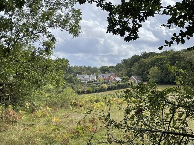
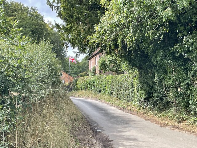
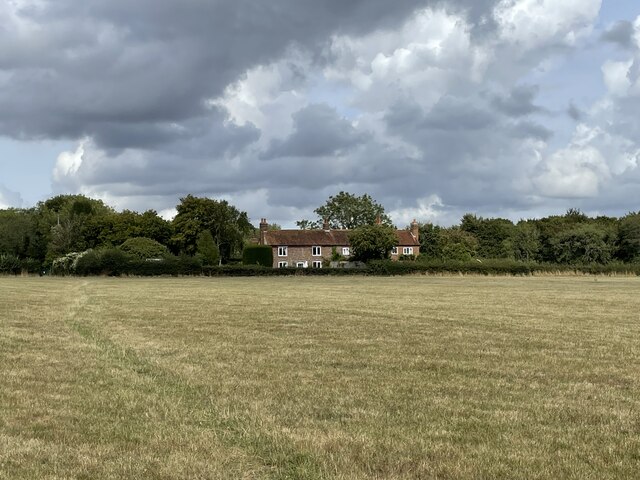
Springalls Plantation is a picturesque woodland located in Oxfordshire, England. Covering an area of approximately 100 acres, it is a captivating destination for nature enthusiasts and those seeking tranquility amidst the bustling city life. The plantation is renowned for its abundant wildlife and diverse flora, making it a haven for hikers, birdwatchers, and photographers.

The woodland is primarily composed of native English tree species, including oak, beech, and birch. These majestic trees create a dense canopy, casting intricate patterns of light and shadow on the forest floor. Bluebells and wild garlic carpet the ground during springtime, adding a burst of color to the already enchanting landscape.

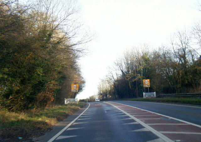
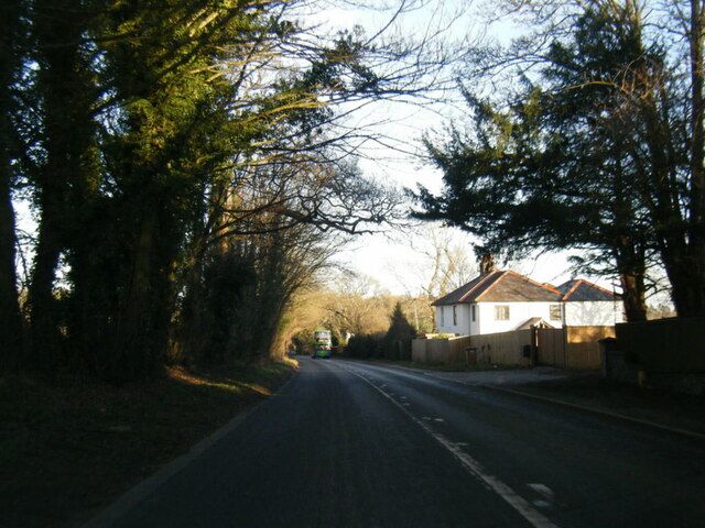
A network of well-maintained footpaths and trails meander through Springalls Plantation, allowing visitors to explore its beauty at their own pace. These paths lead to hidden clearings and viewpoints, providing breathtaking vistas of the surrounding countryside. The plantation is particularly known for its ancient trees, some of which are estimated to be several centuries old, adding a sense of history and grandeur to the area.

The diverse ecosystem of Springalls Plantation supports a wide variety of wildlife. Foxes, badgers, and deer are commonly spotted, while bird species such as woodpeckers, jays, and owls can be heard and seen throughout the year. The plantation is also home to several rare and protected species, making it an important conservation site.

Overall, Springalls Plantation offers a serene escape from the hustle and bustle of everyday life. Its natural beauty, rich biodiversity, and tranquil atmosphere make it a must-visit destination for anyone seeking a peaceful retreat in the heart of Oxfordshire.

If you have any feedback on the listing, please let us know in the comments section below.

Springalls Plantation Images

Images are sourced within 2km of 51.58996/-1.0035496 or Grid Reference SU6988. Thanks to Geograph Open Source API. All images are credited.

A4130 at Nuffield village boundary
A4130 at Port Hill
A4130 at Port Hill
Light Snow at The Maker Space The Crown at Nuffield was a lovely traditional pub in the Brakspears of Henley estate, but like so many country pubs these days couldn't keep going. It was closed for a long time <a href="https://www.geograph.org.uk/photo/5583827">SU6787 : The Crown closed inn beside the A4130</a> but happily is now open again as The Maker Space (at The Crown) aiming more at the coffee, cake and light meals market, and also as a craft centre.
Light Snow at The Maker Space
The Crown at Nuffield was a lovely traditional pub in the Brakspears of Henley estate, but like so many country pubs these days couldn't keep going. It was closed for a long time SU6787 : The Crown closed inn beside the A4130 but happily is now open again as The Maker Space (at The Crown) aiming more at the coffee, cake and light meals market, and also as a craft centre.
Ploughed field near Cookley Green
Cottages on the edge of Nettlebed Common This group of cottages sit facing the northern edge of Nettlebed Common but within the parish of Swyncombe.
Cottages on the edge of Nettlebed Common
This group of cottages sit facing the northern edge of Nettlebed Common but within the parish of Swyncombe.
Digberry Farm, Huntercombe Lane The farm sits within a large square earthwork of unknown age measuring 200 metres across.
Digberry Farm, Huntercombe Lane
The farm sits within a large square earthwork of unknown age measuring 200 metres across.
Cottages at Park Corner Looking north along the footpath from Huntercombe End.
Cottages at Park Corner
Looking north along the footpath from Huntercombe End.
Frosty House at Cookley Green A light dusting of snow this morning brought out the usual crop of wintery scenes.
This house is facing onto the village green.
Frosty House at Cookley Green
A light dusting of snow this morning brought out the usual crop of wintery scenes. This house is facing onto the village green.
Burial Copse Woodland north of Church Lane.
Burial Copse
Woodland north of Church Lane.
War Memorial, Cookley Green
Cottages at Cookley Green
Swyncombe House The House, together with the Rectory and St Botolph's Church make up the hamlet of Swyncombe.
Most of the parishioners live in Cookley Green and Russell's Water.
The house was built in 1840 to replace an earlier manor. 
Like most country houses round here it has appeared in Midsomer Murders.
Swyncome information on <span class="nowrap"><a title="https://en.wikipedia.org/wiki/Swyncombe" rel="nofollow ugc noopener" href="https://en.wikipedia.org/wiki/Swyncombe">Link</a><img style="margin-left:2px;" alt="External link" title="External link - shift click to open in new window" src="https://s1.geograph.org.uk/img/external.png" width="10" height="10"/></span>
Swyncombe House
The House, together with the Rectory and St Botolph's Church make up the hamlet of Swyncombe. Most of the parishioners live in Cookley Green and Russell's Water. The house was built in 1840 to replace an earlier manor. Like most country houses round here it has appeared in Midsomer Murders. Swyncome information on LinkExternal link
Road junction and grass island Looking along the B481.
Road junction and grass island
Looking along the B481.
The entrance to Cookley Farm At a height of about 220m, this is fairly high up, by the standards of southern England.

Whether any land here is down to arable, I can't say - but there were ewes and lambs in the field just to the right of the gateway.
The entrance to Cookley Farm
At a height of about 220m, this is fairly high up, by the standards of southern England. Whether any land here is down to arable, I can't say - but there were ewes and lambs in the field just to the right of the gateway.
Swyncombe Cricket Club pavilion It's good to see the ground and pavilion are still in good shape. I've not seen it since Bix used to play here in the 1970's and 80's. The ground used to be on Cookley Green itself, beside the B481, but when the club started 100 years ago the traffic was lighter!
Swyncombe Cricket Club pavilion
It's good to see the ground and pavilion are still in good shape. I've not seen it since Bix used to play here in the 1970's and 80's. The ground used to be on Cookley Green itself, beside the B481, but when the club started 100 years ago the traffic was lighter!
B451 passes across Cookley Green The green used to be used for cricket matches but moved to a new site a few hundred yards to the west. However, tea was still taken in a hall, situated at the left edge of this picture.
B451 passes across Cookley Green
The green used to be used for cricket matches but moved to a new site a few hundred yards to the west. However, tea was still taken in a hall, situated at the left edge of this picture.
War Memorial at Cookley Green
The Green, Cookley Green This is the area of green space that gives the village its name.  It is crossed by Shakespeare's Way.  This jubilee seat is, I think, from the Queen's golden jubilee in 2002 not her diamond one in 2012.
The Green, Cookley Green
This is the area of green space that gives the village its name. It is crossed by Shakespeare's Way. This jubilee seat is, I think, from the Queen's golden jubilee in 2002 not her diamond one in 2012.
Show me another place!

Springalls Plantation is located at Grid Ref: SU6988 (Lat: 51.58996, Lng: -1.0035496)

Administrative County: Oxfordshire

District: South Oxfordshire

Police Authority: Thames Valley

What 3 Words

///remotes.paths.downcast. Near Watlington, Oxfordshire

Related Wikis

HM Prison Huntercombe

HM Prison Huntercombe is a Category C men's prison, located near Nuffield in Oxfordshire, England. It is operated by His Majesty's Prison Service. ��2...

Nuffield Place

Nuffield Place is a country house near the village of Nuffield in the Chiltern Hills in South Oxfordshire, England, just over 4 miles (6 km) east of Wallingford...

Berrick Trench

Berrick Trench is a 2.1-hectare (5.2-acre) biological Site of Special Scientific Interest north of Nettlebed in Oxfordshire.This is an ancient semi-natural...

Nettlebed

Nettlebed is a village and civil parish in Oxfordshire in the Chiltern Hills about 4+1⁄2 miles (7 km) northwest of Henley-on-Thames and 6 miles (10 km...

Swyncombe

Swyncombe is a hamlet and large civil parish in the high Chilterns, within the Area of Outstanding Natural Beauty about 4+1⁄2 miles (7 km) east of Wallingford...

Crocker End House

Crocker End House in Nettlebed in Henley-on-Thames, Oxfordshire, England is a spacious Victorian home built to replace Nettlebed's prosperous rectory in...

Russell's Water

Russell's Water is a hamlet about 6 miles (9.7 km) north of Henley-on-Thames in South Oxfordshire. It is in the Chiltern Hills about 620 feet (190 m)...

Nuffield, Oxfordshire

Nuffield is a village and civil parish in the Chiltern Hills in South Oxfordshire, England, just over 4 miles (6 km) east of Wallingford. The 2011 Census...

Nearby Amenities

Located within 500m of 51.58996,-1.0035496
Created By: osmeditor2
Lat/Long: 51.5881717/-1.0024367
Created By: osmeditor2
Lat/Long: 51.5873317/-1.0038617
Park Corner
Created By: osmeditor2
Place: village
Lat/Long: 51.5924528/-1.000267
Created By: osmeditor2
Lat/Long: 51.5865133/-0.9989067
Bus Stop
Park Corner Turn
Bus: yes
Naptan AtcoCode: 340000603OPP
Naptan Bearing: N
Naptan BusStopType: CUS
Naptan CommonName: Park Corner Turn
Naptan Indicator: Opp Bus Shelter
Naptan Landmark: Opp Bus Shelter
Naptan NaptanCode: oxfgjwtj
Naptan Street: B481
Naptan Verified: no
Public Transport: platform
Source: naptan_import
Lat/Long: 51.5940859/-1.0029953
Bus Stop
Park Corner Turn
Bus: yes
Naptan AtcoCode: 340000603T
Naptan Bearing: S
Naptan CommonName: Park Corner Turn
Naptan Indicator: Bus Shelter
Naptan Landmark: Bus Shelter
Naptan NaptanCode: oxfapwpm
Naptan Street: B481
Naptan Verified: no
Public Transport: platform
Source: naptan_import
Lat/Long: 51.5940186/-1.0027735
Barrier: stile
Foot: yes
Lat/Long: 51.5940612/-1.0030073
Power: pole
Source: Bing
Lat/Long: 51.5920242/-1.0097898
Power: pole
Source: Bing
Lat/Long: 51.5925107/-1.0079123
Power: pole
Source: Bing
Lat/Long: 51.5941138/-1.0060401
Power: pole
Source: Bing
Lat/Long: 51.5935688/-1.0066704
Power: pole
Source: Bing
Lat/Long: 51.5919692/-1.0085319
Power: pole
Source: Bing
Lat/Long: 51.5930306/-1.0072873
Barrier: stile
Foot: yes
Material: wood
Stile: stepover
Lat/Long: 51.5895555/-1.0011864
Barrier: kissing_gate
Foot: yes
Lat/Long: 51.5911391/-0.9971166
Barrier: stile
Foot: yes
Material: wood
Stile: stepover
Lat/Long: 51.5908076/-1.0003718
Barrier: kissing_gate
Foot: yes
Lat/Long: 51.5935886/-1.0003064
Maxspeed: 30 mph
Traffic Sign: maxspeed
Lat/Long: 51.587242/-0.999603
Power: pole
Lat/Long: 51.5875747/-1.0009186
Power: pole
Lat/Long: 51.5869964/-1.002312
Power: pole
Lat/Long: 51.5864032/-1.0037228
Power: pole
Lat/Long: 51.5858174/-1.0051095
Power: pole
Lat/Long: 51.5914542/-1.0091731
Power: pole
Lat/Long: 51.590771/-1.0093984
Power: pole
Lat/Long: 51.5901311/-1.0095888
Power: pole
Lat/Long: 51.5893878/-1.0098571
Power: pole
Lat/Long: 51.5886546/-1.0101172
Fixme: solar panel?
Lat/Long: 51.5934911/-1.0015341
The data included in this document is from www.openstreetmap.org. The data is made available under ODbL.

Have you been to Springalls Plantation?

Leave your review of Springalls Plantation below (or comments, questions and feedback).