Beckham, East

Settlement in Norfolk North Norfolk

England

Beckham, East

All Saints' church, Gresham See <span class="nowrap"><a title="http://www.norfolkchurches.co.uk/gresham/gresham.htm" rel="nofollow ugc noopener" href="http://www.norfolkchurches.co.uk/gresham/gresham.htm">Link</a><img style="margin-left:2px;" alt="External link" title="External link - shift click to open in new window" src="https://s1.geograph.org.uk/img/external.png" width="10" height="10"/></span>.
All Saints' church, Gresham Credit: Bikeboy

Beckham is a small village located in the county of Norfolk, in the East of England. Situated approximately 20 miles north of the city of Norwich, Beckham is part of the North Norfolk district. The village is set amidst picturesque countryside, characterized by rolling hills, meadows, and farmland.

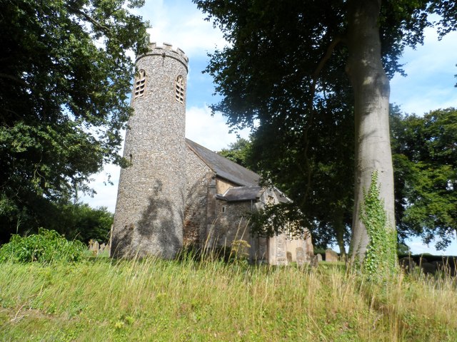
With its origins dating back to medieval times, Beckham is steeped in history. It is home to a number of historic buildings, including St. Helen's Church, which dates back to the 13th century and features a splendid medieval wall painting. The village also boasts several charming thatched cottages, adding to its quintessential English village atmosphere.

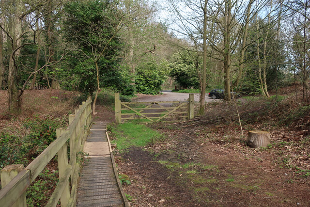
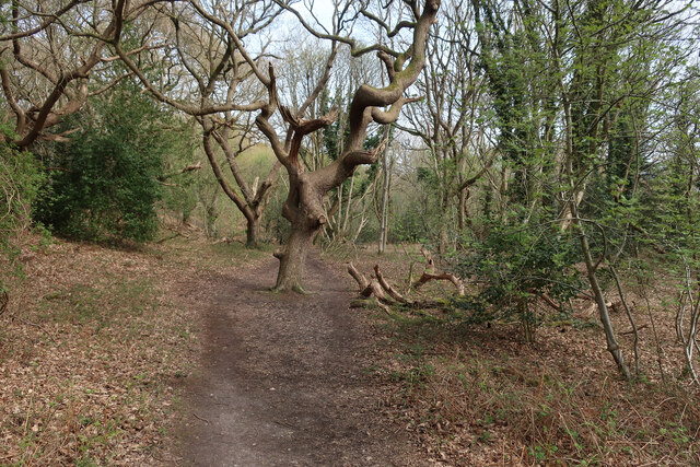
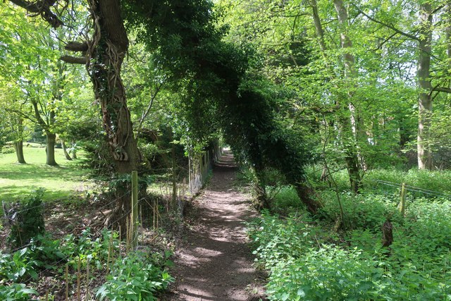
Despite its small size, Beckham offers a range of amenities to its residents and visitors. These include a village hall, where various community events and activities take place, as well as a local pub that serves as a popular meeting point for locals and visitors alike. The village is also surrounded by scenic walking and cycling routes, providing opportunities to explore the beautiful surrounding countryside.

Beckham is ideally located for those seeking a peaceful and rural retreat, while still being within easy reach of larger towns and cities. The nearby market town of Holt offers a wider range of shops, amenities, and services, and the coastal town of Sheringham is just a short drive away, providing access to stunning sandy beaches and the North Norfolk coast.

Overall, Beckham is a charming and idyllic village, perfect for those seeking a tranquil setting in the heart of the Norfolk countryside.

If you have any feedback on the listing, please let us know in the comments section below.

Beckham, East Images

Images are sourced within 2km of 52.91367/1.210778 or Grid Reference TG1539. Thanks to Geograph Open Source API. All images are credited.

All Saints' church, Gresham See <span class="nowrap"><a title="http://www.norfolkchurches.co.uk/gresham/gresham.htm" rel="nofollow ugc noopener" href="http://www.norfolkchurches.co.uk/gresham/gresham.htm">Link</a><img style="margin-left:2px;" alt="External link" title="External link - shift click to open in new window" src="https://s1.geograph.org.uk/img/external.png" width="10" height="10"/></span>.
All Saints' church, Gresham
See LinkExternal link.
Gresham village sign Village signs are typically placed along the principal road or in a prominent location such as a village green or close by the church. The design often depicts a particularly feature of the village or a scene from its history, heritage, or culture. They are typically made of wood or metal or a combination of both, the designs are often made by the local community.
Although they do appear in villages and towns all over the country they are more prominent in East Anglia than elsewhere in the country.
Gresham village sign
Village signs are typically placed along the principal road or in a prominent location such as a village green or close by the church. The design often depicts a particularly feature of the village or a scene from its history, heritage, or culture. They are typically made of wood or metal or a combination of both, the designs are often made by the local community. Although they do appear in villages and towns all over the country they are more prominent in East Anglia than elsewhere in the country.
Gresham village sign The grasshopper on top of the sign is an heraldic device used by the Gresham family. It is used by Gresham College, which was founded by Sir Thomas Gresham and can also be seen as the weathervane on the Royal Exchange in the City of London, which he also founded in 1565. The windmill, watermill and castle are also featured
Gresham village sign
The grasshopper on top of the sign is an heraldic device used by the Gresham family. It is used by Gresham College, which was founded by Sir Thomas Gresham and can also be seen as the weathervane on the Royal Exchange in the City of London, which he also founded in 1565. The windmill, watermill and castle are also featured
East and West Beckham War Memorial The Memorial bears nine names of the men lost in WW1. They are repeated on the Roll of Honour which stands outside the church and is in a very poor condition with the surface of the stone flaking badly. <a title="https://www.geograph.org.uk/photo/2113136" href="https://www.geograph.org.uk/photo/2113136">Link</a>
East and West Beckham War Memorial
The Memorial bears nine names of the men lost in WW1. They are repeated on the Roll of Honour which stands outside the church and is in a very poor condition with the surface of the stone flaking badly. Link
Gresham War Memorial The Memorial has twelve names of men lost in WW1 and on another face are the names of six men lost in WW2.
Gresham War Memorial
The Memorial has twelve names of men lost in WW1 and on another face are the names of six men lost in WW2.
New sand quarry Adding to the large quarry to the west. The material is glacial moraines.
New sand quarry
Adding to the large quarry to the west. The material is glacial moraines.
Closed bridleway Rerouted as the sand quarry spreads into this area.
Closed bridleway
Rerouted as the sand quarry spreads into this area.
Trees planted in field With the quarry expanding in this direction, these presumably replace some trees lost elsewhere.
Trees planted in field
With the quarry expanding in this direction, these presumably replace some trees lost elsewhere.
Field by Row Plantation
Path through Sheringham Wood
Entrance of Sheringham Wood
Pretty Corner Woods car park
Boardwalk path through Pretty Corner Woods
Path in Pretty Corner Woods
Path through Pretty Corner Woods
Old Milestone by the A148, Holt Road, Upper Sheringham Milestone on the A148 in the parish of Upper Sheringham, North Norfolk District; Holt Road, at entrance to Mill Farm Bowling Club, 4m West of entrance on verge, South side of road. The stone was buried, probably as a WWII security measure, discovered in 2015 and re-erected in 2017.

Inscription reads:-
: TO / HOLT / 4 / MILES : : SHERRINGHAM : : TO / CROMER / 5 / MILES :
Note the older spelling of the parish name. 

Milestone Society ID: NO_CH05.
Old Milestone by the A148, Holt Road, Upper Sheringham
Milestone on the A148 in the parish of Upper Sheringham, North Norfolk District; Holt Road, at entrance to Mill Farm Bowling Club, 4m West of entrance on verge, South side of road. The stone was buried, probably as a WWII security measure, discovered in 2015 and re-erected in 2017. Inscription reads:- : TO / HOLT / 4 / MILES : : SHERRINGHAM : : TO / CROMER / 5 / MILES : Note the older spelling of the parish name. Milestone Society ID: NO_CH05.
Footpath into Sheringwood
Show me another place!

Beckham, East is located at Grid Ref: TG1539 (Lat: 52.91367, Lng: 1.210778)

Administrative County: Norfolk

District: North Norfolk

Police Authority: Norfolk

What 3 Words

///thundered.clan.fancy. Near Sheringham, Norfolk

Related Wikis

East Beckham

East Beckham is a village and a civil parish in the English county of Norfolk. The village is 23.4 miles (37.7 km) north of Norwich, 5 miles (8 km) south...

Wood-Dene School

Wood-Dene School was a private school for the creative arts in the English county of Norfolk in Great Britain, closing during March 2010. The school was...

Gresham, Norfolk

Gresham is a village and civil parish in North Norfolk, England, five miles (8 km) south-west of Cromer. A predominantly rural parish, Gresham centres...

Briton's Lane Gravel Pit

Briton's Lane Gravel Pit is a 21.5-hectare (53-acre) geological Site of Special Scientific Interest east of Sheringham in Norfolk. It is a Geological...

Gresham Castle

Gresham Castle is located south of the village of Gresham in the north of the English county of Norfolk. The medieval castle was actually a fortified manor...

RAF West Beckham

Royal Air Force Station West Beckham, commonly known as RAF West Beckham, is a former Chain Home radar station controlled by the Royal Air Force (RAF)...

Aylmerton

Aylmerton is a village in the county of Norfolk, England. It is in the area of North Norfolk and lies 2.2 miles (3.5 km) south of the North Sea, 3.2 miles...

A1082 road

The A1082 is an English A road entirely in the county of Norfolk. It runs from a junction with the A148 King's Lynn to Cromer Road to a roundabout on the...

Nearby Amenities

Located within 500m of 52.91367,1.210778
Post Box
Lat/Long: 52.9121766/1.2141908
Bench
Backrest: yes
Material: wood
Seats: 2
Lat/Long: 52.9120937/1.2142461
Bench
Backrest: yes
Material: wood
Seats: 3
Lat/Long: 52.9121042/1.2142226
Abandoned Amenity: place_of_worship
Denomination: anglican
Historic: ruins
Listed Status: Grade II
Material: stone
Old Name: Saint Helen's Church
Religion: christian
Ruins: church
Short Name: Saint Helen
Website: http://www.heritage.norfolk.gov.uk/record-details?MNF6631
Wikidata: Q26654601
Lat/Long: 52.9127/1.2036735
Power: pole
Lat/Long: 52.9148706/1.2093946
Power: pole
Lat/Long: 52.9157229/1.2157971
Power: pole
Lat/Long: 52.9157197/1.2137505
Power: pole
Lat/Long: 52.9154253/1.2045345
Power: pole
Lat/Long: 52.9152701/1.2059748
Power: pole
Lat/Long: 52.9150679/1.2077263
Power: pole
Lat/Long: 52.9158523/1.2047034
Power: pole
Lat/Long: 52.9158232/1.2067017
Power: pole
Lat/Long: 52.9157925/1.2085041
Power: pole
Lat/Long: 52.9157941/1.2098882
Power: pole
Lat/Long: 52.9157569/1.2118918
Power: pole
Lat/Long: 52.9147379/1.210953
Give Way
Lat/Long: 52.9175286/1.208366
Give Way
Lat/Long: 52.9137303/1.2107103
East Beckham
Colour: black
Inscription: 2000
Man Made: village_sign
Material: metal
Start Date: 2000
Lat/Long: 52.9136365/1.2109074
Power: pole
Lat/Long: 52.9143546/1.2148583
Power: pole
Lat/Long: 52.9145471/1.2131135
Power: pole
Lat/Long: 52.9132338/1.2170336
Power: pole
Lat/Long: 52.9137756/1.215958
The data included in this document is from www.openstreetmap.org. The data is made available under ODbL.

Have you been to Beckham, East?

Leave your review of Beckham, East below (or comments, questions and feedback).