Buckners Shaw

Wood, Forest in Oxfordshire South Oxfordshire

England

Buckners Shaw

Fingerposts at Highmoor Cross
Fingerposts at Highmoor Cross Credit: David Howard

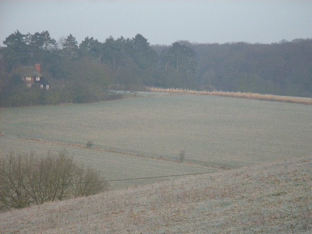
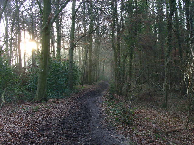
Buckners Shaw is a picturesque woodland located in Oxfordshire, England. Nestled in the heart of the county, this enchanting forest is a haven for nature enthusiasts and a popular destination for recreational activities.

Covering an area of approximately 200 acres, Buckners Shaw boasts a diverse range of flora and fauna, making it a thriving ecosystem. The woodland consists mainly of native tree species such as oak, beech, and birch, creating a captivating and tranquil environment. Walking through the forest, visitors can expect to encounter bluebells, wild garlic, and an array of vibrant wildflowers during the spring and summer months.

The forest is home to a variety of wildlife, including deer, foxes, badgers, and numerous bird species. Birdwatchers can delight in the chance to spot woodpeckers, owls, and even the elusive nightingale. The forest's serene atmosphere also makes it a perfect spot for bird nesting, providing a safe haven for breeding.

For outdoor enthusiasts, Buckners Shaw offers a range of activities. There are several well-maintained trails for hikers and cyclists, allowing visitors to explore the forest's natural beauty at their own pace. The forest also features picnic areas, where families can enjoy a meal surrounded by the calming sounds of nature.

Buckners Shaw is a true gem in Oxfordshire, offering a peaceful retreat and an opportunity to connect with nature. Its lush woodland, diverse wildlife, and recreational offerings make it a must-visit destination for nature lovers and outdoor enthusiasts alike.

If you have any feedback on the listing, please let us know in the comments section below.

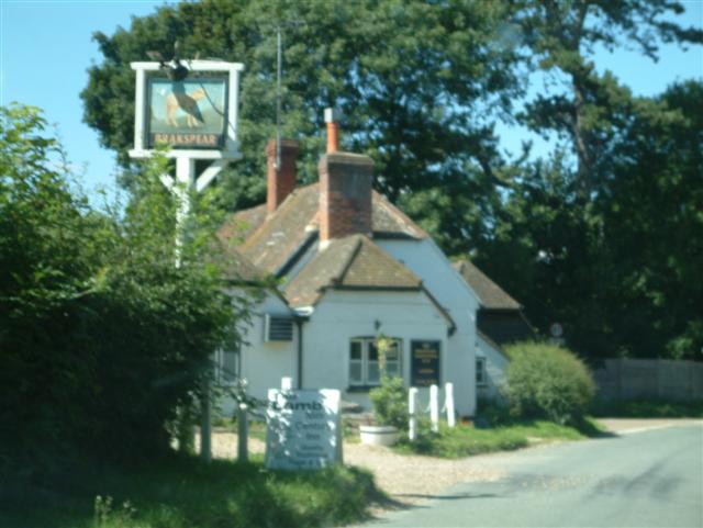
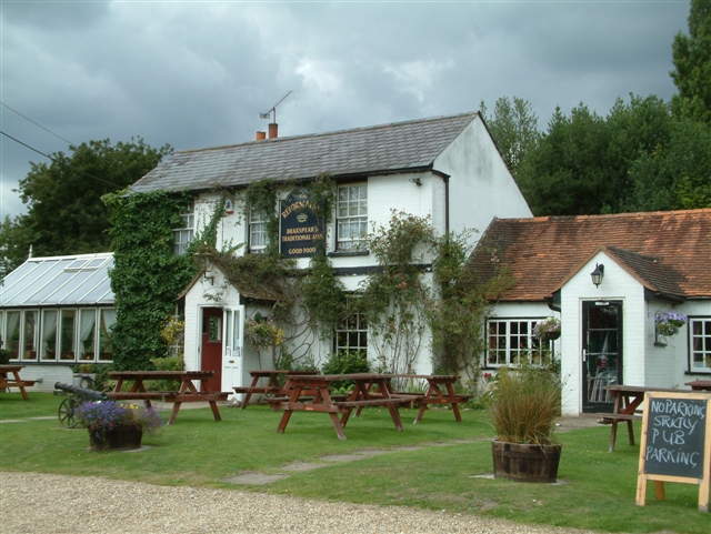
Buckners Shaw Images

Images are sourced within 2km of 51.539113/-1.0079333 or Grid Reference SU6882. Thanks to Geograph Open Source API. All images are credited.

Fingerposts at Highmoor Cross
The road to Stoke Row Going through Bear Wood
The road to Stoke Row
Going through Bear Wood
Bear Wood, Stoke Row
Stoke Row The road becomes Kit Lane but the maps don't give a name till beyond the end of the village.
Stoke Row
The road becomes Kit Lane but the maps don't give a name till beyond the end of the village.
Stoke Row Green
Stoke Row Green
Stoke Row
Stoke Row
Houses in Stoke Row Looking towards Church View.
Houses in Stoke Row
Looking towards Church View.
Church View, Stoke Row
Basset Wood
Basset Wood
Woods north east of Stoke Row
The Maharajah's Well, Stoke Row This is an unlikely looking structure to find in an Oxfordshire village. Its origins lie in the friendship that developed between Edward Anderton Reade, the son of a local squire who spent his working life in India, and the Maharajah of Benares. In Victorian times the villages of this part of Oxfordshire had only limited access to clean water bringing considerable hardship to the poor of the area. Learning of these difficulties, the Maharajah - who had remained loyal to the British during the Indian Mutiny of 1857 - determined that a charity should be set up to relieve the problem. The result was a well dug to a depth of 368 feet, a considerable engineering achievement. To honour the Maharajah, who never visited Britain, a splendid well canopy was built incorporating a gold elephant representing the Hindu god Ganesh. The well was used until the beginning of the Second World War although by that time most houses in the village had a mains connection. Today the well has been renovated and preserved and is maintained by the Maharajah's Well Trust.

The octagonal cottage to the right was built to house the well warden. The last warden died in 1979 since when it has been rented out to supplement the charity's income.
The Maharajah's Well, Stoke Row
This is an unlikely looking structure to find in an Oxfordshire village. Its origins lie in the friendship that developed between Edward Anderton Reade, the son of a local squire who spent his working life in India, and the Maharajah of Benares. In Victorian times the villages of this part of Oxfordshire had only limited access to clean water bringing considerable hardship to the poor of the area. Learning of these difficulties, the Maharajah - who had remained loyal to the British during the Indian Mutiny of 1857 - determined that a charity should be set up to relieve the problem. The result was a well dug to a depth of 368 feet, a considerable engineering achievement. To honour the Maharajah, who never visited Britain, a splendid well canopy was built incorporating a gold elephant representing the Hindu god Ganesh. The well was used until the beginning of the Second World War although by that time most houses in the village had a mains connection. Today the well has been renovated and preserved and is maintained by the Maharajah's Well Trust. The octagonal cottage to the right was built to house the well warden. The last warden died in 1979 since when it has been rented out to supplement the charity's income.
The Maharajah's Well, Stoke Row This is looking under the canopy of the well where the gold elephant takes pride of place. See <a href="https://www.geograph.org.uk/photo/7620533">SU6784 : The Maharajah's Well, Stoke Row</a> for a wider view and some historical notes.
The Maharajah's Well, Stoke Row
This is looking under the canopy of the well where the gold elephant takes pride of place. See SU6784 : The Maharajah's Well, Stoke Row for a wider view and some historical notes.
The Lamb, Satwell The Lamb at Satwell
The Lamb, Satwell
The Lamb at Satwell
St Pauls Church, Highmoor St Pauls Church in the south-western corner of the gridsquare
St Pauls Church, Highmoor
St Pauls Church in the south-western corner of the gridsquare
Satwell
Satwell
The Lamb at Satwell
The Lamb at Satwell
The valley north of Peppard Looking from the hillside above Littlebottom Wood over to the house and woods in the northwestern area of the square.
The valley north of Peppard
Looking from the hillside above Littlebottom Wood over to the house and woods in the northwestern area of the square.
The bridleway in Littlebottom Wood Looking southwards from the northern end of the wood.
The bridleway in Littlebottom Wood
Looking southwards from the northern end of the wood.
Show me another place!

Buckners Shaw is located at Grid Ref: SU6882 (Lat: 51.539113, Lng: -1.0079333)

Administrative County: Oxfordshire

District: South Oxfordshire

Police Authority: Thames Valley

What 3 Words

///venue.truffles.valuables. Near Rotherfield Peppard, Oxfordshire

Related Wikis

Wyfold Court

Wyfold Court is a country house at Rotherfield Peppard in south Oxfordshire. It is a Grade II* listed building. By the year 2000, the estate had been converted...

Bear, Oveys and Great Bottom Woods

Bear, Oveys and Great Bottom Woods is a 64.1-hectare (158-acre) biological Site of Special Scientific Interest west of Henley-on-Thames in Oxfordshire...

Stoke Row

Stoke Row is a village and civil parish in the Chiltern Hills, about 5 miles (8 km) west of Henley-on-Thames in South Oxfordshire and about 9 miles (14...

Gallowstree Common

Gallowstree Common is a hamlet in South Oxfordshire, England, about 4.5 miles (7.2 km) north of Reading, Berkshire. The village had a public house, the...

Highmoor, Oxfordshire

Highmoor is a village and civil parish in the Chiltern Hills in Oxfordshire, about 4 miles (6.4 km) west of Henley-on-Thames. The parish includes the hamlet...

Hook End Recording Studios

Hook End Recording Studios was a recording studio located in Hook End Manor, a 16th-century Elizabethan house near Checkendon, Oxfordshire, England. Its...

St Peter and St Paul, Checkendon

St Peter and St Paul is the Church of England parish church of Checkendon, a village in Oxfordshire, England. Its parish is part of the Deanery of Henley...

Checkendon

Checkendon is a village and civil parish about 6 miles (10 km) west of Henley-on-Thames in South Oxfordshire and about 9 miles (14 km) north west of Reading...

Nearby Amenities

Located within 500m of 51.539113,-1.0079333
Turning Circle
Turning Circle: circle
Lat/Long: 51.5383162/-1.0086847
Turning Circle
Turning Circle: hammer
Lat/Long: 51.5375015/-1.0074083
Bus Stop
The Grouse and Claret PH
Naptan AtcoCode: 340003300CNR
Naptan Bearing: SE
Naptan CommonName: The Grouse and Claret PH
Naptan Indicator: Corner
Naptan Landmark: The Grouse and Claret PH
Naptan NaptanCode: oxfgmagp
Naptan Street: Stoke Row Road
Naptan Verified: no
Source: naptan_import
Lat/Long: 51.5371687/-1.003483
Bus Stop
The Grouse and Claret PH
Bus: yes
Naptan AtcoCode: 340003300OPP
Naptan Bearing: NW
Naptan CommonName: The Grouse and Claret PH
Naptan Indicator: Opposite
Naptan Landmark: The Grouse and Claret PH
Naptan NaptanCode: oxfgmagm
Naptan Street: Stoke Row Road
Naptan Verified: no
Public Transport: platform
Source: naptan_import
Lat/Long: 51.5375949/-1.0041551
Post Box
Post Box Type: lamp
Ref: RG9 93D
Royal Cypher: EIIR
Royal Cypher Wikidata: Q33102113
Lat/Long: 51.5370837/-1.0032048
Direction: 110
Fixme: survey for panel count
Generator Method: photovoltaic
Generator Output Electricity: yes
Generator Solar Modules: 39
Generator Source: solar
Generator Type: solar_photovoltaic_panel
Location: roof
Power: generator
Lat/Long: 51.541204/-1.0130526
Traffic Calming: hump
Lat/Long: 51.5366936/-1.0100587
Traffic Calming: hump
Lat/Long: 51.5371043/-1.0117652
The data included in this document is from www.openstreetmap.org. The data is made available under ODbL.

Have you been to Buckners Shaw?

Leave your review of Buckners Shaw below (or comments, questions and feedback).