Barnet, East

Settlement in Hertfordshire

England

Barnet, East

Heading south on Cockfosters Road at the junction with Chalk Lane
Heading south on Cockfosters Road at the junction with Chalk Lane Credit: Rob Purvis

Barnet is a town located in the East Hertfordshire district of Hertfordshire, England. Situated just outside of Greater London, it lies approximately 10 miles north of the city center. With a population of over 30,000 people, Barnet is a vibrant and bustling town with a rich history.

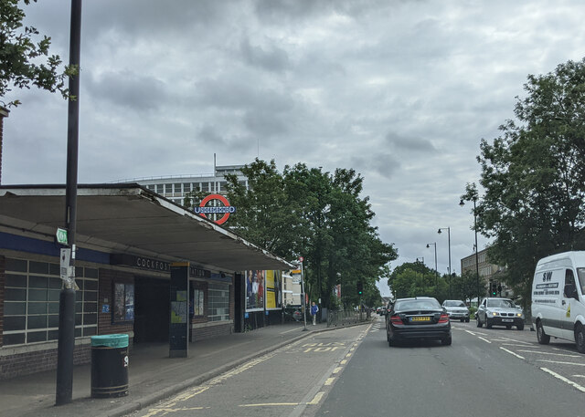
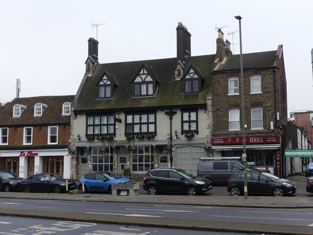
One of the town's main attractions is its historic High Street, which is lined with a variety of shops, restaurants, and pubs. This well-preserved area showcases a mix of architectural styles, from Tudor to Georgian, giving visitors a glimpse into the town's past. Additionally, the town has a weekly market that has been operating for over 800 years, attracting locals and tourists alike.

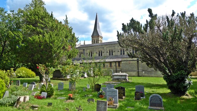
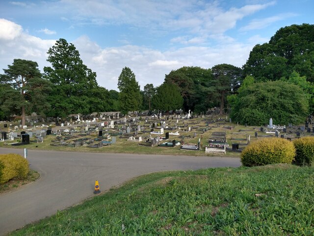
Barnet is also home to several notable landmarks, including the Church of St John the Baptist, a medieval parish church known for its impressive architecture. Another prominent site is the Royal Air Force Museum, which houses a vast collection of aircraft and aviation memorabilia.

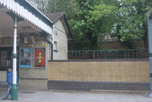
The town is well-connected to the rest of the country, with good transport links. It has its own railway station, making it easy to travel to nearby towns and cities such as London and Cambridge. Furthermore, Barnet is well-served by local buses, providing convenient access to surrounding areas.

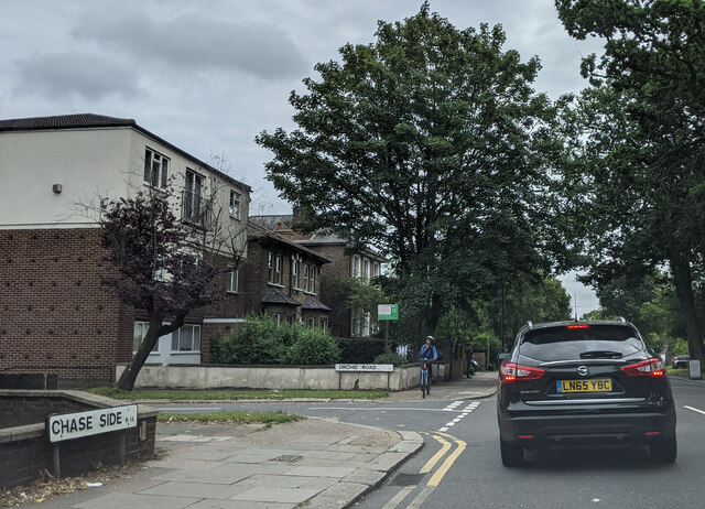
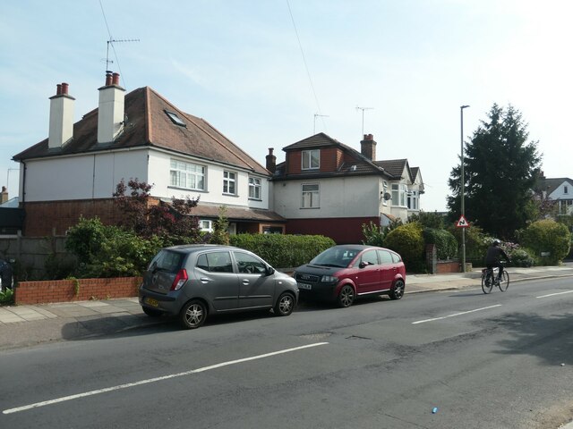
Barnet boasts a range of amenities and facilities, including schools, healthcare services, and recreational spaces. The town has a strong sense of community and hosts various events throughout the year, such as festivals and fairs.

Overall, Barnet offers a blend of history, modern amenities, and a convenient location, making it an attractive place to live or visit in East Hertfordshire.

If you have any feedback on the listing, please let us know in the comments section below.

Barnet, East Images

Images are sourced within 2km of 51.638434/-0.160376 or Grid Reference TQ2794. Thanks to Geograph Open Source API. All images are credited.

Heading south on Cockfosters Road at the junction with Chalk Lane
Passing Cockfosters station, on Cockfosters Road heading south
The roundabout where the A111 meets the A110
On Chase Side at the junction with Exeter Road
On Chase Side at the junction with Orchid Road
Christ Church, Cockfosters Christ Church was built in 1837-39 when Cockfosters became a separate parish, and was paid for by Robert Bevan of nearby Trent Park. The hamlet of Cock Fosters effectively developed as an estate village for the large estates of Trent Park and Beech Hill Park.
Christ Church, Cockfosters
Christ Church was built in 1837-39 when Cockfosters became a separate parish, and was paid for by Robert Bevan of nearby Trent Park. The hamlet of Cock Fosters effectively developed as an estate village for the large estates of Trent Park and Beech Hill Park.
Cockfosters Cricket Club Cockfosters Cricket Club was founded in 1873.
Cockfosters Cricket Club
Cockfosters Cricket Club was founded in 1873.
Monken Hadley Common The display board and map welcomes visitors at the eastern entrance to the common.

The Common is a remnant of the former Royal Forest of Enfield Chase, which was enclosed by an Act of Parliament of 1777.  A small part was allotted to the village of Monken Hadley.  It's the only land which has remained as a common. Until the 1950s the commoners exercised their rights to use the land for grazing.
Monken Hadley Common
The display board and map welcomes visitors at the eastern entrance to the common. The Common is a remnant of the former Royal Forest of Enfield Chase, which was enclosed by an Act of Parliament of 1777. A small part was allotted to the village of Monken Hadley. It's the only land which has remained as a common. Until the 1950s the commoners exercised their rights to use the land for grazing.
Cyclist on Alverstone Avenue Passing houses that have been extended, as many have in this part of North London. The houses were built in the 1920s or early 1930s.
Cyclist on Alverstone Avenue
Passing houses that have been extended, as many have in this part of North London. The houses were built in the 1920s or early 1930s.
Albemarle Road, off Alverstone Avenue Looking north towards the valley of Pymes Brook.
Albemarle Road, off Alverstone Avenue
Looking north towards the valley of Pymes Brook.
Parade of shops, Gallants Farm Road Shopping habits have changes since these shops were built in the 1950s. One is now being converted to a flat, one at least is out of use, and the others offer specialist, not daily, services and purchases.
Parade of shops, Gallants Farm Road
Shopping habits have changes since these shops were built in the 1950s. One is now being converted to a flat, one at least is out of use, and the others offer specialist, not daily, services and purchases.
Extending another house in Gallants Farm Road Already extended sideways, now extending into the roof space.
Extending another house in Gallants Farm Road
Already extended sideways, now extending into the roof space.
New Southgate Cemetery New Southgate Cemetery view
New Southgate Cemetery
New Southgate Cemetery view
The (onetime) Ever Ready office block Whetstone This decaying early 1960's concrete office block was once the proud Ever Ready Batteries' office building. Lately it was a Barnet Council office but now it is empty and ready for demolition. It looks old and tired and an eyesore. My father took a photo of it in 1966 and it was then clean and bright and doubtless seen as cutting edge for the time. Today it seems like an embarrassing reminder of a failed dream. I doubt it will be missed.
The (onetime) Ever Ready office block Whetstone
This decaying early 1960's concrete office block was once the proud Ever Ready Batteries' office building. Lately it was a Barnet Council office but now it is empty and ready for demolition. It looks old and tired and an eyesore. My father took a photo of it in 1966 and it was then clean and bright and doubtless seen as cutting edge for the time. Today it seems like an embarrassing reminder of a failed dream. I doubt it will be missed.
The Griffin Inn Whetstone The Griffin prospers as a gastro pub on Whetstone High Road, once the Great North Road. It was a Coaching Inn originally from the seventeenth century I understand. Diagonally opposite it to the camera's right and out of picture is the soon to be demolished 1960's concrete office block that has become an eyesore. I have also uploaded a photo of that building. That the old building survives and the new one goes under perhaps is the exception to the economic rule of creative destruction as expounded by Joseph Schumpeter to explain the workings of capitalism.
In front of the blue car in the photo the horse trough is not original and the 'whetstone' was no such thing. Perhaps it's creative heritage capitalism?
The Griffin Inn Whetstone
The Griffin prospers as a gastro pub on Whetstone High Road, once the Great North Road. It was a Coaching Inn originally from the seventeenth century I understand. Diagonally opposite it to the camera's right and out of picture is the soon to be demolished 1960's concrete office block that has become an eyesore. I have also uploaded a photo of that building. That the old building survives and the new one goes under perhaps is the exception to the economic rule of creative destruction as expounded by Joseph Schumpeter to explain the workings of capitalism. In front of the blue car in the photo the horse trough is not original and the 'whetstone' was no such thing. Perhaps it's creative heritage capitalism?
Sign at Totteridge and Whetstone Station
Totteridge and Whetstone Station
Cockfosters station - trainshed Cockfosters opened in 1933 and is one of many Underground stations built of concrete and glass and designed by Charles Holden.
Cockfosters station - trainshed
Cockfosters opened in 1933 and is one of many Underground stations built of concrete and glass and designed by Charles Holden.
Show me another place!

Barnet, East is located at Grid Ref: TQ2794 (Lat: 51.638434, Lng: -0.160376)

Unitary Authority: Barnet

Police Authority: Metropolitan

What 3 Words

///note.tamed.rated. Near Barnet, London

Related Wikis

Oak Hill Park (Barnet)

Oak Hill Park is in East Barnet in the London Borough of Barnet. It is one of Barnet's premier parks and received a Green Flag Award for 2009–10. It is...

Pymmes Brook

Pymmes Brook is located in North London and named after William Pymme, a local land owner. It is a minor tributary of the River Lea. The brook mostly...

Oakleigh Park railway station

Oakleigh Park railway station serves Oakleigh Park in the London Borough of Barnet, north London, England. It is 8 miles 30 chains (13.5 km) down the line...

St Mary the Virgin, East Barnet

St Mary the Virgin is the Church of England parish church for East Barnet within the Diocese of St Albans. It is located on Church Hill. == History... ==

Nearby Amenities

Located within 500m of 51.638434,-0.160376
Mini Roundabout
Lat/Long: 51.6392478/-0.1664233
Crossing
Crossing: uncontrolled
Crossing Ref: zebra
Lat/Long: 51.6361167/-0.1564564
Turning Circle
Lat/Long: 51.635747/-0.1598975
Ref GB Tflcid: RWG287321
Traffic Calming: hump
Lat/Long: 51.6357291/-0.1561281
Bus Stop
Oakleigh Park Station
Local Ref: BY
Naptan AtcoCode: 490001218N
Naptan Bearing: N
Naptan CommonName: Oakleigh Park
Naptan Indicator: BY
Naptan Verified: no
Public Transport: platform
Ref: 72035
Lat/Long: 51.6379233/-0.1669778
Bus Stop
Oakleigh Park Station
Local Ref: BW
Naptan AtcoCode: 490001218S
Naptan Bearing: S
Naptan CommonName: Oakleigh Park
Naptan Indicator: BW
Naptan Street: NETHERLANDS ROAD
Naptan Verified: no
Public Transport: platform
Ref: 56115
Lat/Long: 51.6370927/-0.166147
Bus Stop
Cedar Avenue
Local Ref: BM
Naptan AtcoCode: 490004907N
Naptan Bearing: N
Naptan CommonName: Cedar Avenue Church Hill Rd
Naptan Indicator: Stop BM
Naptan Street: CHURCH HILL ROAD
Naptan Verified: no
Public Transport: platform
Lat/Long: 51.6387034/-0.1602931
Bus Stop
Cedar Avenue
Bus: yes
Local Ref: BJ
Naptan AtcoCode: 490004907S
Naptan Bearing: S
Naptan CommonName: Cedar Avenue Church Hill Rd
Naptan Indicator: Stop BJ
Naptan Street: CHURCH HILL ROAD
Naptan Verified: no
Public Transport: platform
Ref: 51940
Source Ref: naptan
Lat/Long: 51.6396539/-0.1609741
Bus Stop
Church Hill Road
Local Ref: BH
Naptan AtcoCode: 490006316S
Naptan Bearing: S
Naptan CommonName: East Barnet War Memorial
Naptan Indicator: Stop BH
Naptan Street: CHURCH HILL ROAD
Naptan Verified: no
Public Transport: platform
Lat/Long: 51.6419718/-0.1628639
Bus Stop
Littlegrove
Bus: yes
Local Ref: BN
Naptan AtcoCode: 490007297N
Naptan Bearing: N
Naptan CommonName: Goodwin Court
Naptan Indicator: Stop BN
Naptan Street: CHURCH HILL ROAD
Naptan Verified: no
Public Transport: platform
Ref: 54257
Source Ref: naptan
Lat/Long: 51.6399252/-0.1614456
Bus Stop
St Mary's Church
Local Ref: BL
Naptan AtcoCode: 490012790N
Naptan Bearing: N
Naptan CommonName: St Marys ChurchChurch Hill Rd
Naptan Indicator: BL
Naptan Street: CHURCH HILL ROAD
Naptan Verified: no
Public Transport: platform
Lat/Long: 51.6361655/-0.1567202
Bus Stop
St Mary's Church
Local Ref: BK
Naptan AtcoCode: 490012790S
Naptan Bearing: S
Naptan CommonName: St Marys ChurchChurch Hill Rd
Naptan Indicator: BK
Naptan Street: CHURCH HILL ROAD
Naptan Verified: no
Public Transport: platform
Lat/Long: 51.6360482/-0.1561984
East Barnet
Place: suburb
Wikidata: Q150212
Lat/Long: 51.6416813/-0.1628235
Post Box
Lat/Long: 51.6422951/-0.1631561
Historic: memorial
Lat/Long: 51.6425549/-0.1628905
Crossing
Crossing: uncontrolled
Crossing Island: no
Crossing Ref: zebra
Tactile Paving: yes
Lat/Long: 51.6375402/-0.1665271
Turning Circle
Lat/Long: 51.6359755/-0.1594087
Noexit: yes
Lat/Long: 51.6394444/-0.157884
Oak Hill Park
Board Type: map
Information: map
Tourism: information
Lat/Long: 51.6404978/-0.1616787
Barrier: swing_gate
Lat/Long: 51.6377024/-0.1586527
Crossing
Crossing: traffic_signals
Crossing Island: yes
Crossing Ref: pelican
Kerb: lowered
Tactile Paving: yes
Lat/Long: 51.6409126/-0.1622538
Crossing
Crossing: uncontrolled
Crossing Ref: zebra
Lat/Long: 51.6422879/-0.1630269
Waste Basket
Lat/Long: 51.6396875/-0.1609995
Waste Basket
Lat/Long: 51.6397624/-0.1610237
Oakleigh Park
Public Transport: stop_position
Railway: stop
Ref: 1
Train: yes
Lat/Long: 51.6373476/-0.1657192
Bench
Backrest: yes
Material: wood
Lat/Long: 51.6374903/-0.1666303
Bench
Lat/Long: 51.6370488/-0.1562385
Bench
Lat/Long: 51.6369163/-0.1558138
Karim & Saberah Meesaq Memorial Bench
Historic: memorial
Inscription: In Affectionate & Loving Memory Of Mr Karim Meesaq & Mrs Saberah Meesaq (Passed away age 81 &80 in 2016) Still Loving Still Living Still Ours Forever In Our Hearts And Thoughts
Lat/Long: 51.6367768/-0.1553959
Fay Ward Memorial Bench
Historic: memorial
Lat/Long: 51.6372927/-0.1569766
Bench
Lat/Long: 51.6365273/-0.1546419
Bench
Lat/Long: 51.6363666/-0.1542058
Elsie Brierton Memorial Bench
Historic: memorial
Lat/Long: 51.6368704/-0.1574298
Bench
Lat/Long: 51.6361868/-0.1564032
Bench
Backrest: yes
Lat/Long: 51.6356354/-0.1551359
Description: Start line of Oak Hill parkrun, only marked during event
Lat/Long: 51.6381725/-0.1554336
Traffic Signals
Traffic Signals Direction: forward
Lat/Long: 51.6408823/-0.1622254
Traffic Signals
Traffic Signals Direction: backward
Lat/Long: 51.6409472/-0.1622864
Oakleigh Park
Public Transport: stop_position
Railway: stop
Ref: 2
Train: yes
Lat/Long: 51.6373004/-0.1658528
Oakleigh Park
Public Transport: stop_position
Railway: stop
Ref: 4
Train: yes
Lat/Long: 51.6382473/-0.1669727
Oakleigh Park
Public Transport: stop_position
Railway: stop
Ref: 3
Train: yes
Lat/Long: 51.6382813/-0.1668121
Oakleigh Park
Naptan AtcoCode: 9100OKLGHPK
Network: National Rail
Network Website: https://www.nationalrail.co.uk/stations/okl/
Network Wikidata: Q26334
Operator: Great Northern
Public Transport: station
Railway: station
Ref Crs: OKL
Ref Tiploc: OKLGHPK
Wheelchair: no
Wikidata: Q1222897
Wikipedia: en:Oakleigh Park railway station
Lat/Long: 51.6376675/-0.1662251
Sir Karl Popper
Description: English Heritage
Historic: memorial
Inscription: Sir Karl Popper (1902–1994) Philosopher lived here 1946–1950
Memorial: plaque
Openplaques Id: 9680
Lat/Long: 51.6353352/-0.1590203
Material: wood
Waterway: weir
Lat/Long: 51.6381304/-0.1537667
Post Box
Collection Times: Mo-Fr 17:45; Sa 11:30; Su off
Drive Through: no
Operator: Royal Mail
Operator Wikidata: Q638098
Ref: EN4 90
Lat/Long: 51.6388947/-0.160539
Post Box
Collection Times: Mo-Fr 09:00; Sa 07:00; Su off
Drive Through: no
Operator: Royal Mail
Operator Wikidata: Q638098
Ref: EN4 119D
Lat/Long: 51.6364188/-0.1616347
Post Box
Collection Times: Mo-Fr 17:30; Sa 11:15; Su off
Drive Through: no
Operator: Royal Mail
Operator Wikidata: Q638098
Ref: EN4 27
Lat/Long: 51.6417831/-0.1591057
Post Box
Collection Times: Mo-Fr 17:45; Sa 11:30; Su off
Drive Through: no
Operator: Royal Mail
Operator Wikidata: Q638098
Ref: EN4 89
Lat/Long: 51.6397743/-0.1654319
Barrier: bollard
Lat/Long: 51.6358603/-0.1594696
Hookah Lounge
Aurora Sky
Addr Housenumber: 11
Addr Street: Church Hill Road
Fixme: #surveyme to check existence of this feature
Lat/Long: 51.6421039/-0.1628042
Give Way
Direction: forward
Lat/Long: 51.6423978/-0.1631321
Give Way
Direction: forward
Lat/Long: 51.642765/-0.1619705
Bicycle Parking
Bicycle Parking: stands
Capacity: 4
Ref GB Tflcid: RWG281295
Lat/Long: 51.6378219/-0.1652485
Bicycle Parking
Bicycle Parking: stands
Capacity: 4
Ref GB Tflcid: RWG281307
Lat/Long: 51.6413979/-0.1627851
Ref GB Tflcid: RWG287310
Traffic Calming: hump
Lat/Long: 51.6344859/-0.158189
Bench
Backrest: yes
Material: wood
Lat/Long: 51.6360474/-0.1665021
Waste Basket
Lat/Long: 51.6398828/-0.156763
Give Way
Direction: backward
Lat/Long: 51.6412909/-0.1601703
Give Way
Direction: forward
Lat/Long: 51.6412406/-0.1602864
Barrier: bollard
Bollard: foldable
Lat/Long: 51.6405382/-0.1617391
The data included in this document is from www.openstreetmap.org. The data is made available under ODbL.

Have you been to Barnet, East?

Leave your review of Barnet, East below (or comments, questions and feedback).