Barming, East

Settlement in Kent Maidstone

England

Barming, East

Houses on Hermitage Lane
Houses on Hermitage Lane Credit: N Chadwick

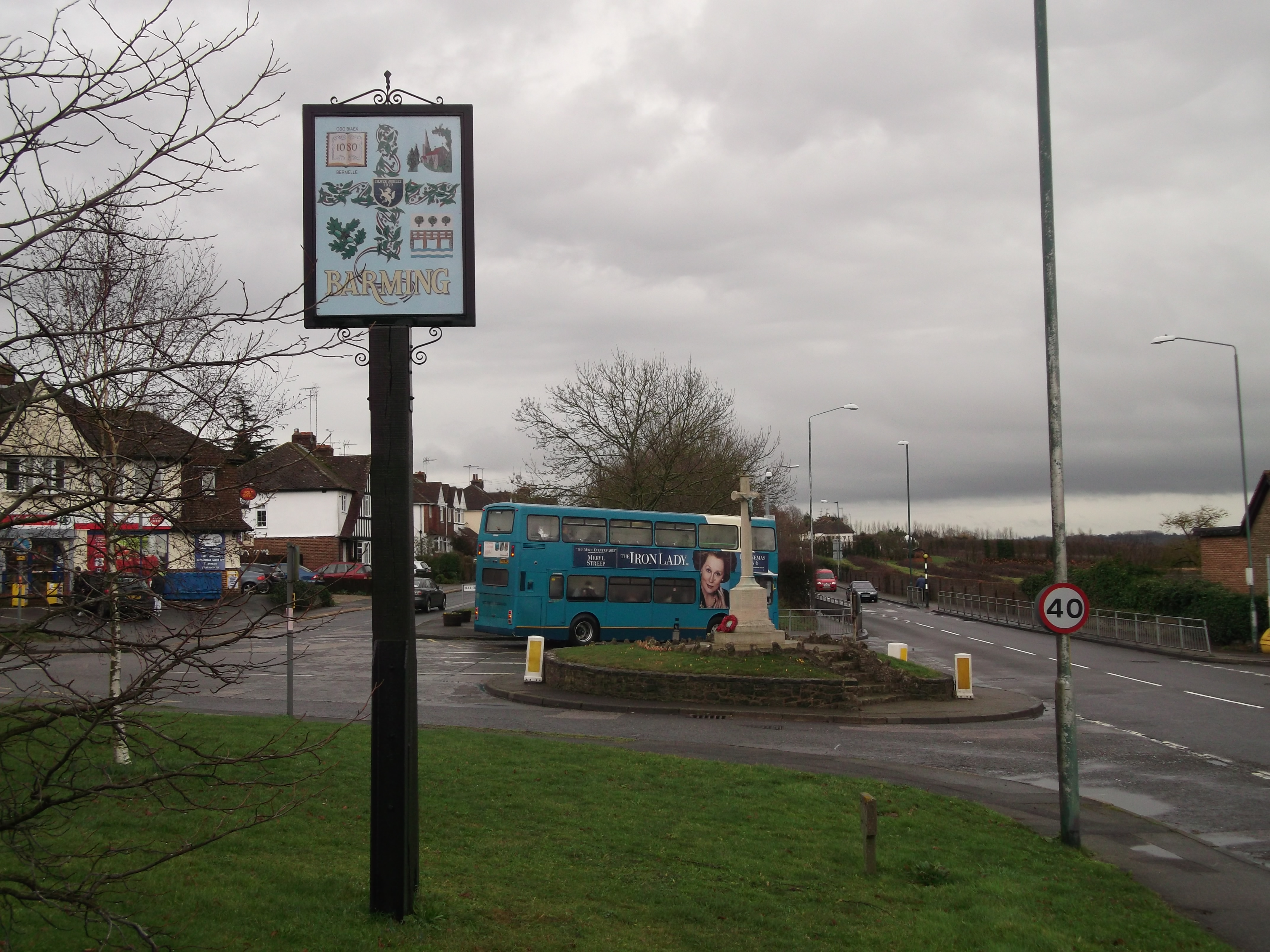
Barming is a residential area located in the eastern part of Kent, England. It is situated around 3 miles west of the county town of Maidstone and lies on the eastern bank of the River Medway. Barming is a part of the larger district of Maidstone and falls under the jurisdiction of the borough council.

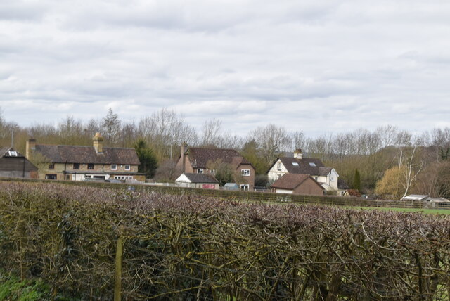
The area is primarily residential, with a mix of housing types including detached houses, terraced houses, and apartments. Barming also has a number of local amenities, including a primary school, a medical center, and a range of shops and services, providing the residents with easy access to essential facilities.

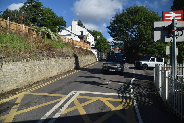
Barming benefits from its proximity to Maidstone, which offers a wider range of amenities and entertainment options. The town center of Maidstone is easily accessible by road or public transport, providing residents with access to a variety of shops, restaurants, and leisure facilities.

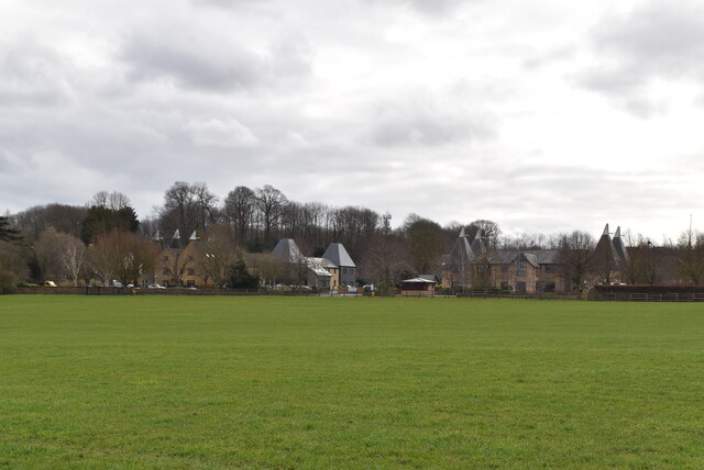
The area is surrounded by picturesque countryside, offering residents the opportunity to enjoy outdoor activities such as walking, cycling, and boating along the River Medway. The area is also home to several parks and green spaces, providing recreational areas for families and individuals to enjoy.

Overall, Barming, East, Kent is a pleasant residential area with a range of amenities, good transport links, and access to beautiful countryside, making it an attractive place to live for families and individuals looking for a peaceful and convenient location.

If you have any feedback on the listing, please let us know in the comments section below.

Barming, East Images

Images are sourced within 2km of 51.262742/0.468481 or Grid Reference TQ7254. Thanks to Geograph Open Source API. All images are credited.

Houses on Hermitage Lane
Hermitage Court Oast Now an inline four round kiln oast house. The building originally had six round kilns.

Also see two fake oast houses at Hermitage Court here <a title="https://www.geograph.org.uk/snippet/22548" href="https://www.geograph.org.uk/snippet/22548">Link</a> & here <a title="https://www.geograph.org.uk/snippet/1358" href="https://www.geograph.org.uk/snippet/1358">Link</a>
Hermitage Court Oast
Now an inline four round kiln oast house. The building originally had six round kilns. Also see two fake oast houses at Hermitage Court here Link & here Link
The Barn, Hermitage Court A fake oast or maltings. The four square kilns with cowls have recently been built.

Once of two fake oast houses and one real oast house at Hermitage Court. Also see <a title="https://www.geograph.org.uk/snippet/22548" href="https://www.geograph.org.uk/snippet/22548">Link</a> and <a title="https://www.geograph.org.uk/snippet/3629" href="https://www.geograph.org.uk/snippet/3629">Link</a>
The Barn, Hermitage Court
A fake oast or maltings. The four square kilns with cowls have recently been built. Once of two fake oast houses and one real oast house at Hermitage Court. Also see Link and Link
Mock Oast, Hermitage Court Buildings made to look like oast houses.
Mock Oast, Hermitage Court
Buildings made to look like oast houses.
The Barn, Hermitage Court A fake oast or maltings. The four square kilns with cowls have recently been built.

Once of two fake oast houses and one real oast house at Hermitage Court. Also see <a title="https://www.geograph.org.uk/snippet/22548" href="https://www.geograph.org.uk/snippet/22548">Link</a> and <a title="https://www.geograph.org.uk/snippet/3629" href="https://www.geograph.org.uk/snippet/3629">Link</a>
The Barn, Hermitage Court
A fake oast or maltings. The four square kilns with cowls have recently been built. Once of two fake oast houses and one real oast house at Hermitage Court. Also see Link and Link
Hermitage Court Oast Now an inline four round kiln oast house. The building originally had six round kilns.

Also see two fake oast houses at Hermitage Court here <a title="https://www.geograph.org.uk/snippet/22548" href="https://www.geograph.org.uk/snippet/22548">Link</a> & here <a title="https://www.geograph.org.uk/snippet/1358" href="https://www.geograph.org.uk/snippet/1358">Link</a>
Hermitage Court Oast
Now an inline four round kiln oast house. The building originally had six round kilns. Also see two fake oast houses at Hermitage Court here Link & here Link
Mock Oast, Hermitage Court Buildings made to look like oast houses.
Mock Oast, Hermitage Court
Buildings made to look like oast houses.
The Barn, Hermitage Court A fake oast or maltings. The four square kilns with cowls have recently been built.

Once of two fake oast houses and one real oast house at Hermitage Court. Also see <a title="https://www.geograph.org.uk/snippet/22548" href="https://www.geograph.org.uk/snippet/22548">Link</a> and <a title="https://www.geograph.org.uk/snippet/3629" href="https://www.geograph.org.uk/snippet/3629">Link</a>
The Barn, Hermitage Court
A fake oast or maltings. The four square kilns with cowls have recently been built. Once of two fake oast houses and one real oast house at Hermitage Court. Also see Link and Link
Hermitage Court Oast, The Barn and Mock Oast, Hermitage Court Now an inline four round kiln oast house. The building originally had six round kilns.

Also see two fake oast houses at Hermitage Court here <a title="https://www.geograph.org.uk/snippet/22548" href="https://www.geograph.org.uk/snippet/22548">Link</a> & here <a title="https://www.geograph.org.uk/snippet/1358" href="https://www.geograph.org.uk/snippet/1358">Link</a>
Hermitage Court Oast, The Barn and Mock Oast, Hermitage Court
Now an inline four round kiln oast house. The building originally had six round kilns. Also see two fake oast houses at Hermitage Court here Link & here Link
Clear footpath
Clear footpath
Footpath by railway line
Footpath meets byway
Byway through Hermitage Estate
Fake Oast House Buildings made to look like oast houses.
Fake Oast House
Buildings made to look like oast houses.
Farleigh Lane
Farleigh Lane
Show me another place!

Barming, East is located at Grid Ref: TQ7254 (Lat: 51.262742, Lng: 0.468481)

Administrative County: Kent

District: Maidstone

Police Authority: Kent

What 3 Words

///woes.guess.offer. Near Wateringbury, Kent

Nearby Locations

Barming, East East Barming

Related Wikis

Barming

Barming is a civil parish in the Maidstone District of Kent, England. It lies to the west of Maidstone and at the 2011 census had a population of 2,690...

Barming Heath

Barming Heath is an area of north-western Maidstone in Kent, England. Its parish church is dedicated to St Andrew. == See also == Barming East Barming...

All Saints Church, West Farleigh

All Saints is a parish church in West Farleigh, Kent. It was begun in the 11th century and is a Grade I listed building. == Building == The church was...
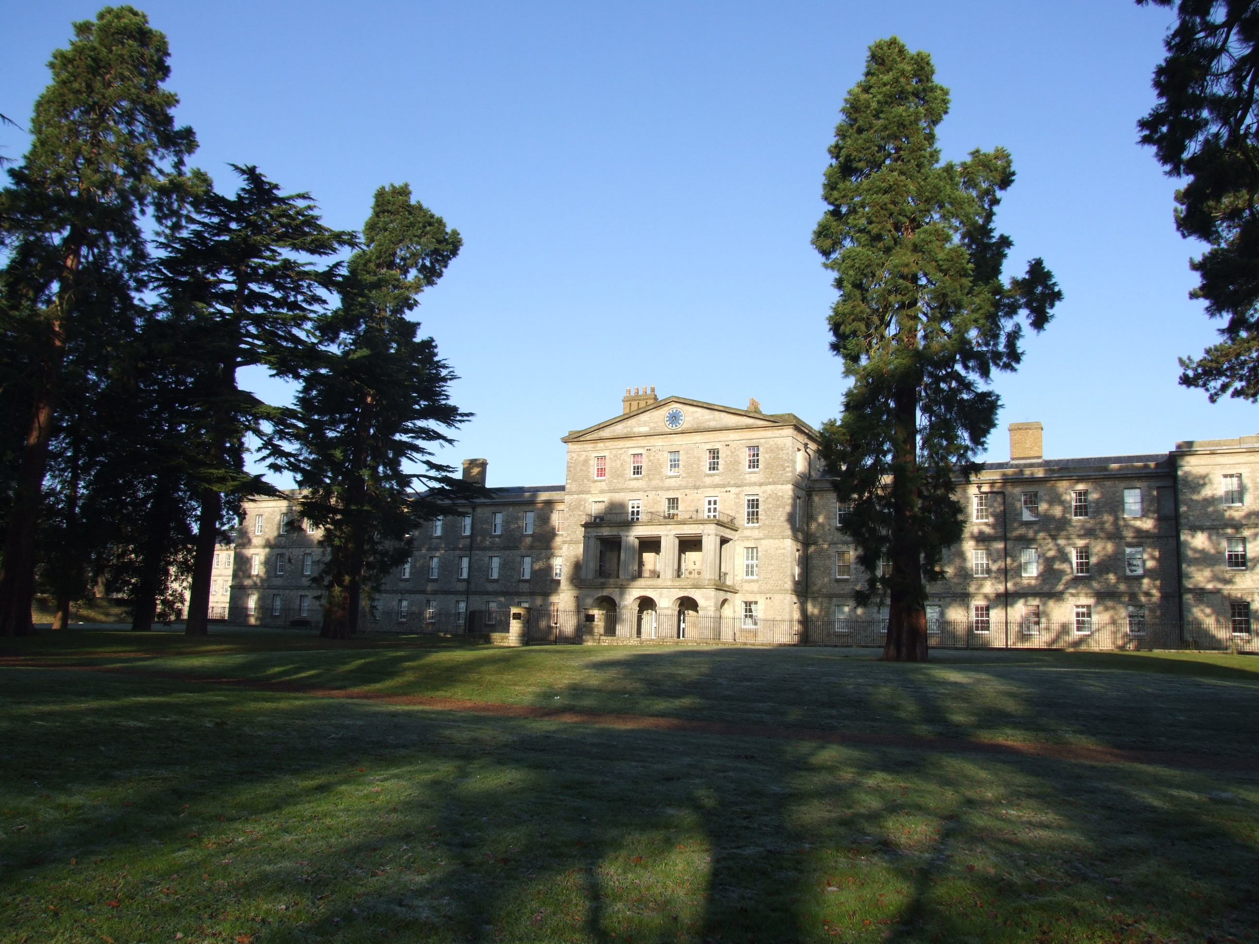
Oakwood Hospital

Oakwood Hospital in Barming Heath near Maidstone, England was a psychiatric hospital founded in 1833 as the Kent County Lunatic Asylum. Following transfer...

East Barming

East Barming is a village in the civil parish of Barming in the Maidstone District of Kent, England. The village is located on the A26 road out of Maidstone...

East Farleigh railway station

East Farleigh railway station is on the Medway Valley Line in Kent, England, located to the south-west of Maidstone and close to the village of East Farleigh...

East Farleigh Bridge

East Farleigh Bridge is a road bridge across the River Medway in East Farleigh, Kent, England. The bridge is medieval and was probably constructed in the...

Maidstone Hospital

Maidstone Hospital is a hospital in Barming, Maidstone, England. It is managed by the Maidstone and Tunbridge Wells NHS Trust. == History == The hospital...

Nearby Amenities

Located within 500m of 51.262742,0.468481
Pub
The Bull Inn
Wikidata: Q26628083
Lat/Long: 51.2632634/0.4701671
Bus Stop
Redstart Inn
Naptan AtcoCode: 2400100514
Naptan Bearing: N
Naptan CommonName: Redstart Inn
Naptan Indicator: opp
Naptan Landmark: Redstart Inn
Naptan NaptanCode: kntgtgtm
Naptan PlusbusZoneRef: MSTONEB
Naptan Street: North Street
Naptan Verified: no
Source: naptan_import
Lat/Long: 51.2658906/0.4711884
Bus Stop
Redstart Inn
Naptan AtcoCode: 2400100517
Naptan Bearing: S
Naptan CommonName: Redstart Inn
Naptan Indicator: adj
Naptan Landmark: Redstart Inn
Naptan NaptanCode: kntgtgmp
Naptan PlusbusZoneRef: MSTONEB
Naptan Street: North Street
Naptan Verified: no
Source: naptan_import
Lat/Long: 51.2657764/0.4714834
Bus Stop
Glebe Lane
Naptan AtcoCode: 2400A000430A
Naptan Bearing: W
Naptan CommonName: Glebe Lane
Naptan Indicator: adj
Naptan Landmark: Glebe Lane
Naptan NaptanCode: kntadmdm
Naptan PlusbusZoneRef: MSTONEB
Naptan Street: Tonbridge Road
Naptan Verified: no
Public Transport: platform
Ref: kntadmdm
Source: naptan_import
Source Date: 2018-02-22T10:07:00
Lat/Long: 51.2631611/0.4753944
Bus Stop
The Bull
Naptan AtcoCode: 2400A000440A
Naptan Bearing: W
Naptan CommonName: The Bull
Naptan Indicator: adj
Naptan Landmark: The Bull
Naptan NaptanCode: kntadmdp
Naptan Street: Tonbridge Road
Naptan Verified: no
Public Transport: platform
Ref: kntadmdp
Shelter: yes
Source: naptan_import
Source Date: 2018-02-22T10:33:00
Lat/Long: 51.2633832/0.4699877
Bus Stop
The Bull
Naptan AtcoCode: 2400A000450A
Naptan Bearing: S
Naptan CommonName: The Bull
Naptan Indicator: nr
Naptan Landmark: North Street
Naptan NaptanCode: kntadmdt
Naptan PlusbusZoneRef: MSTONEB
Naptan Street: Tonbridge Road
Naptan Verified: no
Public Transport: platform
Ref: kntadmdt
Source: naptan_import
Source Date: 2018-02-22T10:34:00
Lat/Long: 51.2635035/0.4706822
Crossing
Crossing: zebra
Lat/Long: 51.2633771/0.4712575
Historic: memorial
Memorial: war_memorial
Lat/Long: 51.2635265/0.470442
Post Box
Post Box Type: pillar
Ref: ME16 156
Royal Cypher: GR
Royal Cypher Wikidata: Q33102273
Lat/Long: 51.2637451/0.4706929
Post Office
Barming Post Office
Addr Country: GB
Addr Postcode: ME16 9EU
Brand: Post Office
Brand Wikidata: Q1783168
Contact Website: https://www.postoffice.co.uk/branch-finder/1619411/barming
Operator: Key Store
Ref Pol Id: 3813
Lat/Long: 51.2637209/0.4708109
Old Phone: +441622728013
Removed Amenity: telephone
Lat/Long: 51.263711/0.470649
Barrier: cycle_barrier
Material: metal
Lat/Long: 51.2584437/0.4695103
Information: board
Tourism: information
Lat/Long: 51.2584302/0.4695776
Barrier: kissing_gate
Foot: yes
Lat/Long: 51.2584549/0.4694288
Power: tower
Lat/Long: 51.2601152/0.4630632
Bus Stop
The Bull
Naptan AtcoCode: 2400102377
Naptan Bearing: N
Naptan CommonName: The Bull
Naptan Indicator: opp
Naptan Landmark: The Bull
Naptan NaptanCode: kntgtmjm
Naptan Street: North Street
Public Transport: platform
Ref: kntgtmjm
Source: NAPTAN
Source Date: 2018-02-22T10:34:00
Lat/Long: 51.2636371/0.4703167
The data included in this document is from www.openstreetmap.org. The data is made available under ODbL.

Have you been to Barming, East?

Leave your review of Barming, East below (or comments, questions and feedback).