East Bank

Settlement in Monmouthshire

Wales

East Bank

Tilers Arms, Bournville Roadside public house, now derelict and apparently in danger of collapse.
Tilers Arms, Bournville Credit: Alan Hughes

East Bank is a small village located in Monmouthshire, Wales. Situated on the eastern bank of the River Wye, the village offers stunning views of the surrounding countryside and the nearby Wye Valley Area of Outstanding Natural Beauty.

The village is home to a close-knit community of residents who take pride in their picturesque surroundings and rich local history. East Bank is known for its quaint cottages, traditional pubs, and charming country lanes, making it a popular destination for visitors looking to experience the tranquility of rural Wales.

In addition to its natural beauty, East Bank also offers a range of outdoor activities for nature enthusiasts, including hiking, cycling, and fishing along the river. The village is also within easy reach of the historic town of Monmouth, where visitors can explore attractions such as Monmouth Castle and the Nelson Garden.

Overall, East Bank is a peaceful and idyllic village that serves as a perfect retreat for those looking to escape the hustle and bustle of city life and immerse themselves in the beauty of the Welsh countryside.

If you have any feedback on the listing, please let us know in the comments section below.

East Bank Images

Images are sourced within 2km of 51.746651/-3.132695 or Grid Reference SO2105. Thanks to Geograph Open Source API. All images are credited.

Tilers Arms, Bournville Roadside public house, now derelict and apparently in danger of collapse.
Tilers Arms, Bournville
Roadside public house, now derelict and apparently in danger of collapse.
Tilers Arms Public house, now derelict.  Note the old name, painted on the wall behind the render.
Tilers Arms
Public house, now derelict. Note the old name, painted on the wall behind the render.
Rose Hayworth Road, Blaenau
Road junction Junction of Smith Road and Rose Hayworth Road.
Road junction
Junction of Smith Road and Rose Hayworth Road.
Methodist Church, Blaenau Gwent
View over Cwmtillery
Old stone bridge Bridge at the end of Cwmtillery Reservoir.
Old stone bridge
Bridge at the end of Cwmtillery Reservoir.
Water treatment works, Cwmtillery Reservoir
Cwmtillery Reservoir
Ducks on Cwmtillery lake
Gateway to St Paul’s Church
Path to old mine workings Above Cwmtillery.
Path to old mine workings
Above Cwmtillery.
57 pigeons A flock of pigeons circling over Abertillery.
57 pigeons
A flock of pigeons circling over Abertillery.
A valleys town View over Abertillery from the slopes of Penrhiwgarreg.
A valleys town
View over Abertillery from the slopes of Penrhiwgarreg.
Darran Road A typical street in the Welsh valleys.
Darran Road
A typical street in the Welsh valleys.
Old Milestone, Abertillery Museum Mile Post / Mile Marker originally from the bridge over the Ebbw on the A467 Aberbeeg Road at <a href="https://www.geograph.org.uk/gridref/SO+21630+03798">SO 21630 03798</a>.

Inscription: Abertillery / District / Local / Board // Newport / 16 Miles // Brynmawr / 5⅓  Miles

Milestone Society National ID: MON_NPBM16
Old Milestone, Abertillery Museum
Mile Post / Mile Marker originally from the bridge over the Ebbw on the A467 Aberbeeg Road at SO 21630 03798. Inscription: Abertillery / District / Local / Board // Newport / 16 Miles // Brynmawr / 5⅓ Miles Milestone Society National ID: MON_NPBM16
Old Milestone, Abertillery Museum Mile Post / Mile Marker originally from the A467 between Blaina and Blaenau Gwent at <a href="https://www.geograph.org.uk/gridref/SO+20196+06553">SO 20196 06553</a>.

Inscription: Blaina / District / Local / Board // Brynmawr / 3⅓  Miles
 // Newport / 18 Miles
Milestone Society National ID: MON_NPBM18
Old Milestone, Abertillery Museum
Mile Post / Mile Marker originally from the A467 between Blaina and Blaenau Gwent at SO 20196 06553. Inscription: Blaina / District / Local / Board // Brynmawr / 3⅓ Miles // Newport / 18 Miles Milestone Society National ID: MON_NPBM18
Old Milestone, Abertillery Museum Mile Post / Mile Marker originally from what is now Chapel Road in Nantyglo at <a href="https://www.geograph.org.uk/gridref/SO+19073+11130">SO 19073 11130</a>.

Inscription: Blaina / District / Local / Board // Newport / 21 Miles // Brynmawr / ⅓  Miles

Milestone Society National ID: MON_NPBM21
Old Milestone, Abertillery Museum
Mile Post / Mile Marker originally from what is now Chapel Road in Nantyglo at SO 19073 11130. Inscription: Blaina / District / Local / Board // Newport / 21 Miles // Brynmawr / ⅓ Miles Milestone Society National ID: MON_NPBM21
Show me another place!

East Bank is located at Grid Ref: SO2105 (Lat: 51.746651, Lng: -3.132695)

Unitary Authority: Blaenau Gwent

Police Authority: Gwent

What 3 Words

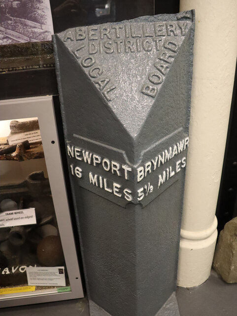
///inefficient.kindest.clearing. Near Abertillery, Blaenau Gwent

Related Wikis

Abertillery Excelsiors A.F.C.

Abertillery Excelsiors A.F.C. are a Welsh football club from the town of Abertillery, Blaenau Gwent in South Wales. Formed in 2000 as Tillery FC, they...

Cwmtillery

Cwmtillery (from Welsh Cwmtyleri) (population 2011. 4800) is a ward of Abertillery. Located within the historic boundaries of Monmouthshire, it is part...

Abertillery Learning Community

Abertillery Learning Community is an all-through school in Abertillery, Wales. The school was formed by merging several schools in 2016. Abertillery Comprehensive...

Bournville (Mon) Halt railway station

Bournville (Mon) Halt railway station was a station which served Ty'r-Cecil near Blaina Abertillery in the Welsh county of Monmouthshire. == History... ==

Nearby Amenities

Located within 500m of 51.746651,-3.132695
Place Of Worship
St Paul's
Religion: christian
Source: OS_OpenData_StreetView
Lat/Long: 51.748979/-3.1324995
Cwmtillery
Name Cy: Cwmtyleri
Note: The site may not load if you are using Chrome / Brave. If you get a error message about privacy, type "thisisunsafe" without clicking the URL box.
Place: village
Population: 4800
Source Population: http://www.neighbourhood.statistics.gov.uk/dissemination/LeadKeyFigures.do?a=7&b=13697032&c=Cwmtillery&d=14&e=62&g=6496126&i=1001x1003x1032x1004&m=0&r=1&s=1446822068094&enc=1
Wikidata: Q3405637
Wikipedia: en:Cwmtillery
Lat/Long: 51.7440586/-3.1360199
Telephone
Booth: K6
Covered: booth
Man Made: telephone_box
Old Phone: +44 1495 212108
Lat/Long: 51.7459204/-3.132802
Post Box
Post Box Type: lamp
Lat/Long: 51.7458756/-3.132776
Tourism: artwork
Lat/Long: 51.7467051/-3.1348002
Barrier: cattle_grid
Lat/Long: 51.7488992/-3.1335906
Direction: 255
Generator Method: photovoltaic
Generator Output Electricity: yes
Generator Solar Modules: 6
Generator Source: solar
Generator Type: solar_photovoltaic_panel
Location: roof
Power: generator
Lat/Long: 51.746804/-3.1334557
Direction: ESE
Generator Method: photovoltaic
Generator Output Electricity: yes
Generator Solar Modules: 7
Generator Source: solar
Generator Type: solar_photovoltaic_panel
Location: roof
Power: generator
Lat/Long: 51.7426039/-3.1319304
Direction: 105
Generator Method: photovoltaic
Generator Output Electricity: yes
Generator Solar Modules: 7
Generator Source: solar
Generator Type: solar_photovoltaic_panel
Location: roof
Power: generator
Lat/Long: 51.7432152/-3.1318983
Direction: 75
Generator Method: photovoltaic
Generator Output Electricity: yes
Generator Solar Modules: 7
Generator Source: solar
Generator Type: solar_photovoltaic_panel
Location: roof
Power: generator
Lat/Long: 51.7459858/-3.1343322
Direction: 75
Generator Method: photovoltaic
Generator Output Electricity: yes
Generator Solar Modules: 7
Generator Source: solar
Generator Type: solar_photovoltaic_panel
Location: roof
Power: generator
Lat/Long: 51.7464032/-3.1345148
Direction: 75
Generator Method: photovoltaic
Generator Output Electricity: yes
Generator Solar Modules: 7
Generator Source: solar
Generator Type: solar_photovoltaic_panel
Location: roof
Power: generator
Lat/Long: 51.7465473/-3.134577
Direction: 165
Generator Method: photovoltaic
Generator Output Electricity: yes
Generator Solar Modules: 6
Generator Source: solar
Generator Type: solar_photovoltaic_panel
Location: roof
Power: generator
Lat/Long: 51.7468268/-3.1334935
Direction: 260
Generator Method: photovoltaic
Generator Output Electricity: yes
Generator Solar Modules: 10
Generator Source: solar
Generator Type: solar_photovoltaic_panel
Location: roof
Power: generator
Lat/Long: 51.7476604/-3.1311438
Direction: 255
Generator Method: photovoltaic
Generator Output Electricity: yes
Generator Solar Modules: 7
Generator Source: solar
Generator Type: solar_photovoltaic_panel
Location: roof
Power: generator
Lat/Long: 51.7480443/-3.1313204
Direction: 275
Generator Method: photovoltaic
Generator Output Electricity: yes
Generator Solar Modules: 6
Generator Source: solar
Generator Type: solar_photovoltaic_panel
Location: roof
Power: generator
Lat/Long: 51.7441274/-3.1363276
Direction: 260
Generator Method: photovoltaic
Generator Output Electricity: yes
Generator Solar Modules: 7
Generator Source: solar
Generator Type: solar_photovoltaic_panel
Location: roof
Power: generator
Lat/Long: 51.7431108/-3.1361379
Shelter
Shelter Type: public_transport
Lat/Long: 51.7458054/-3.1327426
The data included in this document is from www.openstreetmap.org. The data is made available under ODbL.

Have you been to East Bank?

Leave your review of East Bank below (or comments, questions and feedback).