West Bank

Settlement in Monmouthshire

Wales

West Bank

Unstable flanks of Cefn yr Arail This is one of a series of chasms which run diagonally down the steep eastern side of this hill.  Up to 20m deep it runs for several hundred metres both across the flat top of the hill and these slopes which were over-steepened by glaciers 20,000 years ago.  More recent undermining by man in the search for coal during the 19th and 20th centuries has reactivated many ancient landslides.
Unstable flanks of Cefn yr Arail Credit: Alan Bowring

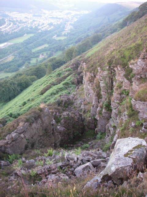
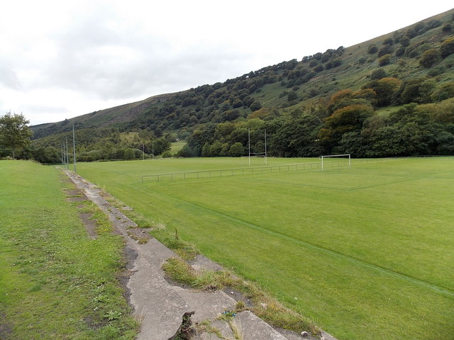
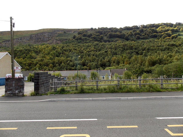
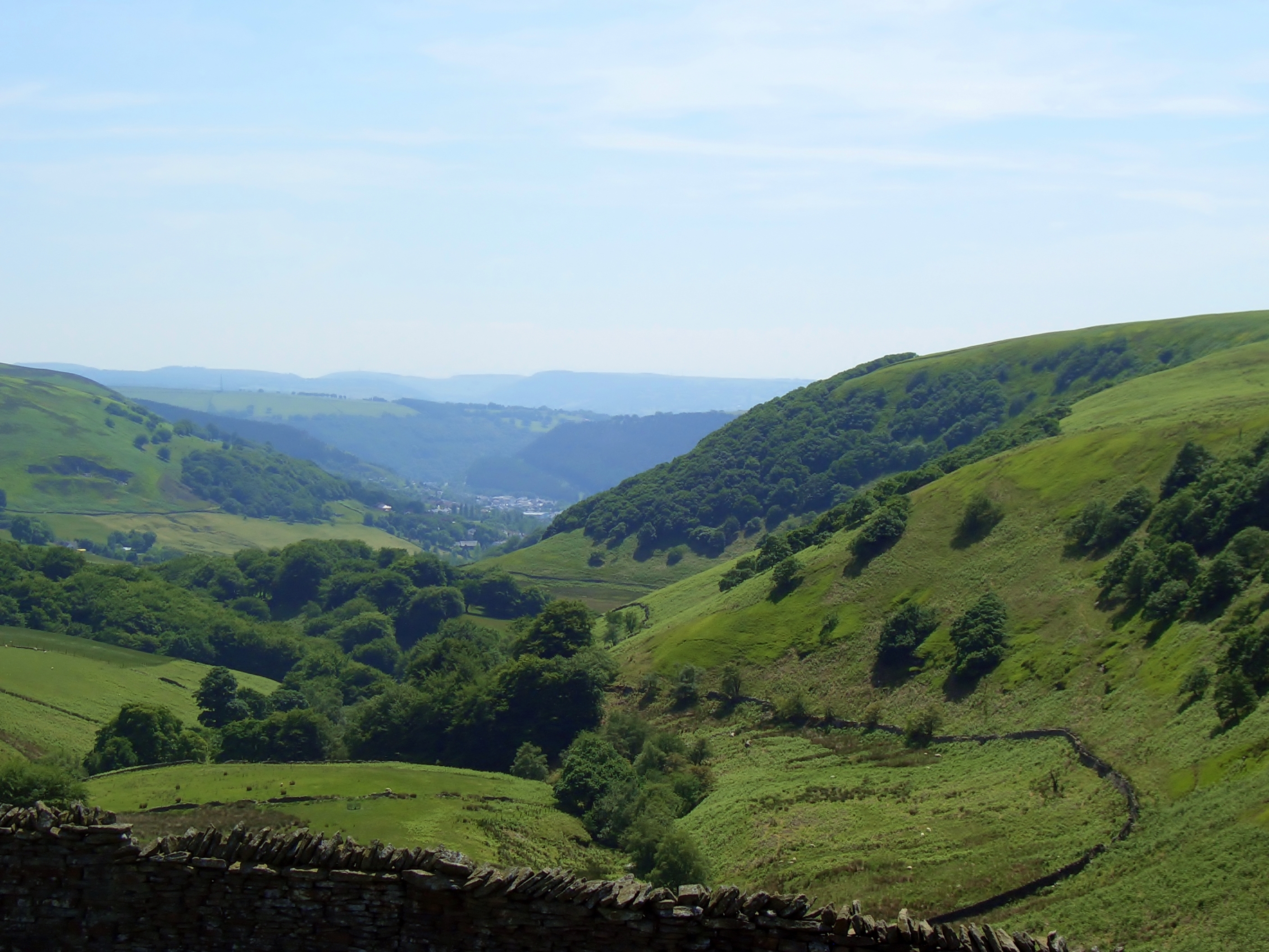
West Bank is a small village located in Monmouthshire, a county in southeast Wales, United Kingdom. Situated on the eastern bank of the River Wye, West Bank is known for its picturesque setting and serene ambiance. The village is surrounded by lush green fields, rolling hills, and the majestic Wye Valley, making it a popular destination for nature enthusiasts and outdoor enthusiasts.

Despite its small size, West Bank offers a range of amenities and services to its residents and visitors. The village has a primary school, a post office, and a local convenience store, ensuring that basic necessities are readily available. Additionally, there are several pubs and restaurants where locals and tourists can enjoy a meal or a drink.

The area surrounding West Bank is steeped in history and offers numerous attractions for history buffs. The nearby Tintern Abbey, a ruined monastery dating back to the 12th century, is a significant tourist attraction and a testament to the region's rich heritage. Visitors can explore the abbey's intricate architecture and learn about its historical significance.

Outdoor activities are abundant in West Bank, with the River Wye providing opportunities for fishing, boating, and kayaking. The village is also a gateway to the beautiful Wye Valley Area of Outstanding Natural Beauty, offering breathtaking views, hiking trails, and wildlife spotting opportunities.

Overall, West Bank, Monmouthshire, offers a peaceful retreat in a stunning natural setting, with a blend of history and outdoor activities, making it an appealing destination for both residents and visitors alike.

If you have any feedback on the listing, please let us know in the comments section below.

West Bank Images

Images are sourced within 2km of 51.746596/-3.138343 or Grid Reference SO2105. Thanks to Geograph Open Source API. All images are credited.

Unstable flanks of Cefn yr Arail This is one of a series of chasms which run diagonally down the steep eastern side of this hill.  Up to 20m deep it runs for several hundred metres both across the flat top of the hill and these slopes which were over-steepened by glaciers 20,000 years ago.  More recent undermining by man in the search for coal during the 19th and 20th centuries has reactivated many ancient landslides.
Unstable flanks of Cefn yr Arail
This is one of a series of chasms which run diagonally down the steep eastern side of this hill. Up to 20m deep it runs for several hundred metres both across the flat top of the hill and these slopes which were over-steepened by glaciers 20,000 years ago. More recent undermining by man in the search for coal during the 19th and 20th centuries has reactivated many ancient landslides.
Sports pitches in Duffryn Park Blaina In many locations in the South Wales valleys, the scarcity of flat sites big enough for a sports field means that river valleys are often used for this purpose, as here, where the pitches are on the east bank of the Ebbw Fach river. The pitch nearer the camera is for football. The other one has both rugby goalposts and football goalposts.
Sports pitches in Duffryn Park Blaina
In many locations in the South Wales valleys, the scarcity of flat sites big enough for a sports field means that river valleys are often used for this purpose, as here, where the pitches are on the east bank of the Ebbw Fach river. The pitch nearer the camera is for football. The other one has both rugby goalposts and football goalposts.
Wooded hillside viewed from Bournville Viewed from Bournville in Blaenau Gwent looking towards Darren Ddu.
Wooded hillside viewed from Bournville
Viewed from Bournville in Blaenau Gwent looking towards Darren Ddu.
Tilers Arms, Bournville Roadside public house, now derelict and apparently in danger of collapse.
Tilers Arms, Bournville
Roadside public house, now derelict and apparently in danger of collapse.
Tilers Arms Public house, now derelict.  Note the old name, painted on the wall behind the render.
Tilers Arms
Public house, now derelict. Note the old name, painted on the wall behind the render.
Rose Hayworth Road, Blaenau
Road junction Junction of Smith Road and Rose Hayworth Road.
Road junction
Junction of Smith Road and Rose Hayworth Road.
Methodist Church, Blaenau Gwent
View over Cwmtillery
Old stone bridge Bridge at the end of Cwmtillery Reservoir.
Old stone bridge
Bridge at the end of Cwmtillery Reservoir.
Water treatment works, Cwmtillery Reservoir
Cwmtillery Reservoir
Ducks on Cwmtillery lake
Gateway to St Paul’s Church
Path to old mine workings Above Cwmtillery.
Path to old mine workings
Above Cwmtillery.
57 pigeons A flock of pigeons circling over Abertillery.
57 pigeons
A flock of pigeons circling over Abertillery.
A valleys town View over Abertillery from the slopes of Penrhiwgarreg.
A valleys town
View over Abertillery from the slopes of Penrhiwgarreg.
Darran Road A typical street in the Welsh valleys.
Darran Road
A typical street in the Welsh valleys.
Show me another place!

West Bank is located at Grid Ref: SO2105 (Lat: 51.746596, Lng: -3.138343)

Unitary Authority: Blaenau Gwent

Police Authority: Gwent

What 3 Words

///saved.deleting.slipped. Near Abertillery, Blaenau Gwent

Related Wikis

Abertillery Excelsiors A.F.C.

Abertillery Excelsiors A.F.C. are a Welsh football club from the town of Abertillery, Blaenau Gwent in South Wales. Formed in 2000 as Tillery FC, they...

Cwmtillery

Cwmtillery (from Welsh Cwmtyleri) (population 2011. 4800) is a ward of Abertillery. Located within the historic boundaries of Monmouthshire, it is part...

Abertillery Learning Community

Abertillery Learning Community is an all-through school in Abertillery, Wales. The school was formed by merging several schools in 2016. Abertillery Comprehensive...

Bournville (Mon) Halt railway station

Bournville (Mon) Halt railway station was a station which served Ty'r-Cecil near Blaina Abertillery in the Welsh county of Monmouthshire. == History... ==

Abertillery railway station

Abertillery railway station was a station which served Abertillery, in the Welsh county of Monmouthshire. == History == Among the lines built by the Monmouthshire...

Abertillery

Abertillery (; Welsh: Abertyleri) is a town and a community of the Ebbw Fach valley in the historic county of Monmouthshire, Wales. Following local government...

Blaina railway station

Blaina railway station was a station which served the small town of Blaina in the Welsh county of Monmouthshire. == History == Among the lines built by...

Coity Mountain

Coity Mountain (also spelled Coety Mountain, Welsh: Mynydd Coety) is a flat-topped mountain in the South Wales Valleys, between Blaenavon and Abertillery...

Nearby Amenities

Located within 500m of 51.746596,-3.138343
Place Of Worship
St Paul's
Religion: christian
Source: OS_OpenData_StreetView
Lat/Long: 51.748979/-3.1324995
Cwmtillery
Name Cy: Cwmtyleri
Note: The site may not load if you are using Chrome / Brave. If you get a error message about privacy, type "thisisunsafe" without clicking the URL box.
Place: village
Population: 4800
Source Population: http://www.neighbourhood.statistics.gov.uk/dissemination/LeadKeyFigures.do?a=7&b=13697032&c=Cwmtillery&d=14&e=62&g=6496126&i=1001x1003x1032x1004&m=0&r=1&s=1446822068094&enc=1
Wikidata: Q3405637
Wikipedia: en:Cwmtillery
Lat/Long: 51.7440586/-3.1360199
Telephone
Booth: K6
Covered: booth
Man Made: telephone_box
Old Phone: +44 1495 212108
Lat/Long: 51.7459204/-3.132802
Post Box
Post Box Type: lamp
Lat/Long: 51.7458756/-3.132776
Tourism: artwork
Lat/Long: 51.7467051/-3.1348002
Barrier: cattle_grid
Lat/Long: 51.7488992/-3.1335906
Direction: 255
Generator Method: photovoltaic
Generator Output Electricity: yes
Generator Solar Modules: 6
Generator Source: solar
Generator Type: solar_photovoltaic_panel
Location: roof
Power: generator
Lat/Long: 51.746804/-3.1334557
Direction: 75
Generator Method: photovoltaic
Generator Output Electricity: yes
Generator Solar Modules: 7
Generator Source: solar
Generator Type: solar_photovoltaic_panel
Location: roof
Power: generator
Lat/Long: 51.7459858/-3.1343322
Direction: 75
Generator Method: photovoltaic
Generator Output Electricity: yes
Generator Solar Modules: 7
Generator Source: solar
Generator Type: solar_photovoltaic_panel
Location: roof
Power: generator
Lat/Long: 51.7464032/-3.1345148
Direction: 75
Generator Method: photovoltaic
Generator Output Electricity: yes
Generator Solar Modules: 7
Generator Source: solar
Generator Type: solar_photovoltaic_panel
Location: roof
Power: generator
Lat/Long: 51.7465473/-3.134577
Direction: 165
Generator Method: photovoltaic
Generator Output Electricity: yes
Generator Solar Modules: 6
Generator Source: solar
Generator Type: solar_photovoltaic_panel
Location: roof
Power: generator
Lat/Long: 51.7468268/-3.1334935
Direction: 275
Generator Method: photovoltaic
Generator Output Electricity: yes
Generator Solar Modules: 6
Generator Source: solar
Generator Type: solar_photovoltaic_panel
Location: roof
Power: generator
Lat/Long: 51.7441274/-3.1363276
Direction: 260
Generator Method: photovoltaic
Generator Output Electricity: yes
Generator Solar Modules: 7
Generator Source: solar
Generator Type: solar_photovoltaic_panel
Location: roof
Power: generator
Lat/Long: 51.7431108/-3.1361379
Shelter
Shelter Type: public_transport
Lat/Long: 51.7458054/-3.1327426
The data included in this document is from www.openstreetmap.org. The data is made available under ODbL.

Have you been to West Bank?

Leave your review of West Bank below (or comments, questions and feedback).