East Aston

Settlement in Hampshire Basingstoke and Deane

England

East Aston

Cricket pavilion, Hurstbourne Priors, Hampshire
Cricket pavilion, Hurstbourne Priors, Hampshire Credit: Oswald Bertram

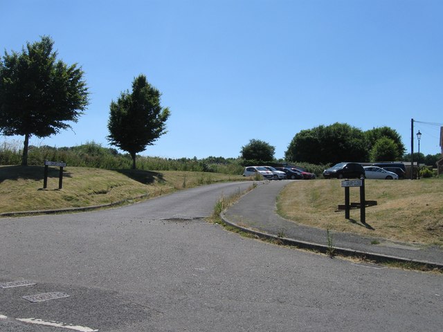
East Aston is a small village located in the county of Hampshire, England. Situated approximately 5 miles east of the market town of Winchester, it is nestled in the picturesque South Downs National Park. The village is surrounded by rolling hills and stunning countryside, offering residents and visitors breathtaking views.

With a population of around 300, East Aston is a close-knit community that exudes a sense of tranquility and charm. The village is known for its quaint cottages, many of which date back several centuries, adding to its historic appeal. The traditional village green is the heart of the community, providing a focal point for social gatherings and events.

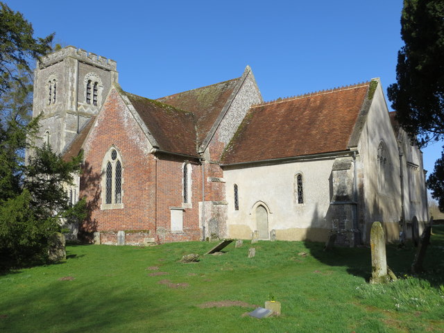
East Aston boasts a rich history, with evidence of human habitation in the area dating back to the Neolithic era. The village is home to a Grade II listed church, St. Peter's, which dates back to the 13th century and showcases stunning architectural features. The church, along with the nearby manor house, adds to the village's character and historical significance.

Despite its small size, East Aston offers a range of amenities for its residents. There is a local pub, The Aston Arms, which serves as a gathering place for villagers and visitors alike. Additionally, the village has a primary school, providing education for the local children.

East Aston's idyllic location provides ample opportunities for outdoor activities. The surrounding countryside offers numerous walking and cycling trails, allowing residents to explore the natural beauty of the area.

If you have any feedback on the listing, please let us know in the comments section below.
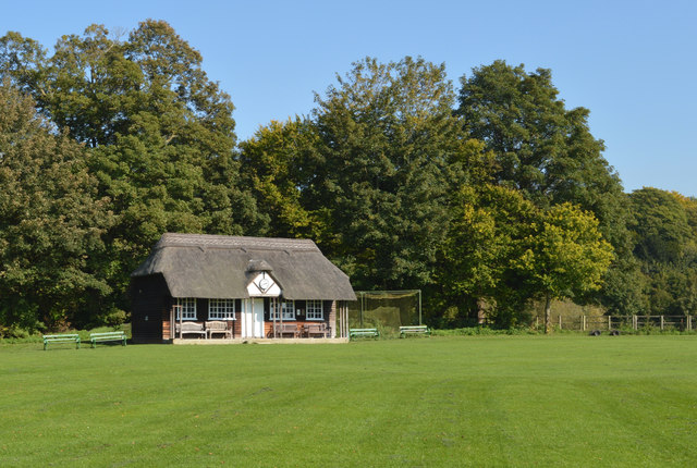
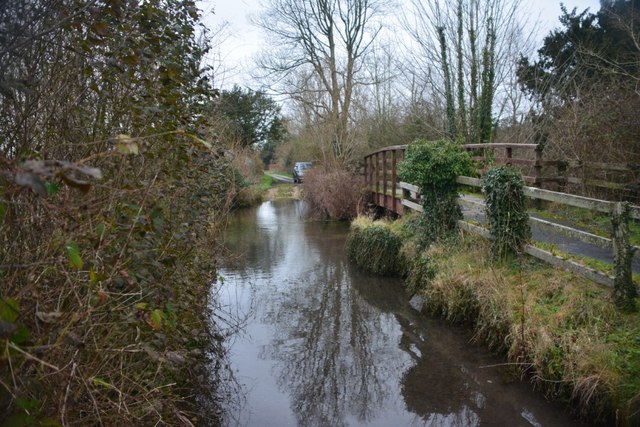
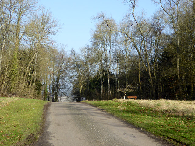
East Aston Images

Images are sourced within 2km of 51.202601/-1.3859115 or Grid Reference SU4345. Thanks to Geograph Open Source API. All images are credited.

Cricket pavilion, Hurstbourne Priors, Hampshire
Longparish Ford Signed as a 'Deep Ford' this ford in Longparish has a steep step on its southern entrance.
Longparish Ford
Signed as a 'Deep Ford' this ford in Longparish has a steep step on its southern entrance.
Deep ford No depth marker, but an inspection showed it was not very deep, with a coarse gravel bottom.  That bit would be no real problem, but at the far side there was a severe step up from the gravel to the tarmac, which ordinary cars would baulk at, fouling their skirts.
Deep ford
No depth marker, but an inspection showed it was not very deep, with a coarse gravel bottom. That bit would be no real problem, but at the far side there was a severe step up from the gravel to the tarmac, which ordinary cars would baulk at, fouling their skirts.
Track to Larkwhistle Farm A strange name - larks don't whistle.
Track to Larkwhistle Farm
A strange name - larks don't whistle.
Lane through Ridges Plantation This area has an 'estate air', with wide grassy verges.
Lane through Ridges Plantation
This area has an 'estate air', with wide grassy verges.
Gate into a field off the Middleway, Middleton
Snowdrops in the rain, off the Middleway
The Church of St Nicholas at Longparish Viewed from the south.
The Church of St Nicholas at Longparish
Viewed from the south.
Ordnance Survey Cut Mark This is one of two marks that can be found on the wall of St Nicholas' Church in Middleton.
For more detail see : <span class="nowrap"><a title="http://www.bench-marks.org.uk/bm29758" rel="nofollow ugc noopener" href="http://www.bench-marks.org.uk/bm29758">Link</a><img style="margin-left:2px;" alt="External link" title="External link - shift click to open in new window" src="https://s1.geograph.org.uk/img/external.png" width="10" height="10"/></span>
Ordnance Survey Cut Mark
This is one of two marks that can be found on the wall of St Nicholas' Church in Middleton. For more detail see : LinkExternal link
Ordnance Survey Cut Mark This is one of the two marks that can be found on the wall of St Nicholas' Church in Middleton.
For more detail see : <a title="https://www.geograph.org.uk/photo/5354561" href="https://www.geograph.org.uk/photo/5354561">Link</a>
Ordnance Survey Cut Mark
This is one of the two marks that can be found on the wall of St Nicholas' Church in Middleton. For more detail see : Link
St Andrew's Church at Hurstbourne Priors Viewed from the south-east.
St Andrew's Church at Hurstbourne Priors
Viewed from the south-east.
Entrance to Hurstbourne Priors
Road junction
Road junction
Drury Close
Drury Close
B3048 southbound
B3048 southbound
B3048 southbound
B3048 southbound
Country road
Country road
North Acre
North Acre
Show me another place!

East Aston is located at Grid Ref: SU4345 (Lat: 51.202601, Lng: -1.3859115)

Administrative County: Hampshire

District: Basingstoke and Deane

Police Authority: Hampshire

What 3 Words

///ignoring.costumes.prettiest. Near Andover, Hampshire

Related Wikis

Longparish

Longparish is a village and civil parish in Hampshire, England. It is composed of the five hamlets of Middleton, East Aston, West Aston ,Forton and Longparish...

East Aston Common

East Aston Common is an 18.2-hectare (45-acre) biological Site of Special Scientific Interest east of Andover in Hampshire.This site in the flood plain...

Hurstbourne Priors

Hurstbourne Priors is a small village and civil parish in the Basingstoke and Deane district of Hampshire, England. Its nearest town is Whitchurch, which...
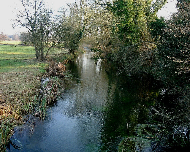
Bourne Rivulet

The Bourne Rivulet is a river in the English county of Hampshire. It is a tributary of the River Test. The Bourne Rivulet (known as 'The Bourne' locally...

Bransbury

Bransbury is a hamlet in Hampshire, England, part of the parish of Barton Stacey. The nearest village is Barton Stacey (where the 2011 census was included...

Longparish railway station

Longparish railway station served the village of Longparish, Hampshire, England from 1885 to 1956 on the Fullerton to Hurstbourne Line. == History == The...

Hurstbourne Park

Hurstbourne Park is a country house and 1200-acre estate near Whitchurch, Hampshire, England. The park and garden are Grade II listed with Historic England...

Dead Man's Plack

Dead Man's Plack is a Grade-II listed 19th-century monument to Æthelwald, Ealdorman of East Anglia, who, according to legend, was killed in 963 near the...

Nearby Amenities

Located within 500m of 51.202601,-1.3859115
Bus Stop
The Cricketers
Naptan AtcoCode: 1900HA100494
Naptan Bearing: SW
Naptan CommonName: The Cricketers
Naptan Crossing: North Acre
Naptan NaptanCode: hamawjwa
Naptan Street: B3048 at Longparish
Naptan Verified: no
Source: naptan_import
Lat/Long: 51.1999375/-1.380369
Bus Stop
The Cricketers
Naptan AtcoCode: 1900HA100495
Naptan Bearing: NE
Naptan CommonName: The Cricketers
Naptan Crossing: North Acre
Naptan NaptanCode: hamawjtw
Naptan Street: B3048 at Longparish
Naptan Verified: no
Source: naptan_import
Lat/Long: 51.2000007/-1.3804254
Acre Stores
Addr City: Andover
Addr Place: Longparish
Addr Postcode: SP11 6PG
Addr Street: North Acre
Brand: Londis
Brand Wikidata: Q21008564
Shop: convenience
Website: https://www.londis.co.uk/our-stores/acre-stores
Lat/Long: 51.1997871/-1.3809035
Pub
The Cricketers Inn
Website: http://www.cricketersinnlongparish.co.uk/
Wikidata: Q26623557
Lat/Long: 51.1994523/-1.3809948
Post Box
Operator: Royal Mail
Post Box Mounting: brick_pillar
Post Box Type: wall
Ref: SP11 132
Royal Cypher: GVIR
Royal Cypher Wikidata: Q33102169
Lat/Long: 51.1997797/-1.3808389
Post Office
Longparish Post Office
Addr Postcode: SP11 6QX
Brand: Post Office
Brand Wikidata: Q1783168
Opening Hours: Mo-Sa 09:00-13:00
Ref Pol Id: 12575
Website: https://www.postoffice.co.uk/branch-finder/3155420/longparish
Lat/Long: 51.1997774/-1.3809696
Paul's Dell
Place: locality
Lat/Long: 51.2050169/-1.3810946
Public Bookcase
Defibrillator
Access: yes
Booth: KX100
Covered: booth
Defibrillator Location: inside old phone box (now used as book exchange) North Acre, Longparish
Disused Amenity: telephone
Emergency: defibrillator
Man Made: telephone_box
Public Bookcase Type: phone_box
Lat/Long: 51.1998264/-1.3815151
The data included in this document is from www.openstreetmap.org. The data is made available under ODbL.

Have you been to East Aston?

Leave your review of East Aston below (or comments, questions and feedback).