Huntley Wood

Wood, Forest in Oxfordshire South Oxfordshire

England

Huntley Wood

A4074 heading north Approaching Chazey Heath.
A4074 heading north Credit: Robin Webster

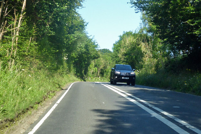
Huntley Wood, located in Oxfordshire, England, is a picturesque woodland area known for its natural beauty and tranquil atmosphere. Covering an expansive area, the wood is characterized by a diverse range of trees, including oak, beech, and birch, creating a lush and vibrant forest environment.

The wood is a popular destination for nature enthusiasts and outdoor lovers, offering a range of activities for visitors to enjoy. Walking and hiking trails wind their way through the woodland, providing opportunities for exploration and discovery. The serene surroundings make it an ideal spot for birdwatching, with a variety of species making their home within the trees.

In addition to its natural features, Huntley Wood also boasts a rich history. The wood has been inhabited since ancient times, with evidence of human activity dating back thousands of years. Archaeological finds, such as pottery fragments and flint tools, have been uncovered in the area, shedding light on the lives of those who lived there in the past.

The wood is well-maintained, with designated picnic areas and facilities available for visitors. It is a popular spot for families and groups to gather and enjoy a day out in nature. The peaceful ambiance and beautiful surroundings make Huntley Wood a cherished destination for locals and tourists alike.

If you have any feedback on the listing, please let us know in the comments section below.
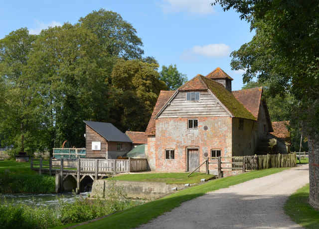
Huntley Wood Images

Images are sourced within 2km of 51.491491/-1.0291902 or Grid Reference SU6777. Thanks to Geograph Open Source API. All images are credited.

A4074 heading north Approaching Chazey Heath.
A4074 heading north
Approaching Chazey Heath.
A4074 Reading Road heading towards Wallingford Passing The Packhorse on the right ('Food and drink all day!').
A4074 Reading Road heading towards Wallingford
Passing The Packhorse on the right ('Food and drink all day!').
A4074 Reading Road heading towards Wallingford
A4074 Reading Road heading towards Wallingford Approaching Cane End.
A4074 Reading Road heading towards Wallingford
Approaching Cane End.
Oxford Road (A329), Purley on Thames
St Mary, Purley-on-Thames: rear view
St Mary, Purley-on-Thames: The Good Samaritan
St Mary, Purley-on-Thames: pulpit
St Mary, Purley-on-Thames: memorial (1)
St Mary, Purley-on-Thames: memorial (2)
St Mary, Purley-on-Thames: memorial (3)
St Mary, Purley-on-Thames: Norman window
Pumpkins by the Greenhouse Back after a couple of years off due to covid, the Tolhurst Organic Farm Squash & Pumpkin Festival was back this year. 
So many pumpkins.
This lot is by one of the old greenhouses which were once part of the Hardwick Hall kitchen garden.
The OS map still marks it with the crosshatch Greenhouse symbol.
Pumpkins by the Greenhouse
Back after a couple of years off due to covid, the Tolhurst Organic Farm Squash & Pumpkin Festival was back this year. So many pumpkins. This lot is by one of the old greenhouses which were once part of the Hardwick Hall kitchen garden. The OS map still marks it with the crosshatch Greenhouse symbol.
Squash & Pumpkin Festival, 2022 After a couple of years off due to covid, the Tolhurst Organic Farm Squash & Pumpkin Festival was back this year. 
We are in the old kitchen garden next to Hardwick Hall for the festival, but the farm covers several nearby fields.
Not just for Halloween, all these varieties are good to eat. Some better than others, but that's vegetables for you.
Squash & Pumpkin Festival, 2022
After a couple of years off due to covid, the Tolhurst Organic Farm Squash & Pumpkin Festival was back this year. We are in the old kitchen garden next to Hardwick Hall for the festival, but the farm covers several nearby fields. Not just for Halloween, all these varieties are good to eat. Some better than others, but that's vegetables for you.
Sheepway Lane at the junction of the A4074
Reading Road in Green Dean Wood
Working watermill, Mapledurham, Oxfordshire C15; extended C17, C18 and C19. Red brick with random grey headers; weatherboarding; plain tile roof. Complex plan. 2 storeys and attic; 3-window range. Central plank door with 2-light windows to left and right with segmental brick heads. Single window to first floor. Weatherboarding to half-hipped cross-gable to roof with 3-light window. Weatherboarded sack hoist; cupola with pyramidal tile roof to centre. Subsidiary wing to left of single storey and attic; with single window to ground floor. gabled dormer. Interior: Timber framing, part probably a survival from the C15 mill. Good collection of mill machinery.

(Source:Historic England)
Working watermill, Mapledurham, Oxfordshire
C15; extended C17, C18 and C19. Red brick with random grey headers; weatherboarding; plain tile roof. Complex plan. 2 storeys and attic; 3-window range. Central plank door with 2-light windows to left and right with segmental brick heads. Single window to first floor. Weatherboarding to half-hipped cross-gable to roof with 3-light window. Weatherboarded sack hoist; cupola with pyramidal tile roof to centre. Subsidiary wing to left of single storey and attic; with single window to ground floor. gabled dormer. Interior: Timber framing, part probably a survival from the C15 mill. Good collection of mill machinery. (Source:Historic England)
Show me another place!

Huntley Wood is located at Grid Ref: SU6777 (Lat: 51.491491, Lng: -1.0291902)

Administrative County: Oxfordshire

District: South Oxfordshire

Police Authority: Thames Valley

What 3 Words

///vase.broken.shorts. Near Pangbourne, Berkshire

Related Wikis

Mapledurham Watermill

Mapledurham Watermill is a historic watermill in the civil parish of Mapledurham in the English county of Oxfordshire. It is driven by the head of water...

Mapledurham House

Mapledurham House is an Elizabethan stately home located in the civil parish of Mapledurham in the English county of Oxfordshire. It is a Grade I listed...

Mapledurham

Mapledurham is a small village, civil parish and country estate beside the River Thames in southern Oxfordshire, England. The large parish borders Caversham...

Trench Green

Trench Green is a hamlet in Oxfordshire about 1 mile (1.6 km) northeast of the village of Mapledurham and about 4 miles (6.4 km) northwest of Reading in...

Mapledurham Lock

Mapledurham Lock is a lock and weir situated on the River Thames in England, about 4 miles upstream of Reading. The lock was first built in 1777 by the...

Hardwick House, Oxfordshire

Hardwick House is a Tudor house on the banks of the River Thames on a slight rise at Whitchurch-on-Thames in the English county of Oxfordshire. It is reputed...

Purley on Thames

Purley on Thames (known locally as Purley) is a village and civil parish in Berkshire, England. Purley is centred 3 miles (4.8 km) north-west of Reading...

Chazey Heath

Chazey Heath is a hamlet in Oxfordshire, England, about 3 miles (4.8 km) north of Reading, Berkshire. It is situated on the A4074 road, between Caversham...

Nearby Amenities

Located within 500m of 51.491491,-1.0291902
Power: tower
Lat/Long: 51.4904604/-1.0361205
Power: tower
Lat/Long: 51.4914194/-1.0345762
Barrier: kissing_gate
Bicycle: no
Foot: yes
Lat/Long: 51.490189/-1.028107
Barrier: kissing_gate
Bicycle: no
Foot: yes
Lat/Long: 51.4905773/-1.0244679
Power: pole
Lat/Long: 51.4943634/-1.0321087
Power: tower
Lat/Long: 51.494158/-1.0302231
Power: tower
Lat/Long: 51.4930057/-1.0321113
Power: pole
Lat/Long: 51.4953002/-1.0319853
Power: tower
Lat/Long: 51.4950447/-1.0287666
Power: tower
Lat/Long: 51.4951162/-1.0261841
The data included in this document is from www.openstreetmap.org. The data is made available under ODbL.

Have you been to Huntley Wood?

Leave your review of Huntley Wood below (or comments, questions and feedback).