Lion's Row

Wood, Forest in Hampshire Basingstoke and Deane

England

Lion's Row

Tunworth Road
Tunworth Road Credit: David Howard

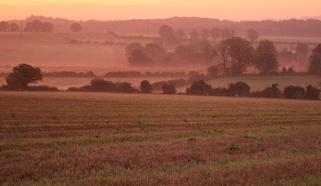
Located in the picturesque county of Hampshire, Lion's Row is a charming woodland area known for its dense forest and serene atmosphere. Situated in the heart of the South Downs National Park, this natural haven offers visitors a unique opportunity to immerse themselves in the beauty of nature.

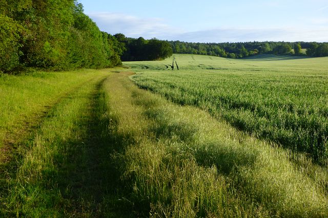
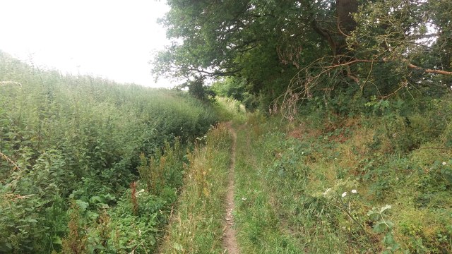
Covering an area of approximately 100 hectares, Lion's Row is characterized by its towering trees, including oak, beech, and pine, which create a lush canopy overhead. The forest floor is adorned with a rich tapestry of wildflowers, ferns, and moss, further enhancing the enchanting ambiance of the area.

The woodland is home to a diverse range of wildlife, making it a popular spot for nature enthusiasts and wildlife photographers. Visitors may catch a glimpse of red deer, foxes, badgers, and a plethora of bird species, including woodpeckers, owls, and warblers. The tranquil surroundings also provide a refuge for rare and endangered species, such as the hazel dormouse and silver-studded blue butterfly.

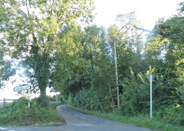
Lion's Row is a haven for outdoor activities, with numerous trails and paths crisscrossing the forest. Hikers and walkers can enjoy exploring the various routes, each offering breathtaking views of the surrounding countryside. The forest also provides an ideal setting for picnics, with designated areas equipped with picnic tables and benches.

Managed by the Hampshire Wildlife Trust, Lion's Row is dedicated to preserving its natural beauty and ensuring the protection of its wildlife. The trust organizes regular educational programs and guided walks to raise awareness about the importance of conservation.

In conclusion, Lion's Row in Hampshire is a captivating woodland area that offers a tranquil retreat for nature lovers. With its diverse wildlife, scenic trails, and commitment to conservation, it is a must-visit destination for anyone seeking solace in the embrace of nature.

If you have any feedback on the listing, please let us know in the comments section below.

Lion's Row Images

Images are sourced within 2km of 51.234231/-1.035773 or Grid Reference SU6748. Thanks to Geograph Open Source API. All images are credited.

Tunworth Road
Tunworth Road
Longroden Lane at the junction of Tunworth Road
Grassland by Tunworth Road
The entrance to The Dower House, Upton Grey
Longroden Lane, Winslade This is shown as a through road on the map, it really isn't.
Longroden Lane, Winslade
This is shown as a through road on the map, it really isn't.
The entrance to The Dower House, Upton Grey It was sunny when I was there last summer <a title="https://www.geograph.org.uk/photo/4631630" href="https://www.geograph.org.uk/photo/4631630">Link</a>
The entrance to The Dower House, Upton Grey
It was sunny when I was there last summer Link
Farmland, Upton Grey A crop of poppies to the north-west of the village.
Farmland, Upton Grey
A crop of poppies to the north-west of the village.
Farmland, Tunworth A crop of barley to the east of Down Farm.
Farmland, Tunworth
A crop of barley to the east of Down Farm.
Farmland, Winslade A crop of oats to the south of the Tunworth to Winslade byroad.
Farmland, Winslade
A crop of oats to the south of the Tunworth to Winslade byroad.
Farmland, Winslade A crop of wheat bisected by a footpath to the east of Hackwood Park.
Farmland, Winslade
A crop of wheat bisected by a footpath to the east of Hackwood Park.
Grassland, Winslade A footpath cut through an uncultivated field in the eastern part of Hackwood Park.
Grassland, Winslade
A footpath cut through an uncultivated field in the eastern part of Hackwood Park.
Byway heading to Tunworth Road From Five Lanes End the byway heading to Tunworth Road
Byway heading to Tunworth Road
From Five Lanes End the byway heading to Tunworth Road
Byway heading to Tunworth Road From Five Lanes End the byway heading to Tunworth Road
Byway heading to Tunworth Road
From Five Lanes End the byway heading to Tunworth Road
Byway nearing Tunworth road From Five Lanes End the byway nearing Tunworth Road
Byway nearing Tunworth road
From Five Lanes End the byway nearing Tunworth Road
Path heading to Winslade From Tunworth Lodge the path heading to Winslade
Path heading to Winslade
From Tunworth Lodge the path heading to Winslade
Path heading to Winslade From Tunworth Lodge the path heading to Winslade
Path heading to Winslade
From Tunworth Lodge the path heading to Winslade
Path heading to Winslade From Tunworth Lodge the path heading to Winslade
Path heading to Winslade
From Tunworth Lodge the path heading to Winslade
Small park on Longroden Lane, Winslade The arch is an entrance to a farm but the little park is on the public road
Small park on Longroden Lane, Winslade
The arch is an entrance to a farm but the little park is on the public road
Show me another place!

Lion's Row is located at Grid Ref: SU6748 (Lat: 51.234231, Lng: -1.035773)

Administrative County: Hampshire

District: Basingstoke and Deane

Police Authority: Hampshire

What 3 Words

///include.polka.bandage. Near Old Basing, Hampshire

Related Wikis

Winslade

Winslade is a hamlet and civil parish in the Basingstoke and Deane district of Hampshire, England. It lies 3 miles (4.8 km) south of Basingstoke, just...

Weston Corbett

Weston Corbett is a hamlet and civil parish in Hampshire and lies three miles south from Basingstoke. There is only one mention of Weston Corbett in the...

Tunworth

Tunworth is a hamlet and civil parish in Hampshire. == Geography == === Location === Tunworth is located in North East Hampshire. Tunworth is located approximately...

Weston Patrick

Weston Patrick is a small village and civil parish in Hampshire. It lies four miles (6 km) southeast from Basingstoke and covers an area of 1,183 acres...

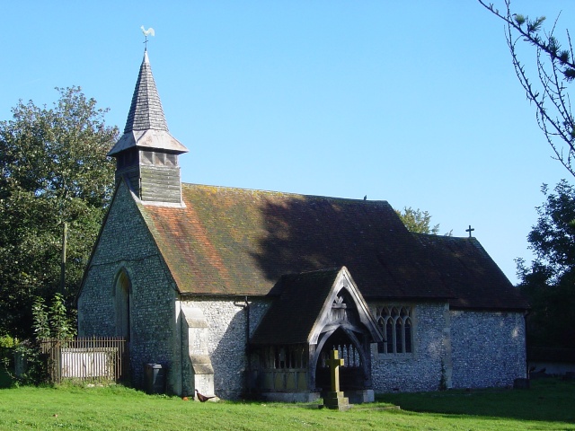
St Lawrence's Church, Weston Patrick

St Lawrence's Church is an Anglican church in the village of Weston Patrick, Hampshire, England. It is a Grade II* listed building and stands on the eastern...

Upton Grey

Upton Grey is a village and civil parish in Hampshire, England. == History == === Roman times === The village is on the line of an ancient Roman road, the...

Hackwood Park

Hackwood Park is a large country estate that primarily consists of an early 18th-century ornamental woodland and formal lawn garden and a large detached...

Herriard

Herriard is a village and civil parish in the Basingstoke and Deane district of Hampshire, England. Its nearest town is Basingstoke, which lies 4+1⁄2 miles...

Nearby Amenities

Located within 500m of 51.234231,-1.035773
Tunworth
Place: hamlet
Source: OS_OpenData_StreetView
Lat/Long: 51.2312963/-1.0327763
Post Box
Post Box Type: lamp
Ref: RG25 67
Royal Cypher: EIIR
Royal Cypher Wikidata: Q33102113
Lat/Long: 51.2318352/-1.0305173
Manor Farm
Addr City: Basingstoke
Addr Place: Tunworth
Addr Postcode: RG25 2NB
Addr Street: Hackwood Lane
Note Retag: CS #48756035
Source: OS_OpenData_StreetView
Source Addr: sign
Lat/Long: 51.2316024/-1.0365432
Tunworth Lodge
Addr City: Basingstoke
Addr Housename: Tunworth Lodge
Addr Place: Tunworth
Addr Postcode: RG25 2NB
Building: house
Source: OS_OpenData_StreetView
Lat/Long: 51.2322551/-1.0382952
Bench
Lat/Long: 51.2319216/-1.0310492
Trelawney
Addr City: Basingstoke
Addr Housename: Trelawney
Addr Place: Tunworth
Addr Postcode: RG25 2NB
Addr Street: Village Road
Building: house
Source: OS_OpenData_StreetView
Lat/Long: 51.2334666/-1.0291968
Manor Farm Cottage
Addr City: Basingstoke
Addr Housename: Manor Farm Cottage
Addr Place: Tunworth
Addr Postcode: RG25 2NB
Addr Street: Village Road
Building: house
Source: OS_OpenData_StreetView
Lat/Long: 51.2336207/-1.0292397
Garden Cottage
Addr City: Basingstoke
Addr Housename: Garden Cottage
Addr Place: Tunworth
Addr Postcode: RG25 2NB
Addr Street: Village Road
Building: house
Source: OS_OpenData_StreetView
Lat/Long: 51.230884/-1.0333752
The Old Rectory
Addr City: Basingstoke
Addr Housename: The Old Rectory
Addr Place: Tunworth
Addr Postcode: RG25 2NB
Addr Street: Village Road
Building: house
Source: OS_OpenData_StreetView
Wikidata: Q26461263
Lat/Long: 51.2306471/-1.0344612
Barrier: cattle_grid
Lat/Long: 51.2313848/-1.0349119
The data included in this document is from www.openstreetmap.org. The data is made available under ODbL.

Have you been to Lion's Row?

Leave your review of Lion's Row below (or comments, questions and feedback).