Nanny's Plantation

Wood, Forest in Nottinghamshire Rushcliffe

England

Nanny's Plantation

Oil Seed Rape at Cotgrave Recreating this 'First' for the square <a title="https://www.geograph.org.uk/photo/161541" href="https://www.geograph.org.uk/photo/161541">Link</a> complete with original title, although the time of year means that one has to imagine the crop itself!
Oil Seed Rape at Cotgrave Credit: Alan Murray-Rust

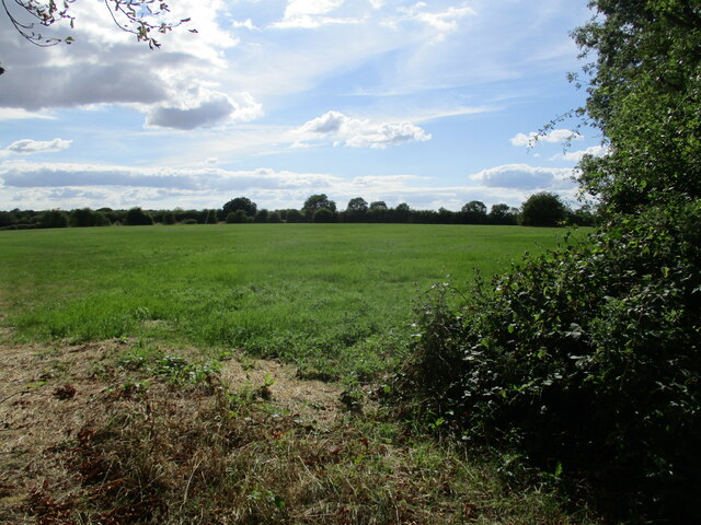
Nanny's Plantation is a picturesque woodland located in Nottinghamshire, England. Situated within the larger area known as Nottinghamshire Wood, the plantation is renowned for its natural beauty and rich biodiversity. With an approximate size of 200 acres, this enchanting forest offers a serene and tranquil escape from the bustling city life.

The plantation is home to a wide variety of tree species, including oak, beech, birch, and pine, which form a dense canopy overhead. The forest floor is adorned with a diverse range of flora, such as bluebells, foxgloves, and wild garlic, adding bursts of color to the landscape. The interplay of sunlight filtering through the canopy creates a mesmerizing play of light and shadows.

Nanny's Plantation is a haven for wildlife enthusiasts, as it provides a habitat for numerous species of birds, small mammals, and insects. Visitors can catch glimpses of woodpeckers, buzzards, and owls soaring through the treetops, while rabbits, squirrels, and badgers scuttle about on the forest floor. The plantation is also known for its resident population of deer, adding a touch of elegance to the woodland experience.

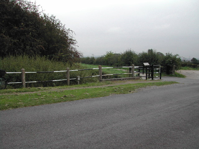
The woodland offers a range of recreational activities for visitors to enjoy. Walking trails meander through the plantation, allowing visitors to explore the forest at their own pace. Picnic areas provide a perfect spot to relax and immerse oneself in the natural surroundings. Nanny's Plantation is a cherished destination for nature lovers, providing a peaceful retreat to reconnect with the great outdoors.

If you have any feedback on the listing, please let us know in the comments section below.

Nanny's Plantation Images

Images are sourced within 2km of 52.896531/-1.0093497 or Grid Reference SK6633. Thanks to Geograph Open Source API. All images are credited.

Oil Seed Rape at Cotgrave Recreating this 'First' for the square <a title="https://www.geograph.org.uk/photo/161541" href="https://www.geograph.org.uk/photo/161541">Link</a> complete with original title, although the time of year means that one has to imagine the crop itself!
Oil Seed Rape at Cotgrave
Recreating this 'First' for the square Link complete with original title, although the time of year means that one has to imagine the crop itself!
Grass field by the Fosse Way near Cotgrave
Former road to Owthorpe This is now reduced to the status of a bridleway and provides access to Wolds Farm. The road was diverted when the A46 was dualled.
Former road to Owthorpe
This is now reduced to the status of a bridleway and provides access to Wolds Farm. The road was diverted when the A46 was dualled.
Road sign at the top of the bank Seen from the former road to Owthorpe.
Road sign at the top of the bank
Seen from the former road to Owthorpe.
Farm track near Cotgrave
Grass field at the top of Wolds Hill
Old course of Colston Gate
Overgrown settling pond This pond is designated 4A and receives run-off from the A46.
Overgrown settling pond
This pond is designated 4A and receives run-off from the A46.
Entrance to Fosse House
Chestnut Tree on Kinoulton Lane looks like it will be a good season for konkers
Chestnut Tree on Kinoulton Lane
looks like it will be a good season for konkers
Walnut Tree Farm, Owthorpe
Mackley's Bridge over the Grantham Canal Being a disused canal, the old original bridge is long gone.
Mackley's Bridge over the Grantham Canal
Being a disused canal, the old original bridge is long gone.
A farm in the hamlet of Owthorpe time seems to have stood still here
A farm in the hamlet of Owthorpe
time seems to have stood still here
Owthorpe Church taken from Park Lane
Owthorpe Church
taken from Park Lane
The Old Farm House on Swab's Lane, near Cropwell Bishop
The Old Farm House
on Swab's Lane, near Cropwell Bishop
A Steel Sentinal on the Owthorpe Road near Spencer's Bridge
A Steel Sentinal
on the Owthorpe Road near Spencer's Bridge
"Power to the People" The countryside seems blighted with powerlines
"Power to the People"
The countryside seems blighted with powerlines
A46 Junction to Cotgrave & Owthorpe
Show me another place!

Nanny's Plantation is located at Grid Ref: SK6633 (Lat: 52.896531, Lng: -1.0093497)

Administrative County: Nottinghamshire

District: Rushcliffe

Police Authority: Nottinghamshire

What 3 Words

///proven.tilting.consented. Near Cotgrave, Nottinghamshire

Related Wikis

Owthorpe

Owthorpe is a small English village and civil parish in the Wolds of the East Midland county of Nottinghamshire. The population of about 90 was included...

St Margaret's Church, Owthorpe

St Margaret's Church, Owthorpe is a Grade II* listed parish church in the Church of England in Owthorpe, Nottinghamshire, England. Owthorpe has an unusual...

Scunthorpe Mudstone

The Scunthorpe Mudstone is a geologic formation in England. It preserves plesiosaur fossils dating back to the Late Triassic (Rhaetian) to Early Jurassic...

Cropwell Bishop

Cropwell Bishop is a village and civil parish in the borough of Rushcliffe in Nottinghamshire. The population taken at the 2011 Census was 1,853. The village...

Nearby Amenities

Located within 500m of 52.896531,-1.0093497
Owthorpe
Is In County: Nottinghamshire
Place: village
Source: NPE
Wikidata: Q7115004
Wikipedia: en:Owthorpe
Lat/Long: 52.8947964/-1.0042479
Power: pole
Source: Bing
Lat/Long: 52.898234/-1.0094436
Power: pole
Source: Bing
Lat/Long: 52.8964121/-1.0130431
Power: pole
Source: Bing
Lat/Long: 52.899509/-1.0076626
Power: pole
Source: Bing
Lat/Long: 52.89604/-1.0146578
Power: pole
Source: Bing
Lat/Long: 52.8957617/-1.0163369
Power: pole
Source: Bing
Lat/Long: 52.9001982/-1.0067721
Power: pole
Source: Bing
Lat/Long: 52.8967823/-1.0114445
Power: pole
Source: Bing
Lat/Long: 52.8975252/-1.0104682
Barrier: stile
Lat/Long: 52.8961076/-1.0086473
Barrier: stile
Lat/Long: 52.8967041/-1.0113813
St Margaret's Church Owthorpe Notices
Advertising: board
Operator: St Margaret's Church
Lat/Long: 52.8946897/-1.0042003
Post Box
Collection Times: Mo-Fr 16:00; Sa 09:30
Drive Through: no
Post Box Type: wall
Ref: NG12 118
Royal Cypher: VR
Royal Cypher Wikidata: Q33102356
Source: survey
Lat/Long: 52.8943788/-1.0046595
Advertising: board
Source: survey
Lat/Long: 52.8943949/-1.0046528
Barrier: stile
Lat/Long: 52.8946667/-1.0038872
Barrier: stile
Lat/Long: 52.8948182/-1.0103618
Power: pole
Source: Bing
Lat/Long: 52.8959255/-1.0064051
Power: pole
Lat/Long: 52.8951815/-1.0053905
Power: pole
Lat/Long: 52.8952359/-1.0058136
Power: pole
Lat/Long: 52.8954186/-1.0064406
Material: wood
Operator: BT
Power: pole
Lat/Long: 52.8944748/-1.0049101
BT Post
Power: pole
Lat/Long: 52.8946607/-1.0051898
Power: pole
Lat/Long: 52.8945846/-1.0058238
Power: pole
Lat/Long: 52.8962901/-1.0056678
Power: pole
Lat/Long: 52.8959686/-1.004346
Power: pole
Lat/Long: 52.8957009/-1.0030243
Power: pole
Lat/Long: 52.8966037/-1.0069837
Barrier: block
Material: stone
Lat/Long: 52.8954364/-1.0161066
Barrier: block
Material: stone
Lat/Long: 52.8954209/-1.016064
Barrier: block
Material: stone
Lat/Long: 52.8954083/-1.0160319
Barrier: block
Material: stone
Lat/Long: 52.8953935/-1.0160004
Barrier: block
Material: stone
Lat/Long: 52.8953854/-1.015963
Power: pole
Lat/Long: 52.8973622/-1.007403
Power: pole
Lat/Long: 52.8982721/-1.0079864
Power: pole
Lat/Long: 52.8989306/-1.0084702
Power: pole
Lat/Long: 52.895591/-1.0072954
Material: wood
Operator: BT
Power: pole
Lat/Long: 52.8943794/-1.0045286
The Physio Gym
Addr City: Owthorpe
Addr Housename: Unit 2
Addr Postcode: NG12 3GE
Addr Street: Park Lane
Leisure: fitness_centre
Phone: +447814035746
Sport: pilates
Website: https://www.thephysiogym.com
Lat/Long: 52.893861/-1.0076564
Brand: National Grid
Brand Wikidata: Q1465461
Material: wood
Operator: National Grid Electricity Distribution Plc
Operator Old: Western Power Distribution
Operator Wikidata: Q7988183
Owner: National Grid Electricity Distribution (East Midlands) Plc
Owner Wikidata: Q114348127
Power: pole
Lat/Long: 52.8948887/-1.0056441
Man Made: utility_pole
Operator: BT
Lat/Long: 52.893959/-1.0046016
Material: wood
Operator: BT
Power: pole
Lat/Long: 52.8944748/-1.0049101
The data included in this document is from www.openstreetmap.org. The data is made available under ODbL.

Have you been to Nanny's Plantation?

Leave your review of Nanny's Plantation below (or comments, questions and feedback).