Maypole Ground Plantation
Wood, Forest in Oxfordshire South Oxfordshire
England
Maypole Ground Plantation

Maypole Ground Plantation is a picturesque woodland located in Oxfordshire, England. Situated in the heart of the county, it covers a vast area of land, providing a natural haven for visitors and wildlife alike.
The plantation boasts a diverse range of tree species, including oak, beech, and birch. These majestic trees create a dense canopy, allowing only dappled sunlight to filter through, creating a tranquil and peaceful atmosphere. The forest floor is covered with a thick layer of moss, ferns, and wildflowers, adding to the enchanting beauty of the woodland.
Walking trails wind their way through the plantation, allowing visitors to explore the area at their leisure. These paths are well-maintained and clearly marked, ensuring a safe and enjoyable experience for all. Along the way, visitors may encounter a variety of wildlife, such as deer, squirrels, and a multitude of bird species.
Maypole Ground Plantation is not only a haven for nature enthusiasts but also a popular destination for outdoor activities. It is a great spot for picnicking, birdwatching, and photography. The forest also offers excellent opportunities for hiking and cycling, with routes catering to different fitness levels.
Managed by local authorities, the plantation has conservation measures in place to protect its natural beauty and promote sustainable practices. Regular maintenance activities, such as tree planting and pruning, help to maintain the health and vitality of the woodland.
In conclusion, Maypole Ground Plantation in Oxfordshire is an idyllic woodland retreat where visitors can immerse themselves in the beauty of nature. With its diverse tree species, well-maintained trails, and abundant wildlife, it offers a serene escape from the bustle of everyday life.
If you have any feedback on the listing, please let us know in the comments section below.
Maypole Ground Plantation Images
Images are sourced within 2km of 51.497393/-1.0516963 or Grid Reference SU6578. Thanks to Geograph Open Source API. All images are credited.


Maypole Ground Plantation is located at Grid Ref: SU6578 (Lat: 51.497393, Lng: -1.0516963)
Administrative County: Oxfordshire
District: South Oxfordshire
Police Authority: Thames Valley
What 3 Words
///third.picked.toward. Near Pangbourne, Berkshire
Related Wikis

Hardwick House, Oxfordshire
Hardwick House is a Tudor house on the banks of the River Thames on a slight rise at Whitchurch-on-Thames in the English county of Oxfordshire. It is reputed...

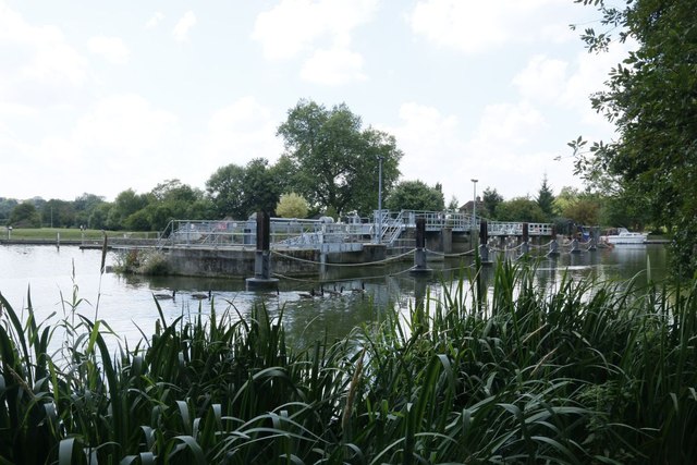
Mapledurham Lock
Mapledurham Lock is a lock and weir situated on the River Thames in England, about 4 miles upstream of Reading. The lock was first built in 1777 by the...

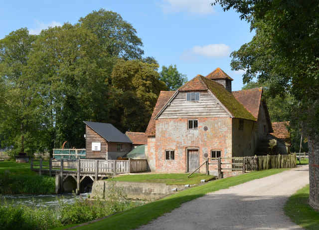
Mapledurham Watermill
Mapledurham Watermill is a historic watermill in the civil parish of Mapledurham in the English county of Oxfordshire. It is driven by the head of water...

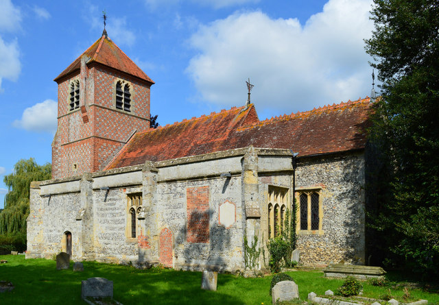
Mapledurham
Mapledurham is a small village, civil parish and country estate beside the River Thames in southern Oxfordshire, England. The large parish borders Caversham...

Mapledurham House
Mapledurham House is an Elizabethan stately home located in the civil parish of Mapledurham in the English county of Oxfordshire. It is a Grade I listed...

Purley on Thames
Purley on Thames (known locally as Purley) is a village and civil parish in Berkshire, England. Purley is centred 3 miles (4.8 km) north-west of Reading...

Whitchurch Hill
Whitchurch Hill is a village in the Chiltern Hills in Oxfordshire, about 5.5 miles (9 km) northwest of Reading, Berkshire, near Whitchurch-on-Thames. The...

Trench Green
Trench Green is a hamlet in Oxfordshire about 1 mile (1.6 km) northeast of the village of Mapledurham and about 4 miles (6.4 km) northwest of Reading in...
Nearby Amenities
Located within 500m of 51.497393,-1.0516963Have you been to Maypole Ground Plantation?
Leave your review of Maypole Ground Plantation below (or comments, questions and feedback).