Three Cornered Wood

Wood, Forest in Oxfordshire South Oxfordshire

England

Three Cornered Wood

Woodland, Checkendon Beeches to the west of Checkendon Court.
Woodland, Checkendon Credit: Andrew Smith

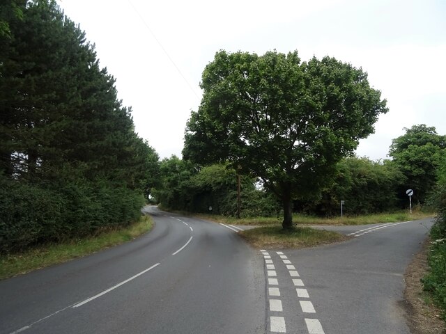
Three Cornered Wood is a beautiful forest located in the county of Oxfordshire, England. Spanning an area of approximately 100 acres, this woodland is a popular destination for nature lovers and outdoor enthusiasts alike. The wood derives its name from its unique triangular shape, which is formed by the convergence of three ancient tracks.

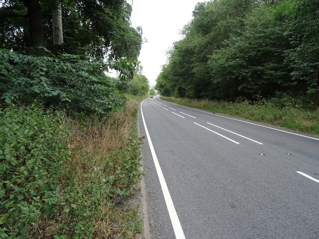
The forest is home to a diverse range of flora and fauna, providing a natural habitat for numerous species of plants, birds, and mammals. Visitors can expect to see oak, beech, and ash trees dominating the landscape, along with an array of wildflowers that bloom during the spring and summer months.

Three Cornered Wood offers a variety of walking trails, making it an ideal location for a leisurely stroll or a more challenging hike. These paths wind through the forest, allowing visitors to immerse themselves in the tranquil surroundings and admire the natural beauty of the area. The woodland also features picnic areas, providing a perfect spot for a relaxing outdoor lunch.

The forest is managed by the local authorities, who have implemented conservation measures to protect the delicate ecosystem within Three Cornered Wood. These efforts ensure that the woodland remains a haven for wildlife and a peaceful retreat for visitors seeking solace in nature.

Overall, Three Cornered Wood in Oxfordshire is a picturesque forest that offers a delightful escape from the hustle and bustle of everyday life. With its stunning scenery and abundant wildlife, it is a true gem for nature enthusiasts and a must-visit destination for anyone looking to connect with the natural world.

If you have any feedback on the listing, please let us know in the comments section below.

Three Cornered Wood Images

Images are sourced within 2km of 51.535649/-1.0567698 or Grid Reference SU6582. Thanks to Geograph Open Source API. All images are credited.

Woodland, Checkendon Beeches to the west of Checkendon Court.
Woodland, Checkendon
Beeches to the west of Checkendon Court.
Pasture and farm buildings, Checkendon Corker's Farm viewed from the footpath passing to its west.
Pasture and farm buildings, Checkendon
Corker's Farm viewed from the footpath passing to its west.
Direction Sign – Signpost on the B471 in Woodcote parish Located on the northwest side of the junction of the B471 Goring Road and Whitehouse Road in Woodcote parish. 3 arms and pawn finial. The Goring Heath / Reading arm had been lost by 2017.

Milestone Society National ID: OX_SU6481
Direction Sign – Signpost on the B471 in Woodcote parish
Located on the northwest side of the junction of the B471 Goring Road and Whitehouse Road in Woodcote parish. 3 arms and pawn finial. The Goring Heath / Reading arm had been lost by 2017. Milestone Society National ID: OX_SU6481
Gated track and footpath off Goring Road
House on Goring Road
Roadworks on Goring Road (B471)
Recreation ground, Woodcote
Village sign, Woodcote
The Red Lion, Woodcote On Goring Road.
See <a href="https://www.geograph.org.uk/photo/7246411">SU6482 : Sign for the Red Lion, Woodcote</a> for sign.
The Red Lion, Woodcote
On Goring Road. See SU6482 : Sign for the Red Lion, Woodcote for sign.
Sign for the Red Lion, Woodcote See <a href="https://www.geograph.org.uk/photo/7246410">SU6482 : The Red Lion, Woodcote</a> for context.
Sign for the Red Lion, Woodcote
George VI postbox on Goring Road, Woodcote Postbox No. RG8 356.
George VI postbox on Goring Road, Woodcote
Postbox No. RG8 356.
Woodcote Village Hall
War Memorial, Woodcote
Fingerpost, Woodcote
Junction of Oxford Road / Tidmore Lane
Red Lane (A4074) Towards Oxford.
Red Lane (A4074)
Towards Oxford.
Greenmoor hill views
1 Langtree Cottages, Checkendon, Oxfordshire 1906 by Maxwell Ayrton in Arts and Crafts style. 

(Source:Historic England)
1 Langtree Cottages, Checkendon, Oxfordshire
1906 by Maxwell Ayrton in Arts and Crafts style. (Source:Historic England)
Show me another place!

Three Cornered Wood is located at Grid Ref: SU6582 (Lat: 51.535649, Lng: -1.0567698)

Administrative County: Oxfordshire

District: South Oxfordshire

Police Authority: Thames Valley

What 3 Words

///verve.bracing.shrimp. Near Rotherfield Peppard, Oxfordshire

Related Wikis

The Oratory School

The Oratory School () is an HMC co-educational private Roman Catholic boarding and day school for pupils aged 11–18 located in Woodcote, 6 miles (9.7 km...

Exlade Street

Exlade Street is a hamlet in Checkendon civil parish in Oxfordshire, about 6 miles (9.7 km) northwest of Reading, in the Chiltern Hills. The hamlet is...

Langtree School

Langtree School is a coeducational secondary school located in the village of Woodcote in South Oxfordshire, England. The school has approximately 624...

Woodcote

Woodcote is a village and civil parish in South Oxfordshire, about 5 miles (8 km) southeast of Wallingford and about 7 miles (11 km) northwest of Reading...

Checkendon

Checkendon is a village and civil parish about 6 miles (10 km) west of Henley-on-Thames in South Oxfordshire and about 9 miles (14 km) north west of Reading...

St Peter and St Paul, Checkendon

St Peter and St Paul is the Church of England parish church of Checkendon, a village in Oxfordshire, England. Its parish is part of the Deanery of Henley...

Hook End Recording Studios

Hook End Recording Studios was a recording studio located in Hook End Manor, a 16th-century Elizabethan house near Checkendon, Oxfordshire, England. Its...

Crays Pond

Crays Pond is a hamlet situated in the parish of Goring Heath in South Oxfordshire. Crays Pond is about 2.4 miles (3.9 km) northeast of Goring-on-Thames...

Nearby Amenities

Located within 500m of 51.535649,-1.0567698
Created By: osmeditor2
Lat/Long: 51.5388983/-1.0555217
Created By: osmeditor2
Lat/Long: 51.5385767/-1.05584
Created By: osmeditor2
Lat/Long: 51.53791/-1.0560833
Created By: osmeditor2
Lat/Long: 51.53735/-1.0562967
Created By: osmeditor2
Lat/Long: 51.536925/-1.05669
Created By: osmeditor2
Lat/Long: 51.5366433/-1.0571233
Created By: osmeditor2
Lat/Long: 51.536325/-1.0578767
Bus Stop
Exlade Street Turn
Naptan AtcoCode: 340001608CNR
Naptan Bearing: SW
Naptan BusStopType: CUS
Naptan CommonName: Exlade Street Turn
Naptan Indicator: Corner
Naptan Landmark: Exlade Street Turn
Naptan NaptanCode: oxfgdtpj
Naptan Street: Cornered Wood
Naptan Verified: no
Source: naptan_import
Lat/Long: 51.5367382/-1.0569278
Bus Stop
Exlade Street Turn
Naptan AtcoCode: 340001608OPP
Naptan Bearing: NE
Naptan BusStopType: CUS
Naptan CommonName: Exlade Street Turn
Naptan Indicator: Opposite
Naptan Landmark: Exlade Street Turn
Naptan NaptanCode: oxfgdwjt
Naptan Street: 3 Cornered Wood
Naptan Verified: no
Source: naptan_import
Lat/Long: 51.5367928/-1.0569988
Bus Stop
Tidmore Lane
Bus: yes
Naptan AtcoCode: 340004146CNR
Naptan Bearing: NE
Naptan CommonName: Tidmore Lane
Naptan Crossing: Tidmore Lane
Naptan Indicator: Corner
Naptan Landmark: Tidmore Lane
Naptan NaptanCode: oxfgpadg
Naptan ShortCommonName: Tidmore Lane
Naptan Street: Reading Road
Naptan Verified: no
Public Transport: platform
Source: naptan_import
Lat/Long: 51.5351382/-1.0614737
Bus Stop
Tidmore Lane
Bus: yes
Naptan AtcoCode: 340004146OPP
Naptan Bearing: SW
Naptan CommonName: Tidmore Lane
Naptan Crossing: Tidmore Lane
Naptan Indicator: Opp
Naptan Landmark: Tidmore Lane
Naptan NaptanCode: oxfgpadj
Naptan ShortCommonName: Tidmore Lane
Naptan Street: Reading Road
Naptan Verified: no
Public Transport: platform
Source: naptan_import
Lat/Long: 51.5349684/-1.061607
Traffic Calming: island
Lat/Long: 51.5347976/-1.0570965
Exlade Street
Place: hamlet
Source Name: OS_OpenData_StreetView
Wikidata: Q5420441
Wikipedia: en:Exlade Street
Lat/Long: 51.5327262/-1.0524962
Barrier: kissing_gate
Bicycle: no
Foot: yes
Lat/Long: 51.5325391/-1.052006
The Nuba Survival
Artist Name: John Buckley
Artwork Type: sculpture
Tourism: artwork
Website: http://www.johnbuckleysculptor.co.uk/the%20nuba%20survival.html
Lat/Long: 51.5385056/-1.0577204
Direction: 120
Generator Method: photovoltaic
Generator Output Electricity: yes
Generator Solar Modules: 14
Generator Source: solar
Generator Type: solar_photovoltaic_panel
Location: roof
Power: generator
Lat/Long: 51.5356056/-1.0633751
Direction: 200
Generator Method: photovoltaic
Generator Output Electricity: yes
Generator Solar Modules: 14
Generator Source: solar
Generator Type: solar_photovoltaic_panel
Location: roof
Power: generator
Lat/Long: 51.5356735/-1.0626021
Traffic Calming: island
Lat/Long: 51.5360445/-1.0592833
Barrier: entrance
Lat/Long: 51.5351178/-1.0621351
Post Box
Operator: Royal Mail
Post Box Type: wall
Ref: RG8 46
Royal Cypher: VR
Lat/Long: 51.5328922/-1.0525659
The data included in this document is from www.openstreetmap.org. The data is made available under ODbL.

Have you been to Three Cornered Wood?

Leave your review of Three Cornered Wood below (or comments, questions and feedback).