Earby

Settlement in Yorkshire Pendle

England

Earby

Pennine Bridleway near Salterforth Looking East along Pennine Bridleway near Spen Head Farm
Pennine Bridleway near Salterforth Credit: Rob Bainbridge

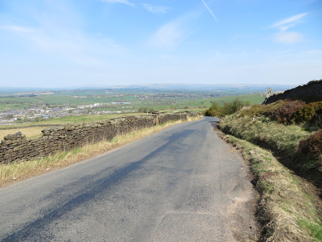
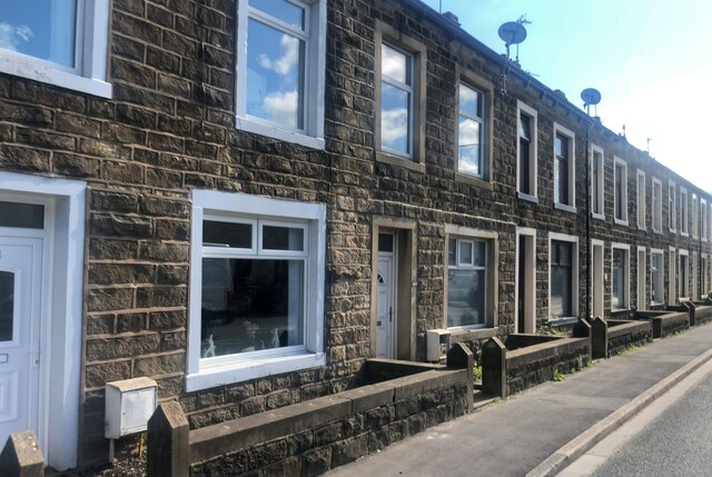
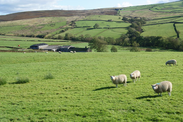
Earby is a small town located in the Craven district of North Yorkshire, England. Situated near the border of Lancashire, it is nestled in the beautiful countryside of the Pennines, offering stunning views and a tranquil atmosphere. With a population of around 6,000 people, it has a close-knit community that takes pride in its heritage and natural surroundings.

One of the town's notable features is the Leeds and Liverpool Canal, which passes through Earby, providing picturesque walks and opportunities for boating and fishing. The canal also showcases the town's industrial history, as it was once an important transportation route for coal, limestone, and textiles.

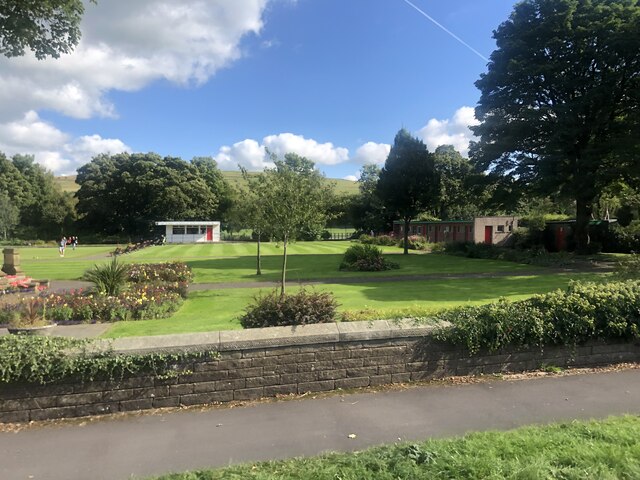
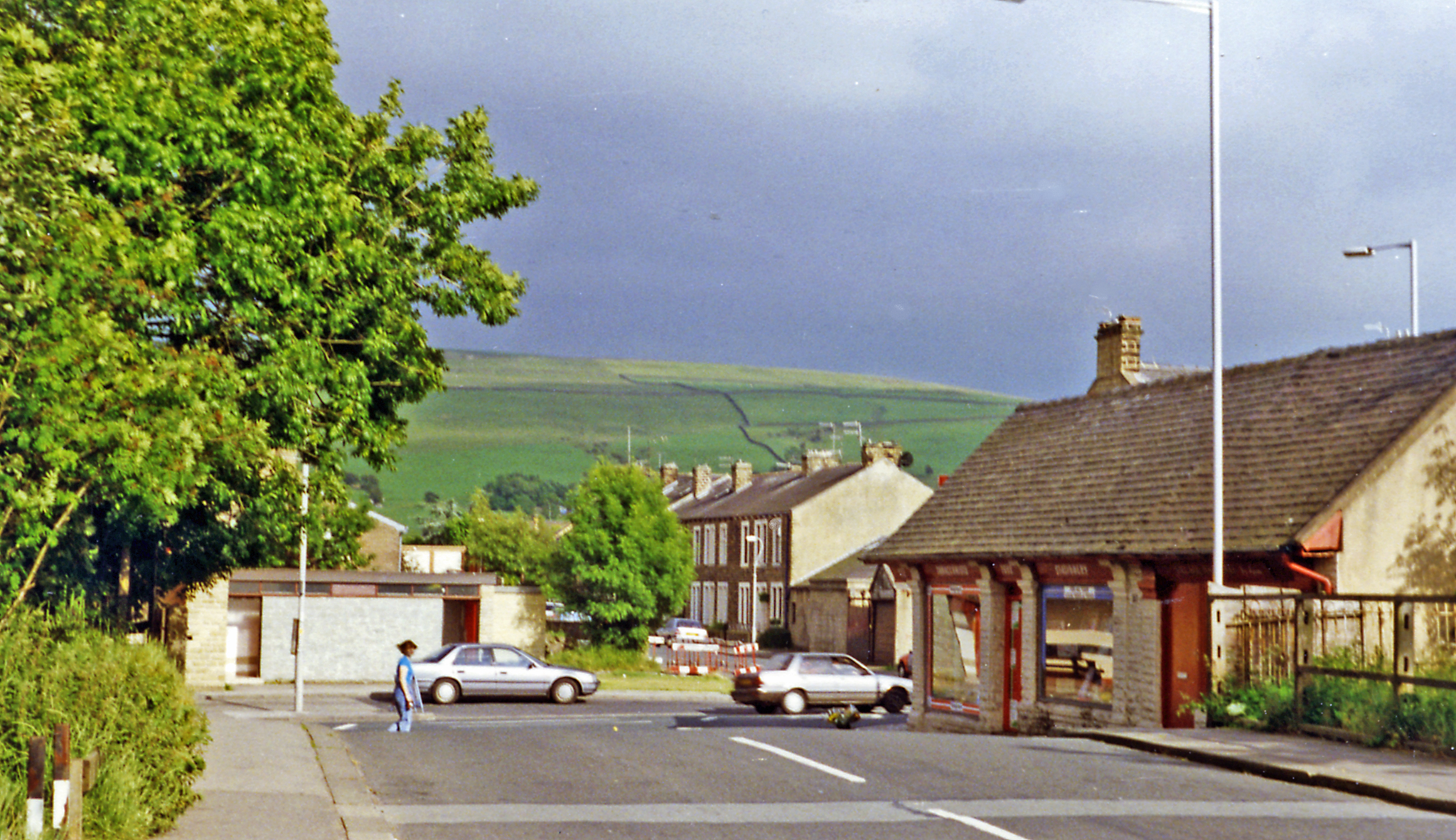
Earby boasts a range of amenities, including local shops, pubs, and restaurants that cater to both residents and visitors. The town is also home to several churches, schools, and community centers, fostering a strong sense of community spirit.

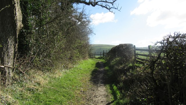
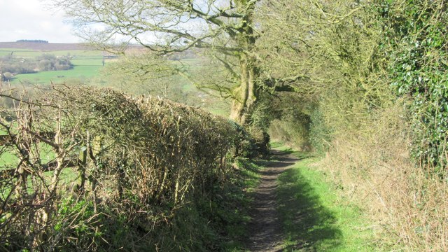
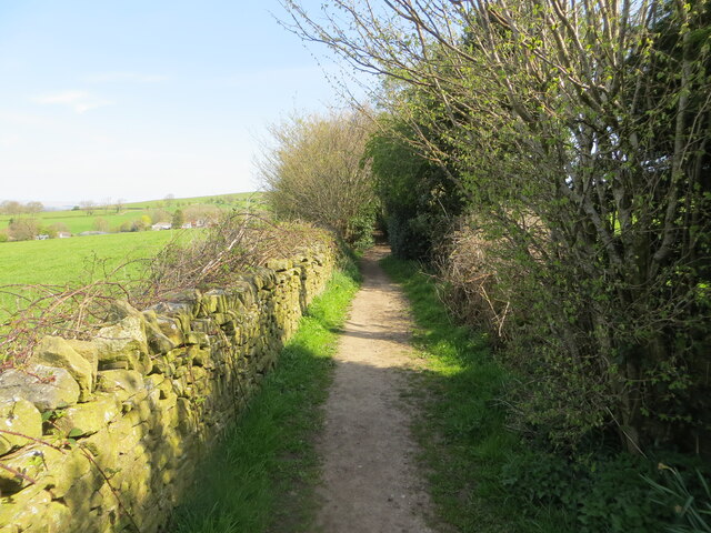
For those interested in outdoor activities, the surrounding countryside offers ample opportunities for hiking, cycling, and exploring nature. The nearby Pennine Way, a long-distance footpath, attracts walkers from all over the country, providing access to the stunning Yorkshire Dales and beyond.

Earby's location allows for easy access to larger towns and cities, with Skipton and Colne just a short drive away. Additionally, the town benefits from good transport links, including regular bus services and proximity to the M65 motorway.

Overall, Earby is a charming Yorkshire town that offers a peaceful retreat in a picturesque setting, with a strong sense of community, stunning natural landscapes, and convenient access to nearby amenities.

If you have any feedback on the listing, please let us know in the comments section below.

Earby Images

Images are sourced within 2km of 53.913227/-2.133175 or Grid Reference SD9146. Thanks to Geograph Open Source API. All images are credited.

Pennine Bridleway near Salterforth Looking East along Pennine Bridleway near Spen Head Farm
Pennine Bridleway near Salterforth
Looking East along Pennine Bridleway near Spen Head Farm
Pennine Bridleway near Salterforth Looking West down the Pennine Bridleway near Spen Head Farm
Pennine Bridleway near Salterforth
Looking West down the Pennine Bridleway near Spen Head Farm
Unknown cutmark Unknown cutmark on Standridge Clough Lane
Unknown cutmark
Unknown cutmark on Standridge Clough Lane
A wall enclosed Bleara Road approaching Bleara Side Looking south-westward.
A wall enclosed Bleara Road approaching Bleara Side
Looking south-westward.
Coolham Lane descending towards Earby Looking northward.
Coolham Lane descending towards Earby
Looking northward.
Mill Lane footpath near Earby Looking north-westward. The path is used by the Pendle Way path.
Mill Lane footpath near Earby
Looking north-westward. The path is used by the Pendle Way path.
Shops on Colne Road
Shops on Colne Road
Terraced housing, Earby A row of two-up two-downs on Colne Road
Terraced housing, Earby
A row of two-up two-downs on Colne Road
Sough Park Bowling greens at the park
Sough Park
Bowling greens at the park
Old milestone Another of the 615 milestones that were set up all over the old West Riding in 1893/94.   Over half are still in situ although some now 'belong' elsewhere.   This corner of Yorkshire near Earby was given away to Lancashire in 1974.  The A56 goes through Earby and this milestone is at the northern end near the Punch Bowl PH.    Several other roadside features including a pre-1920s fingerpost  are kept well painted.   There is a hole in the top of the stone which may be for the Ordnance Survey.
Old milestone
Another of the 615 milestones that were set up all over the old West Riding in 1893/94. Over half are still in situ although some now 'belong' elsewhere. This corner of Yorkshire near Earby was given away to Lancashire in 1974. The A56 goes through Earby and this milestone is at the northern end near the Punch Bowl PH. Several other roadside features including a pre-1920s fingerpost are kept well painted. There is a hole in the top of the stone which may be for the Ordnance Survey.
Pennine Bridleway / Pendle Way above Kelbrook Pennine Bridleway / Pendle Way above and east of Kelbrook
Pennine Bridleway / Pendle Way above Kelbrook
Pennine Bridleway / Pendle Way above and east of Kelbrook
Bridleway gate at field boundary Bridleway gate at field boundary on the Pennine bridleway / Pendle way above Kelbrook
Bridleway gate at field boundary
Bridleway gate at field boundary on the Pennine bridleway / Pendle way above Kelbrook
Old Guide Stone between Colne and Skipton, moved to School Lane, Earby The original location of this guide-stoop is still being debated. Now in the grounds of the old Grammar School on School Lane, against the retaining wall on the left hand side of the driveway. The building, formerly the Mining Museum, is now owned by the Robert Windle Foundation.
Out of place - in public view.

Inscription reads: TOSKIPTOИ / И⅃OƆOT : TO / BLAC / KBVRИ

Milestone Society National ID: YW_XMUEB
Old Guide Stone between Colne and Skipton, moved to School Lane, Earby
The original location of this guide-stoop is still being debated. Now in the grounds of the old Grammar School on School Lane, against the retaining wall on the left hand side of the driveway. The building, formerly the Mining Museum, is now owned by the Robert Windle Foundation. Out of place - in public view. Inscription reads: TOSKIPTOИ / И⅃OƆOT : TO / BLAC / KBVRИ Milestone Society National ID: YW_XMUEB
Old Milestone, A56 Between Earby and Kelbrook (Sough). Located on the East side of road, on verge opposite No. 208. Metal plate attached to stone post, WR casting design, 19th century. 

Inscription reads: COLNE / 4 MILES :: SKIPTON / 8 MILES :: COLNE / & / BROUGHTON / ROAD / EARBY

Milestone Society National ID: YW_SKCO08
Old Milestone, A56
Between Earby and Kelbrook (Sough). Located on the East side of road, on verge opposite No. 208. Metal plate attached to stone post, WR casting design, 19th century. Inscription reads: COLNE / 4 MILES :: SKIPTON / 8 MILES :: COLNE / & / BROUGHTON / ROAD / EARBY Milestone Society National ID: YW_SKCO08
Old Milestone, A56, North of Earby Located on the East side of road, near Punchbowl PH. Metal plate attached to stone post, WR casting design, 19th century. 

Inscription reads: 
COLNE / 5 MILES :: SKIPTON / 7 MILES :: COLNE & BROUGHTON / ROAD / THORNTON / IN / CRAVEN

Milestone Society National ID: YW_SKCO07
Old Milestone, A56, North of Earby
Located on the East side of road, near Punchbowl PH. Metal plate attached to stone post, WR casting design, 19th century. Inscription reads: COLNE / 5 MILES :: SKIPTON / 7 MILES :: COLNE & BROUGHTON / ROAD / THORNTON / IN / CRAVEN Milestone Society National ID: YW_SKCO07
Terraced Cottages in Kelbrook A row of cottages on Main Street, Kelbrook
Terraced Cottages in Kelbrook
A row of cottages on Main Street, Kelbrook
The Mount A farmhouse on the western side of Stone Pit Hill which is undergoing renovation.
The Mount
A farmhouse on the western side of Stone Pit Hill which is undergoing renovation.
Sheep above Oak Slack Farm A farm in the valley of Wentcliff Brook above Earby.
Sheep above Oak Slack Farm
A farm in the valley of Wentcliff Brook above Earby.
Show me another place!

Earby is located at Grid Ref: SD9146 (Lat: 53.913227, Lng: -2.133175)

Division: West Riding

Administrative County: Lancashire

District: Pendle

Police Authority: Lancashire

What 3 Words

///whirlwind.blinks.abacus. Near Earby, Lancashire

Related Wikis

Earby

Earby is a town and civil parish within the Borough of Pendle, Lancashire, England. Although within the boundaries of the historic West Riding of Yorkshire...

Earby railway station

Earby railway station was a junction station that served the town of Earby, in the West Riding of Yorkshire, England. Since 1974 Earby is within the boundaries...

Sough, Lancashire

Sough is a hamlet, in Lancashire, England. Sough is located east of the main A56 road between Earby and Kelbrook; it is in the area known as West Craven...

A58 road

The A58 is a major road in Northern England running between Prescot, Merseyside and Wetherby, West Yorkshire. == Route from West to East == Its westbound...

Related Videos

Lovely v-ewes around Ewe Time Holiday Barn

Views from the moors above Kelbrook, on the border of Lancashire and Yorkshire in northern England. Accessible from our ...

Synovial Sarcoma: Walking with sarcoma - consolidated summary

Clips from all my vlogs in January, just so people who haven't seen my full vlogs can get a gist of what I'm doing. Music by ...

Synovial Sarcoma: Walking With Sarcoma - emotions

Summary and emotions of reaching my goal of getting to Pen-Y-Ghent and the other walks iv done before my surgery in a week ...

Synovial Sarcoma: Walking with Sarcoma - up and coming

Vlog about up and coming walks before surgery #sarcoma #synovialsarcoma #cancer #walkingwithsarcoma #vlog #vlogging ...

Nearby Amenities

Located within 500m of 53.913227,-2.133175
Direction: both
Traffic Calming: hump
Lat/Long: 53.9152412/-2.1367484
Direction: both
Traffic Calming: table
Lat/Long: 53.9154799/-2.1377464
Turning Circle
Spring Mount
Lat/Long: 53.9144209/-2.1372726
Direction: both
Traffic Calming: hump
Lat/Long: 53.9134509/-2.1299395
Direction: both
Traffic Calming: hump
Lat/Long: 53.9137048/-2.1313097
Direction: both
Traffic Calming: hump
Lat/Long: 53.9138907/-2.1323386
Direction: both
Traffic Calming: hump
Lat/Long: 53.9141646/-2.1333608
Direction: both
Traffic Calming: hump
Lat/Long: 53.9145544/-2.134745
Direction: both
Traffic Calming: hump
Lat/Long: 53.9148436/-2.1355017
The data included in this document is from www.openstreetmap.org. The data is made available under ODbL.

Have you been to Earby?

Leave your review of Earby below (or comments, questions and feedback).