Eagle

Settlement in Lincolnshire North Kesteven

England

Eagle

Church Lane, Eagle
Church Lane, Eagle Credit: Humphrey Bolton

Eagle is a small village located in the county of Lincolnshire, England. Situated approximately 12 miles south of the city of Lincoln, Eagle is nestled in the heart of the Lincolnshire countryside. The village is home to a population of around 800 residents.

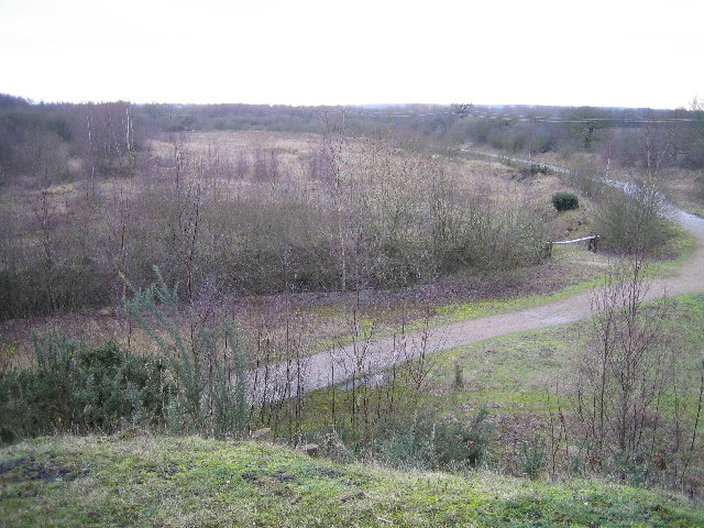
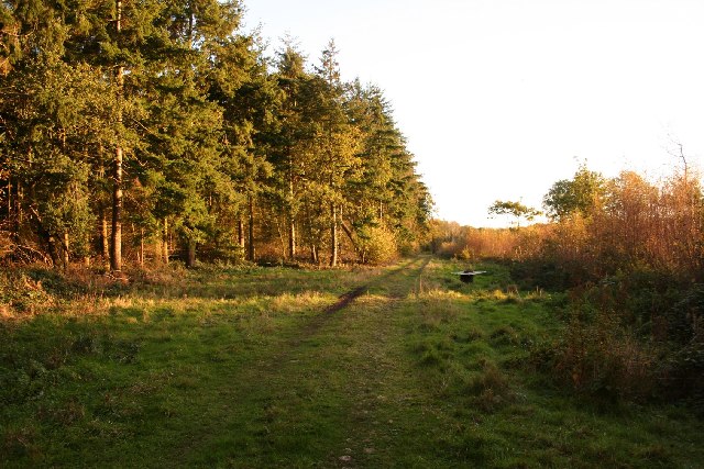
Eagle is renowned for its picturesque and tranquil surroundings, with vast open fields, rolling hills, and charming countryside scenery. The village is characterized by quaint, traditional cottages and historic buildings, which add to its charm and appeal.

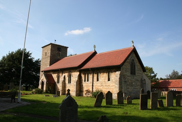
The focal point of Eagle is the St. Andrews Church, a beautiful medieval church dating back to the 13th century. The church is a prominent landmark in the village and attracts visitors who appreciate its architectural significance and historical value.

Despite its small size, Eagle offers a range of amenities for its residents. These include a village hall, a primary school, a local pub, and a village shop that caters to the daily needs of the community. The village also boasts a well-maintained recreation ground, providing a space for outdoor activities and community events.

Eagle is conveniently located for those who enjoy exploring the surrounding areas. The nearby city of Lincoln offers a wealth of cultural and historical attractions, including the iconic Lincoln Cathedral and Lincoln Castle. The village is also within easy reach of the Lincolnshire Wolds, an Area of Outstanding Natural Beauty, which offers opportunities for outdoor pursuits such as hiking, cycling, and wildlife watching.

Overall, Eagle offers residents and visitors alike a peaceful, idyllic retreat with its scenic countryside, historic landmarks, and close proximity to both rural and urban attractions.

If you have any feedback on the listing, please let us know in the comments section below.

Eagle Images

Images are sourced within 2km of 53.199855/-0.675396 or Grid Reference SK8867. Thanks to Geograph Open Source API. All images are credited.

Church Lane, Eagle
Church Lane, Eagle
Path through the churchyard, Eagle
Church gateway and war memorial, Eagle
Former Wesleyan Methodist Chapel, Eagle There is also a former Sunday school, in the same style, to the right.
Former Wesleyan Methodist Chapel, Eagle
There is also a former Sunday school, in the same style, to the right.
Footpath & stile near Mill Farm Towards Woodhouse Farm
Footpath & stile near Mill Farm
Towards Woodhouse Farm
Stile to nowhere Stile in a field, a remnant of a long-gone fence near Mill Farm
Stile to nowhere
Stile in a field, a remnant of a long-gone fence near Mill Farm
Sheep near Mill Farm Footpath across a field of sheep near Mill Farm, with Woodhouse Farm beyond
Sheep near Mill Farm
Footpath across a field of sheep near Mill Farm, with Woodhouse Farm beyond
Hampden crash memorial Memorial in All Saints' churchyard for Pilot John Bernard Kennedy (26) RNZAF, observer Vernon James Hopwood (26) wireless operator/gunner William Leonard Kelly (21) and air gunner George Arthur Metcalfe from the RAF died.

Their 455 Squadron Royal Australian Air Force Hampden bomber had taken off from RAF Wigsley targeting German battleships in the North Sea, but had to return to base because of engine trouble. The aircraft crashed just before 2am on February 13 1942 in an orchard in Eagle as it was preparing to land.

The memorial was unveiled on February 13 2022, 80 years later.
Hampden crash memorial
Memorial in All Saints' churchyard for Pilot John Bernard Kennedy (26) RNZAF, observer Vernon James Hopwood (26) wireless operator/gunner William Leonard Kelly (21) and air gunner George Arthur Metcalfe from the RAF died. Their 455 Squadron Royal Australian Air Force Hampden bomber had taken off from RAF Wigsley targeting German battleships in the North Sea, but had to return to base because of engine trouble. The aircraft crashed just before 2am on February 13 1942 in an orchard in Eagle as it was preparing to land. The memorial was unveiled on February 13 2022, 80 years later.
Pickworth's Plot Pickworth's Plot near the Grange on a frosty November morning
Pickworth's Plot
Pickworth's Plot near the Grange on a frosty November morning
The White House Marked on the map as "The White House" for obvious reasons.
Taken from Thorpe Road looking North.
The White House
Marked on the map as "The White House" for obvious reasons. Taken from Thorpe Road looking North.
Feeding time Cattle grazing a line of feed dropped on a frosty February morning
Feeding time
Cattle grazing a line of feed dropped on a frosty February morning
Whisby Cattle Cattle grazing on summer grass, contrast with the winter scene <a title="https://www.geograph.org.uk/photo/330601" href="https://www.geograph.org.uk/photo/330601">Link</a>
Whisby Cattle
Cattle grazing on summer grass, contrast with the winter scene Link
Oak tree at Whisby Handsome oak tree at Whisby
Oak tree at Whisby
Handsome oak tree at Whisby
White House Farmhouse at Whisby
White House
Farmhouse at Whisby
Track by Whisby Hall Farm track east of Whisby Hall
Track by Whisby Hall
Farm track east of Whisby Hall
Thorpe Farm Machinery TFM and TFM country store, agricultural machinery and equestrian supplies at Whisby
Thorpe Farm Machinery
TFM and TFM country store, agricultural machinery and equestrian supplies at Whisby
Crossroads near Whisby
Footpath for Ducks A Footpath at Whisby.
Footpath for Ducks
A Footpath at Whisby.
Show me another place!

Eagle is located at Grid Ref: SK8867 (Lat: 53.199855, Lng: -0.675396)

Division: Parts of Kesteven

Administrative County: Lincolnshire

District: North Kesteven

Police Authority: Lincolnshire

What 3 Words

///bound.corkscrew.chucked. Near Skellingthorpe, Lincolnshire

Nearby Locations

Eagle

Related Wikis

Eagle, Lincolnshire

Eagle is a village in the civil parish of Eagle and Swinethorpe, in the North Kesteven district of Lincolnshire, England. It is situated 7 miles (11 km...

Whisby

Whisby is a hamlet in the civil parish of Doddington and Whisby, in the North Kesteven district of Lincolnshire, England. It is situated 5 miles (8.0 km...

Thorpe-on-the-Hill railway station

Thorpe on the Hill railway station was a station serving the village of Thorpe-on-the-Hill, Lincolnshire, England. == Opening == It was opened as Thorpe...

Tunman Wood

Tunman Wood is a local nature reserve with an area of over 53 ha (130 acres) located near Eagle Barnsdale, Lincolnshire. It is an area of ancient woodland...

Nearby Amenities

Located within 500m of 53.199855,-0.675396
Eagle Moor
Is In: Lincolnshire, England, UK
Place: hamlet
Source: Sign on road
Lat/Long: 53.2032689/-0.6719038
Bus Stop
Green Lane
Naptan AtcoCode: 270000007822
Naptan Bearing: SW
Naptan CommonName: Green Lane
Naptan Indicator: SW - bound
Naptan Landmark: Green Lane
Naptan NaptanCode: lingmdjt
Naptan Street: Eagle Road
Naptan Verified: no
Source: naptan_import
Lat/Long: 53.2018281/-0.674894
Bus Stop
Green Lane
Naptan AtcoCode: 2700LEM02489
Naptan Bearing: NE
Naptan CommonName: Green Lane
Naptan Indicator: NE - bound
Naptan Landmark: Green Lane
Naptan NaptanCode: linatawt
Naptan Street: Eagle Road
Naptan Verified: no
Source: naptan_import
Lat/Long: 53.2018659/-0.6750575
Holly Tree Farm
Alt Name: Holly Farm
Place: farm
Source: Bing
Lat/Long: 53.2011723/-0.6767025
Barrier: stile
Steps: 2
Stile: stepover
Lat/Long: 53.1986139/-0.6722282
Barrier: stile
Steps: 2
Stile: stepover
Lat/Long: 53.1986055/-0.6715323
Generator Method: photovoltaic
Generator Output Electricity: yes
Generator Source: solar
Generator Type: solar_photovoltaic_panel
Location: roof
Power: generator
Lat/Long: 53.2018077/-0.6755293
Generator Method: photovoltaic
Generator Output Electricity: yes
Generator Source: solar
Generator Type: solar_photovoltaic_panel
Location: roof
Power: generator
Lat/Long: 53.2018044/-0.675583
Generator Method: photovoltaic
Generator Output Electricity: yes
Generator Source: solar
Generator Type: solar_photovoltaic_panel
Location: roof
Power: generator
Lat/Long: 53.2017964/-0.6754676
The data included in this document is from www.openstreetmap.org. The data is made available under ODbL.

Have you been to Eagle?

Leave your review of Eagle below (or comments, questions and feedback).