Eabost West

Settlement in Inverness-shire

Scotland

Eabost West

Buaile Dubh Ard The A863 from Dunvegan to Sligachan cuts a substantial chunk out of the basalt of Buaile Dubh Ard.
Buaile Dubh Ard Credit: John Allan

The requested URL returned error: 429 Too Many Requests

If you have any feedback on the listing, please let us know in the comments section below.
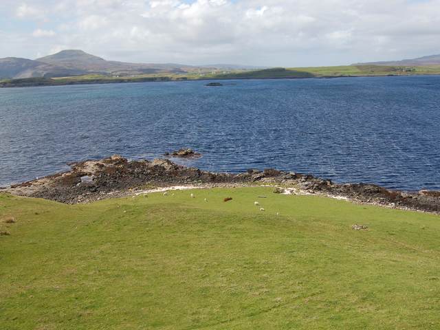
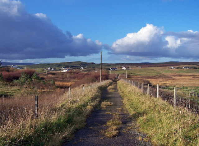
Eabost West Images

Images are sourced within 2km of 57.370715/-6.4761276 or Grid Reference NG3140. Thanks to Geograph Open Source API. All images are credited.

Buaile Dubh Ard The A863 from Dunvegan to Sligachan cuts a substantial chunk out of the basalt of Buaile Dubh Ard.
Buaile Dubh Ard
The A863 from Dunvegan to Sligachan cuts a substantial chunk out of the basalt of Buaile Dubh Ard.
Old Road Looking north west along the old straight road that has been replaced by a new road with a big bend to avoid the boggy land.
Old Road
Looking north west along the old straight road that has been replaced by a new road with a big bend to avoid the boggy land.
House at Eabost Looking SW across Loch Bracadale. In the distance is the island of Wiay.
House at Eabost
Looking SW across Loch Bracadale. In the distance is the island of Wiay.
Mobile Bank Looks to be ready to end its days on this fairly remote farm. I wonder if the Clydesdale know it's here?
Mobile Bank
Looks to be ready to end its days on this fairly remote farm. I wonder if the Clydesdale know it's here?
Ose Farm A recently dug pit, and assorted farming equipment, on the land of Ose Farm.
Ose Farm
A recently dug pit, and assorted farming equipment, on the land of Ose Farm.
Sheep on the Old Road South of Gearymore.
Sheep on the Old Road
South of Gearymore.
Colbost Point Looking across the rough grazings above Colbost Point, near Eabost. The islands visible in Loch Bracadale are Tarner and Harlosh.
Colbost Point
Looking across the rough grazings above Colbost Point, near Eabost. The islands visible in Loch Bracadale are Tarner and Harlosh.
Grazings at Eabost West Croft land with sheep grazing. The view is across Loch Bracadale to the mouth of Loch Caroy.
Grazings at Eabost West
Croft land with sheep grazing. The view is across Loch Bracadale to the mouth of Loch Caroy.
Shelter in Glen Ose Gives the sheep some protection from the weather.
Shelter in Glen Ose
Gives the sheep some protection from the weather.
Friendly sheep One of the users of the shelter <a href="https://www.geograph.org.uk/photo/279249">NG3241 : Shelter in Glen Ose</a>.
Presumably hand reared - certainly very inquisitive.
Friendly sheep
One of the users of the shelter NG3241 : Shelter in Glen Ose. Presumably hand reared - certainly very inquisitive.
Ben Toirlean The trig point on the low summit of Ben Toirlean, looking towards a hazy Black Cuillin.
Ben Toirlean
The trig point on the low summit of Ben Toirlean, looking towards a hazy Black Cuillin.
Mouth of the River Ose Looking downstream towards where the river reaches the sea at Loch Bracadale.
Mouth of the River Ose
Looking downstream towards where the river reaches the sea at Loch Bracadale.
Ose Ose is a large but scattered township. The road in the picture is the A863.
On the horizon are the Cuillin Mountains.
Ose
Ose is a large but scattered township. The road in the picture is the A863. On the horizon are the Cuillin Mountains.
Rusting shed, Ose Sheep farming is a major activity locally, so no doubt this shed is useful to someone.
Rusting shed, Ose
Sheep farming is a major activity locally, so no doubt this shed is useful to someone.
Something missing? We've got the ends up, now just need to fill in the sides and pop the roof on...
See also <a href="https://www.geograph.org.uk/photo/1029538">NG3239 : Building site?</a>.
Something missing?
We've got the ends up, now just need to fill in the sides and pop the roof on... See also NG3239 : Building site?.
Gearymore Gearymore seems to be just a 'no through road' to just a few cottages.
Gearymore
Gearymore seems to be just a 'no through road' to just a few cottages.
Old road through Ose The old single track roads on Skye have mostly been replaced by modern highways often built alongside the original route.
Old road through Ose
The old single track roads on Skye have mostly been replaced by modern highways often built alongside the original route.
New bridge from the old The old and narrow stone bridge is now unused. The new bridge carries the A863 over the River Ose.
New bridge from the old
The old and narrow stone bridge is now unused. The new bridge carries the A863 over the River Ose.
Show me another place!

Eabost West is located at Grid Ref: NG3140 (Lat: 57.370715, Lng: -6.4761276)

Unitary Authority: Highland

Police Authority: Highlands and Islands

What 3 Words

///cork.dislodge.topped. Near Dunvegan, Highland

Related Wikis

Ose, Skye

Ose (Scottish Gaelic: Òs) is a small coastal settlement of Loch Bracadale, in the Scottish Highland area. It lies on the west coast of the Isle of Skye...

Tarner Island

Tarner Island is a triangular shaped island in Loch Bracadale just off the coast off the Harlosh peninsula of Skye in Scotland. It is about 28 hectares...

Struan, Skye

Struan (Scottish Gaelic: An Sruthan) is a small village on the west coast of the island of Skye, on the shores of Loch Beag, itself an inlet of Loch Bracadale...

Ullinish

Ullinish (Gaelic: Uilfhinis) is a crofting township on Loch Bracadale, on the southwest coast of Skye, Scotland. The only promontory fort on Skye is located...

Nearby Amenities

Located within 500m of 57.370715,-6.4761276
Created By: dmgroom_coastlines
Source: PGS
Lat/Long: 57.3745/-6.4724
Created By: dmgroom_coastlines
Source: PGS
Lat/Long: 57.37464/-6.47333
Created By: dmgroom_coastlines
Source: PGS
Lat/Long: 57.3748/-6.47475
Created By: dmgroom_coastlines
Source: PGS
Lat/Long: 57.37429/-6.47478
Created By: dmgroom_coastlines
Source: PGS
Lat/Long: 57.37432/-6.4762
Created By: dmgroom_coastlines
Source: PGS
Lat/Long: 57.37405/-6.47598
Created By: dmgroom_coastlines
Source: PGS
Lat/Long: 57.37328/-6.4758
Created By: dmgroom_coastlines
Source: PGS
Lat/Long: 57.3733/-6.47675
Created By: dmgroom_coastlines
Source: PGS
Lat/Long: 57.3728/-6.47702
Created By: dmgroom_coastlines
Source: PGS
Lat/Long: 57.37254/-6.47727
Created By: dmgroom_coastlines
Source: PGS
Lat/Long: 57.37256/-6.47822
Created By: dmgroom_coastlines
Source: PGS
Lat/Long: 57.37205/-6.47825
Created By: dmgroom_coastlines
Source: PGS
Lat/Long: 57.37195/-6.47968
Created By: dmgroom_coastlines
Source: PGS
Lat/Long: 57.37183/-6.48016
Created By: dmgroom_coastlines
Source: PGS
Lat/Long: 57.37131/-6.47996
Created By: dmgroom_coastlines
Source: PGS
Lat/Long: 57.37106/-6.47998
Created By: dmgroom_coastlines
Source: PGS
Lat/Long: 57.37056/-6.48049
Created By: dmgroom_coastlines
Source: PGS
Lat/Long: 57.37006/-6.481
Created By: dmgroom_coastlines
Source: PGS
Lat/Long: 57.36929/-6.48105
Created By: dmgroom_coastlines
Source: PGS
Lat/Long: 57.36903/-6.48107
Created By: dmgroom_coastlines
Source: PGS
Lat/Long: 57.36827/-6.48112
Created By: dmgroom_coastlines
Source: PGS
Lat/Long: 57.36801/-6.48114
Created By: dmgroom_coastlines
Source: PGS
Lat/Long: 57.36723/-6.48119
Created By: dmgroom_coastlines
Source: PGS
Lat/Long: 57.36711/-6.48097
Created By: dmgroom_coastlines
Source: PGS
Lat/Long: 57.36698/-6.48074
Power: pole
Lat/Long: 57.3723311/-6.4731096
Power: pole
Lat/Long: 57.3726447/-6.4724876
Power: pole
Lat/Long: 57.3729226/-6.4719259
Power: pole
Lat/Long: 57.3733176/-6.4714851
Power: pole
Lat/Long: 57.3737073/-6.4710604
Power: pole
Lat/Long: 57.3736487/-6.4706115
The data included in this document is from www.openstreetmap.org. The data is made available under ODbL.

Have you been to Eabost West?

Leave your review of Eabost West below (or comments, questions and feedback).