Spring Ground Spinney

Wood, Forest in Buckinghamshire

England

Spring Ground Spinney

Road towards Biddlesden
Road towards Biddlesden Credit: Robin Webster

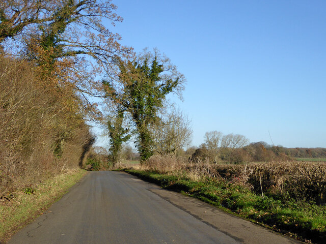
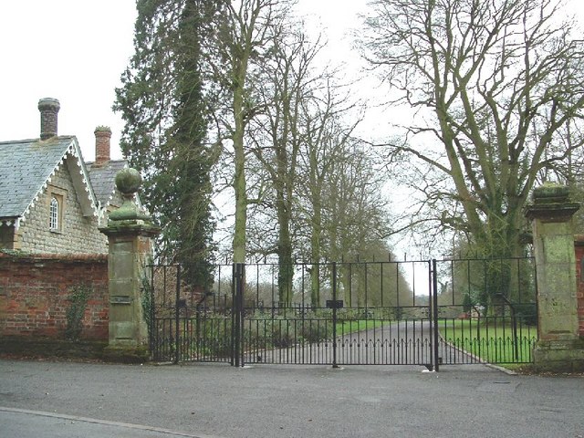
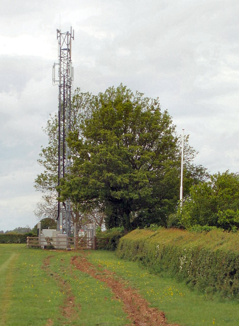
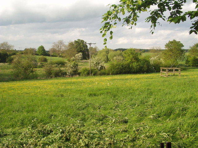
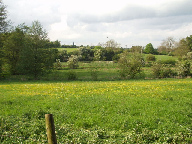
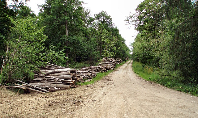
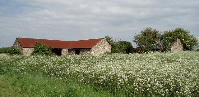
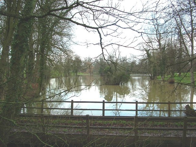
Spring Ground Spinney is a picturesque woodland located in Buckinghamshire, England. Nestled in the heart of the county, this enchanting forest covers an area of approximately 20 acres. It is known for its stunning display of wildflowers, lush greenery, and towering trees, making it a popular destination for nature enthusiasts and hikers alike.

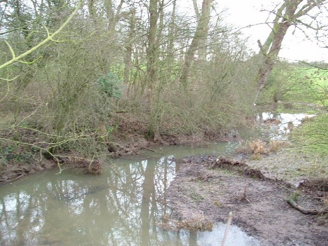
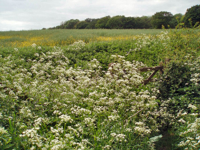
The woodland is home to a diverse range of flora and fauna, with an abundance of native species thriving within its borders. Visitors can expect to spot a variety of birds, including woodpeckers, owls, and songbirds, as well as small mammals such as squirrels and rabbits. The forest floor is carpeted with a vibrant array of flowers, including bluebells, primroses, and wild garlic, creating a breathtaking sight during the spring season.

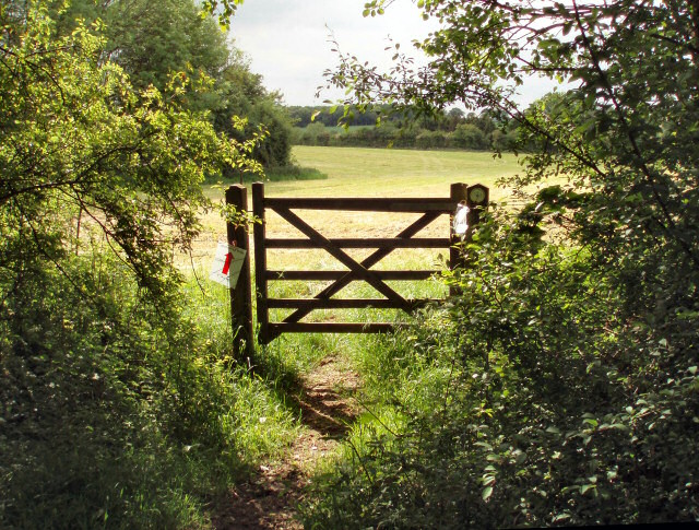
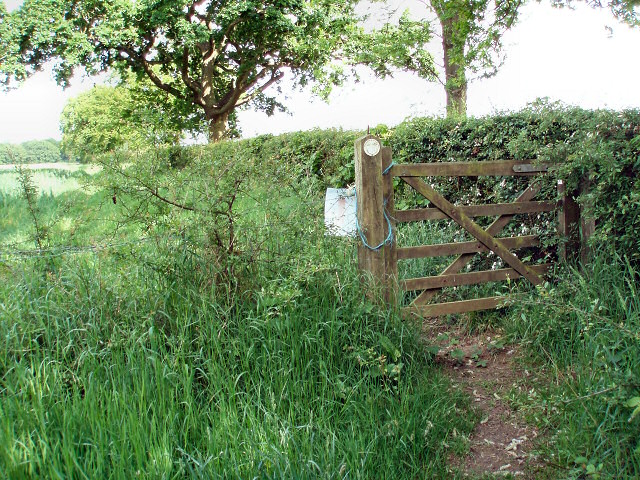
Spring Ground Spinney offers a network of well-maintained footpaths and trails, allowing visitors to explore its beauty at their own pace. The paths wind through the forest, offering glimpses of tranquil ponds, babbling brooks, and hidden clearings along the way. It is a perfect place for a leisurely walk or a peaceful picnic amidst nature.

The woodland is easily accessible, with ample parking facilities available nearby. Additionally, there are informative signposts throughout the site, providing interesting facts about the local wildlife and the history of the area. It is important to note that Spring Ground Spinney is a protected area, and visitors are encouraged to respect the natural surroundings and adhere to any guidelines set forth by the local authorities.

Overall, Spring Ground Spinney is a captivating woodland in Buckinghamshire, offering a serene and immersive experience in the heart of nature.

If you have any feedback on the listing, please let us know in the comments section below.

Spring Ground Spinney Images

Images are sourced within 2km of 52.057197/-1.0770688 or Grid Reference SP6340. Thanks to Geograph Open Source API. All images are credited.

Road towards Biddlesden
St James the Great's, Syresham
Biddlesden View from the bottom of Biddlesden
Biddlesden
View from the bottom of Biddlesden
Gatehouse to Biddlesden House The Gatehouse to Biddlesden House
Gatehouse to Biddlesden House
The Gatehouse to Biddlesden House
Entrance to Biddlesden House The Entrance to Biddlesden House, the Gatehouse is on the left
Entrance to Biddlesden House
The Entrance to Biddlesden House, the Gatehouse is on the left
The Great Ouse at Biddlesden View from Biddlesden Bridge of the river Great Ouse
The Great Ouse at Biddlesden
View from Biddlesden Bridge of the river Great Ouse
High Street, Syresham
Corner outside Syresham,  heading towards Wappenham There are some newly planted trees and a commemorative bench in this small area on the outside of a bend in the road.
Corner outside Syresham, heading towards Wappenham
There are some newly planted trees and a commemorative bench in this small area on the outside of a bend in the road.
Bench close to Syresham The bench carries a plaque which reads:
Golden Jubilee 2002
Donated by the Archer Family
In memory of Eric Archer (1915-1980)
& Joan Archer (1914-2001)
Bench close to Syresham
The bench carries a plaque which reads: Golden Jubilee 2002 Donated by the Archer Family In memory of Eric Archer (1915-1980) & Joan Archer (1914-2001)
Speed camera on the A43
Mobile phone masts close to the Green Man pub
River Ouse Biddlesden Looking from houses in Biddlesden across field to the meadow of the upper River Ouse valley, river is just a small stream in the meadow on the far side of the hedgeline.
River Ouse Biddlesden
Looking from houses in Biddlesden across field to the meadow of the upper River Ouse valley, river is just a small stream in the meadow on the far side of the hedgeline.
River Ouse Biddlesden Looking from the rear of houses in Biddlesen to the River Ouse valley. River is a small stream in the bottom of the valley.
River Ouse Biddlesden
Looking from the rear of houses in Biddlesen to the River Ouse valley. River is a small stream in the bottom of the valley.
Logs piled beside track Helpfully marked with warning signs telling you not to climb the stacks.
Logs piled beside track
Helpfully marked with warning signs telling you not to climb the stacks.
Castle Farm An ideal fixer-upper opportunity?
Castle Farm
An ideal fixer-upper opportunity?
Footpath gate Leading up to Home Wood
Footpath gate
Leading up to Home Wood
Gate out of Briary Wood Part of the Westbury Circular Ride - <span class="nowrap"><a title="http://www.ride-uk.org.uk/extent/seast/b-westbury.htm" rel="nofollow ugc noopener" href="http://www.ride-uk.org.uk/extent/seast/b-westbury.htm">Link</a><img style="margin-left:2px;" alt="External link" title="External link - shift click to open in new window" src="https://s1.geograph.org.uk/img/external.png" width="10" height="10"/></span>
Gate out of Briary Wood
Part of the Westbury Circular Ride - LinkExternal link
Show me another place!

Spring Ground Spinney is located at Grid Ref: SP6340 (Lat: 52.057197, Lng: -1.0770688)

Unitary Authority: Buckinghamshire

Police Authority: Thames Valley

What 3 Words

///tomato.lawns.encoded. Near Silverstone, Northamptonshire

Related Wikis

Biddlesden

Biddlesden is a village and civil parish in Aylesbury Vale district in north-west Buckinghamshire, England on the boundary with Northamptonshire. It is...

Biddlesden Park

Biddlesden Park is a country house at Biddlesden in north-west Buckinghamshire. It is a Grade II* listed building. == History == The house, which lies...

Biddlesden Abbey

Biddlesden was a Cistercian abbey founded in 1147 by Arnold de Bosco (de Bois), steward to the Earl of Leicester. Abbot William Wibert was deposed in 1198...

Syresham

Syresham is a village and civil parish in the English district of West Northamptonshire. The civil parish population at the 2011 census was 855. It is...

Crowfield, Northamptonshire

Crowfield is a hamlet of some two dozen houses in the civil parish of Syresham in that part of the English county of Northamptonshire popularly known as...

Turweston Aerodrome

Turweston Aerodrome (ICAO: EGBT) is an airfield located near the village of Turweston, in north Buckinghamshire near the Northamptonshire border. It is...

Syresham Marshy Meadows

Syresham Marshy Meadows is a 17.8-hectare (44-acre) biological Site of Special Scientific Interest west of Silverstone in Northamptonshire.This site consists...

Whitfield, Northamptonshire

Whitfield is a village and parish in the south-west of the English county of Northamptonshire in the valley of the River Great Ouse which forms the border...

Nearby Amenities

Located within 500m of 52.057197,-1.0770688
Barrier: kissing_gate
Foot: yes
Lat/Long: 52.0603033/-1.0730408
Barrier: kissing_gate
Foot: yes
Lat/Long: 52.0606331/-1.0755805
Barrier: stile
Steps: 1
Lat/Long: 52.0612606/-1.0753378
Biddlesden
Place: hamlet
Source: OS25k
Lat/Long: 52.0561701/-1.0777422
Post Box
Operator: Royal Mail
Post Box Type: lamp
Ref: NN13 87
Royal Cypher: EIIR
Royal Cypher Wikidata: Q33102113
Lat/Long: 52.0557529/-1.0773361
Power: pole
Source: Bing
Lat/Long: 52.0544499/-1.0714379
Power: pole
Source: Bing
Lat/Long: 52.0552696/-1.0722962
Power: pole
Source: Bing
Lat/Long: 52.0555582/-1.0734254
Power: pole
Source: Bing
Lat/Long: 52.0559689/-1.074906
Power: pole
Source: Bing
Lat/Long: 52.0562262/-1.0758984
Power: pole
Source: Bing
Lat/Long: 52.0565874/-1.0772261
Power: pole
Source: Bing
Lat/Long: 52.0567699/-1.0783239
Power: pole
Lat/Long: 52.0578113/-1.0838634
Power: pole
Lat/Long: 52.0585806/-1.0823681
Power: pole
Lat/Long: 52.0593694/-1.0808923
Power: pole
Lat/Long: 52.0601473/-1.0794146
Power: pole
Lat/Long: 52.0611429/-1.0782131
Power: pole
Lat/Long: 52.0616441/-1.0781046
Power: pole
Lat/Long: 52.0607942/-1.0779762
Power: pole
Lat/Long: 52.0599171/-1.0778571
Power: pole
Lat/Long: 52.0583343/-1.0780722
Power: pole
Lat/Long: 52.0609238/-1.0768303
Power: pole
Lat/Long: 52.0610448/-1.0755041
Power: pole
Lat/Long: 52.0566942/-1.0812678
Power: pole
Lat/Long: 52.0573119/-1.0810698
Power: pole
Lat/Long: 52.0575238/-1.0804423
Power: pole
Lat/Long: 52.0579146/-1.079293
Power: pole
Lat/Long: 52.0560832/-1.0814619
Power: pole
Lat/Long: 52.0552905/-1.0817143
Power: pole
Lat/Long: 52.0545188/-1.0825681
Power: pole
Lat/Long: 52.0589533/-1.0780038
Power: pole
Source: Bing
Lat/Long: 52.0568699/-1.0783078
The data included in this document is from www.openstreetmap.org. The data is made available under ODbL.

Have you been to Spring Ground Spinney?

Leave your review of Spring Ground Spinney below (or comments, questions and feedback).