Ashengrove Wood
Wood, Forest in Oxfordshire South Oxfordshire
England
Ashengrove Wood

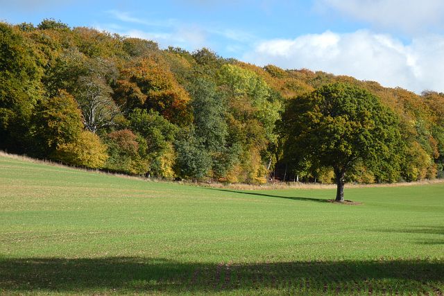
Ashengrove Wood is a picturesque woodland located in Oxfordshire, England. Spanning over an area of approximately 50 acres, it is a popular destination for nature lovers and outdoor enthusiasts. The wood is situated near the village of Ashengrove, and it offers a serene and tranquil environment for visitors to explore.
The wood is characterized by its diverse range of trees, including oak, beech, and birch, which create a stunning canopy of foliage during the summer months. The forest floor is covered with a carpet of wildflowers, making it an ideal location for those interested in botany or photography.
Ashengrove Wood is home to a variety of wildlife, attracting birdwatchers and animal enthusiasts alike. Common sightings include woodpeckers, owls, squirrels, and deer. The wood also provides habitats for several rare and endangered species, making it an important conservation area.
There are several walking trails that crisscross through the wood, allowing visitors to explore and appreciate its natural beauty. These paths are well-maintained and suitable for all ages and fitness levels. Additionally, there is a picnic area where families can enjoy a meal surrounded by the peacefulness of nature.
The wood is easily accessible, with a car park located nearby, and it is open to the public year-round. Ashengrove Wood offers a welcome retreat from the hustle and bustle of everyday life, providing a tranquil space for individuals to connect with nature and enjoy the beauty of the Oxfordshire countryside.
If you have any feedback on the listing, please let us know in the comments section below.
Ashengrove Wood Images
Images are sourced within 2km of 51.524822/-1.0966907 or Grid Reference SU6281. Thanks to Geograph Open Source API. All images are credited.


Ashengrove Wood is located at Grid Ref: SU6281 (Lat: 51.524822, Lng: -1.0966907)
Administrative County: Oxfordshire
District: South Oxfordshire
Police Authority: Thames Valley
What 3 Words
///peroxide.shuttled.beauty. Near Goring, Oxfordshire
Nearby Locations
Related Wikis

Elvendon
Elvendon is a small settlement in Oxfordshire and the Chiltern Hills, near Goring. It includes the grade II listed building Elvendon Priory. == Etymology... ==

Goring Heath
Goring Heath is a hamlet and civil parish in the Chiltern Hills in South Oxfordshire. The civil parish includes the villages of Whitchurch Hill and Crays...

Crays Pond
Crays Pond is a hamlet situated in the parish of Goring Heath in South Oxfordshire. Crays Pond is about 2.4 miles (3.9 km) northeast of Goring-on-Thames...
The Oratory Preparatory School
The Oratory Prep School is a Roman Catholic day and boarding school for some 330 boys and girls aged from two to thirteen, founded in 1925. The school...
Goring Rural District
Goring was a rural district in Oxfordshire, England from 1894 to 1932. It was formed from that part of the Bradfield rural sanitary district which was...

Woodcote
Woodcote is a village and civil parish in South Oxfordshire, about 5 miles (8 km) southeast of Wallingford and about 7 miles (11 km) northwest of Reading...

Langtree School
Langtree School is a coeducational secondary school located in the village of Woodcote in South Oxfordshire, England. The school has approximately 624...

Whitchurch Hill
Whitchurch Hill is a village in the Chiltern Hills in Oxfordshire, about 5.5 miles (9 km) northwest of Reading, Berkshire, near Whitchurch-on-Thames. The...
Nearby Amenities
Located within 500m of 51.524822,-1.0966907Have you been to Ashengrove Wood?
Leave your review of Ashengrove Wood below (or comments, questions and feedback).