Charcoal Plantation

Wood, Forest in Nottinghamshire Newark and Sherwood

England

Charcoal Plantation

Solar Farm, Budby North Forest
Solar Farm, Budby North Forest Credit: Jonathan Thacker

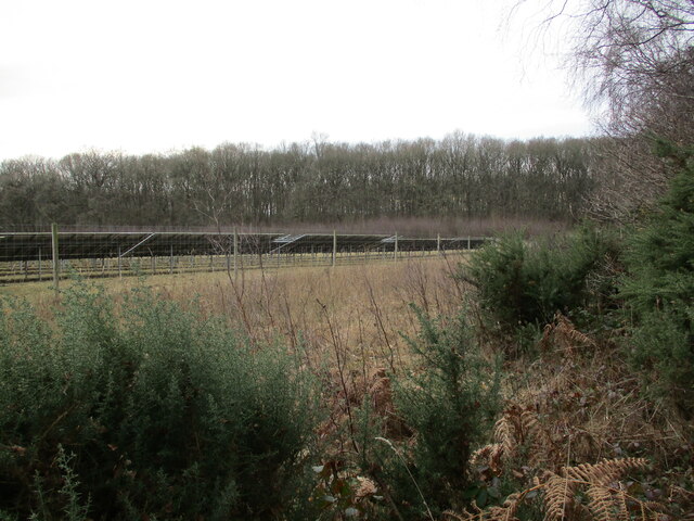
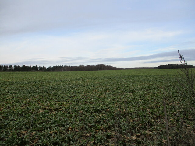
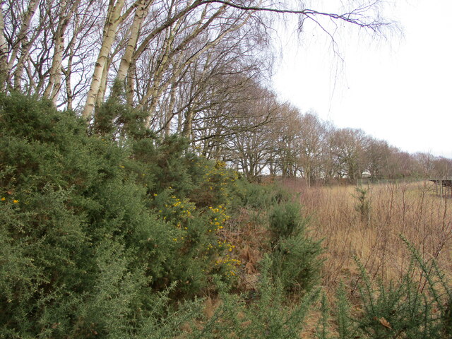
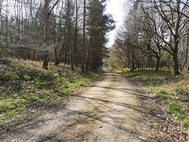
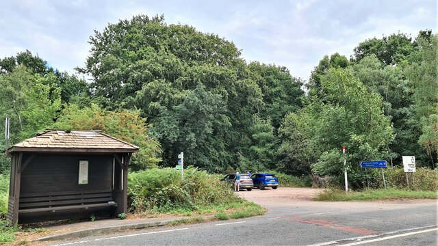
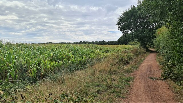
Charcoal Plantation, located in Nottinghamshire, is a flourishing woodland area known for its extensive growth of trees and production of charcoal. Situated in the heart of Sherwood Forest, the plantation covers a vast expanse of land, providing a serene and picturesque environment for nature enthusiasts and visitors alike.

The woodland is predominantly populated by oak, birch, and beech trees, creating a diverse and rich ecosystem. These trees not only contribute to the beauty of the plantation but are also the primary source of charcoal production. The abundance of timber allows for sustainable harvesting, ensuring the longevity of the plantation.

Charcoal production has a long and storied history in Nottinghamshire, dating back to medieval times when it was used as a fuel source for blacksmithing and household heating. Today, the plantation continues this tradition, supplying high-quality charcoal to various industries and individuals who appreciate its unique properties.

Moreover, the Charcoal Plantation is a haven for wildlife, offering a habitat for a range of species. Birds such as woodpeckers, owls, and thrushes can be spotted amongst the trees, while small mammals like squirrels and rabbits thrive in the undergrowth. The plantation also supports a diverse insect population, attracting butterflies, bees, and beetles.

Visitors to Charcoal Plantation can enjoy a variety of activities, including guided walks, birdwatching, and picnicking amidst the peaceful surroundings. The plantation also hosts educational programs and workshops, allowing visitors to learn about the history, ecology, and sustainable management of the woodland.

Overall, Charcoal Plantation in Nottinghamshire is a remarkable destination that combines natural beauty, historical significance, and sustainable industry, providing a unique experience for nature lovers and those interested in the region's heritage.

If you have any feedback on the listing, please let us know in the comments section below.

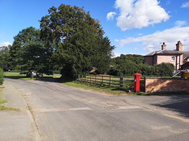
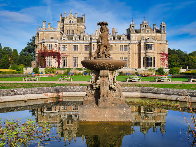
Charcoal Plantation Images

Images are sourced within 2km of 53.239652/-1.0688599 or Grid Reference SK6271. Thanks to Geograph Open Source API. All images are credited.

Solar Farm, Budby North Forest
Cultivated field, Budby North Forest
Belt of trees, Budby North Forest There is virtually no time of the year when gorse can't be found in flower.
Belt of trees, Budby North Forest
There is virtually no time of the year when gorse can't be found in flower.
Gibraltar Plantation
Car park by Duncanwood Lodge
Track by Budby North Forest
Budby Village
Budby Village
Thoresby Hall and Garden The ornate fountain in front of the house is Grade II-listed (Historic England List Entry 1370209 <span class="nowrap"><a title="https://historicengland.org.uk/listing/the-list/list-entry/1370209" rel="nofollow ugc noopener" href="https://historicengland.org.uk/listing/the-list/list-entry/1370209">Link</a><img style="margin-left:2px;" alt="External link" title="External link - shift click to open in new window" src="https://s1.geograph.org.uk/img/external.png" width="10" height="10"/></span> ). It dates from 1865.
Thoresby Hall and Garden
The ornate fountain in front of the house is Grade II-listed (Historic England List Entry 1370209 LinkExternal link ). It dates from 1865.
Former Stable Block at Thoresby Hall Built at the same time as Thoresby Hall, the stable block is Grade II-listed (List Entry No <span class="nowrap"><a title="https://historicengland.org.uk/listing/the-list/list-entry/1370209" rel="nofollow ugc noopener" href="https://historicengland.org.uk/listing/the-list/list-entry/1370209">Link</a><img style="margin-left:2px;" alt="External link" title="External link - shift click to open in new window" src="https://s1.geograph.org.uk/img/external.png" width="10" height="10"/></span> Historic England). It is now open to the public as a retail space within Thoresby Park.
Former Stable Block at Thoresby Hall
Built at the same time as Thoresby Hall, the stable block is Grade II-listed (List Entry No LinkExternal link Historic England). It is now open to the public as a retail space within Thoresby Park.
Stables Courtyard, Thoresby Park Built at the same time as Thoresby Hall, the stable block is Grade II-listed (List Entry No <span class="nowrap"><a title="https://historicengland.org.uk/listing/the-list/list-entry/1370209" rel="nofollow ugc noopener" href="https://historicengland.org.uk/listing/the-list/list-entry/1370209">Link</a><img style="margin-left:2px;" alt="External link" title="External link - shift click to open in new window" src="https://s1.geograph.org.uk/img/external.png" width="10" height="10"/></span> Historic England). It is now open to the public as a retail space within Thoresby Park.
Stables Courtyard, Thoresby Park
Built at the same time as Thoresby Hall, the stable block is Grade II-listed (List Entry No LinkExternal link Historic England). It is now open to the public as a retail space within Thoresby Park.
Thoresby Hall The main east front has a central 3-storey projecting porch with a porte-cochere and above it, a 2-stage bell tower with a domed octagonal cupola. The tower has a cornice with 4 urns. The clock stage, above, has triple corner pilasters and rosette decoration. The clock face is to the east.
Thoresby Hall
The main east front has a central 3-storey projecting porch with a porte-cochere and above it, a 2-stage bell tower with a domed octagonal cupola. The tower has a cornice with 4 urns. The clock stage, above, has triple corner pilasters and rosette decoration. The clock face is to the east.
Thoresby Hall, East Face The main east front has a central 3-storey projecting porch with a porte-cochere and above it, a 2-stage bell tower with a domed octagonal cupola. The tower has a cornice with 4 urns. The clock stage, above, has triple corner pilasters and rosette decoration. The clock face is to the east.
Thoresby Hall, East Face
The main east front has a central 3-storey projecting porch with a porte-cochere and above it, a 2-stage bell tower with a domed octagonal cupola. The tower has a cornice with 4 urns. The clock stage, above, has triple corner pilasters and rosette decoration. The clock face is to the east.
Thoresby Hall, South Front The south front has 3 different bay windows. A central scrolled-shaped gable is flanked to left by a square tower with a parapet and to right by a tower with corner cupolas. The Central pedimented doorcase is flanked to left by 3 and to right by 2 casements on each floor.
Thoresby Hall, South Front
The south front has 3 different bay windows. A central scrolled-shaped gable is flanked to left by a square tower with a parapet and to right by a tower with corner cupolas. The Central pedimented doorcase is flanked to left by 3 and to right by 2 casements on each floor.
South Front, Thoresby Hall The south front has 3 different bay windows. A central scrolled-shaped gable is flanked to left by a square tower with a parapet and to right by a tower with corner cupolas. The Central pedimented doorcase is flanked to left by 3 and to right by 2 casements on each floor.

The ornate fountain in front of the house is Grade II-listed (Historic England List Entry 1370209 <span class="nowrap"><a title="https://historicengland.org.uk/listing/the-list/list-entry/1370209" rel="nofollow ugc noopener" href="https://historicengland.org.uk/listing/the-list/list-entry/1370209">Link</a><img style="margin-left:2px;" alt="External link" title="External link - shift click to open in new window" src="https://s1.geograph.org.uk/img/external.png" width="10" height="10"/></span> ). It dates from 1865.
South Front, Thoresby Hall
The south front has 3 different bay windows. A central scrolled-shaped gable is flanked to left by a square tower with a parapet and to right by a tower with corner cupolas. The Central pedimented doorcase is flanked to left by 3 and to right by 2 casements on each floor. The ornate fountain in front of the house is Grade II-listed (Historic England List Entry 1370209 LinkExternal link ). It dates from 1865.
Fountain to the South of Thoresby Hall The ornate fountain in front of the house is Grade II-listed (Historic England List Entry 1370209 <span class="nowrap"><a title="https://historicengland.org.uk/listing/the-list/list-entry/1370209" rel="nofollow ugc noopener" href="https://historicengland.org.uk/listing/the-list/list-entry/1370209">Link</a><img style="margin-left:2px;" alt="External link" title="External link - shift click to open in new window" src="https://s1.geograph.org.uk/img/external.png" width="10" height="10"/></span> ). It dates from 1865.
Fountain to the South of Thoresby Hall
The ornate fountain in front of the house is Grade II-listed (Historic England List Entry 1370209 LinkExternal link ). It dates from 1865.
Thoresby Park Cricket Ground and Pavilion Thoresby Park stands in a rural setting approximately 3km north-west of the village of New Ollerton. It was by enclosure from Sherwood Forest in the seventeenth century by William Pierrepont, fourth Earl of Kingston. The extensive grounds cover more than 1000 acres of rich, unspoilt, undulating countryside that is bounded to the north by a deep woodland belt, beyond which lies the south boundary of Clumber Park, and to the south and west by further extensive woodlands. To the east, part of the boundary is formed by woodland and part by the A614, with Perlethorpe village lying just beyond the centre of the eastern boundary plantation. A minor country road cuts through the park to the north of the Hall, connecting the villages of Haughton in the north-east to Budby in the south-west. It is open to the public and there is a visitor centre in the old stables complex <a href="https://www.geograph.org.uk/photo/7312967">SK6371 : Stables Courtyard, Thoresby Park</a>.

The park is designated Grade I in the Parks and Gardens category of the National Heritage List for England (List Entry Number:1000361 <span class="nowrap"><a title="https://historicengland.org.uk/listing/the-list/list-entry/1000361" rel="nofollow ugc noopener" href="https://historicengland.org.uk/listing/the-list/list-entry/1000361">Link</a><img style="margin-left:2px;" alt="External link" title="External link - shift click to open in new window" src="https://s1.geograph.org.uk/img/external.png" width="10" height="10"/></span> Historic England).
Thoresby Park Cricket Ground and Pavilion
Thoresby Park stands in a rural setting approximately 3km north-west of the village of New Ollerton. It was by enclosure from Sherwood Forest in the seventeenth century by William Pierrepont, fourth Earl of Kingston. The extensive grounds cover more than 1000 acres of rich, unspoilt, undulating countryside that is bounded to the north by a deep woodland belt, beyond which lies the south boundary of Clumber Park, and to the south and west by further extensive woodlands. To the east, part of the boundary is formed by woodland and part by the A614, with Perlethorpe village lying just beyond the centre of the eastern boundary plantation. A minor country road cuts through the park to the north of the Hall, connecting the villages of Haughton in the north-east to Budby in the south-west. It is open to the public and there is a visitor centre in the old stables complex SK6371 : Stables Courtyard, Thoresby Park. The park is designated Grade I in the Parks and Gardens category of the National Heritage List for England (List Entry Number:1000361 LinkExternal link Historic England).
Track, Thoresby Estate Thoresby Park stands in a rural setting approximately 3km north-west of the village of New Ollerton. It was by enclosure from Sherwood Forest in the seventeenth century by William Pierrepont, fourth Earl of Kingston. The extensive grounds cover more than 1000 acres of rich, unspoilt, undulating countryside that is bounded to the north by a deep woodland belt, beyond which lies the south boundary of Clumber Park, and to the south and west by further extensive woodlands. To the east, part of the boundary is formed by woodland and part by the A614, with Perlethorpe village lying just beyond the centre of the eastern boundary plantation. A minor country road cuts through the park to the north of the Hall, connecting the villages of Haughton in the north-east to Budby in the south-west. It is open to the public and there is a visitor centre in the old stables complex <a href="https://www.geograph.org.uk/photo/7312967">SK6371 : Stables Courtyard, Thoresby Park</a>.

The park is designated Grade I in the Parks and Gardens category of the National Heritage List for England (List Entry Number:1000361 <span class="nowrap"><a title="https://historicengland.org.uk/listing/the-list/list-entry/1000361" rel="nofollow ugc noopener" href="https://historicengland.org.uk/listing/the-list/list-entry/1000361">Link</a><img style="margin-left:2px;" alt="External link" title="External link - shift click to open in new window" src="https://s1.geograph.org.uk/img/external.png" width="10" height="10"/></span> Historic England).
Track, Thoresby Estate
Thoresby Park stands in a rural setting approximately 3km north-west of the village of New Ollerton. It was by enclosure from Sherwood Forest in the seventeenth century by William Pierrepont, fourth Earl of Kingston. The extensive grounds cover more than 1000 acres of rich, unspoilt, undulating countryside that is bounded to the north by a deep woodland belt, beyond which lies the south boundary of Clumber Park, and to the south and west by further extensive woodlands. To the east, part of the boundary is formed by woodland and part by the A614, with Perlethorpe village lying just beyond the centre of the eastern boundary plantation. A minor country road cuts through the park to the north of the Hall, connecting the villages of Haughton in the north-east to Budby in the south-west. It is open to the public and there is a visitor centre in the old stables complex SK6371 : Stables Courtyard, Thoresby Park. The park is designated Grade I in the Parks and Gardens category of the National Heritage List for England (List Entry Number:1000361 LinkExternal link Historic England).
Hotham Hill Wood, Thoresby Estate Thoresby Park stands in a rural setting approximately 3km north-west of the village of New Ollerton. It was by enclosure from Sherwood Forest in the seventeenth century by William Pierrepont, fourth Earl of Kingston. The extensive grounds cover more than 1000 acres of rich, unspoilt, undulating countryside that is bounded to the north by a deep woodland belt, beyond which lies the south boundary of Clumber Park, and to the south and west by further extensive woodlands. To the east, part of the boundary is formed by woodland and part by the A614, with Perlethorpe village lying just beyond the centre of the eastern boundary plantation. A minor country road cuts through the park to the north of the Hall, connecting the villages of Haughton in the north-east to Budby in the south-west. It is open to the public and there is a visitor centre in the old stables complex <a href="https://www.geograph.org.uk/photo/7312967">SK6371 : Stables Courtyard, Thoresby Park</a>.

The park is designated Grade I in the Parks and Gardens category of the National Heritage List for England (List Entry Number:1000361 <span class="nowrap"><a title="https://historicengland.org.uk/listing/the-list/list-entry/1000361" rel="nofollow ugc noopener" href="https://historicengland.org.uk/listing/the-list/list-entry/1000361">Link</a><img style="margin-left:2px;" alt="External link" title="External link - shift click to open in new window" src="https://s1.geograph.org.uk/img/external.png" width="10" height="10"/></span> Historic England).
Hotham Hill Wood, Thoresby Estate
Thoresby Park stands in a rural setting approximately 3km north-west of the village of New Ollerton. It was by enclosure from Sherwood Forest in the seventeenth century by William Pierrepont, fourth Earl of Kingston. The extensive grounds cover more than 1000 acres of rich, unspoilt, undulating countryside that is bounded to the north by a deep woodland belt, beyond which lies the south boundary of Clumber Park, and to the south and west by further extensive woodlands. To the east, part of the boundary is formed by woodland and part by the A614, with Perlethorpe village lying just beyond the centre of the eastern boundary plantation. A minor country road cuts through the park to the north of the Hall, connecting the villages of Haughton in the north-east to Budby in the south-west. It is open to the public and there is a visitor centre in the old stables complex SK6371 : Stables Courtyard, Thoresby Park. The park is designated Grade I in the Parks and Gardens category of the National Heritage List for England (List Entry Number:1000361 LinkExternal link Historic England).
Show me another place!

Charcoal Plantation is located at Grid Ref: SK6271 (Lat: 53.239652, Lng: -1.0688599)

Administrative County: Nottinghamshire

District: Newark and Sherwood

Police Authority: Nottinghamshire

What 3 Words

///delighted.tree.effort. Near Hardwick Village, Nottinghamshire

Related Wikis

The Royal Lancers and Nottinghamshire Yeomanry Museum

The Royal Lancers & Nottinghamshire Yeomanry Museum traces the history of three old and famous cavalry regiments, the Royal Lancers, the Sherwood Rangers...

Carburton

Carburton or Carberton is a small village on the west side of Clumber within the Bassetlaw district of Nottinghamshire, England. It is primarily rural...

Budby

Budby is a hamlet and former civil parish, now in the parish of Perlethorpe cum Budby, in the Newark and Sherwood district, in the county of Nottinghamshire...
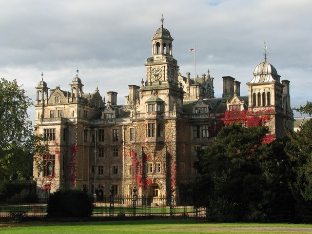
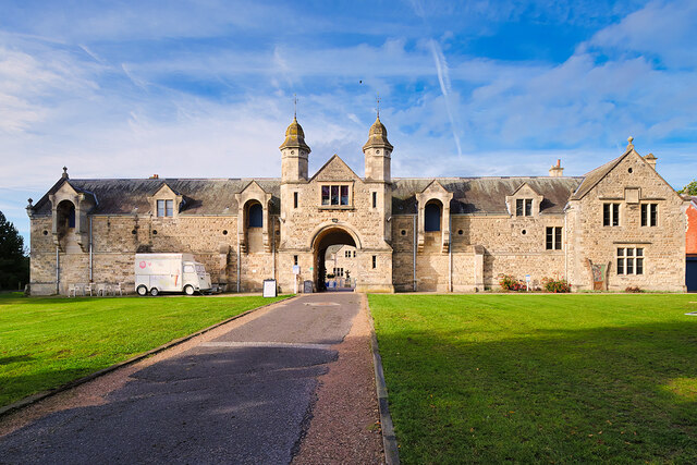
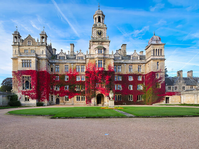
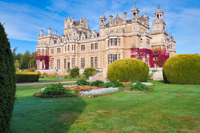
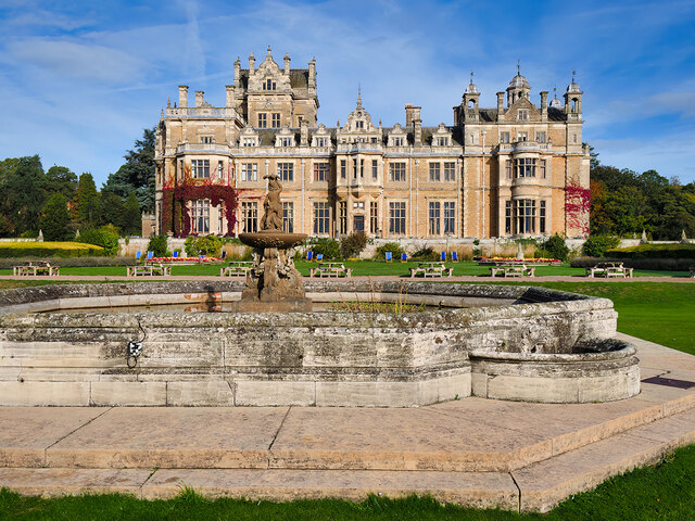
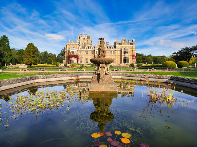
Thoresby Hall

Thoresby Hall is a grade I listed 19th-century country house in Budby, Nottinghamshire, some 2 miles (4 km) north of Ollerton. It is one of four neighbouring...

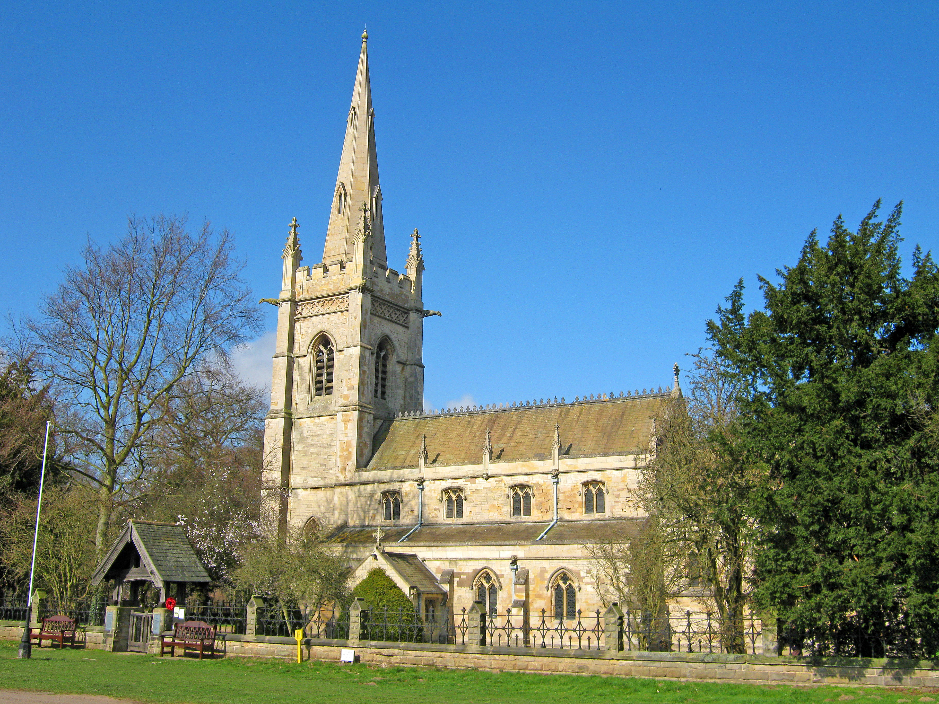
St Giles Church, Carburton

St Giles Church is a redundant Anglican church in Carburton, Nottinghamshire. == History == The church is an unusual shape and dates back to the early...

Perlethorpe

Perlethorpe is a small village and former civil parish, now in the parish of Perlethorpe cum Budby, in the Newark and Sherwood district, in the county...

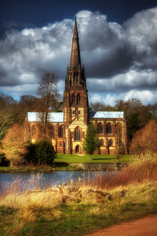
Church of St Mary the Virgin, Clumber Park

The Church of St. Mary the Virgin, Clumber Park, is an Anglican church in Clumber Park, Nottinghamshire, England. The church is Grade I listed by English...

Clumber and Hardwick

Clumber and Hardwick is a civil parish in the Bassetlaw district, in the county of Nottinghamshire, England. The parish includes the settlement of Hardwick...

Nearby Amenities

Located within 500m of 53.239652,-1.0688599
Bench
Lat/Long: 53.2425416/-1.0691934
Bench
Lat/Long: 53.2422174/-1.0693811
The data included in this document is from www.openstreetmap.org. The data is made available under ODbL.

Have you been to Charcoal Plantation?

Leave your review of Charcoal Plantation below (or comments, questions and feedback).