Fishpond Plantation

Wood, Forest in Yorkshire Ryedale

England

Fishpond Plantation

Views near Rievaulx Hole Trig Point
Views near Rievaulx Hole Trig Point Credit: thejackrustles

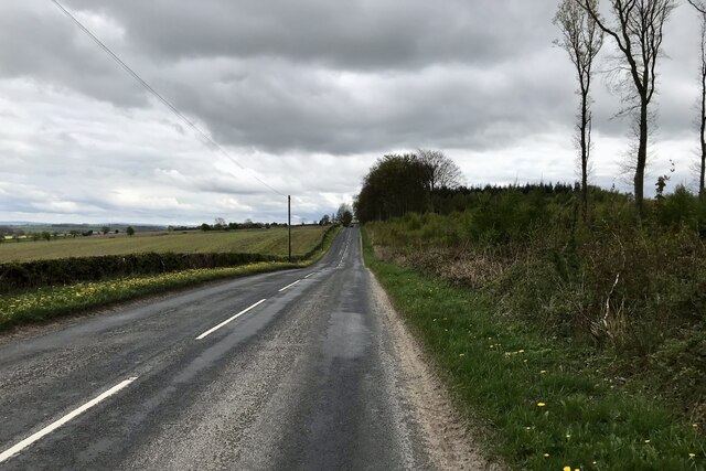
Fishpond Plantation is a picturesque woodland located in Yorkshire, England. Situated in the heart of the county, it covers an area of approximately 200 acres and is known for its diverse and vibrant plant life. The plantation is named after the numerous fishponds that were once used for breeding fish, which were an important food source for the local community in the past.

The woodland is dominated by a mix of deciduous and coniferous trees, creating a unique and enchanting atmosphere. Ancient oak and beech trees provide a majestic canopy, while the smaller birch and rowan trees add to the overall diversity of the plantation. The forest floor is covered with a rich carpet of ferns, wildflowers, and mosses, creating a haven for various species of insects, birds, and small mammals.

Visitors to Fishpond Plantation can enjoy a range of activities, including hiking, birdwatching, and photography. There are several well-marked trails that wind through the woodland, allowing visitors to explore its hidden corners and discover its natural wonders. The plantation also features a small nature reserve, which serves as a sanctuary for rare and endangered plant species.

The peaceful ambiance of Fishpond Plantation makes it an ideal place for nature enthusiasts and those seeking tranquility. It offers a retreat from the hustle and bustle of everyday life, allowing visitors to immerse themselves in the beauty of nature. Whether it's a leisurely stroll along the trails or a picnic under the shade of a towering tree, Fishpond Plantation offers a truly serene and captivating experience.

If you have any feedback on the listing, please let us know in the comments section below.

Fishpond Plantation Images

Images are sourced within 2km of 54.196843/-1.0475872 or Grid Reference SE6278. Thanks to Geograph Open Source API. All images are credited.

Views near Rievaulx Hole Trig Point
Location of Gilling East Surface Block <span class="nowrap"><a title="http://trigpointing.uk/trig/160" rel="nofollow ugc noopener" href="http://trigpointing.uk/trig/160">Link</a><img style="margin-left:2px;" alt="External link" title="External link - shift click to open in new window" src="https://s1.geograph.org.uk/img/external.png" width="10" height="10"/></span>
Location of Gilling East Surface Block
Gilling East, Holy Cross church The benchmark is cut into the west facing wall of the church tower.
Gilling East, Holy Cross church
The benchmark is cut into the west facing wall of the church tower.
Gilling East, Holy Cross church There is a benchmark cut into the west facing wall of the church tower.
Gilling East, Holy Cross church
There is a benchmark cut into the west facing wall of the church tower.
Cawton, farm building The benchmark is cut into a left cornerstone of this roadside farm building, and is about 4ft from ground level.
Cawton, farm building
The benchmark is cut into a left cornerstone of this roadside farm building, and is about 4ft from ground level.
Cawton, farm building There is a benchmark cut into a left cornerstone of this roadside farm building, and is about 4ft from ground level.
Cawton, farm building
There is a benchmark cut into a left cornerstone of this roadside farm building, and is about 4ft from ground level.
B1257 near Oswaldkirk
Church of the Holy Cross, Gilling East Holy Cross Church is a parish church which serves the village and parish of Gilling East. The parish contains the villages of Gilling, Cawton, and Grimston. It is Grade I-listed (List Entry Number 1296322 <span class="nowrap"><a title="https://historicengland.org.uk/listing/the-list/list-entry/1296322?section=official-list-entry" rel="nofollow ugc noopener" href="https://historicengland.org.uk/listing/the-list/list-entry/1296322?section=official-list-entry">Link</a><img style="margin-left:2px;" alt="External link" title="External link - shift click to open in new window" src="https://s1.geograph.org.uk/img/external.png" width="10" height="10"/></span> Historic England).

The oldest part of the church, the arcade dates from around the year 1200. The chancel was added early in the 14th century, and the southern arcade was added slightly later. The tower was added in the late 15th century.
Church of the Holy Cross, Gilling East
Holy Cross Church is a parish church which serves the village and parish of Gilling East. The parish contains the villages of Gilling, Cawton, and Grimston. It is Grade I-listed (List Entry Number 1296322 LinkExternal link Historic England). The oldest part of the church, the arcade dates from around the year 1200. The chancel was added early in the 14th century, and the southern arcade was added slightly later. The tower was added in the late 15th century.
Holy Cross Church, Gilling East Holy Cross Church is a parish church which serves the village and parish of Gilling East. The parish contains the villages of Gilling, Cawton, and Grimston. It is Grade I-listed (List Entry Number 1296322 <span class="nowrap"><a title="https://historicengland.org.uk/listing/the-list/list-entry/1296322?section=official-list-entry" rel="nofollow ugc noopener" href="https://historicengland.org.uk/listing/the-list/list-entry/1296322?section=official-list-entry">Link</a><img style="margin-left:2px;" alt="External link" title="External link - shift click to open in new window" src="https://s1.geograph.org.uk/img/external.png" width="10" height="10"/></span> Historic England).

The oldest part of the church, the arcade dates from around the year 1200. The chancel was added early in the 14th century, and the southern arcade was added slightly later. The tower was added in the late 15th century.
Holy Cross Church, Gilling East
Holy Cross Church is a parish church which serves the village and parish of Gilling East. The parish contains the villages of Gilling, Cawton, and Grimston. It is Grade I-listed (List Entry Number 1296322 LinkExternal link Historic England). The oldest part of the church, the arcade dates from around the year 1200. The chancel was added early in the 14th century, and the southern arcade was added slightly later. The tower was added in the late 15th century.
Gilling East War Memorial Arch at Holy Cross Church The War memorial at Gilling East forms the entrance archway to the Parish Church of the Holy Cross. It commemorates the residents of Gilling East, Grimstone and Cawton who were killed or missing in the First World War. The names of 13 men are shown on 2 bronze plaques fixed to the pillars on either side of the archway. Of these 13 names, 7 were from the Yorkshire Regiment.

Wide buttressed pillars support a Tudor arch topped with a stone slate hipped roof. A form of Fleury cross in stone rises from the centre. The lintel carries a raised inscription, in white outlined in gold paint and on a red background, in Gothic lettering and reading: 
In Memory of the men of Gilling East, Grimstone and Cawton who gave their lives in the Great War 1914 1919. 

The memorial is Grade II-listed (List Entry Number: 1392270 <span class="nowrap"><a title="https://historicengland.org.uk/listing/the-list/list-entry/1392270?section=official-list-entry" rel="nofollow ugc noopener" href="https://historicengland.org.uk/listing/the-list/list-entry/1392270?section=official-list-entry">Link</a><img style="margin-left:2px;" alt="External link" title="External link - shift click to open in new window" src="https://s1.geograph.org.uk/img/external.png" width="10" height="10"/></span> Historic England).
Gilling East War Memorial Arch at Holy Cross Church
The War memorial at Gilling East forms the entrance archway to the Parish Church of the Holy Cross. It commemorates the residents of Gilling East, Grimstone and Cawton who were killed or missing in the First World War. The names of 13 men are shown on 2 bronze plaques fixed to the pillars on either side of the archway. Of these 13 names, 7 were from the Yorkshire Regiment. Wide buttressed pillars support a Tudor arch topped with a stone slate hipped roof. A form of Fleury cross in stone rises from the centre. The lintel carries a raised inscription, in white outlined in gold paint and on a red background, in Gothic lettering and reading: In Memory of the men of Gilling East, Grimstone and Cawton who gave their lives in the Great War 1914 1919. The memorial is Grade II-listed (List Entry Number: 1392270 LinkExternal link Historic England).
Station Road, Gilling East
Fairfax Arms, Gilling East
New milepost In 2003 the milepost at this site was recorded as cracked but repaired.   In 2010 it was destroyed by vehicular impact.   It had been cast at the foundry of F Mattison & Co. Bedale.   Ryedale UDC had this identical replacement cast at Cleveland Corrosion and it was set up in 2011.
New milepost
In 2003 the milepost at this site was recorded as cracked but repaired. In 2010 it was destroyed by vehicular impact. It had been cast at the foundry of F Mattison & Co. Bedale. Ryedale UDC had this identical replacement cast at Cleveland Corrosion and it was set up in 2011.
New milepost A winter view of the replacement milepost with Malton and the Derwent Valley below the horizon.
New milepost
A winter view of the replacement milepost with Malton and the Derwent Valley below the horizon.
New milepost This is one of several replacement mileposts set up by Ryedale Urban District Council about 2010/11.  They were cast at Cleveland Corrosion in Staithes.   Authentic, as they have the hands pointing the wrong way as the original was cast by Mattison's of Bedale.
New milepost
This is one of several replacement mileposts set up by Ryedale Urban District Council about 2010/11. They were cast at Cleveland Corrosion in Staithes. Authentic, as they have the hands pointing the wrong way as the original was cast by Mattison's of Bedale.
Old milepost This is one of the original late 19thC castings with the hands pointing the wrong way.   Ryedale HD stands for Ryedale Highways District.   Highways Districts were responsible for road maintenance before and just after County Councils were set up in the 1880s.   The name of the foundry, Mattison's of Bedale, is cast inside the left hand side.
Old milepost
This is one of the original late 19thC castings with the hands pointing the wrong way. Ryedale HD stands for Ryedale Highways District. Highways Districts were responsible for road maintenance before and just after County Councils were set up in the 1880s. The name of the foundry, Mattison's of Bedale, is cast inside the left hand side.
Old milestone One of four remaining stepstone milestones set up by the York to Oswaldkirk Bank turnpike trust first enacted in 1768.   It was agreed in the Minutes of 1772 to set up stones at 3 mile intervals with wooden posts in the intervening miles.  Each stone had the mileage to York and Helmsley inscribed but most of the legends are illegible now. This one is York 18/Helmsley 5.
Old milestone
One of four remaining stepstone milestones set up by the York to Oswaldkirk Bank turnpike trust first enacted in 1768. It was agreed in the Minutes of 1772 to set up stones at 3 mile intervals with wooden posts in the intervening miles. Each stone had the mileage to York and Helmsley inscribed but most of the legends are illegible now. This one is York 18/Helmsley 5.
Old milestone A view across the small stream by the milestone showing a stone to commemorate the Queen's Sapphire jubilee.  The front face of the milestone has the remnants of the legend YORK/18.   HELMSLEY/5, once inscribed on the left face, has completely eroded away.
Old milestone
A view across the small stream by the milestone showing a stone to commemorate the Queen's Sapphire jubilee. The front face of the milestone has the remnants of the legend YORK/18. HELMSLEY/5, once inscribed on the left face, has completely eroded away.
Show me another place!

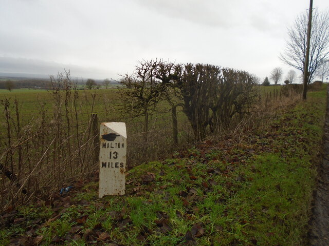
Fishpond Plantation is located at Grid Ref: SE6278 (Lat: 54.196843, Lng: -1.0475872)

Division: North Riding

Administrative County: North Yorkshire

District: Ryedale

Police Authority: North Yorkshire

What 3 Words

///alienated.scatters.bench. Near Helmsley, North Yorkshire

Nearby Locations

Fishpond Plantation

Related Wikis

Church of Saint Oswald, King and Martyr, Oswaldkirk

The Church of Saint Oswald, King and Martyr is an Anglican church serving the village and parish of Oswaldkirk, North Yorkshire, England. It is located...

Oswaldkirk

Oswaldkirk is a small village and civil parish 4 miles (6.4 km) south of Helmsley and 20 miles (32 km) north of York in North Yorkshire, England. It is...

Gilling railway station

Gilling railway station is a disused railway station in North Yorkshire, England that served the village of Gilling East. East of it, the Gilling and Pickering...

Holy Cross Church, Gilling

Holy Cross Church is a parish church which serves the village and parish of Gilling East in North Yorkshire, England. The parish contains the villages...

Gilling East

Gilling East is a village and civil parish in North Yorkshire, England, on the main B1363 road between York and Helmsley, 2 miles (3.2 km) south of Oswaldkirk...

St Martin's Ampleforth

St Martin's Ampleforth (SMA) was a private school and the preparatory school for Ampleforth College, which closed in July 2020. Until 2018 it was at Gilling...

Gilling Castle

Gilling Castle is a Grade I listed country house near Gilling East, North Yorkshire, England (grid reference SE611768). == History == The castle was originally...

Ampleforth College

Ampleforth College is a co-educational fee-charging boarding and day school in the English public school tradition. It opened in 1802 as a boys' school...

Nearby Amenities

Located within 500m of 54.196843,-1.0475872
The data included in this document is from www.openstreetmap.org. The data is made available under ODbL.

Have you been to Fishpond Plantation?

Leave your review of Fishpond Plantation below (or comments, questions and feedback).