Ashendon

Settlement in Buckinghamshire

England

Ashendon

Pasture, Ashendon Ewes and lambs in a rather weedy field crossed by the more easterly of the two footpaths south of Lower Pollicott.
Pasture, Ashendon Credit: Andrew Smith

Ashendon is a small village located in the county of Buckinghamshire, England. Situated approximately five miles northwest of the market town of Aylesbury, Ashendon is nestled within the picturesque countryside of the Chiltern Hills. The village is part of the Aylesbury Vale district and falls under the civil parish of Ashendon with Boarstall.

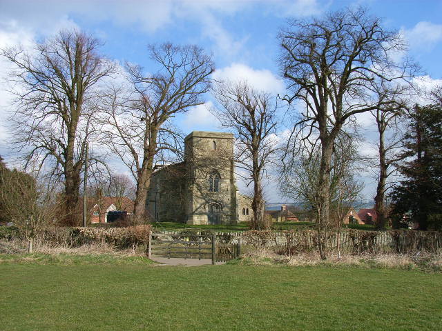
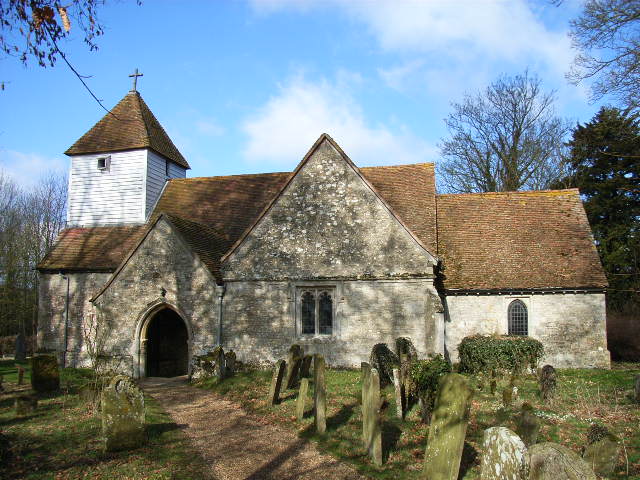
Historically, Ashendon has a rich heritage dating back to the medieval period. The village is home to St. Mary's Church, a Grade II listed building that dates back to the 13th century. The church features a beautiful timber-framed bell tower and is known for its stunning stained glass windows.

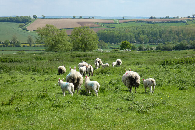
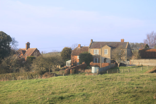
With a population of around 200 residents, Ashendon is a close-knit community that offers a peaceful and idyllic setting. The village is characterized by its charming thatched cottages, traditional red-brick houses, and well-maintained gardens. The surrounding countryside provides ample opportunities for outdoor activities such as walking, cycling, and horse riding.

Although Ashendon is primarily a residential area, there are a few amenities available to residents and visitors. These include a village hall, a local pub, and a cricket pitch. For more extensive amenities and services, the nearby town of Aylesbury offers a wider range of shops, restaurants, and recreational facilities.

Overall, Ashendon is a tranquil and picturesque village, perfect for those seeking a rural retreat while remaining within easy reach of larger towns and cities.

If you have any feedback on the listing, please let us know in the comments section below.
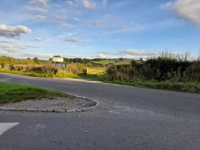
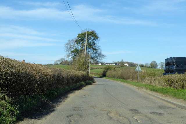
Ashendon Images

Images are sourced within 2km of 51.821671/-0.978607 or Grid Reference SP7014. Thanks to Geograph Open Source API. All images are credited.

Pasture, Ashendon Ewes and lambs in a rather weedy field crossed by the more easterly of the two footpaths south of Lower Pollicott.
Pasture, Ashendon
Ewes and lambs in a rather weedy field crossed by the more easterly of the two footpaths south of Lower Pollicott.
Pasture, Ashendon A bridleway follows the edge of a field shared by cattle and sheep at Watbridge Farm.
Pasture, Ashendon
A bridleway follows the edge of a field shared by cattle and sheep at Watbridge Farm.
Road junction in Dorton
Pasture, Wotton Underwood A little used footpath follows the field's edge in cattle-grazed pasture.
Pasture, Wotton Underwood
A little used footpath follows the field's edge in cattle-grazed pasture.
Farmland, Ashendon Arable fields are seen below cut silage fields on the hillside to the west of the village.
Farmland, Ashendon
Arable fields are seen below cut silage fields on the hillside to the west of the village.
Farmland, Ashendon Pasture and a cut silage field are viewed from the footpath dropping down to the south-west of Upper Pollicott.
Farmland, Ashendon
Pasture and a cut silage field are viewed from the footpath dropping down to the south-west of Upper Pollicott.
Footpath at Brackwell Farm
Fields and trees near Ashendon An irregular fence line follows the tree lined meanders of a small brook.
Fields and trees near Ashendon
An irregular fence line follows the tree lined meanders of a small brook.
Road to Ashendon The road slopes up to Ashendon which is on top of a hill,
Road to Ashendon
The road slopes up to Ashendon which is on top of a hill,
Houses at Upper Pollicott Viewed from the road to Lower Pollicott.
Houses at Upper Pollicott
Viewed from the road to Lower Pollicott.
Fields and hedges near Ashendon
Ashendon, St Mary
Ashendon, St Mary
Road from Ashendon to Westcott By Watbridge Farm Cottages.
Road from Ashendon to Westcott
By Watbridge Farm Cottages.
Road from Ashendon to Westcott
Sheep, Ashendon
Sheep, Ashendon
Road towards Ashendon, Upper Pollicott
Road to Ashendon at brook crossing A tributary of the Thame separates the parishes of Ashendon and Chearsley.
Road to Ashendon at brook crossing
A tributary of the Thame separates the parishes of Ashendon and Chearsley.
Road towards Ashendon
Show me another place!

Ashendon is located at Grid Ref: SP7014 (Lat: 51.821671, Lng: -0.978607)

Unitary Authority: Buckinghamshire

Police Authority: Thames Valley

What 3 Words

///careful.slack.audibly. Near Waddesdon, Buckinghamshire

Nearby Locations

Ashendon Ashendon

Related Wikis

Ashendon

Ashendon is a small village and civil parish in Buckinghamshire, England. It is about nine miles west of Aylesbury and seven miles north of Thame. The...
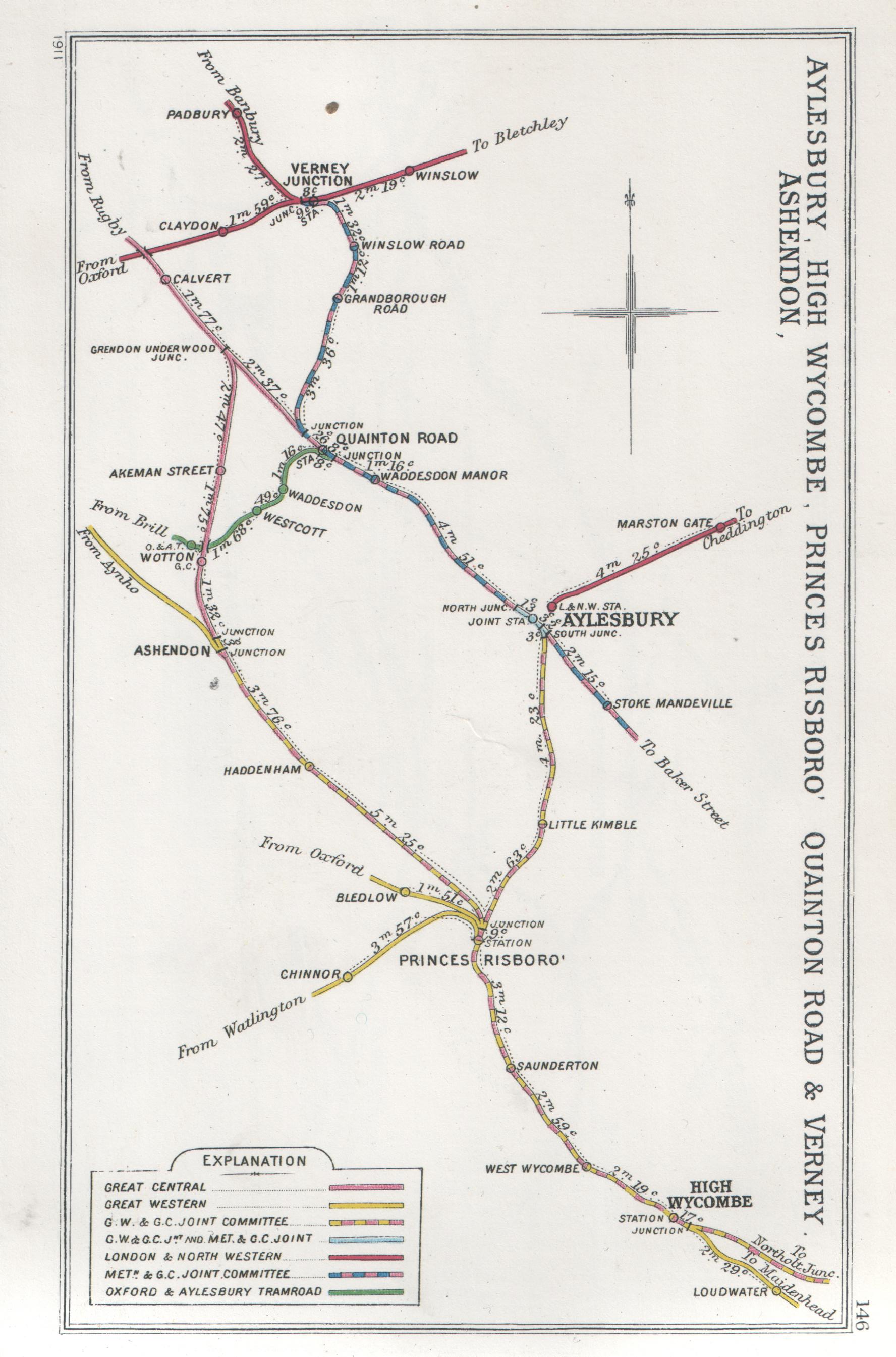
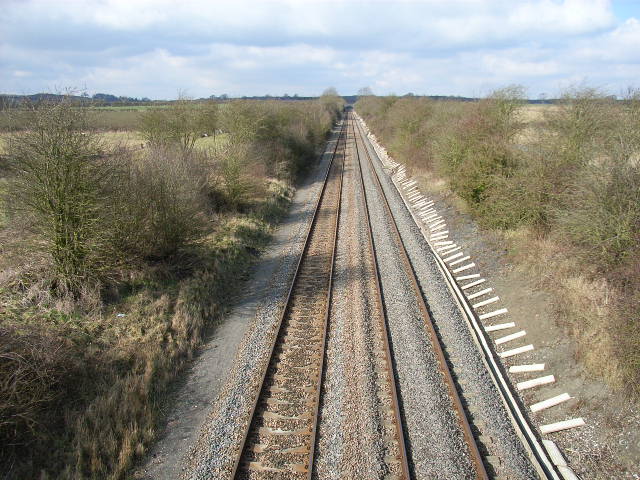
Ashendon Junction

Ashendon Junction in Buckinghamshire, England, was a major mainline railway junction where, from July 1910, the Great Western Railway's (GWR) London-Birmingham...

Wotton railway station (Great Central Railway)

Wotton was a railway station at Wotton Underwood, Buckinghamshire, on the Great Central Railway's link line between Calvert and Ashendon Junction. ��2...

Wotton railway station (Brill Tramway)

Wotton railway station was a small station in Buckinghamshire, England, built by the Duke of Buckingham in 1871. Part of a private horse-drawn tramway...

Rocket Propulsion Establishment

The Rocket Propulsion Establishment at Westcott, Buckinghamshire on the site of the former RAF Westcott has made a number of notable contributions in the...

Dorton Halt railway station

Dorton Halt railway station was a railway station serving the village of Dorton in Buckinghamshire. It was on what is now known as the Chiltern Main Line...

Wotton Underwood

Wotton Underwood is a village and civil parish in Buckinghamshire, England, 7 miles (11 km) north of Thame, Oxfordshire. The toponym is derived from the...

Dorton

Dorton (or Dourton) is a village and civil parish in the Aylesbury Vale district of Buckinghamshire. It is in the western part of the county, about 5 miles...

Nearby Amenities

Located within 500m of 51.821671,-0.978607
Ashendon
Place: village
Source: NPE
Wikidata: Q3481805
Wikipedia: en:Ashendon
Lat/Long: 51.8228083/-0.9770245
Ele NPE: 484 ft
Fixme: ?metric?
Source: npe
Lat/Long: 51.8216636/-0.9829542
Post Box
Brand: Royal Mail
Brand Wikidata: Q638098
Brand Wikipedia: en:Royal Mail
Collection Times: Mo-Fr 17:00; Sa 09:45
Operator: Royal Mail
Operator Type: private
Operator Wikidata: Q638098
Post Box Type: lamp
Ref: HP18 200
Royal Cypher: EIIR
Royal Cypher Wikidata: Q33102113
Source: survey
Survey Date: 2015-08-02
Lat/Long: 51.8235315/-0.9792353
Post Box
Brand: Royal Mail
Brand Wikidata: Q638098
Brand Wikipedia: en:Royal Mail
Collection Times: Mo-Fr 15:45; Sa 08:00
Operator: Royal Mail
Operator Type: private
Operator Wikidata: Q638098
Post Box Type: lamp
Ref: HP18 201
Royal Cypher: EIIR
Royal Cypher Wikidata: Q33102113
Source: survey
Survey Date: 2015-08-02
Lat/Long: 51.8239006/-0.9752183
Barrier: kissing_gate
Lat/Long: 51.8235733/-0.9785601
Barrier: stile
Stile: stepover
Lat/Long: 51.8254116/-0.9768824
Barrier: stile
Material: wood
Stile: stepover
Lat/Long: 51.8253802/-0.9769442
Bench
Backrest: yes
Lat/Long: 51.8222798/-0.9781265
Entrance: yes
Lat/Long: 51.8220564/-0.9783485
Bench
Backrest: yes
Lat/Long: 51.8220664/-0.9782875
Entrance: yes
Lat/Long: 51.8219959/-0.9797359
Leisure: picnic_table
Lat/Long: 51.8219974/-0.97971
Playground: structure
Lat/Long: 51.8222325/-0.9794653
Playground: swing
Lat/Long: 51.8221945/-0.9795582
Playground: slide
Lat/Long: 51.8221601/-0.9796397
Playground: swing
Lat/Long: 51.8221319/-0.9797063
Fitness Station: balance_posts
Leisure: balance_beam
Lat/Long: 51.8220805/-0.9795769
Fitness Station: balance_posts
Leisure: fitness_station
Sport: fitness
Lat/Long: 51.8221659/-0.9793724
Playground: springy
Lat/Long: 51.822129/-0.9794703
Bench
Backrest: yes
Lat/Long: 51.82193/-0.9798892
Bench
Backrest: yes
Lat/Long: 51.8219231/-0.9799057
Bench
Backrest: yes
Lat/Long: 51.8219584/-0.9802277
Bench
Backrest: no
Lat/Long: 51.8218558/-0.9799317
Bench
Backrest: no
Lat/Long: 51.8218533/-0.9799558
Bench
Backrest: no
Lat/Long: 51.8218426/-0.9799813
Bench
Backrest: no
Lat/Long: 51.8218326/-0.9800094
Bench
Backrest: yes
Lat/Long: 51.8221319/-0.9792048
Bench
Backrest: yes
Lat/Long: 51.8220525/-0.9797439
Waste Basket
Waste: trash
Lat/Long: 51.820503/-0.9804041
Bench
Backrest: yes
Lat/Long: 51.8204965/-0.9804282
Direction: 195
Generator Method: photovoltaic
Generator Output Electricity: yes
Generator Solar Modules: 34
Generator Source: solar
Generator Type: solar_photovoltaic_panel
Location: roof
Power: generator
Lat/Long: 51.8201007/-0.9809849
Direction: 215
Generator Method: photovoltaic
Generator Output Electricity: yes
Generator Solar Modules: 7
Generator Source: solar
Generator Type: solar_photovoltaic_panel
Location: roof
Power: generator
Lat/Long: 51.8226561/-0.9764258
Direction: 125
Generator Method: photovoltaic
Generator Output Electricity: yes
Generator Solar Modules: 6
Generator Source: solar
Generator Type: solar_photovoltaic_panel
Location: roof
Power: generator
Lat/Long: 51.8228231/-0.976293
Direction: SE
Generator Method: photovoltaic
Generator Output Electricity: yes
Generator Solar Modules: 14
Generator Source: solar
Generator Type: solar_photovoltaic_panel
Location: roof
Power: generator
Lat/Long: 51.8234625/-0.9768551
The data included in this document is from www.openstreetmap.org. The data is made available under ODbL.

Have you been to Ashendon?

Leave your review of Ashendon below (or comments, questions and feedback).