Meandown Copse

Wood, Forest in Berkshire

England

Meandown Copse

Edge of the Terrace, Basildon Park An ornamental wall at the edge of the formal garden on the east side of Basildon House.
Edge of the Terrace, Basildon Park Credit: Des Blenkinsopp

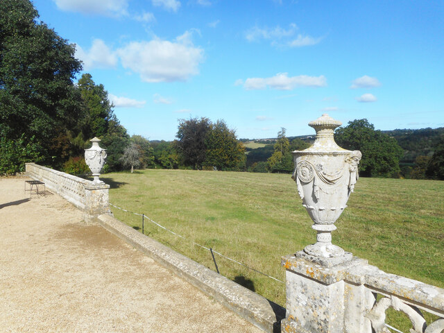
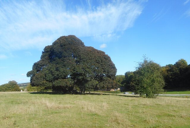
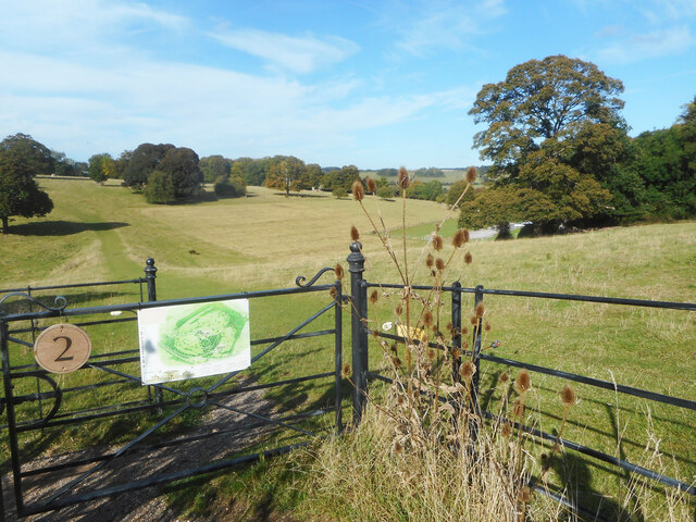
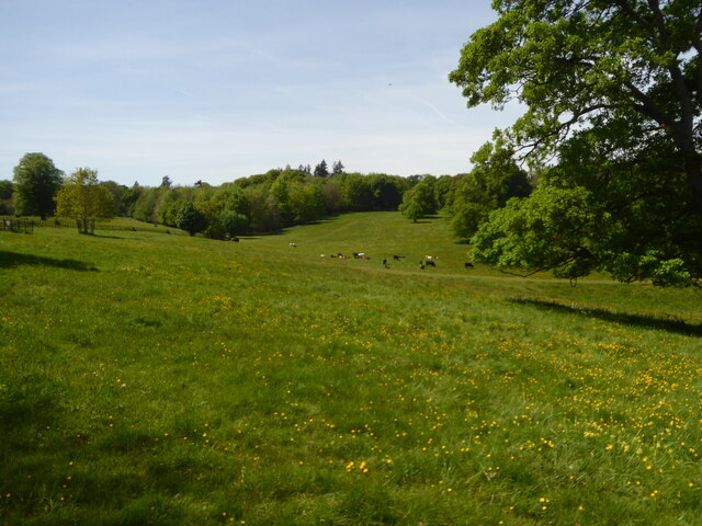
Meandown Copse is a beautiful woodland area located in the county of Berkshire, England. Covering an area of approximately 50 acres, this ancient forest is known for its diverse flora and fauna, making it a popular destination for nature enthusiasts and hikers.

The copse is characterized by its dense canopy of tall, mature trees, including oak, beech, and birch. These majestic trees create a serene and peaceful atmosphere, providing shade and shelter for a variety of wildlife. The forest floor is covered in a thick layer of leaf litter, interspersed with patches of wildflowers, ferns, and mosses, creating a rich and vibrant ecosystem.

Visitors to Meandown Copse can expect to encounter a wide range of wildlife. Squirrels and rabbits can often be seen darting through the undergrowth, while birdwatchers may spot woodpeckers, owls, and various species of songbirds. The copse is also home to an array of insects, including butterflies and dragonflies, which add dashes of color to the woodland landscape.

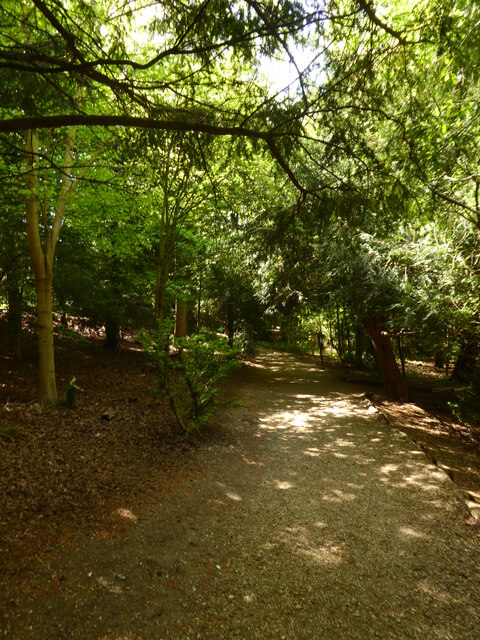
Several well-maintained trails wind their way through the copse, allowing visitors to explore its natural beauty at their own pace. These paths offer opportunities for leisurely walks, jogging, or even picnicking in the tranquil surroundings. The copse is also a popular spot for photography enthusiasts, who can capture the stunning vistas and capture close-ups of the diverse plant and animal life.

Overall, Meandown Copse is a haven of natural beauty, offering a peaceful retreat from the hustle and bustle of everyday life. Whether you are a nature lover, an avid hiker, or simply seeking solace in nature, this enchanting forest is sure to captivate and rejuvenate all who visit.

If you have any feedback on the listing, please let us know in the comments section below.

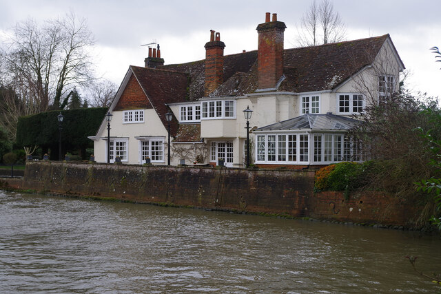
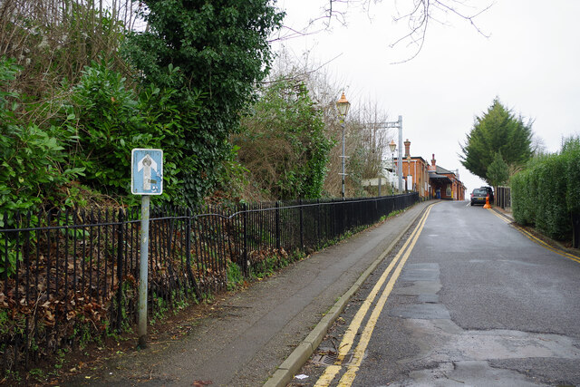
Meandown Copse Images

Images are sourced within 2km of 51.491107/-1.1124666 or Grid Reference SU6177. Thanks to Geograph Open Source API. All images are credited.

Edge of the Terrace, Basildon Park An ornamental wall at the edge of the formal garden on the east side of Basildon House.
Edge of the Terrace, Basildon Park
An ornamental wall at the edge of the formal garden on the east side of Basildon House.
Basildon Park A traditional bit of country house parkland with grazing and strategically placed trees.
This is actually several closely planted trees all growing together into a single canopy.
Basildon Park
A traditional bit of country house parkland with grazing and strategically placed trees. This is actually several closely planted trees all growing together into a single canopy.
View across Basildon Park The north west bit of the park viewed from near the house.
View across Basildon Park
The north west bit of the park viewed from near the house.
The Swan, Pangbourne As the writing on the wall makes clear, this riverside pub on Shooter's Hill is believed to date from 1642. Internally it is surprisingly large with a number of separate areas and there is a terrace overlooking the Thames on the other side. The pub gets a mention in Jerome K Jerome's classic 'Three Men in a Boat' - it was here that they abandoned their boat in the last chapter before getting a train to London for a good meal. According to one story, the county boundary between Berkshire and Oxfordshire used to pass through the building necessitating two separate licences and different closing times for each half of the bar. See <a href="https://www.geograph.org.uk/photo/4642616">SU6376 : The Swan Inn, Pangbourne</a> for a wider view.
The Swan, Pangbourne
As the writing on the wall makes clear, this riverside pub on Shooter's Hill is believed to date from 1642. Internally it is surprisingly large with a number of separate areas and there is a terrace overlooking the Thames on the other side. The pub gets a mention in Jerome K Jerome's classic 'Three Men in a Boat' - it was here that they abandoned their boat in the last chapter before getting a train to London for a good meal. According to one story, the county boundary between Berkshire and Oxfordshire used to pass through the building necessitating two separate licences and different closing times for each half of the bar. See SU6376 : The Swan Inn, Pangbourne for a wider view.
Weirpool, Pangbourne This large house overlooking the River Thames at Pangbourne - just below the weir - dates from about 1650 although there were alterations and additions in around 1900. It is grade II listed.
Weirpool, Pangbourne
This large house overlooking the River Thames at Pangbourne - just below the weir - dates from about 1650 although there were alterations and additions in around 1900. It is grade II listed.
To the station at Pangbourne This access road leads up from Shooter's Hill to Pangbourne station and then back down again - the loop sensibly designated as a one way street. The Great Western Railway buildings, iron railings and mock gas lamps all help to create a slightly olde-world atmosphere despite a few modern intrusions.
To the station at Pangbourne
This access road leads up from Shooter's Hill to Pangbourne station and then back down again - the loop sensibly designated as a one way street. The Great Western Railway buildings, iron railings and mock gas lamps all help to create a slightly olde-world atmosphere despite a few modern intrusions.
Under the railway at Pangbourne The bridge that connects Shooter's Hill with Station Road under the Great Western main line railway has a separate pedestrian subway section that is partly lined with white glazed bricks. It could be an unpleasant spot but in well-heeled Pangbourne it is kept acceptably clean and tidy with a refreshing absence of graffiti.
Under the railway at Pangbourne
The bridge that connects Shooter's Hill with Station Road under the Great Western main line railway has a separate pedestrian subway section that is partly lined with white glazed bricks. It could be an unpleasant spot but in well-heeled Pangbourne it is kept acceptably clean and tidy with a refreshing absence of graffiti.
Pangbourne village sign This well-maintained village sign stands adjacent to the village hall car park. It depicts Bertwulf, King of Mercia, who was granted land here in AD844.
Pangbourne village sign
This well-maintained village sign stands adjacent to the village hall car park. It depicts Bertwulf, King of Mercia, who was granted land here in AD844.
The Cross Keys, Pangbourne This Church Road pub is part of the Greene King estate and has a rear garden on the banks of the River Pang. The building dates from the early to mid 18th century, with 19th century alterations and additions, and is grade II listed.
The Cross Keys, Pangbourne
This Church Road pub is part of the Greene King estate and has a rear garden on the banks of the River Pang. The building dates from the early to mid 18th century, with 19th century alterations and additions, and is grade II listed.
River Thames, Pangbourne A number of vessels are moored here on the Pangbourne bank of the river just upstream from Whitchurch Bridge.
River Thames, Pangbourne
A number of vessels are moored here on the Pangbourne bank of the river just upstream from Whitchurch Bridge.
Whitchurch Bridge - toll booth The first bridge spanning the River Thames connecting Whitchurch to Pangbourne was built in 1792; at the same time the toll house (seen here in the background) was constructed at the northern end of the bridge. The original timber bridge was replaced with another wooden bridge of a different design in 1853. That in turn was replaced with an iron bridge in 1902 which was strengthened in the 1920s. A fourth bridge was built in 2014 with a similar visual appearance to the 1902 bridge but better able to cope with modern traffic conditions. The bridge remains privately owned, changing hands for the first time in 2019 when it was sold to the General Estates Company Ltd; nevertheless it carries a classified road, the B471. The toll booth dates from 1992 and the current charge for cars is 60p.
Whitchurch Bridge - toll booth
The first bridge spanning the River Thames connecting Whitchurch to Pangbourne was built in 1792; at the same time the toll house (seen here in the background) was constructed at the northern end of the bridge. The original timber bridge was replaced with another wooden bridge of a different design in 1853. That in turn was replaced with an iron bridge in 1902 which was strengthened in the 1920s. A fourth bridge was built in 2014 with a similar visual appearance to the 1902 bridge but better able to cope with modern traffic conditions. The bridge remains privately owned, changing hands for the first time in 2019 when it was sold to the General Estates Company Ltd; nevertheless it carries a classified road, the B471. The toll booth dates from 1992 and the current charge for cars is 60p.
The Greyhound, Whitchurch-on-Thames One of two pubs in the village, the Greyhound was first recorded as a public house in 1831 and was converted by Blatch's Brewery of Theale, Berkshire from cottage properties; further major alterations were made in 1879. It is believed that the building may have been occupied at one time by a ferryman, although this would presumably have been before 1792 when the bridge was opened. Blatch's pub estate of 22 houses was absorbed by Ind Coope in 1965 and since 2021 the Greyhound has been part of Oak Taverns Group.
The Greyhound, Whitchurch-on-Thames
One of two pubs in the village, the Greyhound was first recorded as a public house in 1831 and was converted by Blatch's Brewery of Theale, Berkshire from cottage properties; further major alterations were made in 1879. It is believed that the building may have been occupied at one time by a ferryman, although this would presumably have been before 1792 when the bridge was opened. Blatch's pub estate of 22 houses was absorbed by Ind Coope in 1965 and since 2021 the Greyhound has been part of Oak Taverns Group.
Eastfield House, Pangbourne Surrounded by Heras fencing and boarded up, Eastfield House operated as a care home until its closure in 2016. As is usually the case with derelict properties like this, there is a long history of planning wrangles that are still not resolved. The owner is Majesticare and the house was registered to provide accommodation for 27 residents; the company first applied to demolish the building in 2014 but this was rejected. Despite obtaining permission (on appeal) in 2016 to build an extension that would increase the provision to 45 bedrooms, Majesticare then announced that the building was unsuitable for continued use as a care home for several reasons amongst which was the impossibility of providing en-suite facilities for all of the bedrooms. Their new proposal was for a completely new building in a similar red brick style that would have a larger basement to accommodate a kitchen and laundry. This was again refused by South Oxfordshire District Council on the grounds that it could adversely affect the conservation area and could harm two protected trees on the site. That decision was reported early in 2019 and three years later nothing appears to have happened except that, no doubt, the building is gradually deteriorating. This must surely be an unsatisfactory state of affairs for all concerned.
Eastfield House, Pangbourne
Surrounded by Heras fencing and boarded up, Eastfield House operated as a care home until its closure in 2016. As is usually the case with derelict properties like this, there is a long history of planning wrangles that are still not resolved. The owner is Majesticare and the house was registered to provide accommodation for 27 residents; the company first applied to demolish the building in 2014 but this was rejected. Despite obtaining permission (on appeal) in 2016 to build an extension that would increase the provision to 45 bedrooms, Majesticare then announced that the building was unsuitable for continued use as a care home for several reasons amongst which was the impossibility of providing en-suite facilities for all of the bedrooms. Their new proposal was for a completely new building in a similar red brick style that would have a larger basement to accommodate a kitchen and laundry. This was again refused by South Oxfordshire District Council on the grounds that it could adversely affect the conservation area and could harm two protected trees on the site. That decision was reported early in 2019 and three years later nothing appears to have happened except that, no doubt, the building is gradually deteriorating. This must surely be an unsatisfactory state of affairs for all concerned.
Coombeside Cottage, Whitchurch-on-Thames Somehow reminiscent of a doll's house, this building, originally two cottages now one, is dated by Historic England as 'probably late 18th century' although other sources suggest 1820. The gothic-style windows are a distinctive feature although the one above the doors has been painted on the wall. At one time one of the cottages served as the village post office. It is grade II listed.
Coombeside Cottage, Whitchurch-on-Thames
Somehow reminiscent of a doll's house, this building, originally two cottages now one, is dated by Historic England as 'probably late 18th century' although other sources suggest 1820. The gothic-style windows are a distinctive feature although the one above the doors has been painted on the wall. At one time one of the cottages served as the village post office. It is grade II listed.
The approach to Basildon House
Parkland at Basildon Park
Path through the woods at Basildon Park
War memorial in the churchyard of St James Church Pangbourne
Show me another place!

Meandown Copse is located at Grid Ref: SU6177 (Lat: 51.491107, Lng: -1.1124666)

Unitary Authority: West Berkshire

Police Authority: Thames Valley

What 3 Words

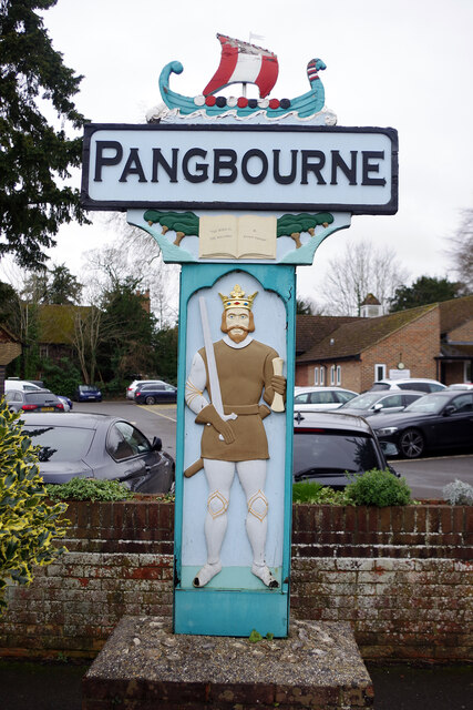
///supposing.compelled.prevented. Near Pangbourne, Berkshire

Related Wikis

Beale Wildlife Park

Beale Wildlife Park is situated by the River Thames, between the villages of Pangbourne and Lower Basildon in Berkshire, England. It has three main areas...
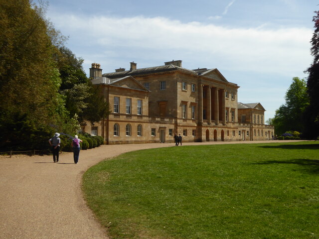
Basildon Park

Basildon Park is a country house situated 2 miles (3 kilometres) south of Goring-on-Thames and Streatley in Berkshire, between the villages of Upper Basildon...

A329 road

The A329 is an east–west road in Southern England that runs from Wentworth in Surrey to Thame in Oxfordshire. == Route == The A329 starts at the A30 in...

Pangbourne College Boat Club

Pangbourne College Boat Club is a rowing club based on the River Thames at Pangbourne College Boathouse, Shooters Hill, Pangbourne, Berkshire. == History... ==

Lower Basildon

Lower Basildon is a small English village in the civil parish of Basildon, near Pangbourne, in the county of Berkshire. == Amenities == === Shops and... ===

Pangbourne railway station

Pangbourne railway station serves the village of Pangbourne in the county of Berkshire, and across the River Thames the village of Whitchurch-on-Thames...
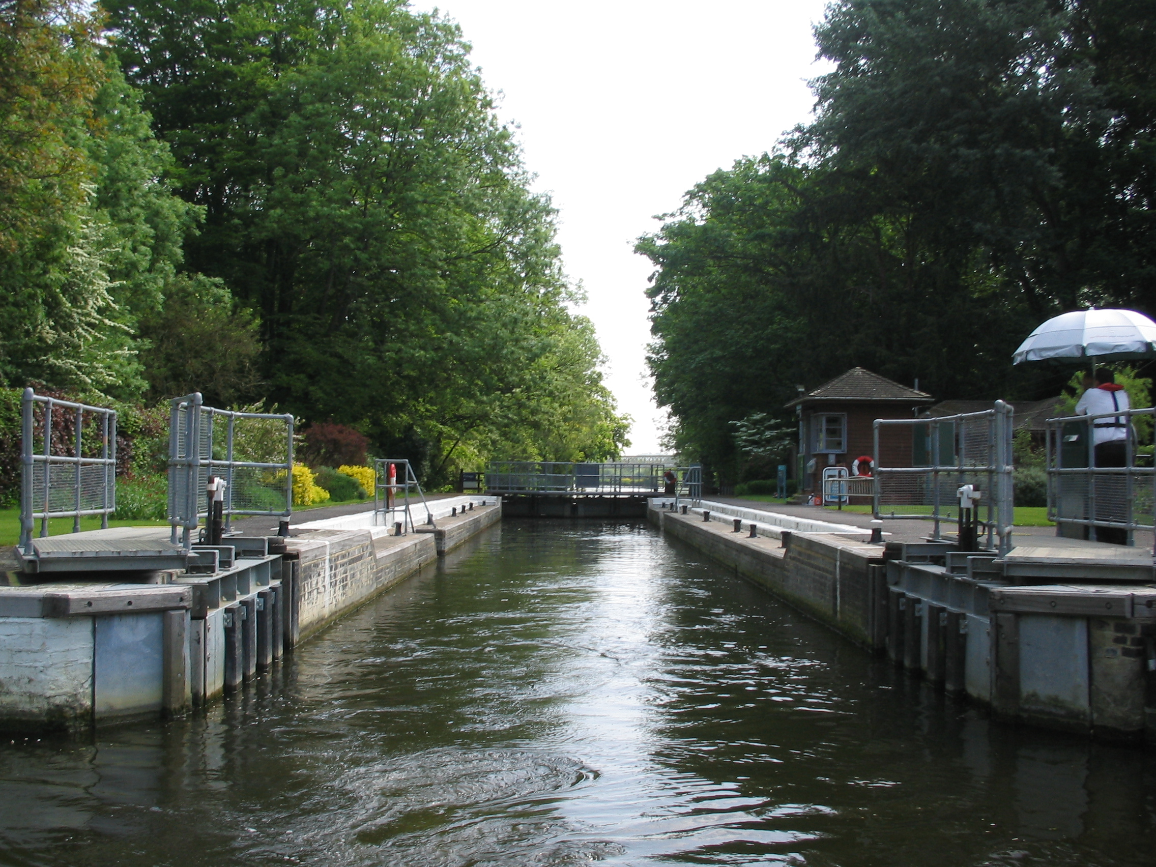
Whitchurch Lock

Whitchurch Lock is a lock and weir on the River Thames in England. It is a pound lock, built by the Thames Navigation Commissioners in 1787. It is on an...

Whitchurch-on-Thames

Whitchurch-on-Thames is a village and civil parish on the Oxfordshire bank of the River Thames, about 5.5 miles (9 km) northwest of Reading, Berkshire...

Nearby Amenities

Located within 500m of 51.491107,-1.1124666
Railway: crossing
Lat/Long: 51.4943954/-1.107639
Tourism: picnic_site
Lat/Long: 51.4936049/-1.1067805
Power: pole
Lat/Long: 51.4942957/-1.1112178
Power: pole
Lat/Long: 51.4935543/-1.11035
Power: pole
Lat/Long: 51.4917382/-1.1081627
Power: pole
Lat/Long: 51.4907028/-1.1069128
Power: pole
Lat/Long: 51.4901466/-1.1062047
The data included in this document is from www.openstreetmap.org. The data is made available under ODbL.

Have you been to Meandown Copse?

Leave your review of Meandown Copse below (or comments, questions and feedback).