Dunston
Settlement in Durham
England
Dunston

Dunston is a small village located in County Durham, in the northeast of England. It lies on the south bank of the River Tyne, just a few miles from the city of Newcastle upon Tyne. The village is known for its picturesque setting, with rolling hills and lush green countryside surrounding it.
Dunston has a long history, dating back to Roman times when a fort was built in the area to guard the river crossing. In the Middle Ages, the village grew as a center for coal mining and shipping, with the river providing an important transport route for goods.
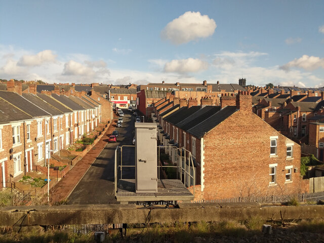
Today, Dunston is a quiet residential area with a mix of traditional stone cottages and more modern housing developments. The village has a small number of shops, pubs, and restaurants, providing essential amenities for its residents. There are also several parks and green spaces, offering opportunities for outdoor recreation.
Overall, Dunston is a charming village with a rich history and a close-knit community, making it a desirable place to live for those seeking a peaceful rural setting within easy reach of urban amenities.
If you have any feedback on the listing, please let us know in the comments section below.
Dunston Images
Images are sourced within 2km of 54.953502/-1.646297 or Grid Reference NZ2262. Thanks to Geograph Open Source API. All images are credited.


Dunston is located at Grid Ref: NZ2262 (Lat: 54.953502, Lng: -1.646297)
Unitary Authority: Gateshead
Police Authority: Northumbria
What 3 Words
///coats.shots.alone. Near Whickham, Tyne & Wear
Nearby Locations
Related Wikis

Dunston UTS F.C.
Dunston UTS Football Club is a football club based in the Dunston area of Gateshead, Tyne and Wear, England. They are currently members of the Northern...
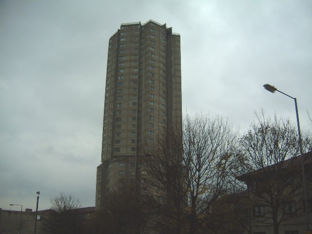
Derwent Tower
Derwent Tower was a 29-storey residential apartment building in Dunston, Tyne and Wear, United Kingdom, opened in 1972. Due to its unusual shape it was...
Dunston, Tyne and Wear
Dunston is a western area of the town of Gateshead on the south bank of the River Tyne, in the Metropolitan Borough of Gateshead, North East England (into...
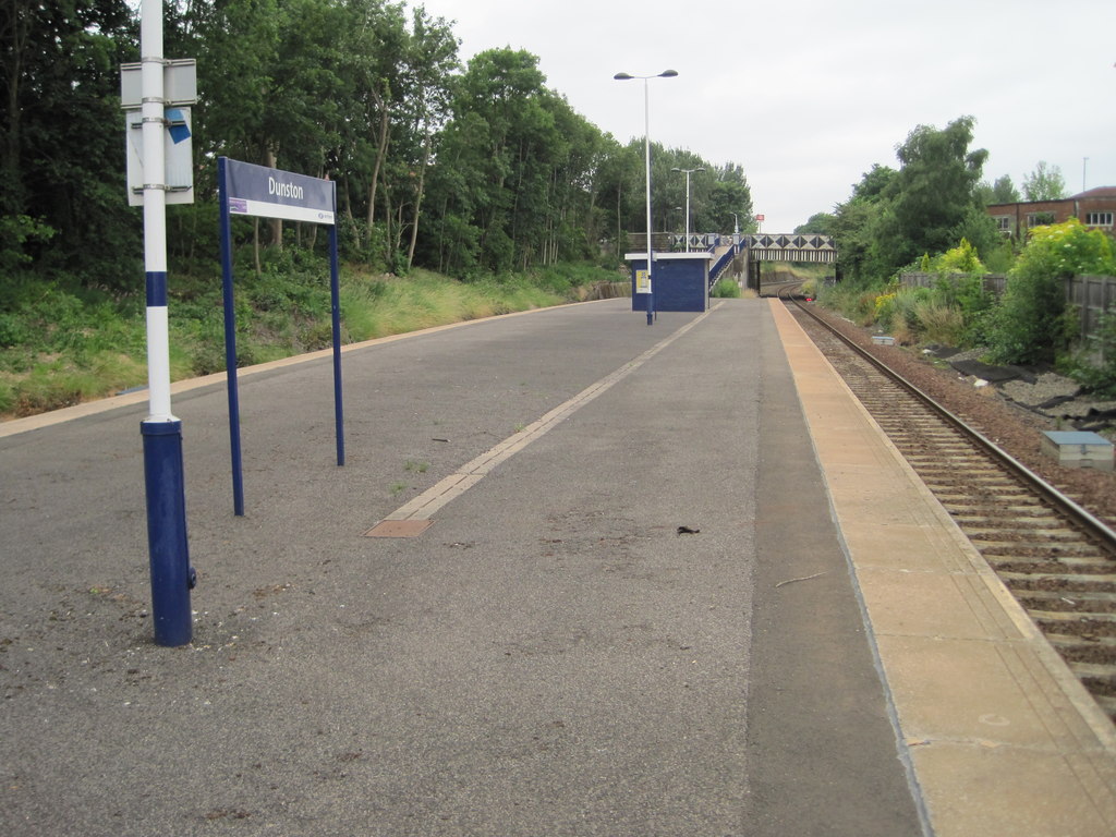
Dunston railway station
Dunston is a railway station on the Tyne Valley Line, which runs between Newcastle and Carlisle via Hexham. The station, situated 2 miles 23 chains (2...
Nearby Amenities
Located within 500m of 54.953502,-1.646297Have you been to Dunston?
Leave your review of Dunston below (or comments, questions and feedback).