Baxton's Strip

Wood, Forest in Yorkshire Ryedale

England

Baxton's Strip

Track on Helmsley Bank Track and public footpath heading west along the top of the Tabular Hills scarp.
Track on Helmsley Bank Credit: Gordon Hatton

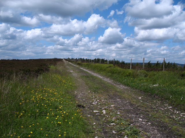
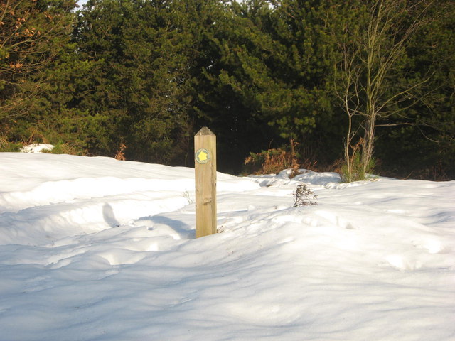
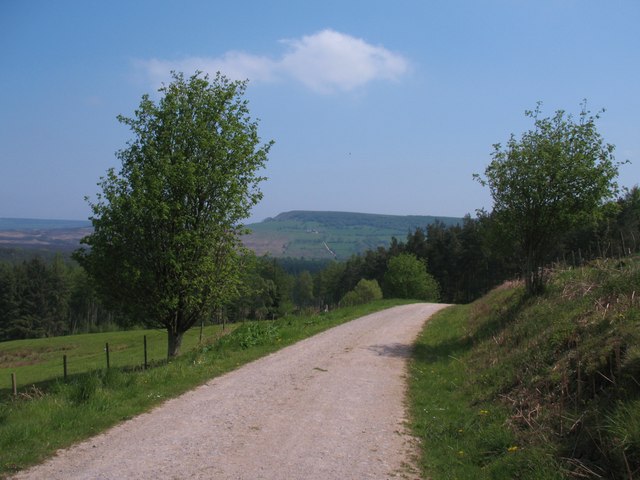
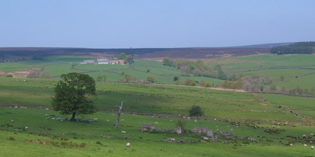
Baxton's Strip, located in Yorkshire, England, is a picturesque woodland area known for its dense forest, captivating scenery, and diverse wildlife. Spanning over several acres, this natural haven offers a tranquil escape from the hustle and bustle of city life.

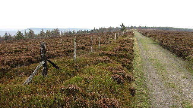
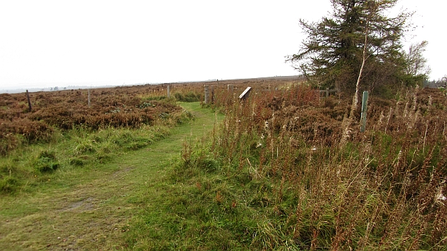
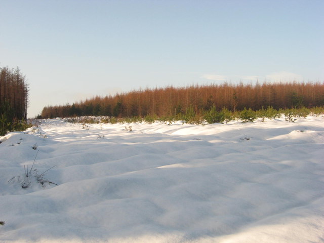
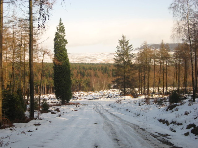
The woodland of Baxton's Strip is characterized by its tall, majestic trees, primarily consisting of oak, beech, and birch. These ancient trees provide a dense canopy, creating a cool and shaded atmosphere even on the warmest of summer days. The forest floor is adorned with a rich carpet of lush green moss and wildflowers, adding to the enchanting ambiance.

As visitors explore the trails that wind through the woods, they may encounter a wide array of wildlife. Baxton's Strip is home to various bird species, including woodpeckers, owls, and thrushes. Lucky observers may even catch a glimpse of deer, foxes, or squirrels darting through the undergrowth. The presence of these animals showcases the thriving ecosystem that thrives within the woodland.

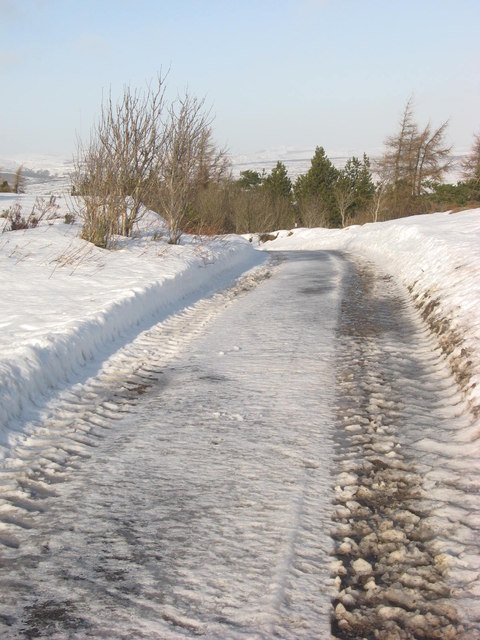
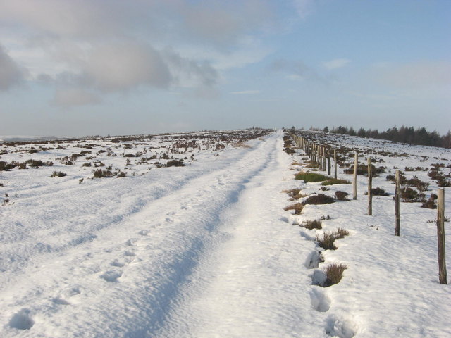
Nature enthusiasts will find plenty of opportunities for outdoor activities at Baxton's Strip. Hiking and walking trails crisscross the forest, offering breathtaking views and allowing visitors to immerse themselves in the serenity of nature. The woodland also features designated picnic areas, providing an ideal spot for families and friends to enjoy a leisurely lunch amidst the tranquility of the surroundings.

Baxton's Strip is not only a haven for nature lovers but also an important site for ecological conservation. The forest is carefully managed by local authorities to preserve its unique biodiversity and protect its natural resources for future generations to enjoy.

In summary, Baxton's Strip in Yorkshire is a captivating woodland area that offers a peaceful retreat for visitors. With its dense forest, diverse wildlife, and well-maintained trails, it is a haven for those seeking to reconnect with nature and experience the beauty of the Yorkshire countryside.

If you have any feedback on the listing, please let us know in the comments section below.

Baxton's Strip Images

Images are sourced within 2km of 54.292626/-1.0813916 or Grid Reference SE5988. Thanks to Geograph Open Source API. All images are credited.

Track on Helmsley Bank Track and public footpath heading west along the top of the Tabular Hills scarp.
Track on Helmsley Bank
Track and public footpath heading west along the top of the Tabular Hills scarp.
Rievaulx Moor triangulation pillar A dreich day, but the pink glow in the sky is scattered sunlight from the heatwave in the south (Sheffield had a glorious day). 
The pillar is named "Roppa" in the OS database and has been painted like all triangulation pillars were until the early 1980s. I remember being shocked by the unfamiliarity of meeting plain concrete ones in Ireland at the time. Now they are nearly all plain concrete.
Rievaulx Moor triangulation pillar
A dreich day, but the pink glow in the sky is scattered sunlight from the heatwave in the south (Sheffield had a glorious day). The pillar is named "Roppa" in the OS database and has been painted like all triangulation pillars were until the early 1980s. I remember being shocked by the unfamiliarity of meeting plain concrete ones in Ireland at the time. Now they are nearly all plain concrete.
Rievaulx Moor Track running up to the triangulation pillar from a public road. The fence is reduced to charred posts, the result of muirburn, or maybe something more sinister (the forest on Helmsley Bank is intact).
Rievaulx Moor
Track running up to the triangulation pillar from a public road. The fence is reduced to charred posts, the result of muirburn, or maybe something more sinister (the forest on Helmsley Bank is intact).
Path on Helmsley Bank The path leaves the road at the edge of the scarp on Helmsley Bank and runs over Rievaulx Moor to Newgate Bank as a well surfaced moorland road.
Path on Helmsley Bank
The path leaves the road at the edge of the scarp on Helmsley Bank and runs over Rievaulx Moor to Newgate Bank as a well surfaced moorland road.
Baxton's wood in the snow Taken on a snowy January morning from the footpath junction in Baxton's Wood above Clarke Bank.
Baxton's wood in the snow
Taken on a snowy January morning from the footpath junction in Baxton's Wood above Clarke Bank.
The top of Clarke Bank Public footpath sign showing the path that descends through the woods at Clarke Bank.
The top of Clarke Bank
Public footpath sign showing the path that descends through the woods at Clarke Bank.
Helmsley Bank Due to the snow being too soft and deep higher up on the moor near the trig point, a shortcut down the single track road on Helmsley Bank had to be made to rejoin the planned circular route back to Cowhouse Bank.
Helmsley Bank
Due to the snow being too soft and deep higher up on the moor near the trig point, a shortcut down the single track road on Helmsley Bank had to be made to rejoin the planned circular route back to Cowhouse Bank.
Helmsley Moor Due to the rising temperatures, the snow was getting softer and as it was still very deep, it was becoming impossible to climb any higher across the moor.
Helmsley Moor
Due to the rising temperatures, the snow was getting softer and as it was still very deep, it was becoming impossible to climb any higher across the moor.
Roppa Wood Looking down the icy and slippery forest track which is also a public footpath.
Roppa Wood
Looking down the icy and slippery forest track which is also a public footpath.
Forest track below Clark Bank A break in the forestry plantations gives a view towards Birk Nab and the scarp slope of the Tabular Hills.
Forest track below Clark Bank
A break in the forestry plantations gives a view towards Birk Nab and the scarp slope of the Tabular Hills.
An island of farmland An area of improved ground surrounded on three sides by forestry pantations and on the fourth by open moorland. In the distance is Potter House Farm, whilst closer to the camera are the ruins of a dwelling named as Broad Oak on old OS maps.
An island of farmland
An area of improved ground surrounded on three sides by forestry pantations and on the fourth by open moorland. In the distance is Potter House Farm, whilst closer to the camera are the ruins of a dwelling named as Broad Oak on old OS maps.
Line of 18thC watercourse in the woods An unexpected find in the woodland on Clark Bank. The prow is sloping uphill to the right, but to the left is what appears to be a narrow level path through the wood. It is actually a section of the Carlton water race, constructed in 1759 and running 7 miles from reliable water sources above Bilsdale [in SE5895] on the moor and contouring around the scarp slope to eventually reach the village of Carlton on the limestone plateau.  The engineer was Joseph Foord of Kirkbymoorside, and he was responsible for a series of cleverly constructed water channels that brought water from the moors to the limestone villages and farms. At this point the channel is around 260m above sea level, having dropped some 40m from its source.
Line of 18thC watercourse in the woods
An unexpected find in the woodland on Clark Bank. The prow is sloping uphill to the right, but to the left is what appears to be a narrow level path through the wood. It is actually a section of the Carlton water race, constructed in 1759 and running 7 miles from reliable water sources above Bilsdale [in SE5895] on the moor and contouring around the scarp slope to eventually reach the village of Carlton on the limestone plateau. The engineer was Joseph Foord of Kirkbymoorside, and he was responsible for a series of cleverly constructed water channels that brought water from the moors to the limestone villages and farms. At this point the channel is around 260m above sea level, having dropped some 40m from its source.
Larch plantation below Helmsley Bank Tall straight larches close to the bottom of Helmsley Bank. Looking at old OS maps, it would appear that these were planted at some time between  1958 and 1977.
Larch plantation below Helmsley Bank
Tall straight larches close to the bottom of Helmsley Bank. Looking at old OS maps, it would appear that these were planted at some time between 1958 and 1977.
Bilsdale mast from Helmsley Bank
Track above Clark Bank
Road down Helmsley Bank Although a tarred council road, the light traffic and tree debris means the road is rather tricky in wet, icy or snowy weather.
Road down Helmsley Bank
Although a tarred council road, the light traffic and tree debris means the road is rather tricky in wet, icy or snowy weather.
Annual clean up completed A fresh coat of masonry paint for 'my' trig point on Roppa Edge. Unfortunately a large number of tiny black flies seemed intent on landing on the wet paint!
Annual clean up completed
A fresh coat of masonry paint for 'my' trig point on Roppa Edge. Unfortunately a large number of tiny black flies seemed intent on landing on the wet paint!
Helmsley Moor Snowscene Recent snowfall and fog makes for an eerie scene north of Helmsley.
Helmsley Moor Snowscene
Recent snowfall and fog makes for an eerie scene north of Helmsley.
Show me another place!

Baxton's Strip is located at Grid Ref: SE5988 (Lat: 54.292626, Lng: -1.0813916)

Division: North Riding

Administrative County: North Yorkshire

District: Ryedale

Police Authority: North Yorkshire

What 3 Words

///matchbox.pressing.migrants. Near Helmsley, North Yorkshire

Related Wikis

Laskill

Laskill is a small hamlet in Bilsdale, 5 miles (8 km) north-west of Helmsley, North Yorkshire, England, on the road from Helmsley to Stokesley and is located...

Rievaulx Terrace

Rievaulx Terrace is a site located in the North York Moors National Park, in North Yorkshire, England, overlooking Rievaulx Abbey and owned by the National...

Swiss Cottage, Rievaulx

Swiss Cottage is a Grade II listed building in the English village of Rievaulx, North Yorkshire. It dates to at least the 17th century, with earlier origins...

Rievaulx

Rievaulx (usually pronounced REE-voh) is a small village and civil parish in Rye Dale within the North York Moors National Park near Helmsley in North...

Rievaulx Abbey

Rievaulx Abbey ( ree-VOH) was a Cistercian abbey in Rievaulx, near Helmsley, in the North York Moors National Park, North Yorkshire, England. It was one...

Pockley

Pockley is a small village and civil parish in North Yorkshire, England. It is about 1 mile north-east of Helmsley turning north from the A170 road. Its...

Bilsdale

Bilsdale is a dale in the western part of the North York Moors in North Yorkshire, England. The head of the dale is at Hasty Bank, and the dale extends...

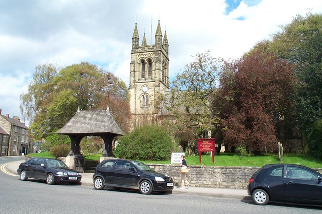
Church of All Saints, Helmsley

The Church of All Saints is an Anglican parish church serving the town of Helmsley in North Yorkshire, England. It is located between the north-west corner...

Have you been to Baxton's Strip?

Leave your review of Baxton's Strip below (or comments, questions and feedback).