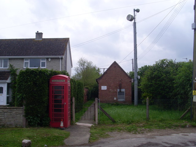
Ashcott Corner

Settlement in Somerset Mendip

England

Ashcott Corner

Trail across Shapwick Heath Heath NNR Photograph of the trail running across Shapwick Heath National Nature Reserve.
Photograph taken close to the car park at Ashcott Corner, looking west.
Trail here is a gravel track which is uneven and potholed in places, and will be muddy and puddled in wet weather.
Trail across Shapwick Heath Heath NNR Credit: Kevin Pearson

Ashcott Corner is a small village located in the county of Somerset, England. Situated approximately 8 miles northeast of the town of Bridgwater, it is nestled in the picturesque landscape of the Somerset Levels.

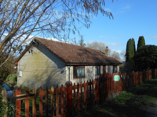
The village is primarily residential, with a population of around 500 residents. It is characterized by its charming thatched-roof cottages and traditional architecture, giving it a quintessentially English countryside feel. The community is close-knit and friendly, with a strong sense of community spirit.

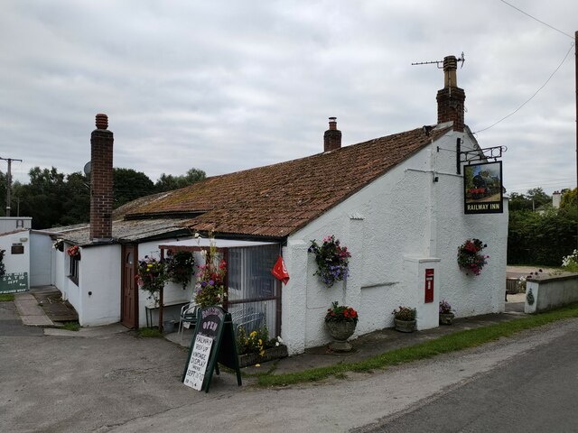
Despite its small size, Ashcott Corner has a few amenities to offer its residents. The village boasts a local pub, The Ashcott Inn, which serves traditional pub food and provides a gathering place for locals to socialize. Additionally, there is a village hall that hosts various community events and activities.

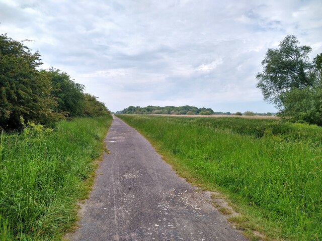
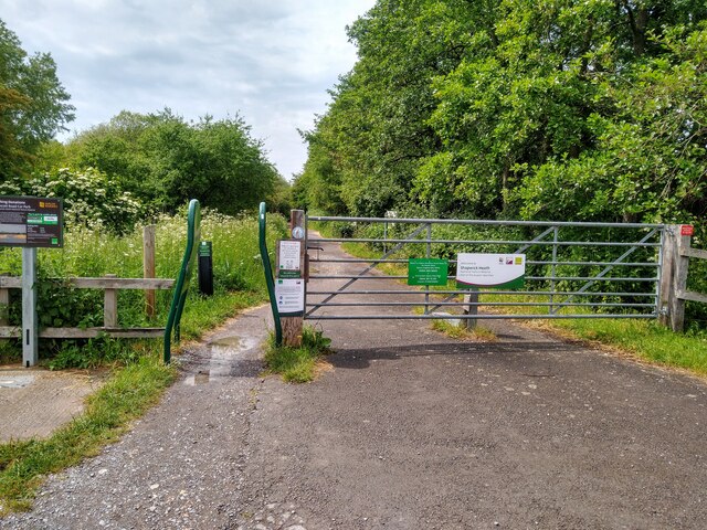
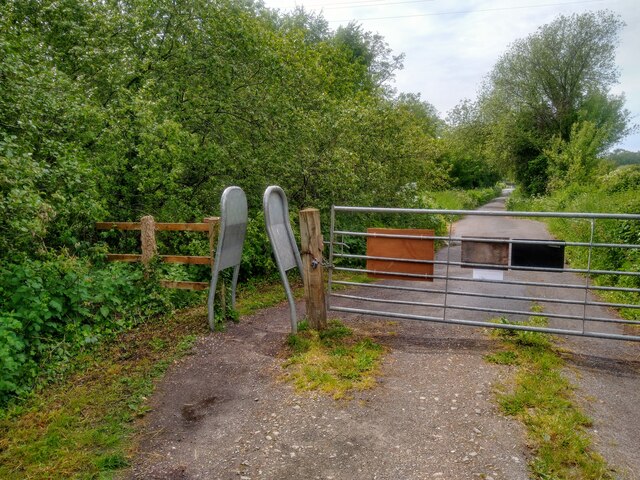
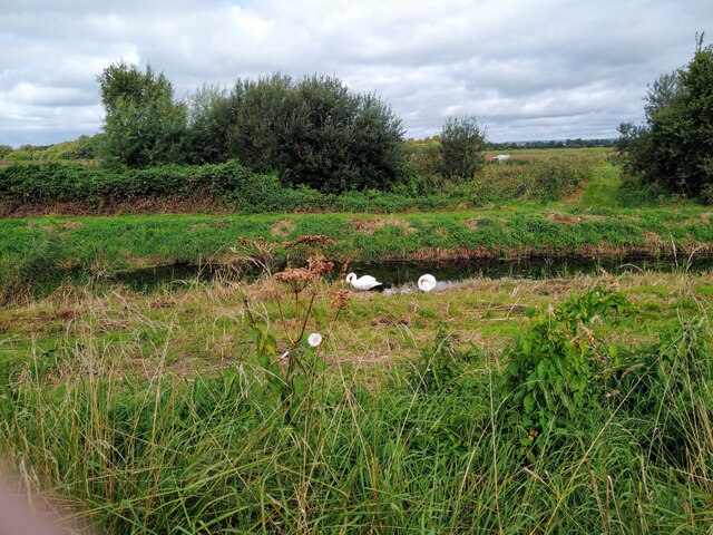
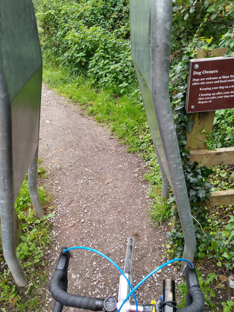
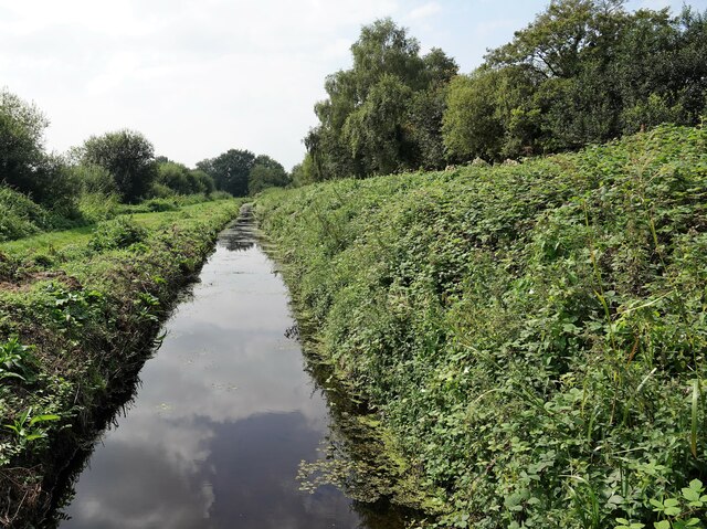
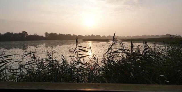
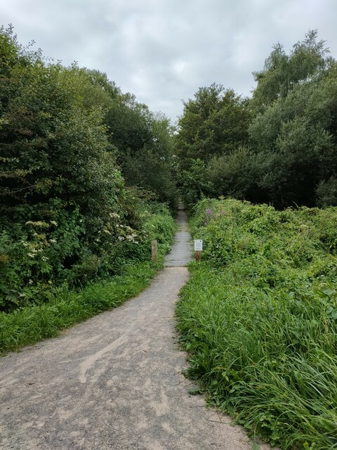
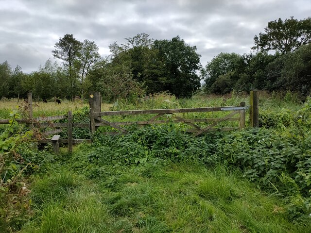
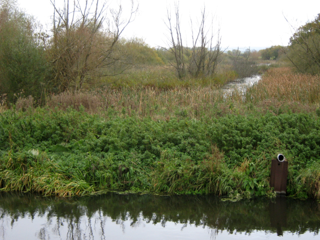
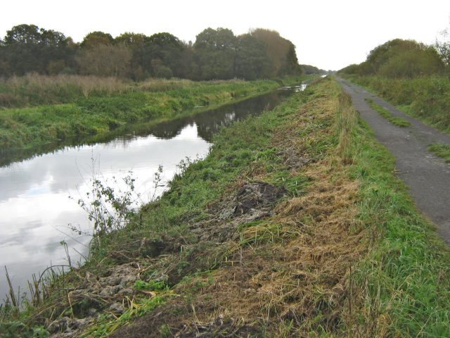
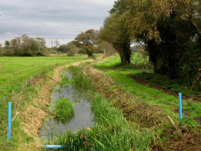
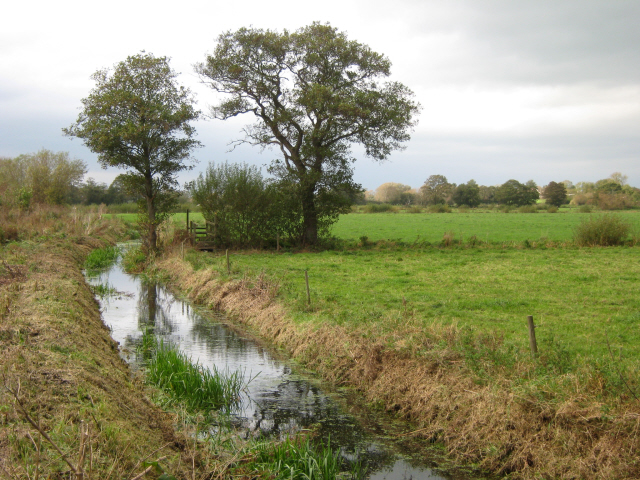
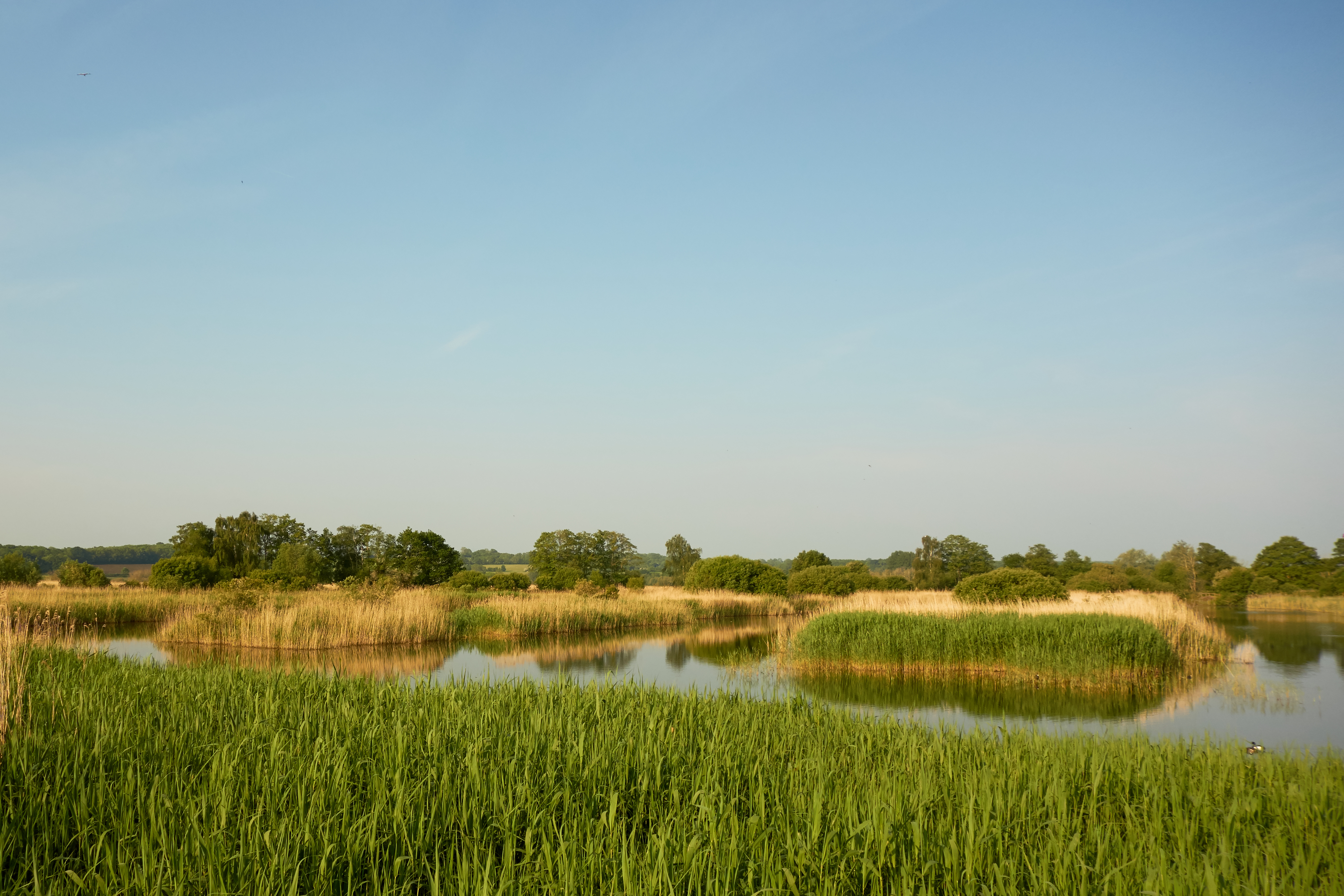
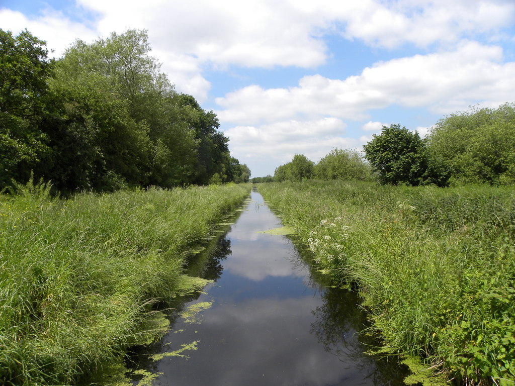
Nature lovers will appreciate the village's proximity to the natural beauty of the Somerset Levels. The area is known for its wetlands and bird reserves, making it a popular destination for birdwatching enthusiasts. The nearby Shapwick Heath National Nature Reserve offers stunning walks and opportunities to spot a variety of wildlife.

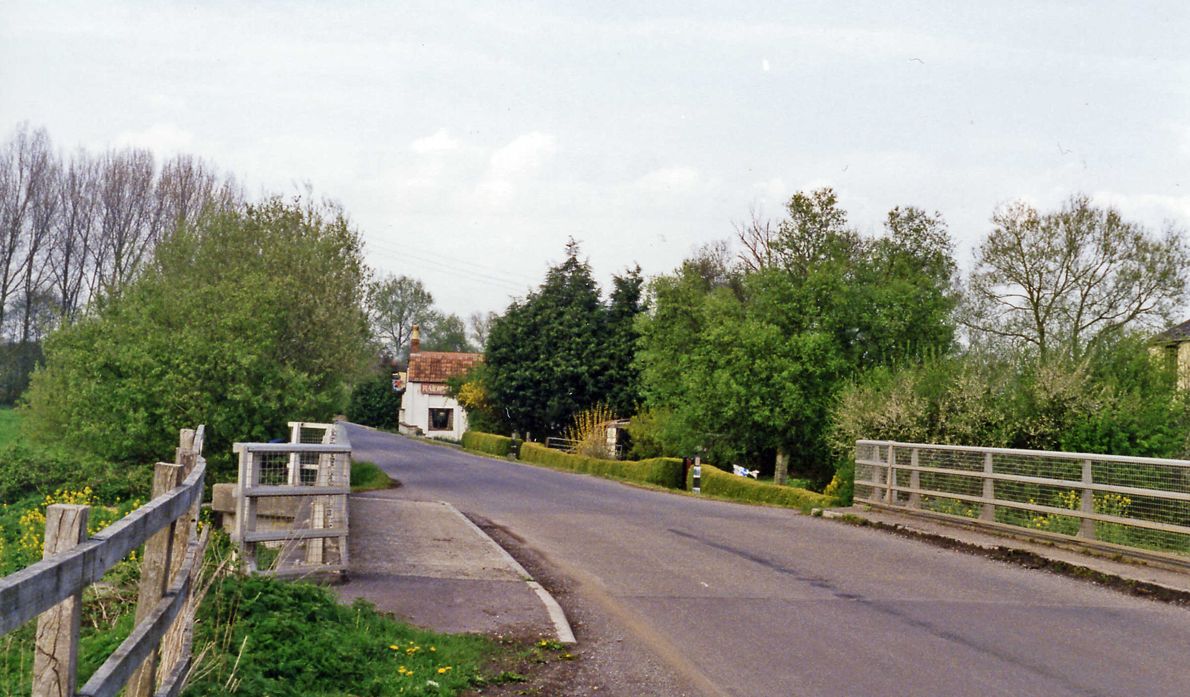
Ashcott Corner is well-connected to neighboring towns and cities. The A39 road runs through the village, providing easy access to Bridgwater and Glastonbury. Public transportation options include regular bus services that connect Ashcott Corner to surrounding areas.

Overall, Ashcott Corner is a charming village that offers a peaceful and idyllic lifestyle, surrounded by the natural beauty of the Somerset Levels.

If you have any feedback on the listing, please let us know in the comments section below.

Ashcott Corner Images

Images are sourced within 2km of 51.15363/-2.7889923 or Grid Reference ST4439. Thanks to Geograph Open Source API. All images are credited.

Trail across Shapwick Heath Heath NNR Photograph of the trail running across Shapwick Heath National Nature Reserve.
Photograph taken close to the car park at Ashcott Corner, looking west.
Trail here is a gravel track which is uneven and potholed in places, and will be muddy and puddled in wet weather.
Trail across Shapwick Heath Heath NNR
Photograph of the trail running across Shapwick Heath National Nature Reserve. Photograph taken close to the car park at Ashcott Corner, looking west. Trail here is a gravel track which is uneven and potholed in places, and will be muddy and puddled in wet weather.
A Frame Barrier at Shapwick Heath NNR An A frame barrier from the car park onto the main trail at Shapwick Heath National Nature Reserve.
This barrier is at the car park on the eastern end of the reserve at Ashcott Corner.
Gap through the barrier is 70cm.
The trail through the reserve is a gravel track which is potholed and uneven in places, and will be muddy and puddled in wet weather.
A Frame Barrier at Shapwick Heath NNR
An A frame barrier from the car park onto the main trail at Shapwick Heath National Nature Reserve. This barrier is at the car park on the eastern end of the reserve at Ashcott Corner. Gap through the barrier is 70cm. The trail through the reserve is a gravel track which is potholed and uneven in places, and will be muddy and puddled in wet weather.
A Frame Barrier at Ham Wall RSPB Reserve An A frame barrier at Ham Wall RSPB Reserve.  This barrier is located at the western end of the reserve by Ashcott Corner.
The barrier is very restrictive with a width of just over 60cm.
There is a RADAR lock on the gate but please note that the lock on the gate at the other end of the reserve is not a RADAR lock.
The trail through the reserve is a gravel track which is rutted, potholed, and uneven in places, and will be muddy and puddled in wet weather.
A Frame Barrier at Ham Wall RSPB Reserve
An A frame barrier at Ham Wall RSPB Reserve. This barrier is located at the western end of the reserve by Ashcott Corner. The barrier is very restrictive with a width of just over 60cm. There is a RADAR lock on the gate but please note that the lock on the gate at the other end of the reserve is not a RADAR lock. The trail through the reserve is a gravel track which is rutted, potholed, and uneven in places, and will be muddy and puddled in wet weather.
Swan family on the Glastonbury Canal at Ham Wall A pair of Mute Swans with two cygnets beside the Glastonbury Canal at Ham Wall RSPB reserve.
Swan family on the Glastonbury Canal at Ham Wall
A pair of Mute Swans with two cygnets beside the Glastonbury Canal at Ham Wall RSPB reserve.
Accessibility Barrier at Ham Wall RSPB Reserve An A frame barrier blocking access for some users to the RSPB reserve at Ham Wall.
This barrier is at the western entrance to the reserve.
The handlebars of the bicycle in the photograph are 42cm in width as a comparison.
The local authority has been advised of this restriction to access.
Accessibility Barrier at Ham Wall RSPB Reserve
An A frame barrier blocking access for some users to the RSPB reserve at Ham Wall. This barrier is at the western entrance to the reserve. The handlebars of the bicycle in the photograph are 42cm in width as a comparison. The local authority has been advised of this restriction to access.
Glastonbury Canal, Ham Wall
Wooden Sculptures at Hamwall Nature Reserve
Noah's Lake, Shapwick Heath
The Old Station, Ashcott With the tracks long gone. All that remains is the old station building which has been converted into a private dwelling.
The Old Station, Ashcott
With the tracks long gone. All that remains is the old station building which has been converted into a private dwelling.
The Railway Inn, Meare
Footpath in RSPB Ham Wall
Gate and Stile near former Thurlbury Station
Telephone Exchange, Meare Situated in St Mary's Road, this TE dates from the GPO era with a red telephone box in front of it. It used to take the name "Meare Heath" after the area South of the B3151 road between Meare and Westhay. Two microwave dishes can be seen on the pole adjacent to the TE, which serves the two aforementioned villages. The TE has (01458) 860xxx numbers and its postcode is BA6 9SP.
Telephone Exchange, Meare
Situated in St Mary's Road, this TE dates from the GPO era with a red telephone box in front of it. It used to take the name "Meare Heath" after the area South of the B3151 road between Meare and Westhay. Two microwave dishes can be seen on the pole adjacent to the TE, which serves the two aforementioned villages. The TE has (01458) 860xxx numbers and its postcode is BA6 9SP.
The Glastonbury Canal and Meare Heath
The Glastonbury Canal and cycle track, Shapwick Heath
Heath Rhyne, Meare Heath
Meare Heath Hide
Meare Heath Hide
Show me another place!

Ashcott Corner is located at Grid Ref: ST4439 (Lat: 51.15363, Lng: -2.7889923)

Administrative County: Somerset

District: Mendip

Police Authority: Avon and Somerset

What 3 Words

///mega.thankful.division. Near Glastonbury, Somerset

Nearby Locations

Ashcott Corner

Related Wikis

Ashcott railway station

Ashcott railway station was a station on the Highbridge branch of the Somerset and Dorset Joint Railway. Opened by the Somerset Central Railway in 1856...

Ham Wall

Ham Wall is an English wetland National Nature Reserve (NNR) 4 kilometres (2.5 mi) west of Glastonbury on the Somerset Levels. It is managed by the Royal...

Street Heath

Street Heath (grid reference ST464394) is a 12.5 hectare (31.0 acre) biological Site of Special Scientific Interest 4 km west of Glastonbury in Somerset...

Sharpham Moor Plot

Sharpham Moor Plot (grid reference ST465389) is a 0.5-hectare (1.3 acre) biological Site of Special Scientific Interest at Sharpham in Somerset, UK, notified...

Shapwick Heath

Shapwick Heath is a 394.0-hectare (973.6 acre) biological Site of Special Scientific Interest and national nature reserve between Shapwick and Westhay...

Meare

Meare is a village and civil parish in Somerset, England, 3 miles (4.8 km) north-west of Glastonbury on the Somerset Levels. The parish includes the village...

Manor Farmhouse, Meare

The Manor Farmhouse in Meare, Somerset, England, was built in the 14th century as the summer residence of the Abbots from Glastonbury Abbey and is now...

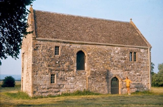
The Abbot's Fish House, Meare

The Abbot's Fish House in Meare, Somerset, England, was built in the 14th century and has been designated as a Grade I listed building and Scheduled Ancient...

Nearby Amenities

Located within 500m of 51.15363,-2.7889923
Ashcott Corner
Lat/Long: 51.1537629/-2.7888678
Bench
Building: gazebo
Material: wood
Seats: 8
Lat/Long: 51.1536127/-2.7895238
RSPB Ham Wall
Board Type: board
Information: board
Tourism: information
Lat/Long: 51.1538238/-2.7885114
Barrier: cycle_barrier
Bicycle: yes
Foot: yes
Lat/Long: 51.1538196/-2.7895872
Ashcott
Historic Railway: station
Old Name: Ashcott and Meare
Railway: site
Wikidata: Q4804746
Wikipedia: en:Ashcott railway station
Lat/Long: 51.1534421/-2.7884038
Toilets
Access: customers
Drinking Water: no
Fee: no
Operator: Railway Inn
Toilets Disposal: flush
Toilets Position: seated;urinal
Wheelchair: no
Lat/Long: 51.1545941/-2.7880094
Bicycle Parking
Bicycle Parking: stands
Capacity: 8
Source: survey
Lat/Long: 51.1537431/-2.7891584
Sedgemoor East
Name En: Sedgemoor East
Tourism: attraction
Lat/Long: 51.1537969/-2.7895691
Bench
Alan Whitehouse
Fixme: needs exact location
Historic: memorial
Inscription: Alan Whitehouse 1950-2011 He loved sitting, walking and cycling on the moors
Material: wood
Memorial: bench
Openbenches Id: 5088
Seats: 4
Lat/Long: 51.1526631/-2.7847948
Leisure: bird_hide
Lat/Long: 51.1537205/-2.7916792
Board Type: map
Information: board
Tourism: information
Lat/Long: 51.1539298/-2.7898493
Board Type: notice
Information: board
Tourism: information
Lat/Long: 51.1537798/-2.7895905
Board Type: history
Information: board
Tourism: information
Lat/Long: 51.1537202/-2.7891654
Vending Machine
Currency GBP: yes
Operator: Natural England
Payment Coins: yes
Vending: parking_tickets
Lat/Long: 51.1537656/-2.7896035
Vending Machine
Currency GBP: yes
Operator: RSPB
Payment Coins: yes
Vending: parking_tickets
Lat/Long: 51.1527184/-2.7879222
Leisure: picnic_table
Material: wood
Lat/Long: 51.1526682/-2.7878276
Bench
Lat/Long: 51.1527998/-2.7876973
Information: board
Tourism: information
Lat/Long: 51.1532102/-2.7888226
Post Box
Brand: Royal Mail
Brand Wikidata: Q638098
Brand Wikipedia: en:Royal Mail
Operator: Royal Mail
Operator Wikidata: Q638098
Post Box Type: wall
Ref: BA6 136
Royal Cypher: EVIIR
Royal Cypher Wikidata: Q33102324
Lat/Long: 51.1546325/-2.7883779
Bench
Lat/Long: 51.1531289/-2.7819069
Tourism: viewpoint
Lat/Long: 51.1526751/-2.7837635
The data included in this document is from www.openstreetmap.org. The data is made available under ODbL.

Have you been to Ashcott Corner?

Leave your review of Ashcott Corner below (or comments, questions and feedback).