Dunrostan

Settlement in Argyllshire

Scotland

Dunrostan

Sheep grazing in field with cross slab
Sheep grazing in field with cross slab Credit: Steven Brown

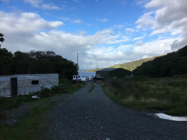
Dunrostan is a small village located in the picturesque region of Argyllshire, in western Scotland. Nestled within the stunning scenery of rolling hills and serene lochs, this charming settlement is home to a close-knit community of approximately 300 residents.

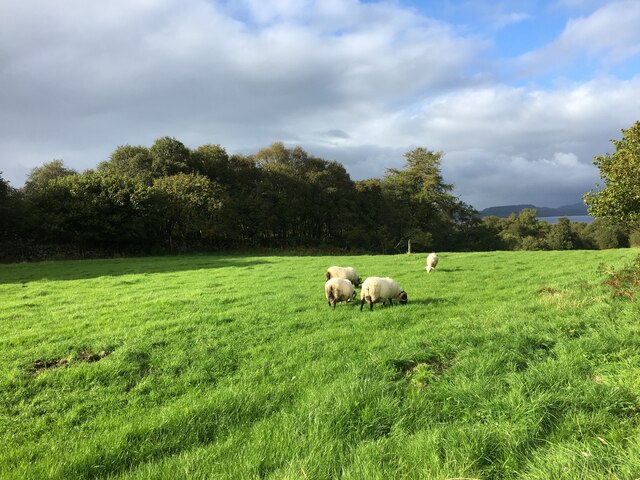
The village of Dunrostan boasts a rich history, with its origins dating back to the 12th century. It was originally established as a farming settlement and, to this day, agriculture remains an integral part of the local economy. The lush green fields surrounding the village are dotted with sheep and cattle, providing a picturesque backdrop to the rural setting.

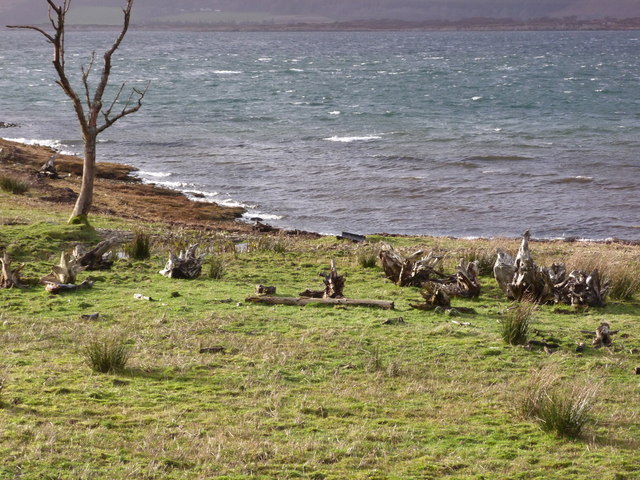
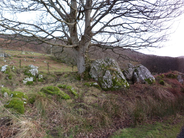
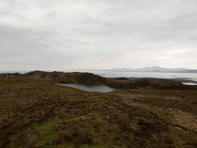
Dunrostan is a place of natural beauty, with the nearby Loch Dunrostan attracting visitors from far and wide. The tranquil waters of the loch are ideal for fishing and boating, offering a serene escape for outdoor enthusiasts. The surrounding hills also provide ample opportunities for hiking and exploring, with breathtaking vistas awaiting those who venture up their slopes.

The village itself is characterized by its quaint stone cottages, adding to the idyllic charm of the area. A small but vibrant community, Dunrostan boasts a local pub, a village hall, and a primary school that serves the needs of the local children.

Visitors to Dunrostan can expect a warm and welcoming atmosphere, as the residents take great pride in their village. Whether it's exploring the natural wonders of the area or simply enjoying the peace and tranquility, Dunrostan offers a delightful escape from the hustle and bustle of city life.

If you have any feedback on the listing, please let us know in the comments section below.

Dunrostan Images

Images are sourced within 2km of 55.968177/-5.6390934 or Grid Reference NR7381. Thanks to Geograph Open Source API. All images are credited.

Sheep grazing in field with cross slab
Driftwood by Loch Sween An array of tree stumps, presumably washed ashore by the Winter storms.
Driftwood by Loch Sween
An array of tree stumps, presumably washed ashore by the Winter storms.
Roadside by Loch Sween Near Dunrostan.
Roadside by Loch Sween
Near Dunrostan.
Cruinn Loch, Knapdale Looking down on Cruinn Loch from a ridge to the north east with Jura in the background.
Cruinn Loch, Knapdale
Looking down on Cruinn Loch from a ridge to the north east with Jura in the background.
Taynish Island
Taynish Island
Skerries in Loch Sween
Western shore of Loch Sween
Rubha Bhreatanich Rubha Bhreatanich, as well as being a small headland is a Peninsula, almost an island, but forms a part of the Island of Danna, which is only an island at high tide, and is connected to the mainland by a small road bridge. The inlet to the right is Ceann an t-Sàilein which dries at its head, about one kilometre out of view, and turns sharply west to pass under said road bridge to provide a high tide passage to Loch na Cille for (very) small boats. Even as sea kayakers (and seaworthy boats don't come any smaller) we've opted for the outside passage south of Danna to enter Loch Sween.
Rubha Bhreatanich
Rubha Bhreatanich, as well as being a small headland is a Peninsula, almost an island, but forms a part of the Island of Danna, which is only an island at high tide, and is connected to the mainland by a small road bridge. The inlet to the right is Ceann an t-Sàilein which dries at its head, about one kilometre out of view, and turns sharply west to pass under said road bridge to provide a high tide passage to Loch na Cille for (very) small boats. Even as sea kayakers (and seaworthy boats don't come any smaller) we've opted for the outside passage south of Danna to enter Loch Sween.
Lunch at Taynish jetty There is an inevitability about some sea kayaking trips that if you get the assistance of the tide on one day (as we did yesterday paddling down the Sound of Jura on the ebb) you will be paddling against it to return towards your starting point. Although we'd done a shuttle so we could return up Loch Sween where tidal flows are much weaker, our choice to use the channel between the Taynish peninsula and Taynish Island meant we'd just had a short stretch fighting against quite a strong outflow from Linnhe Mhuirich to reach this spot for lunch. Some of us chose to paddle right to the beach, whilst others, aware that the water was going away, chose to tie up to the jetty to avoid having to drag boats at the start of our second session.
Lunch at Taynish jetty
There is an inevitability about some sea kayaking trips that if you get the assistance of the tide on one day (as we did yesterday paddling down the Sound of Jura on the ebb) you will be paddling against it to return towards your starting point. Although we'd done a shuttle so we could return up Loch Sween where tidal flows are much weaker, our choice to use the channel between the Taynish peninsula and Taynish Island meant we'd just had a short stretch fighting against quite a strong outflow from Linnhe Mhuirich to reach this spot for lunch. Some of us chose to paddle right to the beach, whilst others, aware that the water was going away, chose to tie up to the jetty to avoid having to drag boats at the start of our second session.
Farm road near Dunrostan
Road to boat yard near Dunrostan
Minor road near Kilbryd
Eastern shoreline of Loch Sween
Volcanic evidence on slate rock face This picture shows the top section of a slate rock face rising out of Loch Sween to still have evidence of its Volcanic past.
Volcanic evidence on slate rock face
This picture shows the top section of a slate rock face rising out of Loch Sween to still have evidence of its Volcanic past.
Old Milestone north of Kilbride, Knapdale parish, Loch Sween Stone post by the UC road in parish of Knapdale (District), Kilbride, North of Castlesween, near track to house/farm, in front of wire fence, West side of road.

Inscription once read:-
(Lochgilphead)
(15)

Surveyed

Milestone Society National ID: AB_CCKY10
Old Milestone north of Kilbride, Knapdale parish, Loch Sween
Stone post by the UC road in parish of Knapdale (District), Kilbride, North of Castlesween, near track to house/farm, in front of wire fence, West side of road. Inscription once read:- (Lochgilphead) (15) Surveyed Milestone Society National ID: AB_CCKY10
Old Milestone by Dunrostan, Loch Sween Milestone by the UC road, in parish of Knapdale (District), Dunrostan, in ditch.

Inscription once read:-
(Lochgilphead)
(14)

Surveyed

Milestone Society National ID: AB_CCKY09
Old Milestone by Dunrostan, Loch Sween
Milestone by the UC road, in parish of Knapdale (District), Dunrostan, in ditch. Inscription once read:- (Lochgilphead) (14) Surveyed Milestone Society National ID: AB_CCKY09
Small cliff on Rubha Bhreatanich Looking north into Loch Sween.
Small cliff on Rubha Bhreatanich
Looking north into Loch Sween.
The soggy end of Rubha Bhreatanich Looking up Loch Sween into Knapdale.
The soggy end of Rubha Bhreatanich
Looking up Loch Sween into Knapdale.
Show me another place!

Dunrostan is located at Grid Ref: NR7381 (Lat: 55.968177, Lng: -5.6390934)

Unitary Authority: Argyll and Bute

Police Authority: Argyll and West Dunbartonshire

What 3 Words

///many.fists.giraffes. Near Ardrishaig, Argyll & Bute

Related Wikis

Loch Sween

Loch Sween (Scottish Gaelic: Loch Suain or Loch Suibhne) is a sea loch located near Lochgilphead, Argyll and Bute, Scotland. Castle Sween is located on...

Keills Chapel

Keills Chapel is a small chapel located in the west Highlands, Scotland, near the village of Tayvallich, Knapdale.The chapel dates from the 11th century...

Island of Danna

The Island of Danna or Danna (Scottish Gaelic: Danna), is an inhabited tidal island in Argyll and Bute. == Geography == It is connected to the mainland...

Taynish National Nature Reserve

Taynish National Nature Reserve (Scottish Gaelic: Tèarmann Nàdair Nàiseanta Taighnis) is situated southwest of the village of Tayvallich in the council...

Nearby Amenities

Located within 500m of 55.968177,-5.6390934
Source: PGS
Lat/Long: 55.9716576/-5.6351617
Source: PGS
Lat/Long: 55.970391/-5.6356799
Source: PGS
Lat/Long: 55.9700536/-5.6357711
Source: PGS
Lat/Long: 55.9688098/-5.6366484
Source: PGS
Lat/Long: 55.9675669/-5.6376704
Source: PGS
Lat/Long: 55.9670855/-5.6383951
Source: PGS
Lat/Long: 55.9668288/-5.6387786
Source: PGS
Lat/Long: 55.9667218/-5.6388057
Source: PGS
Lat/Long: 55.9661836/-5.6393787
Source: PGS
Lat/Long: 55.9651965/-5.6398075
Source: PGS
Lat/Long: 55.9646295/-5.6407165
Source: PGS
Lat/Long: 55.9645031/-5.6407946
Source: PGS
Lat/Long: 55.9644285/-5.6409571
Power: pole
Lat/Long: 55.9709438/-5.6340931
Power: pole
Lat/Long: 55.9698304/-5.6352975
Power: pole
Lat/Long: 55.9687867/-5.6361113
Power: pole
Lat/Long: 55.9676422/-5.6366314
Power: pole
Lat/Long: 55.9671061/-5.6369017
Power: pole
Lat/Long: 55.9659402/-5.6380447
Power: pole
Lat/Long: 55.9648353/-5.6391473
Power: pole
Lat/Long: 55.9637738/-5.6406968
Power: pole
Lat/Long: 55.964349/-5.639616
Power: pole
Lat/Long: 55.9645223/-5.6400321
Power: pole
Lat/Long: 55.9654239/-5.6385599
Power: pole
Lat/Long: 55.9665379/-5.6374588
Power: pole
Lat/Long: 55.9693625/-5.6358404
Power: pole
Lat/Long: 55.9703077/-5.6347812
The data included in this document is from www.openstreetmap.org. The data is made available under ODbL.

Have you been to Dunrostan?

Leave your review of Dunrostan below (or comments, questions and feedback).