Ash Holt

Wood, Forest in Yorkshire

England

Ash Holt

Tollbar Bridge Where the old turnpike crossed Paper Mill Dyke, the site of an old mill according to the 1854 6 inch Ordnance Survey map.
Tollbar Bridge Credit: Chris Morgan

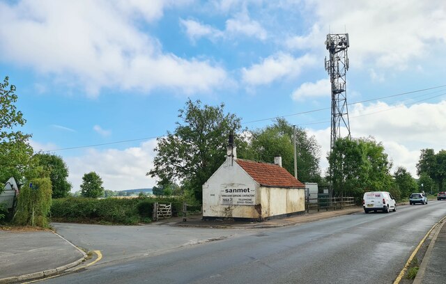
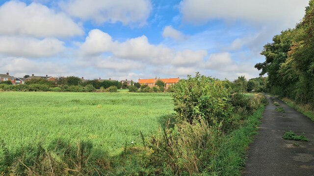
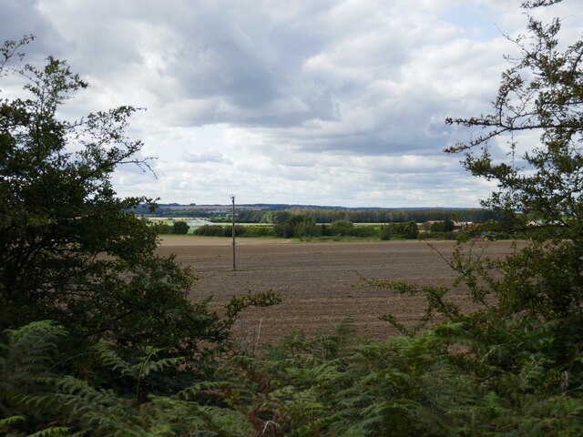
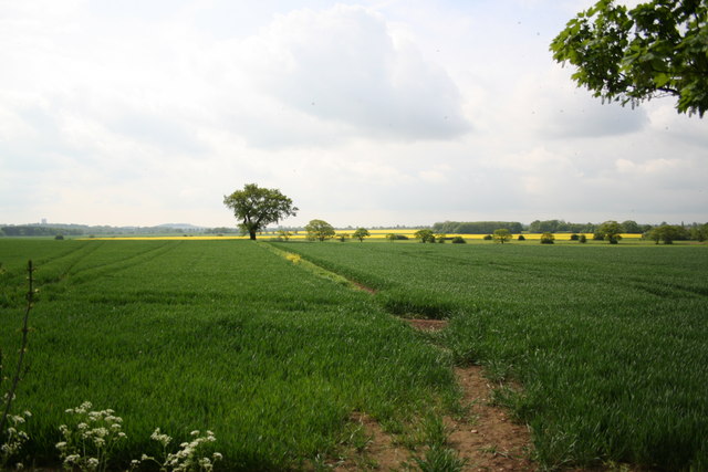
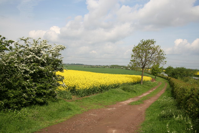
Ash Holt is a charming village located in the beautiful county of Yorkshire, England. Nestled amidst a dense woodland, it is aptly named for the abundance of ash trees that grace its landscape. The village is renowned for its tranquil and picturesque setting, making it a popular destination for nature lovers and those seeking a peaceful retreat.

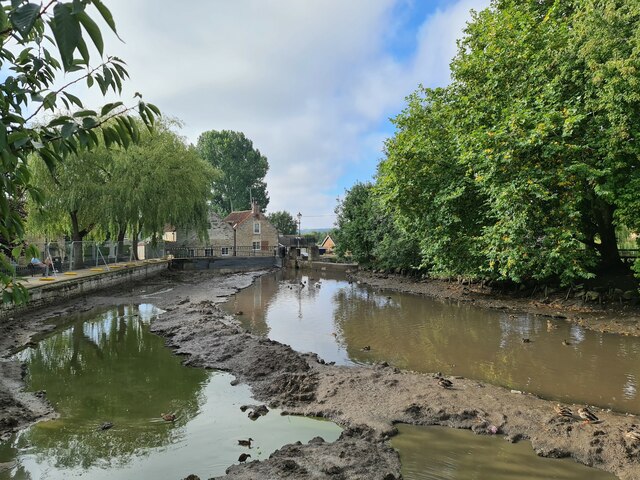
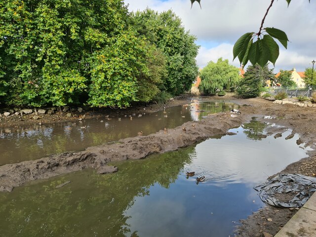
The woodlands surrounding Ash Holt provide a haven for wildlife, with various species of birds, deer, and small mammals calling it home. Walking trails crisscross the forest, offering visitors the opportunity to explore the natural beauty of the area and immerse themselves in the peaceful ambiance.

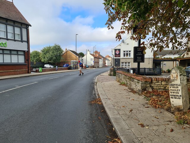
The village itself is characterized by traditional stone cottages, giving it a timeless and rustic feel. The local community is close-knit and friendly, with a strong sense of pride in their village. The village center boasts a quaint country pub, where locals and visitors can enjoy a pint of ale and indulge in hearty, homemade meals.

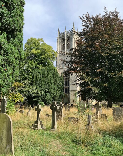
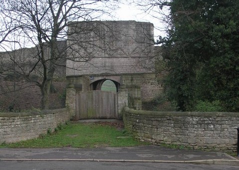
Ash Holt is also steeped in history, with traces of its past evident in the ancient remains of a Norman castle nearby. History enthusiasts can delve into the village's heritage by exploring the castle ruins and learning about its significance in the region's history.

Overall, Ash Holt offers a unique blend of natural beauty, historical intrigue, and a warm community spirit. It is a destination that captivates visitors with its idyllic setting and provides a welcome escape from the hustle and bustle of modern life.

If you have any feedback on the listing, please let us know in the comments section below.

Ash Holt Images

Images are sourced within 2km of 53.444525/-1.1048577 or Grid Reference SK5994. Thanks to Geograph Open Source API. All images are credited.

Tollbar Bridge Where the old turnpike crossed Paper Mill Dyke, the site of an old mill according to the 1854 6 inch Ordnance Survey map.
Tollbar Bridge
Where the old turnpike crossed Paper Mill Dyke, the site of an old mill according to the 1854 6 inch Ordnance Survey map.
Track beside A1(M) at Tickhill
Landscape below Sawney Hill
St Mary's church, Tickhill Men were working to cut the grass at the smart opposite end of the churchyard, in total contrast with the picture seen here.
St Mary's church, Tickhill
Men were working to cut the grass at the smart opposite end of the churchyard, in total contrast with the picture seen here.
Carpenters Arms, Tickhill And milestone on Bawtry and Tinsley old toll road
Carpenters Arms, Tickhill
And milestone on Bawtry and Tinsley old toll road
Water Mill Dam Under repair as part of flood prevention works
Water Mill Dam
Under repair as part of flood prevention works
Drained pond at Water Mill Dam During repair work to improve flood defences
Drained pond at Water Mill Dam
During repair work to improve flood defences
Lancaster Crescent, Tickhill
Curious stone in wall Outside Lindrick House. It didn't get like that by accident.
Curious stone in wall
Outside Lindrick House. It didn't get like that by accident.
Railway bridge across Apy Hill Lane The tracks have been lifted following closure of nearby Harworth Colliery. The low bridge remains a liability for the Strategic Rail Authority's successors to maintain and high road vehicles to avoid.
Railway bridge across Apy Hill Lane
The tracks have been lifted following closure of nearby Harworth Colliery. The low bridge remains a liability for the Strategic Rail Authority's successors to maintain and high road vehicles to avoid.
St Mary's church, Tickhill
Wellingley Lane Bridge over the A1(M) The A1 is the longest numbered road in the UK at 410 miles long. It connects London with Edinburgh, via the east of England. 
For much of its path it follows the Great North Road the old coaching route between London and Edinburgh. Several sections of the route are classified as motorway A1(M). The modern A1 bypasses the towns the Great North Road passed through and is dual carriageway for most of its route through England.
Wellingley Lane Bridge over the A1(M)
The A1 is the longest numbered road in the UK at 410 miles long. It connects London with Edinburgh, via the east of England. For much of its path it follows the Great North Road the old coaching route between London and Edinburgh. Several sections of the route are classified as motorway A1(M). The modern A1 bypasses the towns the Great North Road passed through and is dual carriageway for most of its route through England.
St.Mary's church, Tickhill Large perpendicular church of gleaming white limestone - more glass than wall !
St.Mary's church, Tickhill
Large perpendicular church of gleaming white limestone - more glass than wall !
Tickhill from the East The eastern approach to Tickhill on the A631 passes beneath the A1(M).  Access to the A1 is over 3 miles away at Blyth island.
Tickhill from the East
The eastern approach to Tickhill on the A631 passes beneath the A1(M). Access to the A1 is over 3 miles away at Blyth island.
Billy Wrights Lane The junction of narrow Wellingley Lane and even narrower Billy Wrights Lane to Stancil
Billy Wrights Lane
The junction of narrow Wellingley Lane and even narrower Billy Wrights Lane to Stancil
Egg Lane Footpath from Wellingley to Wadworth Carr known as Egg Lane
Egg Lane
Footpath from Wellingley to Wadworth Carr known as Egg Lane
Footpath from Stancil Lane looking south along the footpath towards Tickhill from Stancil Lane
Footpath from Stancil Lane
looking south along the footpath towards Tickhill from Stancil Lane
Farm track near Dadsley Well Bridge A rural scene spoilt by the roar of the A1M close by
Farm track near Dadsley Well Bridge
A rural scene spoilt by the roar of the A1M close by
Show me another place!

Ash Holt is located at Grid Ref: SK5994 (Lat: 53.444525, Lng: -1.1048577)

Division: West Riding

Unitary Authority: Doncaster

Police Authority: South Yorkshire

What 3 Words

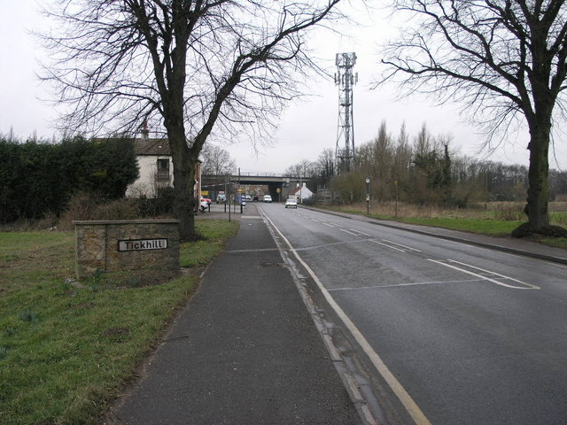
///crescendo.introduce.worker. Near Tickhill, South Yorkshire

Nearby Locations

Ash Holt Eastfield Wood

Related Wikis

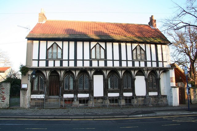
St Leonard's Hospital, Tickhill

St Leonard's Hospital is a grade II* listed timber-framed building in Tickhill, South Yorkshire, in England. It was originally constructed in the 15th...

Tickhill & Wadworth (ward)

Tickhill & Wadworth—consisting of Braithwell, Micklebring, Stainton, Tickhill, Wadworth and Woodfield—is one of 21 electoral wards in the Metropolitan...

Strafforth and Tickhill

Strafforth and Tickhill , originally known as Strafforth, was the southernmost wapentake in the West Riding of Yorkshire, England. The west of the district...

Tickhill and Wadworth railway station

Tickhill and Wadworth railway station, originally simply known as Tickhill, was located where the road linking the town of Tickhill and the village of...

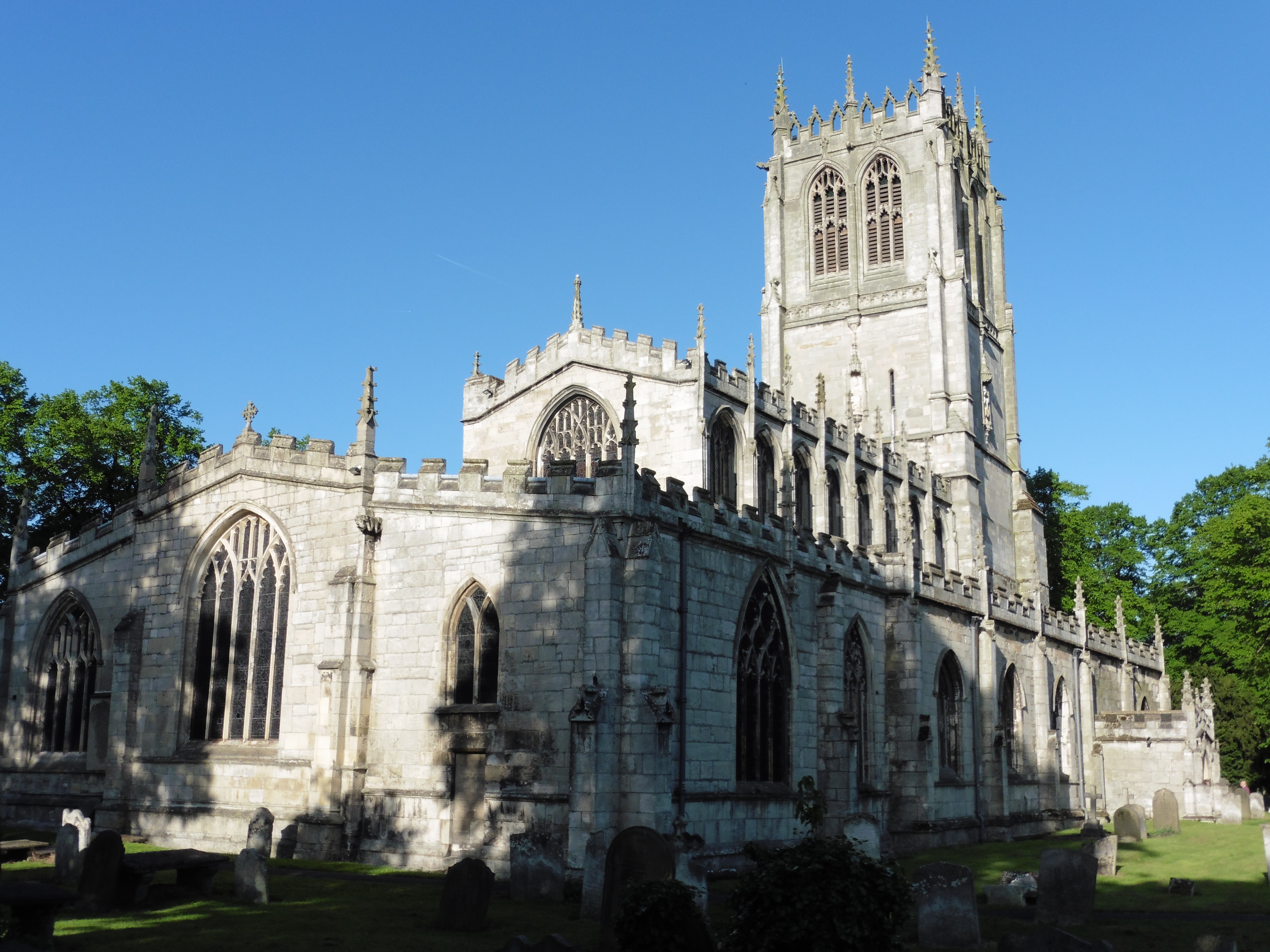
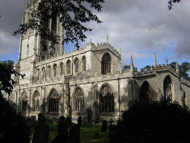
St Mary's Church, Tickhill

St Mary's Church is a Grade I listed Anglican church in Tickhill, South Yorkshire, England. Dating from the early 12th century and built with local Magnesian...

Tickhill

Tickhill is a market town and civil parish in the City of Doncaster, South Yorkshire, England, close to the border with Nottinghamshire. At the 2001 census...

Tickhill Castle

Tickhill Castle was a castle in Tickhill, in South Yorkshire, England and a prominent stronghold during the reign of King John. == Early history == The...

Tickhill Friary

Tickhill Friary was an Augustinian friary in Tickhill, South Yorkshire, England. John Clarel, a canon of Southwell, founded it about 1260. It was dissolved...

Nearby Amenities

Located within 500m of 53.444525,-1.1048577
Phone
Check Date: 2024-01-07
Emergency: phone
Lat/Long: 53.4464787/-1.1071735
Phone
Check Date: 2024-01-07
Emergency: phone
Lat/Long: 53.4463583/-1.1075773
Power: pole
Lat/Long: 53.4436438/-1.1071167
Power: pole
Lat/Long: 53.4407673/-1.1082848
Power: pole
Lat/Long: 53.4430871/-1.1071569
Power: pole
Lat/Long: 53.4416318/-1.1082517
Power: pole
Lat/Long: 53.442456/-1.1081922
Material: wood
Power: pole
Lat/Long: 53.4460656/-1.1075981
Power: pole
Lat/Long: 53.4453012/-1.106827
Power: pole
Lat/Long: 53.44456/-1.1069303
Power: pole
Lat/Long: 53.4416836/-1.1096071
The data included in this document is from www.openstreetmap.org. The data is made available under ODbL.

Have you been to Ash Holt?

Leave your review of Ash Holt below (or comments, questions and feedback).