Roughhill Wood
Wood, Forest in Nottinghamshire
England
Roughhill Wood
Roughhill Wood is a picturesque forest located in the county of Nottinghamshire, England. Situated near the village of Southwell, it covers an area of approximately 100 acres. The wood is a popular destination for nature lovers and outdoor enthusiasts due to its tranquil atmosphere and diverse wildlife.
The wood is primarily composed of deciduous trees, including oak, beech, and birch. These trees create a dense canopy overhead, providing shade and shelter for a variety of flora and fauna. In the spring, the forest floor comes alive with a carpet of bluebells, creating a stunning display of vibrant colors.
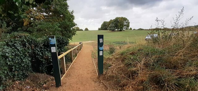
Numerous walking trails wind their way through Roughhill Wood, offering visitors the opportunity to explore its natural beauty. These paths take visitors past babbling brooks, moss-covered rocks, and ancient trees, providing a sense of peace and tranquility.
The forest is home to a wide range of wildlife, including deer, foxes, rabbits, and various species of birds. Birdwatchers will be delighted by the chance to spot woodpeckers, owls, and thrushes, among others. The wood's diverse ecosystem also supports a variety of insects, butterflies, and small mammals.
Roughhill Wood is managed by the Nottinghamshire Wildlife Trust, which ensures its preservation and protection. The trust actively promotes conservation efforts and educates visitors about the importance of maintaining such natural habitats.
Overall, Roughhill Wood offers a serene escape from the hustle and bustle of everyday life, providing a haven for both nature lovers and those seeking a peaceful retreat in the heart of Nottinghamshire.
If you have any feedback on the listing, please let us know in the comments section below.
Roughhill Wood Images
Images are sourced within 2km of 52.951497/-1.1169877 or Grid Reference SK5939. Thanks to Geograph Open Source API. All images are credited.


Roughhill Wood is located at Grid Ref: SK5939 (Lat: 52.951497, Lng: -1.1169877)
Unitary Authority: Nottingham
Police Authority: Nottinghamshire
What 3 Words
///cuts.reader.shirt. Near Nottingham, Nottinghamshire
Nearby Locations
Related Wikis

Nottingham Racecourse railway station
Nottingham Racecourse railway station was a station opened by the Great Northern Railway to serve Nottingham Racecourse in Nottingham, England. == History... ==
Sneinton
Sneinton (pronounced "Snenton") is a suburb of Nottingham and former civil parish in the Nottingham district, in the ceremonial county of Nottinghamshire...

Sneinton Festival
Sneinton Festival is a local cultural event that takes place every July in Sneinton, Nottingham, England. The first festival was held in 1995, and is run...
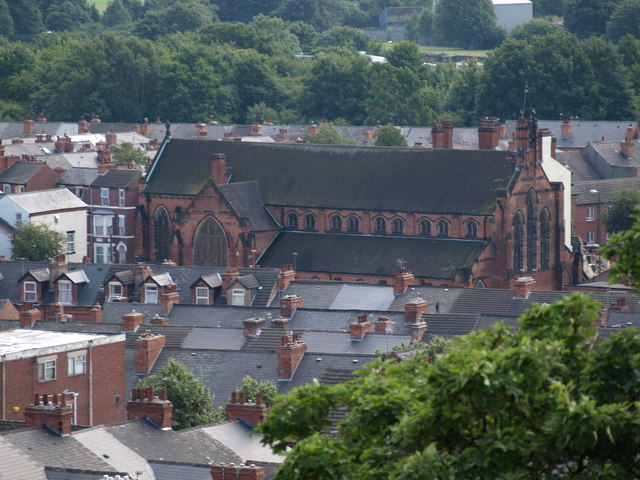
St Christopher's Church, Sneinton
St Christopher's Church, Sneinton is a Church of England church in Sneinton Nottingham. == History == The church was built on the site of a former iron...
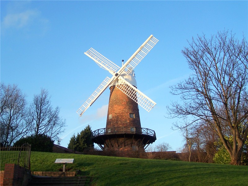
Green's Mill, Sneinton
Green's Windmill is a restored and working 19th century tower windmill in Sneinton, Nottingham. Built in the early 1800s for the milling of wheat into...
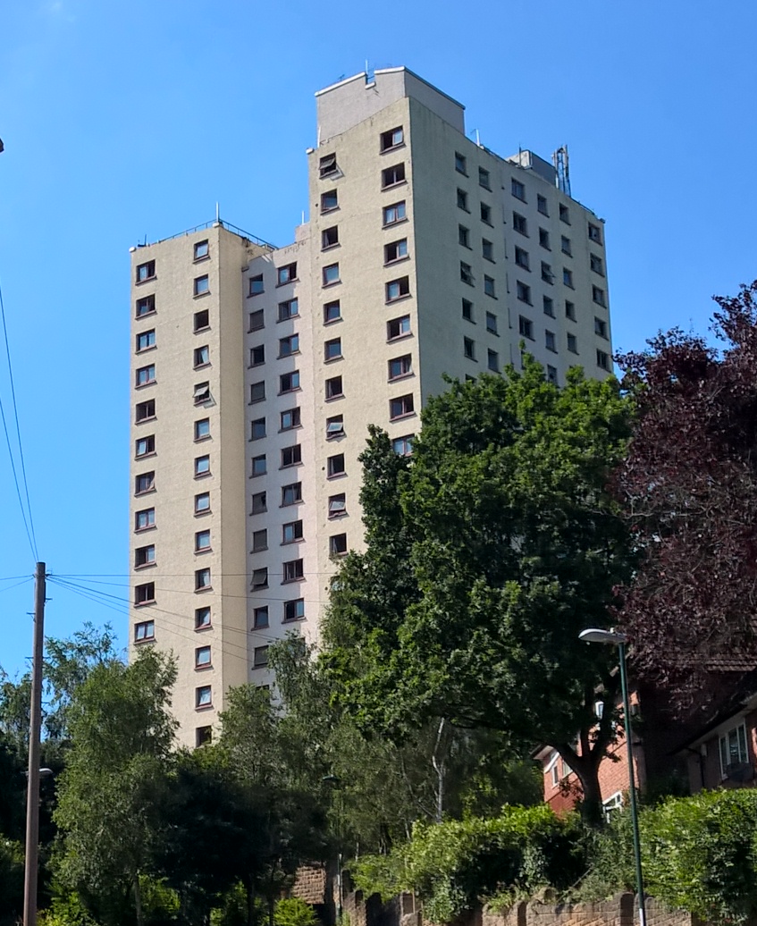
Burrows Court
Burrows Court is a high-rise residential building in the Sneinton neighbourhood in Nottingham, United Kingdom. Built in 1967 to a height of 61 metres...
Bakersfield, Nottingham
Bakersfield is a small residential suburb of Nottingham east of the city centre. == History == Bakersfield was developed during the 1930s, with a mixture...
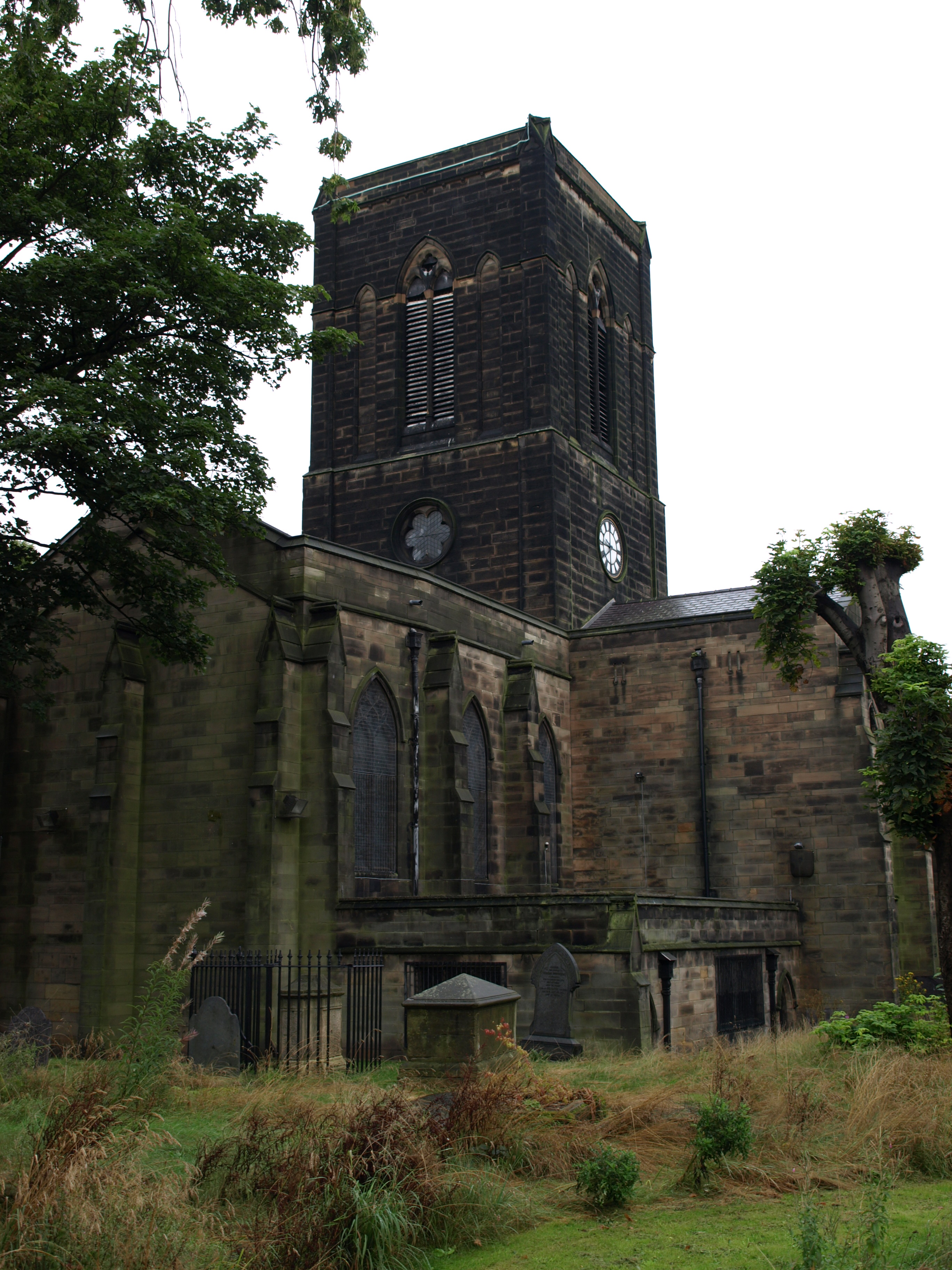
St Stephen's Church, Sneinton
St. Stephen's Church, Sneinton is a parish church in the Church of England. The church is Grade II listed by the Department for Digital, Culture, Media...
Related Videos
Love in the tub ! 😂 Hiking Ginger warming up after lake swim. #alzheimersociety #lejog #uk #bbc
Warming up after a lake swim getting ready and training for my walk from Lands End to John O'Groats on 21st April'24. Massive ...


Notts TV - Nottingham Is Great For Urban Walking
For upcoming walks visit the Get Fit Nottingham page at http://www.meetup.com/get-fit-nottingham and RSVP! Walking is an ...

Nearby Amenities
Located within 500m of 52.951497,-1.1169877Have you been to Roughhill Wood?
Leave your review of Roughhill Wood below (or comments, questions and feedback).