Dunningwell

Settlement in Cumberland Copeland

England

Dunningwell

The Punch Bowl Inn, The Green, Millom
The Punch Bowl Inn, The Green, Millom Credit: Colin Park

Dunningwell is a small village located in the county of Cumberland, in the northwest region of England. Situated amidst the picturesque countryside, the village is known for its serene and idyllic surroundings. Dunningwell is nestled in a valley, surrounded by rolling hills and lush green fields, making it an ideal destination for nature enthusiasts and those seeking a peaceful retreat.

The village itself is relatively small, with a population of around 500 residents. The community in Dunningwell is close-knit and friendly, with a strong sense of community spirit. The village is characterized by its quaint and charming architecture, with traditional stone houses and cottages lining the streets.

Despite its small size, Dunningwell offers a range of amenities to its residents and visitors. The village has a local pub, a small convenience store, and a primary school, which serves the neighboring areas as well. The village also has a village hall, which serves as a venue for community events and gatherings.

Dunningwell is surrounded by natural beauty and offers plenty of opportunities for outdoor activities. The village is situated near several walking and cycling trails, allowing visitors to explore the stunning countryside. Additionally, the nearby Dunningwell Forest is a popular spot for picnics, wildlife spotting, and enjoying nature walks.

Overall, Dunningwell is a charming village that offers a peaceful and picturesque setting, making it an attractive destination for those looking to escape the hustle and bustle of city life and immerse themselves in the tranquility of the English countryside.

If you have any feedback on the listing, please let us know in the comments section below.
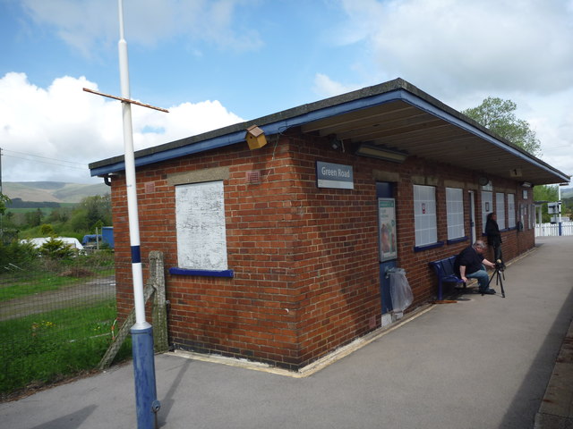
Dunningwell Images

Images are sourced within 2km of 54.244933/-3.275202 or Grid Reference SD1784. Thanks to Geograph Open Source API. All images are credited.

The Punch Bowl Inn, The Green, Millom
Ordnance Survey Cut Mark This OS cut mark can be found on Old Hall Cottage. It marks a point 39.156m above mean sea level.
Ordnance Survey Cut Mark
This OS cut mark can be found on Old Hall Cottage. It marks a point 39.156m above mean sea level.
Ordnance Survey Cut Mark This OS cut mark can be found on Briar Dene. It marks a point 19.020m above mean sea level.
Ordnance Survey Cut Mark
This OS cut mark can be found on Briar Dene. It marks a point 19.020m above mean sea level.
SRPS Cumbrian Coast Railtour 2018 : Green Road Station
Boundary Stone Toppled and damaged, over stream, south side of the A595.
Boundary Stone
Toppled and damaged, over stream, south side of the A595.
Ordnance Survey Rivet This OS rivet can be found on the step of the buried water tank compound. It marks a point 107.189m above mean sea level.
Ordnance Survey Rivet
This OS rivet can be found on the step of the buried water tank compound. It marks a point 107.189m above mean sea level.
Ordnance Survey Rivet This OS rivet can be found on the wall SE side of the road. It marks a point 92.013m above mean sea level.
Ordnance Survey Rivet
This OS rivet can be found on the wall SE side of the road. It marks a point 92.013m above mean sea level.
Ordnance Survey Cut Mark This OS cut mark can be found on the wall south side of the road. It marks a point 54.724m above mean sea level.
Ordnance Survey Cut Mark
This OS cut mark can be found on the wall south side of the road. It marks a point 54.724m above mean sea level.
Ordnance Survey Cut Mark This OS cut mark can be found on the rock face NE side of the road. It marks a point 56.565m above mean sea level.
Ordnance Survey Cut Mark
This OS cut mark can be found on the rock face NE side of the road. It marks a point 56.565m above mean sea level.
Ordnance Survey Cut Mark This OS cut mark can be found on the Village Hall SE side of the road. It marks a point 51.075m above mean sea level.
Ordnance Survey Cut Mark
This OS cut mark can be found on the Village Hall SE side of the road. It marks a point 51.075m above mean sea level.
Ordnance Survey Cut Mark This OS cut mark can be found on the gatepost south side of the road. It marks a point 59.576m above mean sea level.
Ordnance Survey Cut Mark
This OS cut mark can be found on the gatepost south side of the road. It marks a point 59.576m above mean sea level.
Ordnance Survey Flush Bracket (G3081) This OS Flush Bracket can be found on Hall Bank. It marks a point 28.226m above mean sea level.
Ordnance Survey Flush Bracket (G3081)
This OS Flush Bracket can be found on Hall Bank. It marks a point 28.226m above mean sea level.
Ordnance Survey Cut Mark This OS cut mark can be found on the brick building at Waltham Nursery. It marks a point 5.925m above mean sea level.
Ordnance Survey Cut Mark
This OS cut mark can be found on the brick building at Waltham Nursery. It marks a point 5.925m above mean sea level.
Ordnance Survey Cut Mark This OS cut mark can be found on a gatepost SE side of the track. It marks a point 6.172m above mean sea level.
Ordnance Survey Cut Mark
This OS cut mark can be found on a gatepost SE side of the track. It marks a point 6.172m above mean sea level.
Ordnance Survey Flush Bracket (G3077) This OS Flush Bracket can be found on The Oaks. It marks a point 35.752m above mean sea level.
Ordnance Survey Flush Bracket (G3077)
This OS Flush Bracket can be found on The Oaks. It marks a point 35.752m above mean sea level.
Ordnance Survey Cut Mark This OS cut mark can be found on the gatepost NE side of the road. It marks a point 59.489m above mean sea level.
Ordnance Survey Cut Mark
This OS cut mark can be found on the gatepost NE side of the road. It marks a point 59.489m above mean sea level.
Green Road Station sign at Green Road, Cumbria.
Green Road
Station sign at Green Road, Cumbria.
Dwelling in Hallthwaites Bridge at Hallthwaites, Cumbria.
Dwelling in Hallthwaites
Bridge at Hallthwaites, Cumbria.
Show me another place!

Dunningwell is located at Grid Ref: SD1784 (Lat: 54.244933, Lng: -3.275202)

Administrative County: Cumbria

District: Copeland

Police Authority: Cumbria

What 3 Words

///trustees.demanding.alas. Near Millom, Cumbria

Related Wikis

Arnaby

Arnaby is a village in Cumbria, England.

Thwaites, Cumbria

Thwaites is a small village near Duddon Valley and on the edge of the Duddon Estuary in the Lake District National Park in the Borough of Copeland, Cumbria...

St Anne's Church, Thwaites

St Anne's Church is in the village of Thwaites, Cumbria, England. It is an active Anglican parish church in the deanery of Millom, the archdeaconry of...

Millom Without

Millom Without is a civil parish in the county of Cumbria, England. It had a population of 1,638 in 2001, decreasing to 859 at the 2011 Census. Millom...

Nearby Amenities

Located within 500m of 54.244933,-3.275202
Barrier: cattle_grid
Lat/Long: 54.2433249/-3.2736149
Power: tower
Lat/Long: 54.2451774/-3.2808561
Power: tower
Lat/Long: 54.2463137/-3.2746762
Power: tower
Lat/Long: 54.2470157/-3.2708955
Power: pole
Lat/Long: 54.2488326/-3.27881
Power: pole
Lat/Long: 54.2453581/-3.2825554
Power: pole
Lat/Long: 54.2437309/-3.2824859
Power: pole
Lat/Long: 54.2483787/-3.2785611
Power: pole
Lat/Long: 54.24261/-3.276645
Power: pole
Lat/Long: 54.2429767/-3.2798589
Power: pole
Lat/Long: 54.2427864/-3.2818897
Power: pole
Lat/Long: 54.241622/-3.2741975
Power: pole
Lat/Long: 54.241233/-3.273254
Barrier: stile
Lat/Long: 54.2408426/-3.2731268
Barrier: stile
Lat/Long: 54.2413406/-3.2729173
Ford: yes
Lat/Long: 54.2430239/-3.2735164
The data included in this document is from www.openstreetmap.org. The data is made available under ODbL.

Have you been to Dunningwell?

Leave your review of Dunningwell below (or comments, questions and feedback).