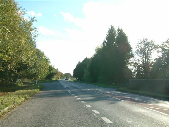
Pitland Copse

Wood, Forest in Hampshire Basingstoke and Deane

England

Pitland Copse

Monk Sherborne Road, Ramsdell
Monk Sherborne Road, Ramsdell Credit: Oscar

Pitland Copse is a charming woodland located in the county of Hampshire, England. Covering an area of approximately 50 acres, this picturesque forest offers a tranquil escape from the hustle and bustle of everyday life.

The copse is predominantly made up of native deciduous trees, including oak, beech, and birch, which provide a rich and diverse habitat for a wide range of wildlife. Walking through the forest, visitors can expect to see a variety of birds, such as woodpeckers and nuthatches, as well as small mammals like squirrels and rabbits.

The woodland floor is adorned with a carpet of bluebells in the spring, creating a stunning display of color and fragrance. In the summer, the canopy provides welcome shade, making it an ideal place for a leisurely stroll or a family picnic. As autumn arrives, the leaves change to vibrant hues of red, orange, and gold, painting a picture-perfect scene.

Pitland Copse is intersected by a network of well-maintained footpaths, allowing visitors to explore the woodland at their own pace. These paths lead to charming clearings and hidden glades, providing opportunities for nature observation and quiet reflection. The forest is also home to a small pond, attracting a variety of water-loving creatures.

Accessible by car, Pitland Copse offers ample parking facilities nearby. The copse is open to the public throughout the year, and there is no entrance fee. It is advisable to wear sturdy footwear and bring insect repellent, especially during the summer months. Pitland Copse is a true gem of Hampshire, offering a peaceful and enchanting experience for nature lovers and outdoor enthusiasts alike.

If you have any feedback on the listing, please let us know in the comments section below.

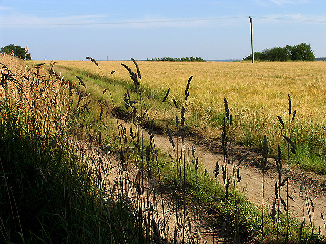
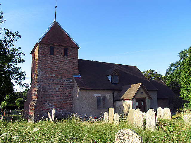
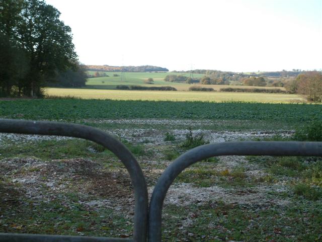
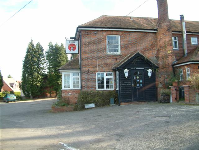
Pitland Copse Images

Images are sourced within 2km of 51.322906/-1.1537748 or Grid Reference SU5958. Thanks to Geograph Open Source API. All images are credited.

Monk Sherborne Road, Ramsdell
Christ Church, Ramsdell A small Victorian (1867) church of flint walls with red brick accents and stone tracery details. The church is Grade II listed <span class="nowrap"><a title="https://historicengland.org.uk/listing/the-list/list-entry/1173070" rel="nofollow ugc noopener" href="https://historicengland.org.uk/listing/the-list/list-entry/1173070">Link</a><img style="margin-left:2px;" alt="External link" title="External link - shift click to open in new window" src="https://s1.geograph.org.uk/img/external.png" width="10" height="10"/></span>
Christ Church, Ramsdell
A small Victorian (1867) church of flint walls with red brick accents and stone tracery details. The church is Grade II listed LinkExternal link
Charlie's Cattery, Pamber End On Aldermaston Road (the A340).
Charlie's Cattery, Pamber End
On Aldermaston Road (the A340).
Farmland near Baughurst This square is largely farmland and a network of minor roads. This view was taken near the footpath, at the intersection in the adjacent square. The view looks southeast along the road.
Farmland near Baughurst
This square is largely farmland and a network of minor roads. This view was taken near the footpath, at the intersection in the adjacent square. The view looks southeast along the road.
St  Stephen's near Baughurst This square is mostly farmland and also contains this church. This view taken from the only spot where one can get the whole building in the picture comfortably, is from the north east.
St Stephen's near Baughurst
This square is mostly farmland and also contains this church. This view taken from the only spot where one can get the whole building in the picture comfortably, is from the north east.
St Stephen's and the graveyard, near Baughurst This view of the church and gravestones, backlit against the late afternoon sun, was taken from more or less the east side of the church. The church is surrounded by the graveyard on three sides, the west side of the church being right on the boundary of the church grounds.
St Stephen's and the graveyard, near Baughurst
This view of the church and gravestones, backlit against the late afternoon sun, was taken from more or less the east side of the church. The church is surrounded by the graveyard on three sides, the west side of the church being right on the boundary of the church grounds.
Paddock near Browning Hill Green This square being largely farmland also has a paddock or two. This paddock is in the north western section of the square.
Paddock near Browning Hill Green
This square being largely farmland also has a paddock or two. This paddock is in the north western section of the square.
Farmland near Stratton Manor This view (where the road takes a sharp turn) shows the entrance to Stratton Manor on the left and the farmland behind the trees is in the east section of the square.
Farmland near Stratton Manor
This view (where the road takes a sharp turn) shows the entrance to Stratton Manor on the left and the farmland behind the trees is in the east section of the square.
A Neat Haystack near Coombe House Farm This square is farmland but also contains Brownhill Copse and two other smaller copses.
A Neat Haystack near Coombe House Farm
This square is farmland but also contains Brownhill Copse and two other smaller copses.
Barley Field near Coombe House Farm The square is currently planted with more than one type of crop. This barley field is in the south western section of the square.
Barley Field near Coombe House Farm
The square is currently planted with more than one type of crop. This barley field is in the south western section of the square.
St Peter's near Tadley Place This square is mostly farmland but also contains the Church of St Peter. The church has a new cemetery and with a new lych gate at its entrance. This new cemetery is opposite the church.
St Peter's near Tadley Place
This square is mostly farmland but also contains the Church of St Peter. The church has a new cemetery and with a new lych gate at its entrance. This new cemetery is opposite the church.
Skyers Farm Ramsdell Skyers Farm looking south from the road to Ramsdell.
Skyers Farm Ramsdell
Skyers Farm looking south from the road to Ramsdell.
Ramsdell Village Church This picturesque church is by the crossroads in the centre of the village of Ramsdell
Ramsdell Village Church
This picturesque church is by the crossroads in the centre of the village of Ramsdell
Portway  to Old Sarum The route of Portway, the old Roman road from Calleva (Silchester) to Old Sarum (Salisbury), and the South Coast. It runs in a straight line to the right of the wood which can be seen to the left of the image, almost directly above the middle of the gates.
Portway to Old Sarum
The route of Portway, the old Roman road from Calleva (Silchester) to Old Sarum (Salisbury), and the South Coast. It runs in a straight line to the right of the wood which can be seen to the left of the image, almost directly above the middle of the gates.
Looking West
Looking West
Looking South
Looking South
West Green
West Green
The White Hart, Charter Alley.
Show me another place!

Pitland Copse is located at Grid Ref: SU5958 (Lat: 51.322906, Lng: -1.1537748)

Administrative County: Hampshire

District: Basingstoke and Deane

Police Authority: Hampshire

What 3 Words

///town.urgent.blindfold. Near Tadley, Hampshire

Related Wikis

West Heath, Hampshire

West Heath is a hamlet in the Basingstoke and Deane district of Hampshire, England. It is in the civil parish of Wootton St Lawrence. Its nearest town...

Charter Alley

Charter Alley is a village in north east Hampshire, England. According to the Post Office the majority of the population at the 2011 Census was included...

Ramsdell

Ramsdell is a small village in the civil parish of Wootton St Lawrence with Ramsdell, in the Basingstoke and Deane district, in the English county of Hampshire...
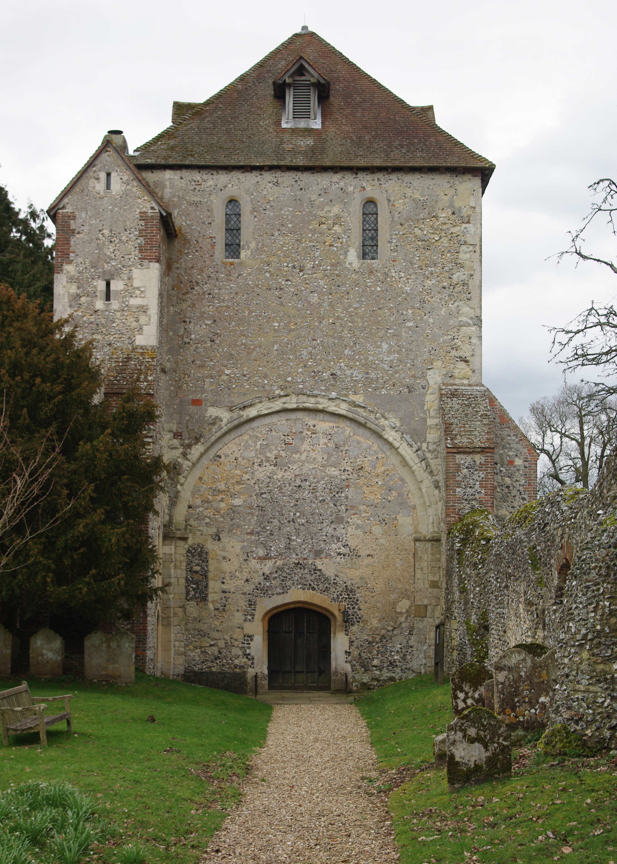
Pamber Priory

Pamber Priory is a Church of England parish church and former priory, then known as West Sherborne Priory or Monk Sherborne Priory, at Monk Sherborne in...

Pamber

Pamber is a civil parish located in the north of Hampshire, England, near the border with Berkshire. The parish population at the 2011 Census was 2,613...

Pamber Green

Pamber Green is a hamlet in north Hampshire, England. == Governance == Pamber Green is part of the parish of Pamber, which covers Pamber Heath, Pamber...

Ron Ward's Meadow With Tadley Pastures

Ron Ward's Meadow With Tadley Pastures is a site of Site of Special Scientific Interest (SSSI). It is based on the edge of Tadley in Hampshire, England...

Pamber End

Pamber End is a hamlet in north Hampshire, England. Located south of Tadley.. == Governance == Pamber End is part of the civil parish of Pamber (where...

Nearby Amenities

Located within 500m of 51.322906,-1.1537748
West Heath
Is In: Hampshire, England, UK
Place: village
Wikidata: Q9372164
Lat/Long: 51.321964/-1.1533624
Power: tower
Source: Bing
Lat/Long: 51.3184394/-1.1533747
Barrier: kissing_gate
Lat/Long: 51.320867/-1.1489896
Witch Lane Farm
Landuse: farm
Note Retag: CS #48756035
Lat/Long: 51.3227426/-1.1499082
Pitlands Farm
Landuse: farm
Note Retag: CS #48756035
Lat/Long: 51.3198977/-1.1495406
Man Made: wastewater_plant
Lat/Long: 51.3212931/-1.1495743
Postal Code: RG26 5PY
Source Postal Code: planning notice
Lat/Long: 51.3191292/-1.1519634
Bus Stop
Pollards Farm
Naptan AtcoCode: 1900HA010545
Naptan Bearing: N
Naptan CommonName: Pollards Farm
Naptan Crossing: Old Vyne Lane
Naptan Landmark: Hawthorne Cottage
Naptan NaptanCode: hamdtwag
Naptan Street: Unamed Road Through Village
Naptan Verified: no
Source: naptan_import
Lat/Long: 51.3210583/-1.1565611
Bus Stop
Pollards Farm
Naptan AtcoCode: 1900HA010546
Naptan Bearing: S
Naptan CommonName: Pollards Farm
Naptan Crossing: The Common
Naptan NaptanCode: hamdtwaj
Naptan Street: Unamed Road Through Village
Naptan Verified: no
Source: naptan_import
Lat/Long: 51.3210042/-1.1565334
Combe House Farm
Landuse: farm
Note Retag: CS #48756035
Source: OS_OpenData_StreetView
Lat/Long: 51.3265479/-1.1545716
Pollards House
Addr Housename: Pollards House
Building: house
Source: OS_OpenData_StreetView
Lat/Long: 51.3226874/-1.1560104
Barrier: kissing_gate
Lat/Long: 51.3191643/-1.1521663
Barrier: yes
Lat/Long: 51.3199019/-1.1491506
The data included in this document is from www.openstreetmap.org. The data is made available under ODbL.

Have you been to Pitland Copse?

Leave your review of Pitland Copse below (or comments, questions and feedback).