Broomhill Copse

Wood, Forest in Berkshire

England

Broomhill Copse

Field boundary, Bradfield, Berkshire
Field boundary, Bradfield, Berkshire Credit: Oswald Bertram

Broomhill Copse is a picturesque woodland located in Berkshire, England. Covering an area of approximately 100 hectares, it is a well-known and much-loved destination for nature enthusiasts and outdoor adventurers alike.

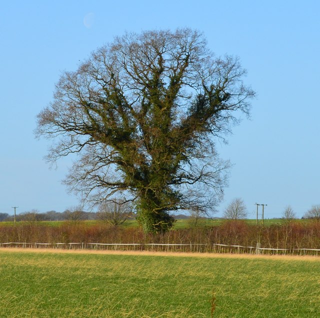
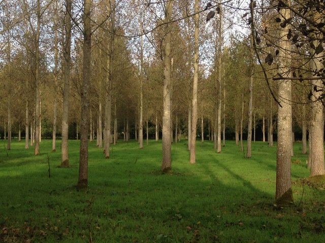
The copse is characterized by its dense forest of deciduous and coniferous trees, creating a lush and vibrant environment. The diverse range of tree species includes oak, beech, birch, and pine, providing a habitat for various flora and fauna.

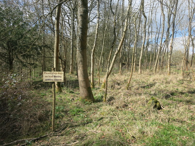
The woodland is crisscrossed by a network of well-maintained footpaths and trails, allowing visitors to easily explore the area. These paths lead visitors through the heart of the copse, passing by bubbling brooks, small ponds, and open meadows. The peaceful ambiance and tranquil surroundings make Broomhill Copse an ideal location for walking, jogging, or simply enjoying a leisurely stroll.

Wildlife is abundant within the copse, with numerous species of birds, mammals, and insects calling it home. Keen birdwatchers may spot woodpeckers, owls, and various songbirds, while lucky visitors may even catch a glimpse of deer or foxes. In spring and summer, the copse comes alive with the sights and sounds of butterflies and dragonflies flitting among the flowers and waterways.

Broomhill Copse is not only a haven for nature enthusiasts but also serves as an educational resource. Local schools and community groups often visit the copse to learn about the importance of conservation and the various ecosystems that exist within woodlands.

Overall, Broomhill Copse offers a serene and enchanting escape from the hustle and bustle of everyday life, providing visitors with a chance to reconnect with nature and appreciate the beauty of the Berkshire countryside.

If you have any feedback on the listing, please let us know in the comments section below.

Broomhill Copse Images

Images are sourced within 2km of 51.460886/-1.1550838 or Grid Reference SU5873. Thanks to Geograph Open Source API. All images are credited.

Field boundary, Bradfield, Berkshire
Footbridge over the M4 The M4 is 190 miles long and runs from London to South Wales. Major centres close to the motorway include Reading, Swindon, Bristol, Newport, Cardiff and Swansea. The motorway was constructed between 1961 and 1996. The M4 originally crossed the first Severn Road Bridge. It has now been diverted to use the Second Severn Crossing and the motorway over the older bridge has been renumbered as M48.
Wikipedia: <span class="nowrap"><a title="http://en.wikipedia.org/wiki/M4_motorway" rel="nofollow ugc noopener" href="http://en.wikipedia.org/wiki/M4_motorway">Link</a><img style="margin-left:2px;" alt="External link" title="External link - shift click to open in new window" src="https://s1.geograph.org.uk/img/external.png" width="10" height="10"/></span>
Footbridge over the M4
The M4 is 190 miles long and runs from London to South Wales. Major centres close to the motorway include Reading, Swindon, Bristol, Newport, Cardiff and Swansea. The motorway was constructed between 1961 and 1996. The M4 originally crossed the first Severn Road Bridge. It has now been diverted to use the Second Severn Crossing and the motorway over the older bridge has been renumbered as M48. Wikipedia: LinkExternal link
Scratchface Lane Bridge, M4 The M4 is 190 miles long and runs from London to South Wales. Major centres close to the motorway include Reading, Swindon, Bristol, Newport, Cardiff and Swansea. The motorway was constructed between 1961 and 1996. The M4 originally crossed the first Severn Road Bridge. It has now been diverted to use the Second Severn Crossing and the motorway over the older bridge has been renumbered as M48.
Wikipedia: <span class="nowrap"><a title="http://en.wikipedia.org/wiki/M4_motorway" rel="nofollow ugc noopener" href="http://en.wikipedia.org/wiki/M4_motorway">Link</a><img style="margin-left:2px;" alt="External link" title="External link - shift click to open in new window" src="https://s1.geograph.org.uk/img/external.png" width="10" height="10"/></span>
Scratchface Lane Bridge, M4
The M4 is 190 miles long and runs from London to South Wales. Major centres close to the motorway include Reading, Swindon, Bristol, Newport, Cardiff and Swansea. The motorway was constructed between 1961 and 1996. The M4 originally crossed the first Severn Road Bridge. It has now been diverted to use the Second Severn Crossing and the motorway over the older bridge has been renumbered as M48. Wikipedia: LinkExternal link
Bag in the Woods Public footpath through mixed woodland known as The Gravels.
I don't know what the bag is about.
It once contained Bartholomew's Bird Seed, so I guess someone's been in here fattening up the pheasants.
Bag in the Woods
Public footpath through mixed woodland known as The Gravels. I don't know what the bag is about. It once contained Bartholomew's Bird Seed, so I guess someone's been in here fattening up the pheasants.
Holy Trinity, Buckhold: early April 2016 (now a private house)
Holy Trinity, Buckhold: early April 2016
(now a private house)
Kiln Pond, Burnt Hill One of the many old clay pits which can be found around here.
Kiln Pond, Burnt Hill
One of the many old clay pits which can be found around here.
Footpath off Scratchface Lane
Scratchface Lane The name suggests it wasn't always as neat as this along here.
Scratchface Lane
The name suggests it wasn't always as neat as this along here.
Miram's Copse This square is about 75% woodland.
Miram's Copse
This square is about 75% woodland.
Crossroads on Yattendon Lane, Upper Basildon
House on Yattendon Road, Ashurst Common
The road from Ashampstead Common to Pangbourne There's no name available on any map I can see.
The road from Ashampstead Common to Pangbourne
There's no name available on any map I can see.
Poplar plantation near Folly Bridge Looking north-west towards Frogmoor Farm.
Poplar plantation near Folly Bridge
Looking north-west towards Frogmoor Farm.
Suck's Lane 'Unsuitable for heavy goods vehicles'.
Suck's Lane
'Unsuitable for heavy goods vehicles'.
Suck's Lane, Ashampstead Common
M4 driving east Just east of the Scratchface over bridge. Yes, I was a passenger.
M4 driving east
Just east of the Scratchface over bridge. Yes, I was a passenger.
West Berkshire : M4 Motorway The M4 Motorway between Junction 13 (Chieveley Interchange) and Junction 12 (Theale Interchange)
West Berkshire : M4 Motorway
The M4 Motorway between Junction 13 (Chieveley Interchange) and Junction 12 (Theale Interchange)
West Berkshire : M4 Motorway The M4 Motorway between Junction 13 (Chieveley Interchange) and Junction 12 (Theale Interchange)
West Berkshire : M4 Motorway
The M4 Motorway between Junction 13 (Chieveley Interchange) and Junction 12 (Theale Interchange)
Show me another place!

Broomhill Copse is located at Grid Ref: SU5873 (Lat: 51.460886, Lng: -1.1550838)

Unitary Authority: West Berkshire

Police Authority: Thames Valley

What 3 Words

///leans.breakfast.lashed. Near Bradfield, Berkshire

Related Wikis

Ashampstead Common

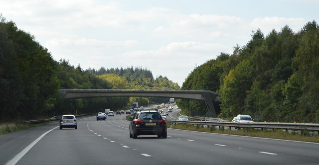
Ashampstead Common is a common in the English county of Berkshire, within the civil parish of Ashampstead. The common lies north of the M4 motorway, near...

Bradfield Rural District

Bradfield was a rural district in Berkshire, England, from 1894 to 1974.It was created under the Local Government Act 1894 from the Bradfield rural sanitary...

St Andrew's School, Pangbourne

St Andrew's School is an independent preparatory school in the hamlet of Buckhold, near Pangbourne, Berkshire, England. Together with its 'Pre-Prep – Early...

Burnt Hill, Berkshire

Burnt Hill is a hamlet in Berkshire, England. It is just north of the M4 motorway in West Berkshire, in the civil parish of Yattendon, which is also the...

Bradfield, Berkshire

Bradfield is a village and civil parish in Berkshire, England. Aside from farms and a smaller amount of woodland its main settlements are Bradfield Southend...

Bradfield College

Bradfield College, formally St Andrew's College, Bradfield, is a public school (English fee-charging boarding and day school) for pupils aged 13–18, located...

Upper Basildon

Upper Basildon is a small village in the civil parish of Basildon (where the United Kingdom 2011 Census population is included), near to Pangbourne, in...

Stanford Dingley

Stanford Dingley is a small village and civil parish in West Berkshire, England, between Newbury and Theale. == Geography == Stanford Dingley fills part...

Nearby Amenities

Located within 500m of 51.460886,-1.1550838
Phone
Check Date: 2023-08-12
Emergency: phone
Ref: 2809A
Lat/Long: 51.4600928/-1.1612702
Phone
Check Date: 2023-08-12
Emergency: phone
Ref: 2809B
Lat/Long: 51.4604856/-1.1612745
The data included in this document is from www.openstreetmap.org. The data is made available under ODbL.

Have you been to Broomhill Copse?

Leave your review of Broomhill Copse below (or comments, questions and feedback).