Dunino

Settlement in Fife

Scotland

Dunino

Pulpit steps A flight of stone steps leading up from Dunino Den to what is said to have been a Druidic pulpit overlooking the Den <a href="https://www.geograph.org.uk/photo/166205">NO5310 : Dunino Den and steps</a>
Pulpit steps Credit: James Allan

Dunino is a small village located in the county of Fife, Scotland. Situated approximately 6 miles south of the town of St. Andrews, Dunino is nestled amidst picturesque countryside and offers a tranquil and scenic setting.

The village is known for its historical significance, with evidence of human habitation in the area dating back to at least the Iron Age. One of the most notable landmarks in Dunino is the ancient Dunino Church, believed to have been founded in the 12th century. The church features a unique Pictish symbol stone, indicating its historical importance.

Despite its small size, Dunino is a vibrant community with a close-knit population. The village is primarily residential, with a mix of traditional cottages and modern homes. The friendly and welcoming atmosphere is one of the village's defining characteristics.

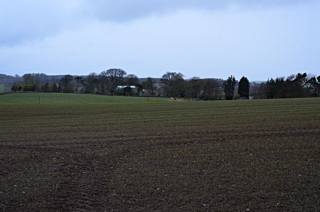
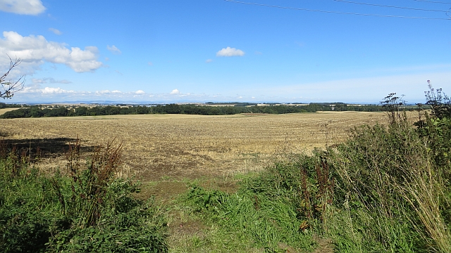
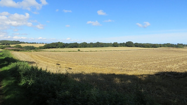
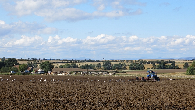
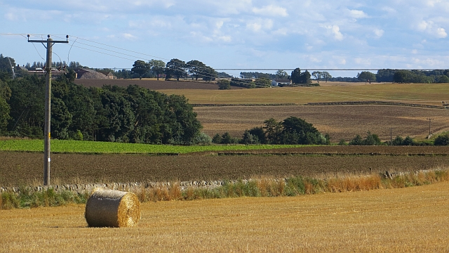
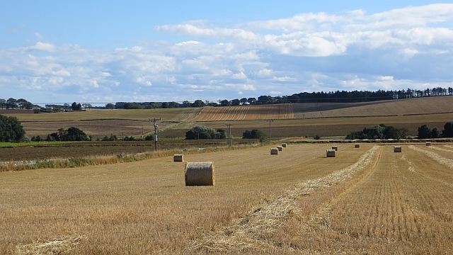
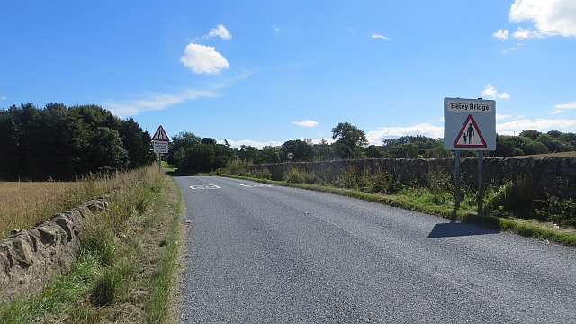
Dunino is also renowned for its stunning natural beauty. The surrounding countryside offers breathtaking views, with rolling hills, lush green landscapes, and charming walking trails. The village is ideally located for outdoor enthusiasts, with opportunities for hiking, cycling, and birdwatching.

While Dunino is a peaceful retreat, it is conveniently located near larger towns and cities. St. Andrews, known for its prestigious university and world-class golf courses, is just a short drive away. The city of Dundee, with its vibrant cultural scene and waterfront development, is also within easy reach.

In summary, Dunino is a small but historically significant village in Fife, Scotland. It offers a beautiful rural setting, a strong sense of community, and convenient access to nearby towns and cities.

If you have any feedback on the listing, please let us know in the comments section below.

Dunino Images

Images are sourced within 2km of 56.290666/-2.749511 or Grid Reference NO5311. Thanks to Geograph Open Source API. All images are credited.

Pulpit steps A flight of stone steps leading up from Dunino Den to what is said to have been a Druidic pulpit overlooking the Den <a href="https://www.geograph.org.uk/photo/166205">NO5310 : Dunino Den and steps</a>
Pulpit steps
A flight of stone steps leading up from Dunino Den to what is said to have been a Druidic pulpit overlooking the Den NO5310 : Dunino Den and steps
The Hunt goes through The hunt passes through a set of road works near Starvithie Mains
The Hunt goes through
The hunt passes through a set of road works near Starvithie Mains
Brake farm From Chesters farm
Brake farm
From Chesters farm
Roe Deer A flushed Roe deer.
Roe Deer
A flushed Roe deer.
Arable Fields Winter cereal fields around Carngour.
Arable Fields
Winter cereal fields around Carngour.
Stubble, Beley Arable land on the ridge running the length of the East Neuk. The area is threatened by wind farmers and there are survey masts in several places. The locals are not impressed.
Stubble, Beley
Arable land on the ridge running the length of the East Neuk. The area is threatened by wind farmers and there are survey masts in several places. The locals are not impressed.
Stubble by The Brake
Cattle, Balkaithly Mixed farming on the higher ground along the ridge between Kenly and Lingo. The higher ground has attracted the wind farmers. There is much local opposition.
Cattle, Balkaithly
Mixed farming on the higher ground along the ridge between Kenly and Lingo. The higher ground has attracted the wind farmers. There is much local opposition.
Arable land near Dunino Higher ground and the farming is mixed with grazing cattle breaking up the arable land here and there.  Not all cereal growing either - brassica crops are also grown.
Arable land near Dunino
Higher ground and the farming is mixed with grazing cattle breaking up the arable land here and there. Not all cereal growing either - brassica crops are also grown.
Dunino Law Not quite as striking a feature as when seen from the north, but it still stands out in an otherwise undramatic landscape (other than the hidden dens).
Dunino Law
Not quite as striking a feature as when seen from the north, but it still stands out in an otherwise undramatic landscape (other than the hidden dens).
A big combine was here Barley straw near Bonnytown - look how far apart the rows are.
A big combine was here
Barley straw near Bonnytown - look how far apart the rows are.
Direct drilling, Stravithie This year's stubble has been replanted without ploughing.
Direct drilling, Stravithie
This year's stubble has been replanted without ploughing.
Brassica crop, Stravithie
Tree lined road, Stravithie Very dark and a bit of a shock after the bright sunlight outside.  The road is a potential rat run and has a weight limit on it.  It was very quiet on this Sunday afternoon.
Tree lined road, Stravithie
Very dark and a bit of a shock after the bright sunlight outside. The road is a potential rat run and has a weight limit on it. It was very quiet on this Sunday afternoon.
Harrowing, Bannafield Feeding time for the gulls in a field being prepared for winter cereals.
Harrowing, Bannafield
Feeding time for the gulls in a field being prepared for winter cereals.
Round bale, Kinaldy There are plans to stick a wind farm on the low ridge in the background. Locals are not amused judging by the roadside displays.
Round bale, Kinaldy
There are plans to stick a wind farm on the low ridge in the background. Locals are not amused judging by the roadside displays.
Stubble and round bales The line of trees on the horizon ( a planned wind farm site) is planted along an old road up to the now ruined South Kinaldy.
Stubble and round bales
The line of trees on the horizon ( a planned wind farm site) is planted along an old road up to the now ruined South Kinaldy.
B9131, Beley Bridge Not a Bailey Bridge, nor a belay from a bridge.
B9131, Beley Bridge
Not a Bailey Bridge, nor a belay from a bridge.
Show me another place!

Dunino is located at Grid Ref: NO5311 (Lat: 56.290666, Lng: -2.749511)

Unitary Authority: Fife

Police Authority: Fife

What 3 Words

///glorious.modifies.chucked. Near St Andrews, Fife

Nearby Locations

Dunino Stravithie

Related Wikis

Dunino

See also Dunino, Poland.Dunino is a village and parish in the East Neuk of Fife. It is 10 km from the nearest town, St Andrews, and 8 km from the fishing...

Stravithie railway station

Stravithie railway station served the hamlet of Stravithie, Fife, Scotland from 1887 to 1930 on the Anstruther and St Andrews Railway. == History == The...

Pittarthie Castle

Pittarthie Castle is the remains of what was a laird’s tower house in Fife, Scotland dating to the end of the sixteenth century. The ruins of the structure...

RNAS Dunino (HMS Jackdaw II)

Royal Naval Air Station Dunino or more simply RNAS Dunino (HMS Jackdaw II) is a former Fleet Air Arm base located 1.8 miles (2.9 km) west of Kingsbarns...

Scottish Championship (golf)

The Scottish Championship was a professional golf tournament that was held 15–18 October 2020 at Fairmont St Andrews, in Fife, Scotland. The principal...

Hero Open

The Hero Open was a professional golf tournament played on the European Tour. The event was created as part of the tour's overhaul in response to the COVID...

Fairmont St Andrews

The Fairmont St Andrews Bay is a 5-star resort hotel situated 2 miles (3.2 km) outside the town of St. Andrews in Fife, Scotland. The hotel is managed...

Boarhills railway station

Boarhills railway station served the hamlet of Boarhills, Fife, Scotland from 1883 to 1930 on the Anstruther and St Andrews Railway. == History == The...

Nearby Amenities

Located within 500m of 56.290666,-2.749511
Place Of Worship
Dunino Den
Religion: Druid
Wikidata: Q56294720
Lat/Long: 56.2883563/-2.7446813
Dunino
Place: hamlet
Lat/Long: 56.2879284/-2.7465088
Hunting Stand
Lat/Long: 56.2919063/-2.7531275
Stravithie Barn
Addr City: St Andrews
Addr Housename: Stravithie Barn
Internet Access: yes
Tourism: chalet
Lat/Long: 56.2905792/-2.7563189
Generator Method: photovoltaic
Generator Output Electricity: yes
Generator Source: solar
Generator Type: solar_photovoltaic_panel
Power: generator
Lat/Long: 56.2885716/-2.747826
Defibrillator
Emergency: defibrillator
Lat/Long: 56.2888287/-2.7430632
Post Box
Collection Times: Mo-Fr 10:30; Sa 09:00
Operator: Royal Mail
Post Box Mounting: pier
Post Box Type: lamp
Ref: KY16 412
Royal Cypher: scottish_crown
Lat/Long: 56.2905152/-2.7493152
Power: pole
Lat/Long: 56.2907105/-2.7569237
Power: pole
Lat/Long: 56.2864717/-2.7509162
Power: pole
Lat/Long: 56.2870466/-2.7509225
Power: pole
Lat/Long: 56.2876461/-2.7509458
Power: pole
Lat/Long: 56.288045/-2.7501002
Power: pole
Lat/Long: 56.2872261/-2.7497663
Power: pole
Lat/Long: 56.2868154/-2.7485952
Power: pole
Lat/Long: 56.2884521/-2.7494365
Power: pole
Lat/Long: 56.2889296/-2.7488594
Power: pole
Lat/Long: 56.2892757/-2.7481682
Power: pole
Lat/Long: 56.2898329/-2.7464687
Power: pole
Lat/Long: 56.2895502/-2.7455344
Power: pole
Lat/Long: 56.2892933/-2.7446043
Power: pole
Lat/Long: 56.2890258/-2.7436805
Power: pole
Lat/Long: 56.2942966/-2.7542582
Power: pole
Lat/Long: 56.2936725/-2.7550234
Power: pole
Lat/Long: 56.2930437/-2.7558182
Power: pole
Lat/Long: 56.2924138/-2.7566088
The data included in this document is from www.openstreetmap.org. The data is made available under ODbL.

Have you been to Dunino?

Leave your review of Dunino below (or comments, questions and feedback).