Sawpit Plantation

Wood, Forest in Nottinghamshire Gedling

England

Sawpit Plantation

Post industrial landscape near Calverton 50 years ago, the view would have been dominated by the winding towers and coal washing plant of Calverton Colliery. The hillside in the background is largely artificial, formed by the colliery spoil tip.
Post industrial landscape near Calverton Credit: Alan Murray-Rust

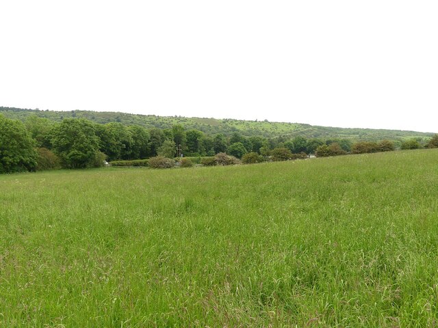
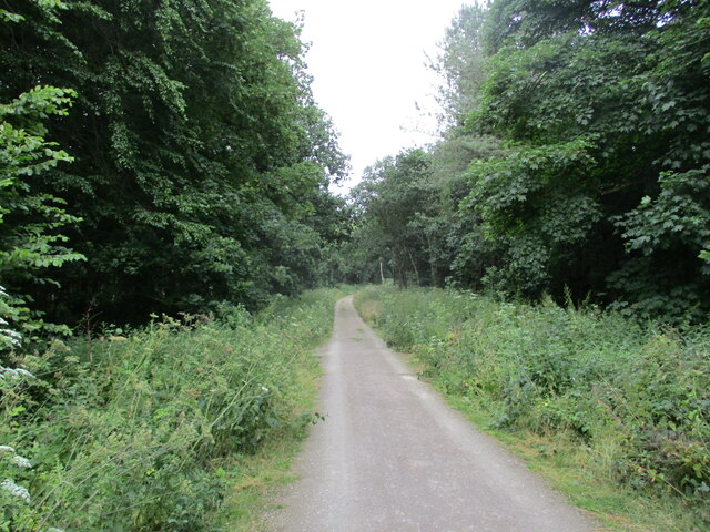
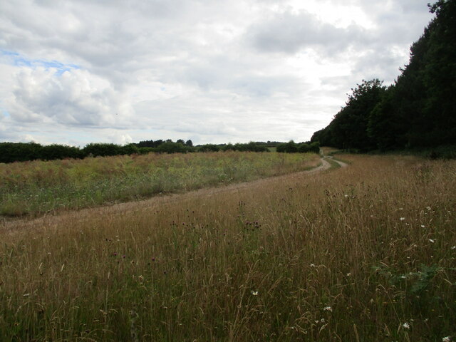
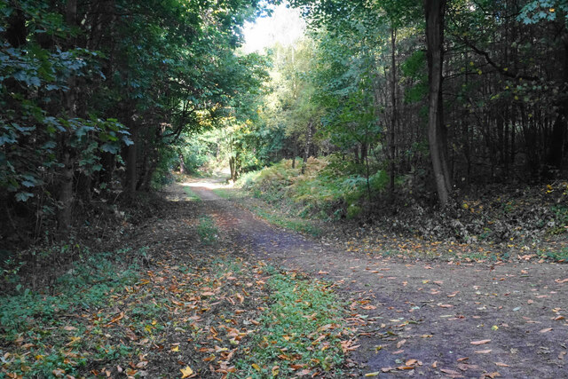
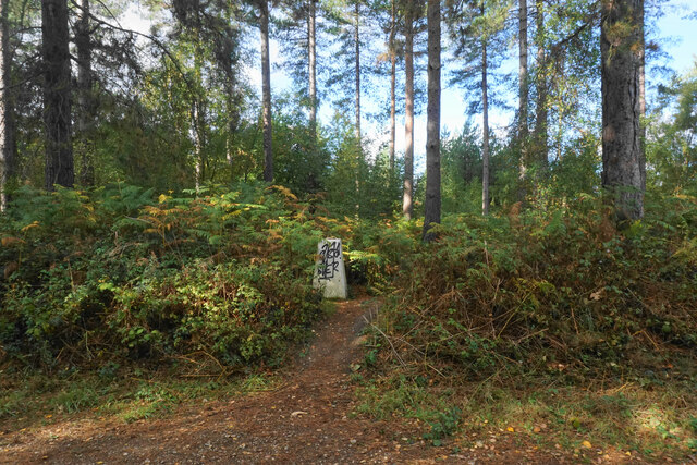
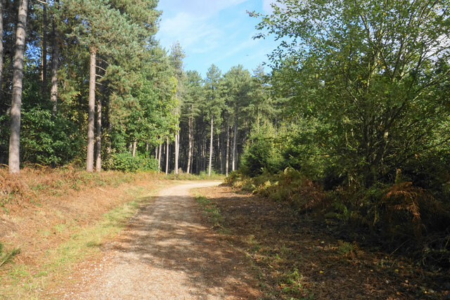
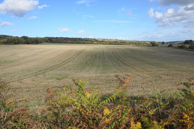
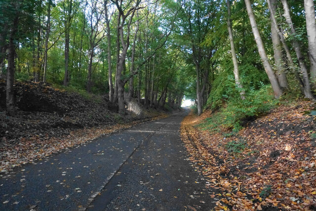
Sawpit Plantation is a picturesque woodland located in Nottinghamshire, England. Situated in the heart of Sherwood Forest, it covers an area of approximately 100 acres, making it one of the largest plantations in the region. The plantation is known for its dense and diverse mix of trees, including oak, beech, and pine, creating a rich and vibrant ecosystem.

The name "Sawpit" refers to the historical practice of using a pit to hold logs while they were sawn into timber. This suggests that the area has a long history of forestry and timber production. Today, however, the plantation is primarily managed for conservation purposes, serving as a haven for a wide range of flora and fauna.

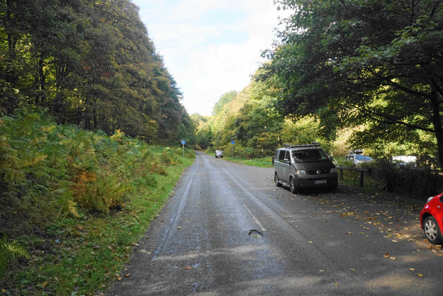
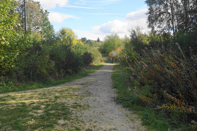
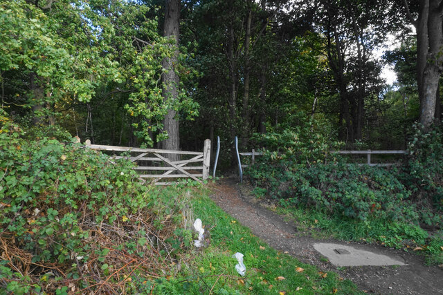
Visitors to Sawpit Plantation can explore numerous well-maintained walking trails that wind through the woodland, providing an opportunity to witness the natural beauty of the area. The plantation is especially popular in the autumn when the leaves turn vibrant shades of red, orange, and gold.

Birdwatchers are also drawn to Sawpit Plantation due to its diverse avian population. Species such as woodpeckers, owls, and various songbirds can be spotted throughout the year, making it a haven for bird enthusiasts.

Overall, Sawpit Plantation offers a tranquil and idyllic setting for nature lovers and outdoor enthusiasts. With its rich history and abundant wildlife, it is a true gem within Nottinghamshire's woodland landscape.

If you have any feedback on the listing, please let us know in the comments section below.

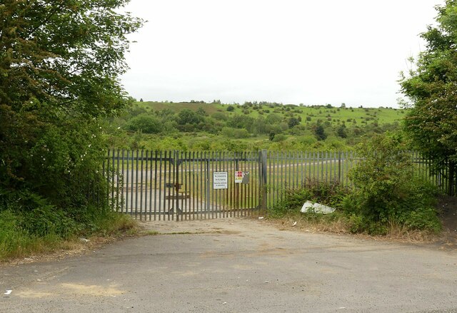
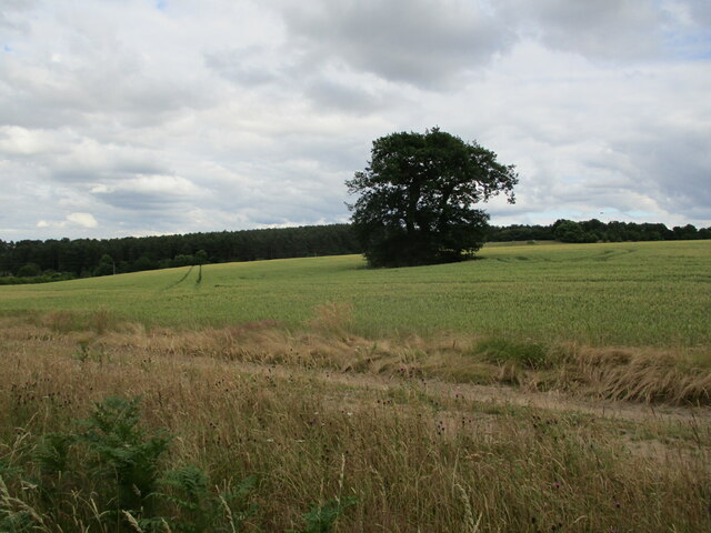
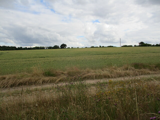
Sawpit Plantation Images

Images are sourced within 2km of 53.052535/-1.1324541 or Grid Reference SK5850. Thanks to Geograph Open Source API. All images are credited.

Post industrial landscape near Calverton 50 years ago, the view would have been dominated by the winding towers and coal washing plant of Calverton Colliery. The hillside in the background is largely artificial, formed by the colliery spoil tip.
Post industrial landscape near Calverton
50 years ago, the view would have been dominated by the winding towers and coal washing plant of Calverton Colliery. The hillside in the background is largely artificial, formed by the colliery spoil tip.
Post industrial landscape near Calverton Former colliery entrance gates. Despite the fence along the road, the area is largely freely accessible. The upper slopes of the former waste tip in the background have been taken over by the Forestry Commission and are designated Open Access Land.
Post industrial landscape near Calverton
Former colliery entrance gates. Despite the fence along the road, the area is largely freely accessible. The upper slopes of the former waste tip in the background have been taken over by the Forestry Commission and are designated Open Access Land.
Robin Hood Way, west of Seven Mile Wood, Papplewick
Isolated tree near Sansom Wood Watchwood Plantation in the distance.
Isolated tree near Sansom Wood
Watchwood Plantation in the distance.
Wheat field near Sansom Wood
Track in Sansom Wood This is also a public footpath.
Track in Sansom Wood
This is also a public footpath.
Farm track alongside Sansom Wood
Gravelly Hollow This road has been blocked off at the far end, so now it is purely an access road for Watchwood Plantation. This is by the main parking area.
Gravelly Hollow
This road has been blocked off at the far end, so now it is purely an access road for Watchwood Plantation. This is by the main parking area.
Track into the Calverton Colliery site The colliery tip site is still undergoing restoration and there is no public access to it yet. There is public access through Watchwood Plantation from where this image was taken.
Track into the Calverton Colliery site
The colliery tip site is still undergoing restoration and there is no public access to it yet. There is public access through Watchwood Plantation from where this image was taken.
Track in Watchwood Plantation A typical track in this woodland. No views are available beyond the immediate foliage.
Track in Watchwood Plantation
A typical track in this woodland. No views are available beyond the immediate foliage.
Top of the hill? A high point along the ridge is marked with a trig pillar, but there are no views available through the surrounding foliage. The trig pillar stands slightly off the main path, and has been defaced with graffiti.
Top of the hill?
A high point along the ridge is marked with a trig pillar, but there are no views available through the surrounding foliage. The trig pillar stands slightly off the main path, and has been defaced with graffiti.
Track in Watchwood Plantation The plantation has a good mix of broad-leaved and coniferous trees, but in this part the pines predominate.
Track in Watchwood Plantation
The plantation has a good mix of broad-leaved and coniferous trees, but in this part the pines predominate.
Harvested field near Watchwood Looking north from Gravelly Hollow.
Harvested field near Watchwood
Looking north from Gravelly Hollow.
Gravelly Hollow This used to be a through route between Calverton and Burntstump, but it has been blocked off at the top of this rise. Now it only provides access to woodland.
Gravelly Hollow
This used to be a through route between Calverton and Burntstump, but it has been blocked off at the top of this rise. Now it only provides access to woodland.
Footpath into Foxcovert Plantation One of numerous forest walks in the locality.
Footpath into Foxcovert Plantation
One of numerous forest walks in the locality.
Road junction on Ollerton Road This used to be a crossroads but the approach from the right has been blocked off.
Road junction on Ollerton Road
This used to be a crossroads but the approach from the right has been blocked off.
The entrance to Sherwood Lodge The joint HQ of Nottinghamshire Police and Fire and Rescue Service. The public cannot go beyond this point.
The entrance to Sherwood Lodge
The joint HQ of Nottinghamshire Police and Fire and Rescue Service. The public cannot go beyond this point.
The Park Hospital A private hospital in the Burntstump complex.
The Park Hospital
A private hospital in the Burntstump complex.
Show me another place!

Sawpit Plantation is located at Grid Ref: SK5850 (Lat: 53.052535, Lng: -1.1324541)

Administrative County: Nottinghamshire

District: Gedling

Police Authority: Nottinghamshire

What 3 Words

///listen.verge.jolt. Near Calverton, Nottinghamshire

Related Wikis

Papplewick Pumping Station

Papplewick Pumping Station, situated in open agricultural land approximately 3 miles (4.8 km) by road from the Nottinghamshire village of Papplewick, was...

Arnold Town F.C.

Arnold Town Football Club is a football club based in Arnold, Nottinghamshire, England. They are currently members of the Central Midlands League South...

Sherwood (UK Parliament constituency)

Sherwood is a constituency represented in the House of Commons of the UK Parliament since 2010 by Mark Spencer, a Conservative. The constituency takes...

Calverton Miners' Welfare F.C.

Calverton Miners' Welfare Football Club is an association football club in Calverton, near Nottingham, Nottinghamshire, England. They are currently members...

Bestwood Pumping Station

Bestwood Pumping Station was a water pumping station operating in Nottinghamshire from 1874 until 1964. == History == Bestwood Pumping Station was built...

Papplewick

Papplewick is a village and civil parish in Nottinghamshire, England, 7.5 miles (12 km) north of Nottingham and 6 miles (10 km) south of Mansfield. It...

Colonel Frank Seely Academy

Colonel Frank Seely Academy (formerly Colonel Frank Seely School) is a coeducational secondary school and sixth form located in Calverton in the English...

Papplewick Hall

Papplewick Hall is a Grade I listed English country house in Papplewick, Nottinghamshire. == History == It was completed around 1787 for the Hon. Frederick...

Nearby Amenities

Located within 500m of 53.052535,-1.1324541
Parking
Description: Layby
Ele: 77.0000000
Lat/Long: 53.0566358/-1.1331969
Parking
Access: destination
Ele: 110.0000000
Lat/Long: 53.0501748/-1.132533
Ele: 93.0000000
Lat/Long: 53.0493372/-1.1362035
Ele: 95.0000000
Lat/Long: 53.049543/-1.1349343
Ele: 107.0000000
Lat/Long: 53.0494027/-1.1334119
Ele: 97.0000000
Lat/Long: 53.0495064/-1.1347406
Ele: 93.0000000
Lat/Long: 53.0490926/-1.1372092
Ele: 94.0000000
Lat/Long: 53.0491399/-1.1370941
Ele: 93.0000000
Lat/Long: 53.0492576/-1.136699
Ele: 78
Lat/Long: 53.0550898/-1.1334249
Ele: 111
Lat/Long: 53.054681/-1.128896
Ele: 79
Lat/Long: 53.0550965/-1.1332451
Ele: 97
Lat/Long: 53.0547966/-1.1305252
The data included in this document is from www.openstreetmap.org. The data is made available under ODbL.

Have you been to Sawpit Plantation?

Leave your review of Sawpit Plantation below (or comments, questions and feedback).