Black Spinney

Wood, Forest in Leicestershire Blaby

England

Black Spinney

The Lime Tree in Whetstone Public House on Cambridge Road, formally called the Kaffir Inn.
<a href="https://www.geograph.org.uk/photo/3926091">SP5596 : The Kaffir Inn on Cambridge Road, Whetstone</a>
The Lime Tree in Whetstone Credit: Mat Fascione

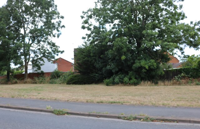
Black Spinney is a picturesque woodland located in Leicestershire, England. It is situated near the village of Woodhouse Eaves, within the Charnwood Forest area. Covering an area of approximately 50 acres, Black Spinney is characterized by its dense canopy of predominantly deciduous trees, creating a serene and tranquil atmosphere for visitors.

The woodland features a variety of tree species, including oak, beech, ash, and sycamore, among others. This diverse mix of trees contributes to the vibrant display of colors during the autumn months, attracting nature enthusiasts and photographers alike. The forest floor is covered with a rich carpet of mosses, ferns, and wildflowers, adding to its natural beauty.

Black Spinney is home to a diverse range of wildlife. Visitors may encounter various bird species, such as woodpeckers, owls, and thrushes, along with small mammals like foxes, rabbits, and squirrels. The woodland also provides a habitat for insects, including butterflies and dragonflies.

The site offers several walking trails that allow visitors to explore the woodland at their own pace. These paths meander through the trees, providing opportunities for peaceful walks and a chance to connect with nature. Additionally, Black Spinney is a popular destination for nature education programs and guided walks, providing visitors with the opportunity to learn about the local flora and fauna.

Overall, Black Spinney in Leicestershire is a natural haven, offering a tranquil escape from the hustle and bustle of everyday life. With its diverse vegetation, wildlife, and scenic trails, it is an ideal destination for nature lovers and those seeking a peaceful retreat.

If you have any feedback on the listing, please let us know in the comments section below.

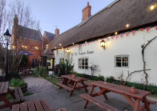
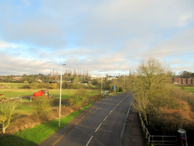
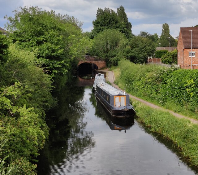
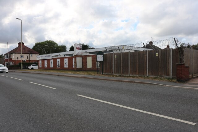
Black Spinney Images

Images are sourced within 2km of 52.57212/-1.1593454 or Grid Reference SP5797. Thanks to Geograph Open Source API. All images are credited.

The Lime Tree in Whetstone Public House on Cambridge Road, formally called the Kaffir Inn.
<a href="https://www.geograph.org.uk/photo/3926091">SP5596 : The Kaffir Inn on Cambridge Road, Whetstone</a>
The Lime Tree in Whetstone
Public House on Cambridge Road, formally called the Kaffir Inn. SP5596 : The Kaffir Inn on Cambridge Road, Whetstone
The Birmingham-Peterborough cross-country line entering Leicester from the south-west
Footpath over Simpkin's Bridge The footpath, from Blaby, crosses the Grand Union Canal, and the railway line from Birmingham (gate ahead) to enter the City of Leicester (Eyres Monsell ward)
Footpath over Simpkin's Bridge
The footpath, from Blaby, crosses the Grand Union Canal, and the railway line from Birmingham (gate ahead) to enter the City of Leicester (Eyres Monsell ward)
Simpkin's Bridge, Grand Union Canal
Glen Parva Manor (pub restaurant) Listed Grade II "Late C16 or early C17 core extended c1860 and modernised" <span class="nowrap"><a title="https://historicengland.org.uk/listing/the-list/list-entry/1074733?section=official-listing" rel="nofollow ugc noopener" href="https://historicengland.org.uk/listing/the-list/list-entry/1074733?section=official-listing">Link</a><img style="margin-left:2px;" alt="External link" title="External link - shift click to open in new window" src="https://s1.geograph.org.uk/img/external.png" width="10" height="10"/></span>. "Sizable countryside restaurant/bar with outdoor seats and pub grub from grills to global classics." <span class="nowrap"><a title="https://www.glenparvamanorpub.co.uk/" rel="nofollow ugc noopener" href="https://www.glenparvamanorpub.co.uk/">Link</a><img style="margin-left:2px;" alt="External link" title="External link - shift click to open in new window" src="https://s1.geograph.org.uk/img/external.png" width="10" height="10"/></span>
Glen Parva Manor (pub restaurant)
Listed Grade II "Late C16 or early C17 core extended c1860 and modernised" LinkExternal link. "Sizable countryside restaurant/bar with outdoor seats and pub grub from grills to global classics." LinkExternal link
The Ford, Glen Parva Crossing the River Sence
The Ford, Glen Parva
Crossing the River Sence
Church of St Thomas the Apostle, South Wigston Listed Grade II "1892-3 with tower of 1901, by Stockdale Harrison" <span class="nowrap"><a title="https://historicengland.org.uk/listing/the-list/list-entry/1073656?section=official-listing" rel="nofollow ugc noopener" href="https://historicengland.org.uk/listing/the-list/list-entry/1073656?section=official-listing">Link</a><img style="margin-left:2px;" alt="External link" title="External link - shift click to open in new window" src="https://s1.geograph.org.uk/img/external.png" width="10" height="10"/></span>
Church of St Thomas the Apostle, South Wigston
Listed Grade II "1892-3 with tower of 1901, by Stockdale Harrison" LinkExternal link
South Wigston War Memorial Listed Grade II. "The aftermath of the First World War saw the biggest single wave of public commemoration ever with tens of thousands of memorials erected across England. This was the result of both the huge impact on communities of the loss of 750,000 British lives, and also the official policy of not repatriating the dead which meant that the memorials provided the main focus of the grief felt at this great loss. One such memorial was raised at South Wigston, as a permanent testament to the sacrifice made by the 106 members of the parishes of South Wigston and Glen Parva who lost their lives in the First World War" Unveiled in 1923, and altered in 1951 to commemorate a further 51 lives lost in the Second World War. <span class="nowrap"><a title="https://historicengland.org.uk/listing/the-list/list-entry/1464815?section=official-listing" rel="nofollow ugc noopener" href="https://historicengland.org.uk/listing/the-list/list-entry/1464815?section=official-listing">Link</a><img style="margin-left:2px;" alt="External link" title="External link - shift click to open in new window" src="https://s1.geograph.org.uk/img/external.png" width="10" height="10"/></span>
South Wigston War Memorial
Listed Grade II. "The aftermath of the First World War saw the biggest single wave of public commemoration ever with tens of thousands of memorials erected across England. This was the result of both the huge impact on communities of the loss of 750,000 British lives, and also the official policy of not repatriating the dead which meant that the memorials provided the main focus of the grief felt at this great loss. One such memorial was raised at South Wigston, as a permanent testament to the sacrifice made by the 106 members of the parishes of South Wigston and Glen Parva who lost their lives in the First World War" Unveiled in 1923, and altered in 1951 to commemorate a further 51 lives lost in the Second World War. LinkExternal link
Ye Olde Bakers Arms in Blaby A thatched pub dating from 1485.
Ye Olde Bakers Arms in Blaby
A thatched pub dating from 1485.
A426 Leicester Road, Blaby Bridge
Narrowboats moored along the Grand Union Canal The boats are moored between bridges 99 and 99A in Glen Parva.
Narrowboats moored along the Grand Union Canal
The boats are moored between bridges 99 and 99A in Glen Parva.
Anglia mobility showroom on Little Glen Road, South Wigston
Railway bridge on Little Glen Road, Glen Parva
Canalside assisted living flats, Glen Parva They are in front of the Grand Union Canal
Canalside assisted living flats, Glen Parva
They are in front of the Grand Union Canal
Art deco building in Glen Parva This was renovated in 2012 by McCarthy and Stone for their Canalside assisted living flats.
Art deco building in Glen Parva
This was renovated in 2012 by McCarthy and Stone for their Canalside assisted living flats.
Blaby Road, South Wigston
Verge by Little Glen Road, Glen Parva Of course Glen Parva means little glen, so quite logical. The Grand Union Canal runs on the left, and the houses are on Grosvenor Close.
Verge by Little Glen Road, Glen Parva
Of course Glen Parva means little glen, so quite logical. The Grand Union Canal runs on the left, and the houses are on Grosvenor Close.
Show me another place!

Black Spinney is located at Grid Ref: SP5797 (Lat: 52.57212, Lng: -1.1593454)

Administrative County: Leicestershire

District: Blaby

Police Authority: Leicestershire

What 3 Words

///heats.legal.handle. Near Blaby, Leicestershire

Nearby Locations

Blaby Black Spinney

Related Wikis

All Saints' Church, Blaby

All Saints' Church is a church in Blaby, Leicestershire. It is a Grade I listed building. == History == The church consists of a nave, vestry, chancel...

Blaby

Blaby () is a large village in the Blaby District in central Leicestershire, England, some five miles south of Leicester city centre. At the time of the...

Blaby railway station

Blaby railway station was a railway station on the Birmingham to Peterborough Line that served Blaby in Leicestershire, England. The station was opened...

Whetstone, Leicestershire

Whetstone is a village and civil parish in the Blaby district of Leicestershire, England and largely acts as a commuter village for Leicester, five miles...

Blaby & Whetstone Athletic F.C.

Blaby & Whetstone Athletic Football Club is a football club based in Whetstone, near Leicester, Leicestershire, England. They play at Warwick Road. �...

Whetstone railway station

Whetstone was a station on the Great Central Railway (GCR), the last main line to be constructed from the north of England to London, which opened in 1899...

Glen Parva Barracks

Glen Parva Barracks was a military installation at Glen Parva near South Wigston in Leicestershire. == History == The barracks opened under the name of...

HM Prison Glen Parva

HM Prison Glen Parva was an adult male prison and Young Offenders Institution, located in Glen Parva, Leicestershire, England. Glen Parva was operated...

Nearby Amenities

Located within 500m of 52.57212,-1.1593454
Blaby
Is In County: Leicestershire
Is In District: Blaby
Place: village
Source: NPE
Lat/Long: 52.5731976/-1.1646389
Mini Roundabout
Direction: clockwise
Lat/Long: 52.5743542/-1.1635791
Mini Roundabout
Direction: clockwise
Lat/Long: 52.569503/-1.160395
Mini Roundabout
Direction: clockwise
Lat/Long: 52.5700954/-1.160562
Post Box
Ref: LE8 253
Lat/Long: 52.5737451/-1.1647086
Post Box
Postal Code: LE8 4
Ref: LE8 685
Lat/Long: 52.5694616/-1.1641605
Bus Stop
Forge Corner
Bus: yes
Naptan AtcoCode: 260003102
Naptan Bearing: S
Naptan CommonName: Forge Corner
Naptan Indicator: outside
Naptan Landmark: 8 'Spencers' Estate Agency
Naptan NaptanCode: leidjgat
Naptan Notes: Hourly - County
Naptan Street: Lutterworth Road
Naptan Verified: no
Public Transport: platform
Shelter: yes
Source: naptan_import
Lat/Long: 52.575144/-1.1632325
Bus Stop
Bulls Head PH
Bus: yes
Naptan AtcoCode: 260003103
Naptan Bearing: NE
Naptan CommonName: Bulls Head PH
Naptan Indicator: outside
Naptan Landmark: 29 Lutterworth Road 'G & L Carpets'
Naptan NaptanCode: leidjgmw
Naptan Notes: Hourly - County
Naptan Street: Lutterworth Road
Naptan Verified: no
Public Transport: platform
Shelter: yes
Source: naptan_import
Tactile Paving: no
Lat/Long: 52.5741601/-1.1639448
Bus Stop
Laurel Road
Bus: yes
Naptan AtcoCode: 260003104
Naptan Bearing: N
Naptan CommonName: Laurel Road
Naptan Indicator: opposite
Naptan Landmark: Laurel Road
Naptan NaptanCode: leidjgpa
Naptan Notes: Hourly - County
Naptan Street: Lutterworth Road
Naptan Verified: no
Public Transport: platform
Shelter: no
Source: naptan_import
Tactile Paving: no
Lat/Long: 52.5720201/-1.1651807
Bus Stop
Laurel Road
Bus: yes
Naptan AtcoCode: 260003105
Naptan Bearing: SW
Naptan CommonName: Laurel Road
Naptan Indicator: adjacent
Naptan Landmark: Laurel Road
Naptan NaptanCode: leidjgaw
Naptan Notes: Hourly - County
Naptan Street: Lutterworth Road
Naptan Verified: no
Public Transport: platform
Shelter: no
Source: naptan_import
Tactile Paving: no
Lat/Long: 52.5714002/-1.1652367
Oakfield Crescent
Naptan AtcoCode: 260003122
Naptan Bearing: NW
Naptan BusStopType: CUS
Naptan CommonName: Oakfield Crescent
Naptan Indicator: outside
Naptan Landmark: 29 Chester Road
Naptan NaptanCode: leidptjd
Naptan Notes: Non-Hourly - County
Naptan Street: Chester Road
Naptan Verified: no
Source: naptan_import
Lat/Long: 52.5685478/-1.1572792
Bus Stop
Chester Road
Bus: yes
Naptan AtcoCode: 260003125
Naptan Bearing: S
Naptan CommonName: Chester Road
Naptan Indicator: adjacent
Naptan Landmark: Chester Road
Naptan NaptanCode: leidptjm
Naptan Notes: Hourly - County
Naptan Street: Winchester Road
Naptan Verified: no
Public Transport: platform
Source: naptan_import
Lat/Long: 52.5683304/-1.1595703
Bus Stop
Chester Road
Bus: yes
Naptan AtcoCode: 260003126
Naptan Bearing: N
Naptan CommonName: Chester Road
Naptan Indicator: opposite
Naptan Landmark: Chester Road
Naptan NaptanCode: leidptjp
Naptan Notes: Hourly - County
Naptan Street: Winchester Road
Naptan Verified: no
Public Transport: platform
Source: naptan_import
Lat/Long: 52.5682697/-1.159896
Library
Source: OS_OpenData_StreetView
Lat/Long: 52.575392/-1.1638332
Shop: greengrocer
Lat/Long: 52.575233/-1.1634901
Milners
Addr City: Blaby
Addr Country: GB
Addr Postcode: LE8 4DN
Addr Street: Lutterworth Road
Addr Unit: 4 Beaumount House
Fhrs Authority: Blaby
Fhrs Id: 1201509
Fhrs Local Authority Id: 1739
Shop: bakery
Lat/Long: 52.5748157/-1.1631562
Flackies Meats
Addr City: Blaby
Addr Country: GB
Addr Postcode: LE8 4DD
Addr Street: Lutterworth Road
Addr Unit: 4 Crossways House
Fhrs Authority: Blaby
Fhrs Id: 1202104
Fhrs Local Authority Id: 47723
Shop: butcher
Lat/Long: 52.57555/-1.1635157
Bank
Lloyds Bank
Brand: Lloyds Bank
Brand Wikidata: Q1152847
Brand Wikipedia: en:Lloyds Bank
Lat/Long: 52.5753903/-1.1634928
The Co-operative Funeralcare
Brand: The Co-operative Funeralcare
Brand Wikidata: Q7726521
Brand Wikipedia: en:Co-op Funeralcare
Opening Hours: Mo-Fr 09:00-17:00
Operator: Central England Co-operative
Operator Wikidata: Q16986583
Shop: funeral_directors
Website: https://stores.centralengland.coop/leicestershire/leicester/9-lutterworth-road
Lat/Long: 52.5748824/-1.1634435
Bank
Santander
Brand: Santander
Brand Wikidata: Q7420065
Brand Wikipedia: en:Santander UK
Lat/Long: 52.5756346/-1.1637327
Your Coop Travel
Brand: Your Coop Travel
Brand Wikidata: Q7726526
Shop: travel_agency
Lat/Long: 52.575633/-1.1638468
Pharmacy
Lloyds Pharmacy
Addr City: Blaby
Addr Country: GB
Addr Housenumber: 5
Addr Postcode: LE8 4DW
Addr Street: Lutterworth Road
Brand: Lloyds Pharmacy
Brand Wikidata: Q6662870
Brand Wikipedia: en:LloydsPharmacy
Fhrs Authority: Blaby
Fhrs Id: 1201502
Fhrs Local Authority Id: 1706
Healthcare: pharmacy
Lat/Long: 52.5751587/-1.1635021
Thomas Cook
Opening Hours: Mo-We,Fr 09:15-17:30; Th 09:30-17:30; Sa 09:15-17:00; Su 11:00-16:00
Shop: travel_agency
Lat/Long: 52.5748685/-1.1636684
Twins News
Addr City: Blaby
Addr Country: GB
Addr Housenumber: 12
Addr Postcode: LE8 4DJ
Addr Street: Johns Court
Fhrs Authority: Blaby
Fhrs Id: 1201492
Fhrs Local Authority Id: 1665
Shop: newsagent
Lat/Long: 52.574857/-1.163824
Bench
Lat/Long: 52.5743758/-1.1639749
Bench
Lat/Long: 52.5747298/-1.1636121
Bench
Lat/Long: 52.574707/-1.1638508
Waste Basket
Lat/Long: 52.5747233/-1.1637087
Crossing
Crossing: zebra
Lat/Long: 52.5756515/-1.1619328
ALDI
Addr City: Blaby
Addr Country: GB
Addr Postcode: LE8 4HY
Addr Street: Welford Road
Brand: ALDI
Brand Wikidata: Q41171672
Brand Wikipedia: en:Aldi
Contact Website: https://stores.aldi.co.uk/blaby/brackley-court-welford-rd
Fhrs Id: 1201857
Opening Hours: Mo-Sa 08:00-22:00; Su 10:00-16:00
Shop: supermarket
Lat/Long: 52.5742587/-1.1628319
Air Ambulance Charity Shop
Opening Hours: Mo-Sa 09:00-17:00; Su 10:00-16:00
Shop: charity
Lat/Long: 52.574642/-1.1639551
LOROS
Shop: charity
Lat/Long: 52.5746576/-1.1635875
Fast Food
Domino's
Addr City: Blaby
Addr Country: GB
Addr Housenumber: 11
Addr Postcode: LE8 4DJ
Addr Street: Johns Court
Brand: Domino's
Brand Wikidata: Q839466
Brand Wikipedia: en:Domino's Pizza
Contact Website: https://www.dominos.co.uk/pizza-near-me/leicester/11-johns-court
Cuisine: pizza
Fhrs Id: 1202066
Takeaway: yes
Lat/Long: 52.574853/-1.1639091
Age UK
Brand: Age UK
Brand Wikidata: Q4691850
Brand Wikipedia: en:Age UK
Shop: charity
Lat/Long: 52.5746552/-1.1637801
Doctors
Hazlemere Medical Centre
Healthcare: doctor
Lat/Long: 52.5721509/-1.164764
Dentist
Blaby Dental
Healthcare: dentist
Lat/Long: 52.5730491/-1.1647318
Simply Kitchens
Shop: kitchen
Lat/Long: 52.5748813/-1.1631614
Betfred
Brand: Betfred
Brand Wikidata: Q4897425
Brand Wikipedia: en:Betfred
Shop: bookmaker
Lat/Long: 52.5749359/-1.1631507
Azalea Hair
Shop: hairdresser
Lat/Long: 52.5750019/-1.1631654
Mind
Brand: Mind
Brand Wikidata: Q3314763
Brand Wikipedia: en:Mind (charity)
Shop: charity
Lat/Long: 52.5750353/-1.1631614
Alberto Costa MP
Office: political_party
Lat/Long: 52.5751201/-1.163093
Crazy Prices
Shop: variety_store
Lat/Long: 52.5751576/-1.163093
BMS Motorbitz
Shop: car_parts
Lat/Long: 52.575204/-1.1630957
Mark Jarvis
Shop: bookmaker
Lat/Long: 52.5752635/-1.1631198
Pub
Fox & Tiger
Addr City: Blaby
Addr Country: GB
Addr Housenumber: 4
Addr Postcode: LE8 4DN
Addr Street: Lutterworth Road
Fhrs Authority: Blaby
Fhrs Id: 1201954
Fhrs Local Authority Id: 39910
Lat/Long: 52.5756441/-1.1632365
Thorp's
Office: estate_agent
Lat/Long: 52.575508/-1.1635034
Haart
Brand: Haart
Brand Wikidata: Q75006731
Office: estate_agent
Lat/Long: 52.5754608/-1.1635007
Nest
Office: estate_agent
Lat/Long: 52.5753312/-1.1634792
Jeff Hardware & DIY
Shop: doityourself
Lat/Long: 52.575279/-1.1634953
Specsavers
Brand: Specsavers
Brand Wikidata: Q2000610
Brand Wikipedia: en:Specsavers
Contact Website: https://www.specsavers.co.uk/stores/blaby
Shop: optician
Lat/Long: 52.5750296/-1.1634913
Fast Food
Hong Kong Takeaway
Addr City: Blaby
Addr Country: GB
Addr Housenumber: 27
Addr Postcode: LE8 4DW
Addr Street: Lutterworth Road
Fhrs Authority: Blaby
Fhrs Id: 1201552
Fhrs Local Authority Id: 19/0062/CP
Lat/Long: 52.5742358/-1.1639781
Sedgeleys
Shop: electronics
Lat/Long: 52.5743874/-1.1633317
Pub
Bulls Head
Addr City: Blaby
Addr Country: GB
Addr Housenumber: 22
Addr Postcode: LE8 4DN
Addr Street: Lutterworth Road
Fhrs Authority: Blaby
Fhrs Id: 1202049
Fhrs Local Authority Id: 45906
Lat/Long: 52.5742187/-1.1635181
Yum Yum Sweet Company
Addr City: Blaby
Addr Country: GB
Addr Housenumber: 10
Addr Postcode: LE8 4DJ
Addr Street: Johns Court
Fhrs Authority: Blaby
Fhrs Id: 1202165
Fhrs Local Authority Id: 48488
Shop: confectionery
Lat/Long: 52.5748471/-1.1639553
Fast Food
Greggs
Addr City: Blaby
Addr Country: GB
Addr Housenumber: 9
Addr Postcode: LE8 4DJ
Addr Street: Johns Court
Brand: Greggs
Brand Wikidata: Q3403981
Brand Wikipedia: en:Greggs
Contact Website: https://www.greggs.co.uk/shop-finder?shop-code=2116
Cuisine: sandwich;bakery
Fhrs Authority: Blaby
Fhrs Id: 1201970
Fhrs Local Authority Id: 1201970
Takeaway: yes
Lat/Long: 52.5748397/-1.1640371
S I Hair
Shop: hairdresser
Lat/Long: 52.5746531/-1.16384
Fast Food
Blaby Chippy
Addr City: Blaby
Addr Country: GB
Addr Housenumber: 2
Addr Postcode: LE8 4DJ
Addr Street: Johns Court
Fhrs Authority: Blaby
Fhrs Id: 1201490
Fhrs Local Authority Id: 1656
Lat/Long: 52.5746653/-1.1636871
Blaby Eye Care
Shop: optician
Lat/Long: 52.5748666/-1.163553
Defibrillator
Emergency: defibrillator
Ref GB The Circuit: ECE24263-0E5B-42D6-830C-AC0800FE5EC0
Lat/Long: 52.574864/-1.163433
Sue Davis Hairdressing
Shop: hairdresser
Lat/Long: 52.5756311/-1.1639513
Barry Bott
Shop: jewelry
Lat/Long: 52.5759441/-1.1632285
Post Office
Blaby Post Office
Addr City: Blaby
Addr Country: GB
Addr Housenumber: 1-3
Addr Postcode: LE8 4GR
Addr Street: Leicester Road
Branch: Blaby
Brand: Post Office
Brand Wikidata: Q1783168
Check Date: 2020-02-20
Contact Website: https://www.postoffice.co.uk/branch-finder/1712179/blaby
Fhrs Authority: Blaby
Fhrs Id: 1201494
Fhrs Local Authority Id: 1667
Ref Pol Id: 4559
Lat/Long: 52.5758723/-1.1632459
Oakland Interiors
Shop: interior_decoration
Lat/Long: 52.5740125/-1.1632606
Cafe
The Drop In Centre
Addr City: Blaby
Addr Country: GB
Addr Housename: Blaby And Glen Parva Community Services
Addr Postcode: LE8 4FS
Addr Street: Welford Road
Fhrs Authority: Blaby
Fhrs Id: 1201522
Fhrs Local Authority Id: 1775
Lat/Long: 52.5739465/-1.1625485
Defibrillator
Emergency: defibrillator
Lat/Long: 52.5695915/-1.1599571
Penny's
Shop: hairdresser
Lat/Long: 52.5696991/-1.1633518
Care Link
Office: employment_agency
Lat/Long: 52.5696958/-1.163266
McColl's
Addr City: Blaby
Addr Country: GB
Addr Housenumber: 17
Addr Postcode: LE8 4FR
Addr Street: Western Drive
Brand: McColl's
Brand Wikidata: Q16997477
Brand Wikipedia: en:McColl's
Contact Website: https://www.mccolls.co.uk/storelocator/leicester-blaby-western-dr/
Fhrs Id: 1201523
Shop: convenience
Lat/Long: 52.5697056/-1.163561
Social Facility
Glebe House
Social Facility: group_home
Social Facility For: senior
Lat/Long: 52.5759816/-1.160439
Pub
Bakers Arms
Addr City: Blaby
Addr Country: GB
Addr Postcode: LE8 4FQ
Addr Street: The Green
Fhrs Authority: Blaby
Fhrs Id: 1201981
Fhrs Local Authority Id: 41552
Lat/Long: 52.576169/-1.1607447
Fast Food
Wans House
Addr City: Blaby
Addr Country: GB
Addr Housenumber: 19
Addr Postcode: LE8 4FJ
Addr Street: Sycamore Street
Fhrs Authority: Blaby
Fhrs Id: 1202061
Fhrs Local Authority Id: 46638
Lat/Long: 52.5756596/-1.1621958
Pub
Black Horse
Addr City: Blaby
Addr Country: GB
Addr Postcode: LE8 4FJ
Addr Street: Sycamore Street
Fhrs Authority: Blaby
Fhrs Id: 1201518
Fhrs Local Authority Id: 1762
Lat/Long: 52.5759392/-1.1623836
Restaurant
Chamelee Balti & Tandoori
Addr City: Blaby
Addr Country: GB
Addr Housenumber: 1a
Addr Postcode: LE8 4FJ
Addr Street: Sycamore Street
Fhrs Authority: Blaby
Fhrs Id: 1201519
Fhrs Local Authority Id: 1763
Lat/Long: 52.5758055/-1.1622508
Fast Food
Queens Square Pizza
Addr City: Blaby
Addr Country: GB
Addr Housenumber: 1
Addr Postcode: LE8 4FD
Addr Street: Cross Street
Fhrs Authority: Blaby
Fhrs Id: 1202127
Fhrs Local Authority Id: 47977
Lat/Long: 52.5757884/-1.1624157
Blaby Nails
Shop: beauty
Lat/Long: 52.5757672/-1.1626075
Spectrum
Office: estate_agent
Lat/Long: 52.5757631/-1.1626652
Blaby Barbers
Shop: hairdresser
Lat/Long: 52.575764/-1.1627457
Natural Beauty
Shop: beauty
Lat/Long: 52.5757607/-1.1628342
Mandala
Shop: tattoo
Lat/Long: 52.5757525/-1.1628985
Dixon Coles & Goddard
Office: lawyer
Lat/Long: 52.5740597/-1.1641927
Blaby General Store
Shop: convenience
Lat/Long: 52.5741274/-1.164135
Donovan
Shop: hairdresser
Lat/Long: 52.5741926/-1.1640385
Bench
Lat/Long: 52.5732146/-1.1534925
Bench
Lat/Long: 52.5733916/-1.1540942
Bench
Lat/Long: 52.5730886/-1.1535291
Bench
Lat/Long: 52.5734222/-1.1542867
Bench
Lat/Long: 52.5731213/-1.1534498
The data included in this document is from www.openstreetmap.org. The data is made available under ODbL.

Have you been to Black Spinney?

Leave your review of Black Spinney below (or comments, questions and feedback).