Ashby Puerorum

Settlement in Lincolnshire East Lindsey

England

Ashby Puerorum

Grazing, Scalp Hill Off the A158.
Grazing, Scalp Hill Credit: JThomas

Ashby Puerorum is a small village located in the county of Lincolnshire, England. Situated approximately 5 miles east of the market town of Horncastle, it is nestled amidst the picturesque Lincolnshire Wolds, an Area of Outstanding Natural Beauty.

The village has a rich history, with its origins dating back to the medieval period. The name "Ashby Puerorum" translates to "the ash tree farm of the boys," suggesting that it was once owned or inhabited by children. Today, the village retains much of its traditional charm, with a collection of well-preserved historic buildings and cottages lining its quiet streets.

Ashby Puerorum is primarily an agricultural community, surrounded by fertile farmland that stretches as far as the eye can see. The landscape is characterized by rolling hills, meandering streams, and lush green pastures, making it an idyllic setting for those seeking a peaceful retreat.

While the village itself is small, it benefits from a close-knit community that takes pride in maintaining its heritage and preserving its rural character. The local church, St. Andrew's, is a prominent landmark in the village, showcasing beautiful architecture and serving as a reminder of the area's religious history.

For those looking to explore the natural beauty of the Lincolnshire Wolds, Ashby Puerorum provides an excellent base. The surrounding countryside offers opportunities for hiking, cycling, and wildlife spotting, with numerous trails and paths crisscrossing the area.

In summary, Ashby Puerorum is a charming and historic village in Lincolnshire, known for its tranquil rural setting, agricultural heritage, and access to the breathtaking Lincolnshire Wolds.

If you have any feedback on the listing, please let us know in the comments section below.

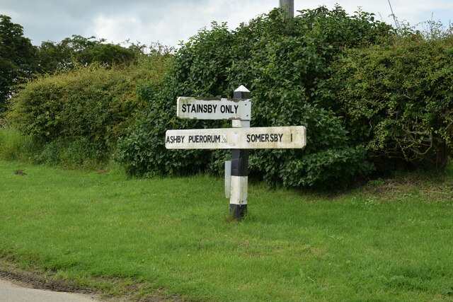
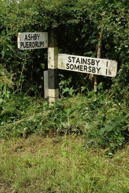
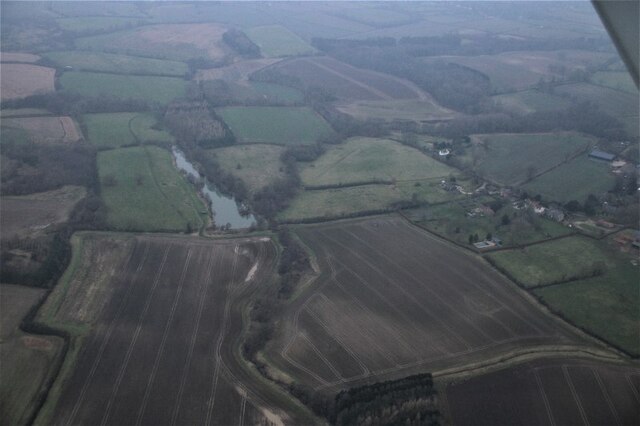
Ashby Puerorum Images

Images are sourced within 2km of 53.223327/-0.01346 or Grid Reference TF3271. Thanks to Geograph Open Source API. All images are credited.

Grazing, Scalp Hill Off the A158.
Grazing, Scalp Hill
Off the A158.
Gated farm track the A158, Scalp Hill
Grazing near Highfield Farm View over a valley from the A158.
Grazing near Highfield Farm
View over a valley from the A158.
Gated field entrance off the A158 near Highfield Farm
A158 towards Horncastle
Beware of horse-drawn vehicles on the A158 Towards Horncastle.
Beware of horse-drawn vehicles on the A158
Towards Horncastle.
Byway to Ashby Puerorum
Footpath to Ashby Puerorum
Barley field near Hagworthingham
Direction Sign – Signpost near Stainsby House in Greetham with Somersby parish Located on the northwest side of T junction northwest of Stainsby House in Greetham with Somersby parish. 3 arms and no finial. See also <a title="https://www.geograph.org.uk/photo/6038852" href="https://www.geograph.org.uk/photo/6038852">Link</a>.

Milestone Society National ID: LI_TF3371
Direction Sign – Signpost near Stainsby House in Greetham with Somersby parish
Located on the northwest side of T junction northwest of Stainsby House in Greetham with Somersby parish. 3 arms and no finial. See also Link. Milestone Society National ID: LI_TF3371
Direction Sign – Signpost near Ashby Puerorum in Greetham with Somersby parish Located on the north side of a T junction north of Ashby Puerorum, Greetham with Somersby parish. 2 arms and no finial.

Milestone Society National ID: LI_TF3271
Direction Sign – Signpost near Ashby Puerorum in Greetham with Somersby parish
Located on the north side of a T junction north of Ashby Puerorum, Greetham with Somersby parish. 2 arms and no finial. Milestone Society National ID: LI_TF3271
Direction Sign – Signpost near Ashby Puerorum in Greetham with Somersby parish Located on the north side of a T junction at Clapgate Farm northwest of Ashby Puerorum, Greetham with Somersby parish. 2 arms and no finial. See also <a title="https://www.geograph.org.uk/photo/6596283" href="https://www.geograph.org.uk/photo/6596283">Link</a>.

Milestone Society National ID: LI_TF3271A
Direction Sign – Signpost near Ashby Puerorum in Greetham with Somersby parish
Located on the north side of a T junction at Clapgate Farm northwest of Ashby Puerorum, Greetham with Somersby parish. 2 arms and no finial. See also Link. Milestone Society National ID: LI_TF3271A
On field path, southwest of Holbeck, near Greetham
Greetham - All Saints' Church
All Saints' church, Greetham A church built over a long period - from the twelfth to twentieth centuries <span class="nowrap"><a title="https://historicengland.org.uk/listing/the-list/list-entry/1147285?section=official-listing" rel="nofollow ugc noopener" href="https://historicengland.org.uk/listing/the-list/list-entry/1147285?section=official-listing">Link</a><img style="margin-left:2px;" alt="External link" title="External link - shift click to open in new window" src="https://s1.geograph.org.uk/img/external.png" width="10" height="10"/></span>
All Saints' church, Greetham
A church built over a long period - from the twelfth to twentieth centuries LinkExternal link
The churchyard and Old Rectory, Greetham
Snowdrops, Greetham churchyard
Somersby: aerial 2022
Show me another place!

Ashby Puerorum is located at Grid Ref: TF3271 (Lat: 53.223327, Lng: -0.01346)

Division: Parts of Lindsey

Administrative County: Lincolnshire

District: East Lindsey

Police Authority: Lincolnshire

What 3 Words

///blend.snooping.revolting. Near Horncastle, Lincolnshire

Related Wikis

Ashby Puerorum

Ashby Puerorum is a small village and former civil parish, now in the parish of Greetham with Somersby, in the East Lindsey district of Lincolnshire, England...

Greetham with Somersby

Greetham with Somersby is a civil parish in the East Lindsey district of Lincolnshire, England. It is situated approximately 3 miles (5 km) north-east...

Bag Enderby

Bag Enderby is a village and former civil parish, now in the parish of Greetham with Somersby, in the East Lindsey district of Lincolnshire, England. It...

Somersby Grange

Somersby Grange is a Grade I listed Georgian country house in Somersby, Lincolnshire.The house was built in 1722 for Robert Burton, the local lord of the...

Salmonby

Salmonby is a village in the civil parish of Tetford, in the East Lindsey district of Lincolnshire, England. It is situated 5.5 miles (8.9 km) north-east...

Greetham, Lincolnshire

Greetham ( GREET-əm) is a village and former civil parish, now in the parish of Greetham with Somersby, in the East Lindsey district of Lincolnshire, England...

Somersby, Lincolnshire

Somersby is a village in the civil parish of Greetham with Somersby, in the East Lindsey district of Lincolnshire, England. It is situated 6 miles (9.7...

Battle of Winceby

The Battle of Winceby took place on 11 October 1643 during the First English Civil War near the village of Winceby, Lincolnshire. In the battle, a Royalist...

Nearby Amenities

Located within 500m of 53.223327,-0.01346
Ashby Puerorum
Is In: Lincolnshire, England, UK
Place: hamlet
Source: Bing
Wikidata: Q4804721
Lat/Long: 53.2244677/-0.014473
Brooklands
Naptan AtcoCode: 270000010487
Naptan Bearing: W
Naptan BusStopType: CUS
Naptan CommonName: Brooklands
Naptan Indicator: W - bound
Naptan Landmark: Brooklands
Naptan NaptanCode: linjmtpd
Naptan Street: Main Street
Naptan Verified: no
Source: naptan_import
Lat/Long: 53.2253836/-0.0132475
Brooklands
Naptan AtcoCode: 2700LAPL5016
Naptan Bearing: E
Naptan BusStopType: CUS
Naptan CommonName: Brooklands
Naptan Indicator: E - bound
Naptan Landmark: Brooklands
Naptan NaptanCode: lindpjpj
Naptan Street: Main Street
Naptan Verified: no
Source: naptan_import
Lat/Long: 53.2254822/-0.0132279
Power: pole
Lat/Long: 53.2244132/-0.0169999
Power: pole
Lat/Long: 53.2250764/-0.0200039
Power: pole
Lat/Long: 53.2240736/-0.0154938
Power: pole
Lat/Long: 53.2247351/-0.0184979
Power: pole
Lat/Long: 53.2237548/-0.0140856
Church Farm
Note: name may not be accurate
Place: farm
Source: Bing
Lat/Long: 53.223729/-0.0130463
Low Knowles
Place: locality
Source: Bing
Lat/Long: 53.2214518/-0.0087251
The data included in this document is from www.openstreetmap.org. The data is made available under ODbL.

Have you been to Ashby Puerorum?

Leave your review of Ashby Puerorum below (or comments, questions and feedback).