Low Wood

Wood, Forest in Yorkshire Ryedale

England

Low Wood

Above Hag Wood Looking NE across Ryedale.
Above Hag Wood Credit: T Eyre

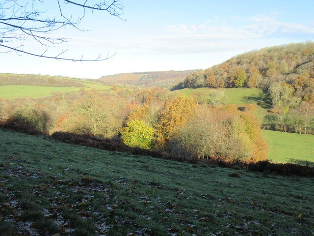
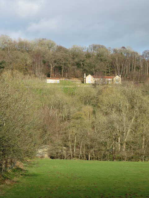
Low Wood is a picturesque village located in the county of Yorkshire, England. Situated in the heart of a dense forest, the village is surrounded by breathtaking natural beauty. The name "Low Wood" originates from the abundance of low-lying trees that cover the area, creating a serene and peaceful atmosphere.

The village itself is small and quaint, with a close-knit community of friendly locals. The houses in Low Wood are typically traditional, made of local stone and exuding a charming rustic charm. The streets are lined with beautiful flower gardens and well-maintained hedges, adding to the village's overall aesthetic appeal.

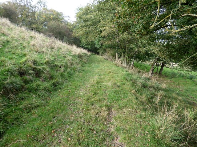
Low Wood is a haven for nature lovers and outdoor enthusiasts. The surrounding forest offers a multitude of walking trails, allowing visitors to immerse themselves in the enchanting woodland. The area is also home to an array of wildlife, including deer and various bird species, making it a haven for wildlife enthusiasts and photographers.

Despite its rural location, Low Wood is well-connected to nearby towns and cities. The village is just a short drive away from the bustling market town of Harrogate and the historic city of York. This convenient proximity allows residents and visitors alike to enjoy the tranquility of village life while still having access to urban amenities.

In conclusion, Low Wood is a hidden gem nestled in the heart of Yorkshire. With its idyllic forest setting, charming village atmosphere, and easy access to surrounding towns, it offers a perfect blend of natural beauty and convenience.

If you have any feedback on the listing, please let us know in the comments section below.

Low Wood Images

Images are sourced within 2km of 54.280315/-1.1289102 or Grid Reference SE5687. Thanks to Geograph Open Source API. All images are credited.

Above Hag Wood Looking NE across Ryedale.
Above Hag Wood
Looking NE across Ryedale.
Far Hag Wood Looking NE across Ryedale.
Far Hag Wood
Looking NE across Ryedale.
Bow Bridge Late 18th or early 19th century bridge. <span class="nowrap"><a title="https://historicengland.org.uk/listing/the-list/list-entry/1149190" rel="nofollow ugc noopener" href="https://historicengland.org.uk/listing/the-list/list-entry/1149190">Link</a><img style="margin-left:2px;" alt="External link" title="External link - shift click to open in new window" src="https://s1.geograph.org.uk/img/external.png" width="10" height="10"/></span>
Bow Bridge
Late 18th or early 19th century bridge. LinkExternal link
Old track leading from Tylas farm to Birk Bank
Track at Birk Bank An obstacle course courtesy of some fallen trees.
Track at Birk Bank
An obstacle course courtesy of some fallen trees.
Footpath leading north from Clavery Ley lane
Head of Oxendale Small, steep sided offshoot of Ryedale. An inviting looking track [not a PRoW] heads down it, but doesn't reappear below on the road to Tylas Farm.
Head of Oxendale
Small, steep sided offshoot of Ryedale. An inviting looking track [not a PRoW] heads down it, but doesn't reappear below on the road to Tylas Farm.
View across Oxendale Oxendale is typical of many small but steep sided valleys that are found in the limestone hills along the southern side of the National Park.
View across Oxendale
Oxendale is typical of many small but steep sided valleys that are found in the limestone hills along the southern side of the National Park.
Tylas Barn Traditional stone built barn with a pantile roof. This is an old building which is named on the first edition OS map of 1853 as 'Tile House Barn', Tile House being the old name of the farm in the valley bottom. It's mid March and the sun is out, but cattle are still being fed within the barn and its yard.
Tylas Barn
Traditional stone built barn with a pantile roof. This is an old building which is named on the first edition OS map of 1853 as 'Tile House Barn', Tile House being the old name of the farm in the valley bottom. It's mid March and the sun is out, but cattle are still being fed within the barn and its yard.
Root crops and Ryedale A view from the plateau near Tylas Barn looking over the edge and down the dale towards Rievaulx Abbey, which can be seen centre left.
Root crops and Ryedale
A view from the plateau near Tylas Barn looking over the edge and down the dale towards Rievaulx Abbey, which can be seen centre left.
Bridleway down the hillside Track heading down from Tylas Barn towards the farm at the bottom of the hill. A view across Ryedale with forested slopes on the far side.
Bridleway down the hillside
Track heading down from Tylas Barn towards the farm at the bottom of the hill. A view across Ryedale with forested slopes on the far side.
Tylas Farm Tylas is a corruption of Tile House, and the farm is shown with the latter name on first edition OS maps of the mid 19th century. This was the site of a tile works belonging to Rievaulx Abbey in the middle ages, so presumably there were suitable deposits of clay nearby.
Tylas Farm
Tylas is a corruption of Tile House, and the farm is shown with the latter name on first edition OS maps of the mid 19th century. This was the site of a tile works belonging to Rievaulx Abbey in the middle ages, so presumably there were suitable deposits of clay nearby.
River Rye The Rye is one of the major rivers that drain the southern side of the North York Moors before eventually meandering across the Vale of Pickering to join the Derwent above Malton. Apart from gathering the various becks in upper Ryedale, the river also receives the considerable waters of the River Seph, which flows through Bilsdale.
River Rye
The Rye is one of the major rivers that drain the southern side of the North York Moors before eventually meandering across the Vale of Pickering to join the Derwent above Malton. Apart from gathering the various becks in upper Ryedale, the river also receives the considerable waters of the River Seph, which flows through Bilsdale.
View towards Bow Bridge Across a riverside meadow towards the part hidden 18thC bridge over the Rye. On the hillside beyond is Crabtree Hall.
View towards Bow Bridge
Across a riverside meadow towards the part hidden 18thC bridge over the Rye. On the hillside beyond is Crabtree Hall.
Marshy ground near the River Rye Footpath number 25.127/009 runs along the bottom of a slope here and presents the walker with a few soggy areas to negotiate or avoid. After wet weather the farm road/bridleway further up the hillside is a better alternative.
Marshy ground near the River Rye
Footpath number 25.127/009 runs along the bottom of a slope here and presents the walker with a few soggy areas to negotiate or avoid. After wet weather the farm road/bridleway further up the hillside is a better alternative.
Ryedale view Looking north along the dale with Tylas Farm house visible right of centre. A line of trees follow the curves of the river in the valley bottom.
Ryedale view
Looking north along the dale with Tylas Farm house visible right of centre. A line of trees follow the curves of the river in the valley bottom.
Track from Oscar Park Farm Hot walk from Helmsley.
Track from Oscar Park Farm
Hot walk from Helmsley.
Stone Barn above East Ley Wood Substantial barn with pantile roof - looks as if in the midst of a restoration process
Stone Barn above East Ley Wood
Substantial barn with pantile roof - looks as if in the midst of a restoration process
Show me another place!

Low Wood is located at Grid Ref: SE5687 (Lat: 54.280315, Lng: -1.1289102)

Division: North Riding

Administrative County: North Yorkshire

District: Ryedale

Police Authority: North Yorkshire

What 3 Words

///branched.swerves.meanings. Near Helmsley, North Yorkshire

Related Wikis

Swiss Cottage, Rievaulx

Swiss Cottage is a Grade II listed building in the English village of Rievaulx, North Yorkshire. It dates to at least the 17th century, with earlier origins...

Rievaulx

Rievaulx (usually pronounced REE-voh) is a small village and civil parish in Rye Dale within the North York Moors National Park near Helmsley in North...

Rievaulx Abbey

Rievaulx Abbey ( ree-VOH) was a Cistercian abbey in Rievaulx, near Helmsley, in the North York Moors National Park, North Yorkshire, England. It was one...

Rievaulx Terrace

Rievaulx Terrace is a site located in the North York Moors National Park, in North Yorkshire, England, overlooking Rievaulx Abbey and owned by the National...

Laskill

Laskill is a small hamlet in Bilsdale, 5 miles (8 km) north-west of Helmsley, North Yorkshire, England, on the road from Helmsley to Stokesley and is located...

Hawnby

Hawnby is a small crossroads village and civil parish in Ryedale in the North York Moors National Park, North Yorkshire, England. The village is about...

Old Byland and Scawton

Old Byland and Scawton is a civil parish in the Ryedale district, in the county of North Yorkshire, England. The parish includes the villages of Old Byland...

Scawton

Scawton is a village and former civil parish in North Yorkshire, England. The hamlet lies just east of Sutton Bank, north of the A170 road, and 5 miles...

Nearby Amenities

Located within 500m of 54.280315,-1.1289102
Barnclose Farm
Place: farm
Lat/Long: 54.2766299/-1.1314914
The data included in this document is from www.openstreetmap.org. The data is made available under ODbL.

Have you been to Low Wood?

Leave your review of Low Wood below (or comments, questions and feedback).