Seven Mile Wood

Wood, Forest in Nottinghamshire Gedling

England

Seven Mile Wood

Footpath on Papplewick Moor
Footpath on Papplewick Moor Credit: David Lally

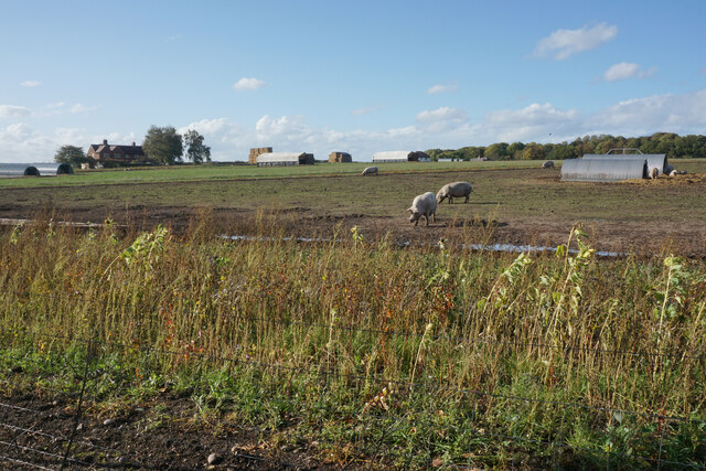
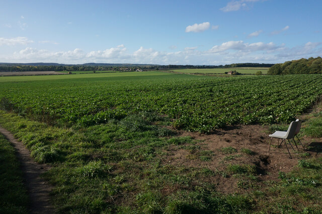
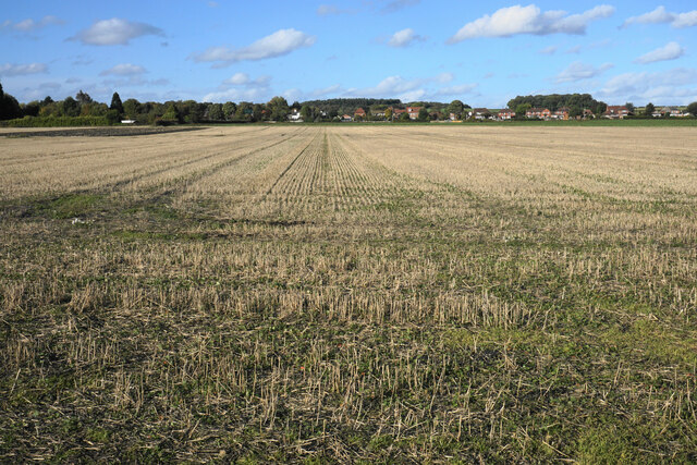
Seven Mile Wood is a beautiful forest located in Nottinghamshire, England. Stretching over an area of approximately seven miles, the wood is a haven for nature enthusiasts and hikers alike. It is situated in the heart of the county, close to the town of Mansfield.

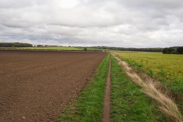
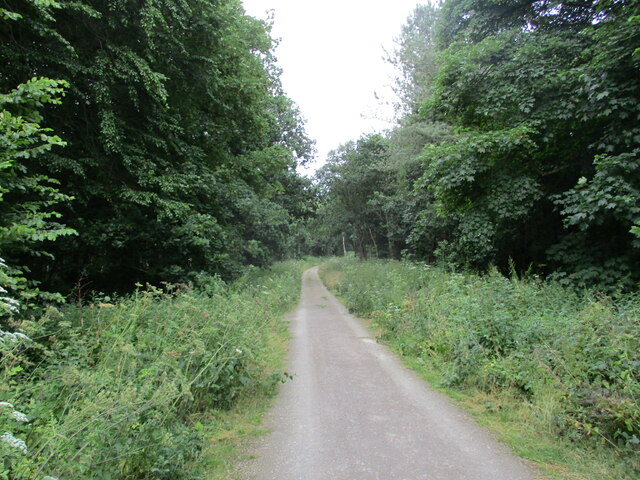
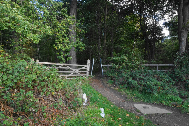
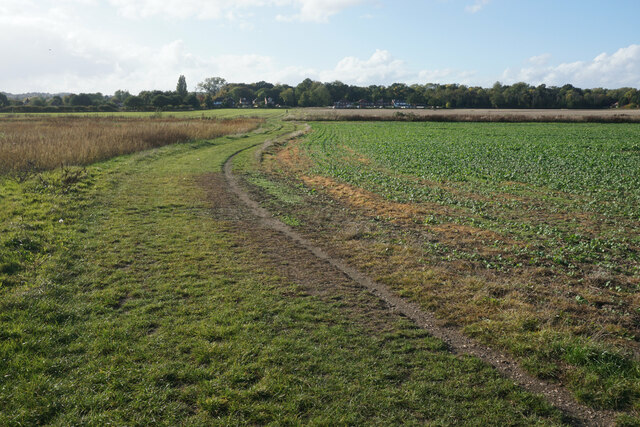
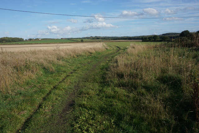
The wood is predominantly composed of oak and beech trees, creating a dense and lush canopy that provides shade and shelter for a variety of wildlife. The forest floor is covered in a carpet of ferns, wildflowers, and moss, adding to its picturesque appeal. There are several well-maintained walking trails that wind through the wood, offering visitors the opportunity to explore and immerse themselves in the natural surroundings.

One of the highlights of Seven Mile Wood is its diverse wildlife population. It is home to numerous species of birds, including woodpeckers, owls, and various songbirds. Deer can often be spotted grazing among the trees, while rabbits and squirrels scurry about in the undergrowth. The forest also supports a rich variety of insects, such as butterflies and beetles.

Seven Mile Wood is a popular destination for outdoor activities, including hiking, birdwatching, and photography. Its tranquil and serene atmosphere make it an ideal spot for relaxation and contemplation. The wood is well-maintained by local authorities, ensuring that it remains a pristine and enjoyable natural environment for both locals and tourists to appreciate.

Overall, Seven Mile Wood is a hidden gem in Nottinghamshire, offering a peaceful retreat from the hustle and bustle of daily life. Its natural beauty and diverse wildlife make it a must-visit destination for anyone seeking a connection with nature.

If you have any feedback on the listing, please let us know in the comments section below.

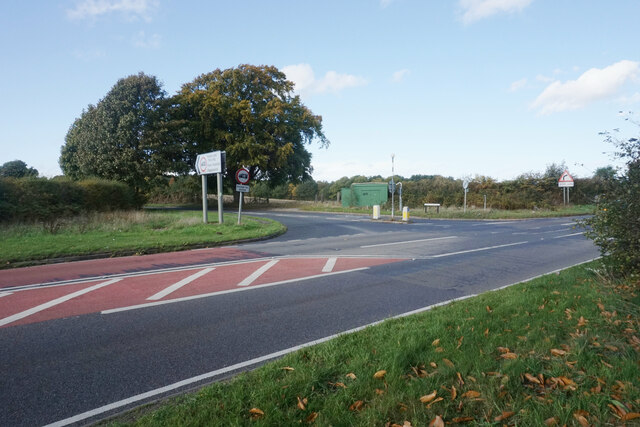
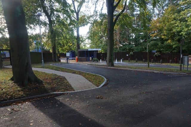
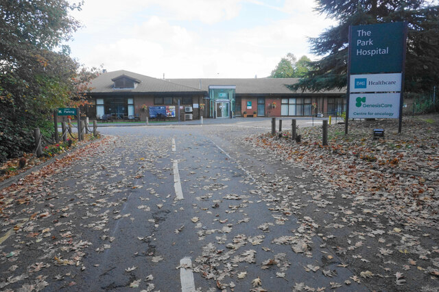
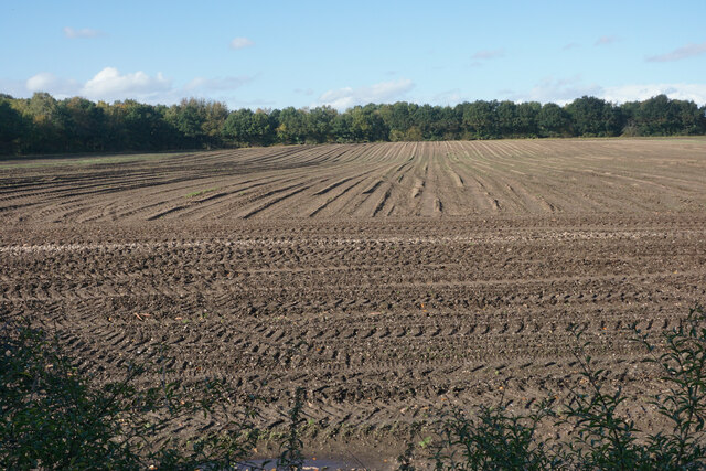
Seven Mile Wood Images

Images are sourced within 2km of 53.052629/-1.1541892 or Grid Reference SK5650. Thanks to Geograph Open Source API. All images are credited.

Footpath on Papplewick Moor
Blocked culvert At the southern end of the Papplewick Trail, this excavated culvert entrance presumably would have carried the mill races under Moor Road?
Blocked culvert
At the southern end of the Papplewick Trail, this excavated culvert entrance presumably would have carried the mill races under Moor Road?
Robin Hood Way, west of Seven Mile Wood, Papplewick
Track in Sansom Wood This is also a public footpath.
Track in Sansom Wood
This is also a public footpath.
Footpath into Foxcovert Plantation One of numerous forest walks in the locality.
Footpath into Foxcovert Plantation
One of numerous forest walks in the locality.
Road junction on Ollerton Road This used to be a crossroads but the approach from the right has been blocked off.
Road junction on Ollerton Road
This used to be a crossroads but the approach from the right has been blocked off.
The entrance to Sherwood Lodge The joint HQ of Nottinghamshire Police and Fire and Rescue Service. The public cannot go beyond this point.
The entrance to Sherwood Lodge
The joint HQ of Nottinghamshire Police and Fire and Rescue Service. The public cannot go beyond this point.
The Park Hospital A private hospital in the Burntstump complex.
The Park Hospital
A private hospital in the Burntstump complex.
Prepared field near Burntstump
Outdoor-reared pork by Stanker Hill Farm As seen from the Robin Hood Way.
Outdoor-reared pork by Stanker Hill Farm
As seen from the Robin Hood Way.
Farmland below Raceground Hill A brief glimpse from the Robin Hood Way, seen across the former railway which serviced Calverton Colliery.
Farmland below Raceground Hill
A brief glimpse from the Robin Hood Way, seen across the former railway which serviced Calverton Colliery.
Farmland on Papplewick Moor A crop of beet is in the foreground. I presume the plastic chairs are for the benefit of the farm workers.
Farmland on Papplewick Moor
A crop of beet is in the foreground. I presume the plastic chairs are for the benefit of the farm workers.
Beet field on Papplewick Moor Wide open spaces seen from the Robin Hood Way.
Beet field on Papplewick Moor
Wide open spaces seen from the Robin Hood Way.
Robin Hood Way near Papplewick The houses ahead are the first of Hucknall and the Nottingham conurbation.
Robin Hood Way near Papplewick
The houses ahead are the first of Hucknall and the Nottingham conurbation.
Stubble field on Papplewick Moor Some of the houses of Papplewick are seen ahead.
Stubble field on Papplewick Moor
Some of the houses of Papplewick are seen ahead.
Path onto Papplewick Moor Part of the Robin Hood Way heading towards Burntstump Hill.
Path onto Papplewick Moor
Part of the Robin Hood Way heading towards Burntstump Hill.
Mini roundabout at the top of Papplewick Lane The village of Papplewick is another half a kilometre along the road ahead.
Mini roundabout at the top of Papplewick Lane
The village of Papplewick is another half a kilometre along the road ahead.
Griffins Head, Papplewick The village pub seen in a sharp rain shower.
Griffins Head, Papplewick
The village pub seen in a sharp rain shower.
Show me another place!

Seven Mile Wood is located at Grid Ref: SK5650 (Lat: 53.052629, Lng: -1.1541892)

Administrative County: Nottinghamshire

District: Gedling

Police Authority: Nottinghamshire

What 3 Words

///swam.redouble.parsnip. Near Hucknall, Nottinghamshire

Related Wikis

Papplewick

Papplewick is a village and civil parish in Nottinghamshire, England, 7.5 miles (12 km) north of Nottingham and 6 miles (10 km) south of Mansfield. It...

Papplewick Pumping Station

Papplewick Pumping Station, situated in open agricultural land approximately 3 miles (4.8 km) by road from the Nottinghamshire village of Papplewick, was...

Papplewick Hall

Papplewick Hall is a Grade I listed English country house in Papplewick, Nottinghamshire. == History == It was completed around 1787 for the Hon. Frederick...

Sherwood (UK Parliament constituency)

Sherwood is a constituency represented in the House of Commons of the UK Parliament since 2010 by Mark Spencer, a Conservative. The constituency takes...

Arnold Town F.C.

Arnold Town Football Club is a football club based in Arnold, Nottinghamshire, England. They are currently members of the Central Midlands League South...

Bestwood Pumping Station

Bestwood Pumping Station was a water pumping station operating in Nottinghamshire from 1874 until 1964. == History == Bestwood Pumping Station was built...

Whyburn

The Whyburn (known locally as Town Brook, and by the UK Government as Baker Lane Brook) is the main watercourse flowing through the town of Hucknall in...

Hidden Valleys

Hidden Valleys is a name, coined in 2004, used to describe an area of interesting historical and scenic value between the city of Nottingham and the town...

Nearby Amenities

Located within 500m of 53.052629,-1.1541892
Traffic Signals
Source Highway: Bing;Notes
Lat/Long: 53.0537042/-1.1527825
Traffic Signals
Source Highway: Bing;Notes
Lat/Long: 53.0498159/-1.1494663
Bus Stop
Forest Lane
Bus: yes
Naptan AtcoCode: 3300GE0068
Naptan Bearing: NW
Naptan CommonName: Forest Lane
Naptan Crossing: Forest Lane
Naptan Indicator: adj
Naptan NaptanCode: ntsaptmw
Naptan Notes: none
Naptan Street: Mansfield Road
Naptan Verified: no
Public Transport: platform
Source: naptan_import
Lat/Long: 53.05405/-1.1533278
Bus Stop
Burntstump Hill
Bus: yes
Naptan AtcoCode: 3300GE0070
Naptan Bearing: NW
Naptan CommonName: Burntstump Hill
Naptan Crossing: Burntstump Hill
Naptan Indicator: opp
Naptan Landmark: Seven Mile House
Naptan NaptanCode: ntsaptpd
Naptan Notes: none
Naptan Street: Mansfield Road
Naptan Verified: no
Public Transport: platform
Shelter: yes
Source: naptan_import
Lat/Long: 53.050115/-1.1498842
Bus Stop
Forest Lane
Bus: yes
Naptan AtcoCode: 3300GE0080
Naptan Bearing: SE
Naptan CommonName: Forest Lane
Naptan Crossing: Forest Lane
Naptan Indicator: opp
Naptan NaptanCode: ntsatgdp
Naptan Notes: none
Naptan Street: Mansfield Road
Naptan Verified: no
Public Transport: platform
Source: naptan_import
Lat/Long: 53.0533767/-1.1521922
Post Box
Collection Times: Mo-Fr 16:00; Sa 10:00
Post Box Type: lamp
Ref: NG5 40
Royal Cypher: EIIR
Royal Cypher Wikidata: Q33102113
Source: survey
Lat/Long: 53.0493399/-1.1492251
Turning Loop
Lat/Long: 53.0501129/-1.1514208
Power: pole
Lat/Long: 53.049968/-1.1532721
Power: pole
Lat/Long: 53.0499213/-1.1528885
Power: pole
Lat/Long: 53.0501922/-1.1548492
Power: pole
Lat/Long: 53.0499306/-1.1559858
Power: pole
Lat/Long: 53.049675/-1.1571083
Power: pole
Lat/Long: 53.0494094/-1.158261
Direction: 330
Man Made: surveillance
Surveillance: public
Surveillance Type: ALPR
Lat/Long: 53.0511029/-1.150495
The data included in this document is from www.openstreetmap.org. The data is made available under ODbL.

Have you been to Seven Mile Wood?

Leave your review of Seven Mile Wood below (or comments, questions and feedback).